South West Pacific Hydrographic Commission Country Report for Kiribati
Kiribati's country report highlights achievements such as receiving satellite-derived bathymetry datasets, hosting awareness workshops, and pursuing funding for LIDAR surveys. Challenges include limitations in meeting mapping authority standards and a lack of legislative support for hydrographic activities. Plans include surveying outer islands and future hydrographic charting efforts.

Download Presentation

Please find below an Image/Link to download the presentation.
The content on the website is provided AS IS for your information and personal use only. It may not be sold, licensed, or shared on other websites without obtaining consent from the author. Download presentation by click this link. If you encounter any issues during the download, it is possible that the publisher has removed the file from their server.
E N D
Presentation Transcript
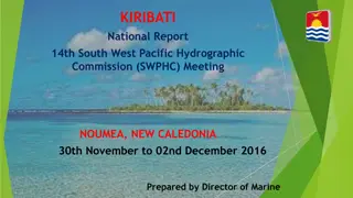
17 17th thMeeting of the Meeting of the South West Pacific South West Pacific Hydrographic Commission Hydrographic Commission Country Report for Kiribati Country Report for Kiribati [ Associate Member State] South West Pacific Hydrographic Commission
Main achievements during the year Main achievements during the year Hydrography Received Satellite Derived Bathymetry Datasets from UKHO for all 33 islands in Kiribati Hosted (GoK) awareness workshop with relevant Government stakeholders (conducted by UKHO) In discussions with World Bank/Asia Development for funding to do LIDAR surveys UKHO is assisting us with the technical component and to produce the charts at the end Staff member was offered scholarship through the Nippon Foundation/GEBCO capacity building program (Cat A training at the University of New Hampshire) Plans to become IHO members is in the pipeline Attending CME Seminar UKHO, London, Nov 2019 2 South West Pacific Hydrographic Commission
Main achievements during the year continue Aids to Navigation Staff member attended IALA AtoN Manager Level 1 course in Suva Fiji conducted by SPC July to August 2019; SPC provides training to AtoN staff on AtoNs Risk Assessment in Kiritimati Island from Nov Dec 2019. Pacific Islands Domestic Ship Safety (PIDSS): Received training on PIDSS in March 2019 conducted by SPC; Received training on wooden boats survey in March, July and Oct 2019 under the Pacific Maritime Safety Program; 3 South West Pacific Hydrographic Commission
Main challenges and/or obstructions Main challenges and/or obstructions Limitation in capacity to meet mapping authority standards (UKHO) No legislation/policy framework in place to support hydrographic activities Funding and financial constraints 4 South West Pacific Hydrographic Commission
Surveys Surveys 4 Outer islands to be Surveyed (LIDAR) during KOITIIP. Abaiang island Nonouti Island Tabiteuea South Island Beru Island 5 South West Pacific Hydrographic Commission
C Charting harting The GOK has it plans in the future to fund a contractor for doing an hydrographic survey for all outer islands in Kiribati in order to revive some charts that have been removed and to produce new charts as well; No ENCs have been produced except BA 729. Expecting new charts after hydrographic survey during KOITIIP 6 South West Pacific Hydrographic Commission
MSI MSI New National MSI Coordinator has been assigned to replace the former National MSI coordinator; There are some H Note messages which have been sent to NAVAREA Coordinator XI (Japan) at the beginning of this year; Good co-ordination between National MSI Coordinator and NAVAREA XI Coordinator; Request training on MSI for capacity building 7 South West Pacific Hydrographic Commission
Contributions to the IHO DCDB and GEBCO None as yet 8 South West Pacific Hydrographic Commission
Progress on MSDI Progress on MSDI There is potential for the development of MSDI capabilities in the country with the Kiribati Outer Islands Transport Infrastructure Investment Project (KOITIIP). Plans for an MSDI would involve investments be on capacity building and physical infrastructure (data infrastructure) 9 South West Pacific Hydrographic Commission
Plans that affect the region Plans that affect the region None as yet 10 South West Pacific Hydrographic Commission
Lessons learned to share Lessons learned to share The Important of MSI Roles and Responsibilities of National MSI Coordinator Networking and getting involved is important Information sharing 11 South West Pacific Hydrographic Commission
Success stories to share Success stories to share Funding for Kiribati Outer Islands, Transport, Infrastructure, Investment Project (KOITIIP)has been approved by the donors (WB and ADB). Hydrographic Survey is one of the other components to be started off first for the 4 outer Islands. Pacific Maritime Safety Program Phase 3 is now under the Marine Division (NZAID) 12 South West Pacific Hydrographic Commission
Kam bati n rabwa. 13 South West Pacific Hydrographic Commission