Fiji Hydrographic Office Overview
 undefined
1
1
5
5
t
t
h
h
S
S
o
o
u
u
t
t
h
h
W
W
e
e
s
s
t
t
P
P
a
a
c
c
i
i
f
f
i
i
c
c
H
H
y
y
d
d
r
r
o
o
g
g
r
r
a
a
p
p
h
h
i
i
c
c
C
C
o
o
m
m
m
m
i
i
s
s
s
s
i
i
o
o
n
n
T
T
e
e
c
c
h
h
n
n
i
i
c
c
a
a
l
l
W
W
o
o
r
r
k
k
s
s
h
h
o
o
p
p
2
2
0
0
t
t
h
h
F
F
e
e
b
b
r
r
u
u
a
a
r
r
y
y
2
2
0
0
1
1
8
8
N
N
a
a
d
d
i
i
,
,
F
F
i
i
j
j
i
i
I
I
s
s
l
l
a
a
n
n
d
d
s
s
F
F
I
I
J
J
I
I
H
H
Y
Y
D
D
R
R
O
O
G
G
R
R
A
A
P
P
H
H
I
I
C
C
O
O
F
F
F
F
I
I
C
C
E
E
B
B
R
R
I
I
E
E
F
F
L
i
e
u
t
e
n
a
n
t
J
e
r
v
i
s
R
o
b
i
n
s
o
n
S
e
n
i
o
r
H
y
d
r
o
g
r
a
p
h
i
c
S
u
r
v
e
y
o
r
F
i
j
i
H
y
d
r
o
g
r
a
p
h
i
c
O
f
f
i
c
e


C
C
o
o
n
n
t
t
e
e
n
n
t
t
s
s
FHO Overview
FHO Overview
Projects
Projects
Constraints
Constraints
Questions
Questions


F
F
H
H
O
O
O
O
V
V
E
E
R
R
V
V
I
I
E
E
W
W

R
o
l
e
s
&
R
e
s
p
o
n
s
i
b
i
l
i
t
i
e
s
1.
To collect with systematic surveys at sea and along the coast geo -
referenced data related to:
Aids to navigation and port survey updates
Depths of the area encompassed within Fiji’s EEZ and of national
interest
Sea bottom composition
Tides and currents
Physical properties of water column
Magnetic properties of the oceanic earths crust within Fiji waters
2. To process the information collected in order to create
organized databases capable of feeding the production of
thematic maps, nautical charts and other types of
documentation for the following most common uses:
Maritime navigation and traffic control
Naval operations
R
o
l
e
s
&
R
e
s
p
o
n
s
i
b
i
l
i
t
i
e
s
3. To update databases through:
Re-survey when and where needed
Gathering supplementary information from other maritime authorities.
4. To ensure the:
Production, distribution and updating of nautical charts and publications
5. To ensure the timely dissemination of marine safety information
Coastal Zone management and defence
Marine environment preservation
Exploitation of marine resources and laying of submarine cables/pipelines
Maritime boundaries delimitation(Law of the Sea implementation)
Scientific studies connected to the sea and near – shore zone
P
P
r
r
o
o
d
d
u
u
c
c
t
t
s
s
a
a
n
n
d
d
S
S
e
e
r
r
v
v
i
i
c
c
e
e
s
s
Hydrographic and Oceanographic Surveys
Hydrographic and Oceanographic Surveys
Nautical Charts
Nautical Charts
Navigational Charts
Navigational Charts
Special Charts
Special Charts
(showing 200 Mile EEZ and Maritime Baselines)
(showing 200 Mile EEZ and Maritime Baselines)
Hydrographic Publications:
Hydrographic Publications:
Fiji Nautical Almanac (published annually)
Fiji Nautical Almanac (published annually)
Fiji Chart Catalogue
Fiji Chart Catalogue
Maritime Safety Information:
Maritime Safety Information:
Fiji Notices to Mariners (periodical)
Fiji Notices to Mariners (periodical)
Fiji Coastal Navigational Warning (MSAF)
Fiji Coastal Navigational Warning (MSAF)
Nautical information (at the request of customer)
Nautical information (at the request of customer)
Historical Archive research
Historical Archive research
S
S
t
t
a
a
t
t
u
u
s
s
o
o
f
f
N
N
a
a
u
u
t
t
i
i
c
c
a
a
l
l
C
C
h
h
a
a
r
r
t
t
s
s
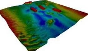
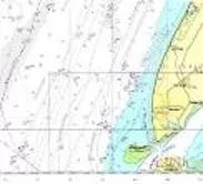
Coverage of Hydrographic Surveying at Depths <200m / >200m (IHO Publication C55 23 Aug. 17)
F
F
H
H
O
O
C
C
u
u
r
r
r
r
e
e
n
n
t
t
S
S
t
t
r
r
e
e
n
n
g
g
t
t
h
h
E
E
q
q
u
u
i
i
p
p
m
m
e
e
n
n
t
t
s
s
D
D
a
a
t
t
a
a
A
A
c
c
q
q
u
u
i
i
s
s
i
i
t
t
i
i
o
o
n
n
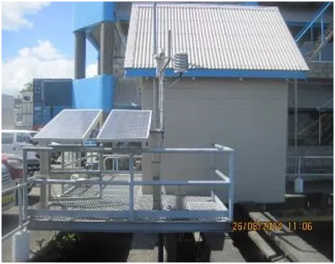
02 x R2Sonic MBES
02 x R2Sonic MBES
Odom MK III SBES together with a Side Scan Transducer
Odom MK III SBES together with a Side Scan Transducer
Thales Differential GPS
Thales Differential GPS
Trimble SPS DGPS
Trimble SPS DGPS
Acquisition software and processing
Acquisition software and processing
C
C
a
a
r
r
t
t
o
o
g
g
r
r
a
a
p
p
h
h
y
y
(
(
C
C
h
h
a
a
r
r
t
t
i
i
n
n
g
g
)
)
Status
•
FHO currently has a catalogue of 15 navigational charts to IHO Standards.
•
Special Charts 3 (Fiji Marine Spaces and EEZ Chart)
•
Printer Nation for 03 INT Charts
•
The last set of charts was published in 1999
•
Continue to Maintain and update to NtMs
•
FHO also publishes the annual Fiji Nautical Almanac.
Contains tidal prediction data for Standard Port
(Suva)
Astronomical Data
Fiji list of lights (K)
Port of entry information
•
Assist in the compilation, promulgation and distribution
of Maritime Safety Information (MSI).
Fiji Notices to Mariners
Admiralty, AUS & NZ Notices to Mariners
Fiji Coastal Navigational Warnings
NAVAREA XIV Warnings
Developments
•
Introduction of Digital Chart Production System (2015)
•
FHO uses the Teledyne CARIS Software Package;
Base Editor
- Analyse and compile processed
bathymetry data
Paper Chart Composer
- Produce and maintain INT1 / INT2
compliant paper charts and raster chart
outputs including BSB-format RNCs
S57 Composer
- Produce and maintain S-57 products
(ENC,AML,IENC) and in the future
S-100 / S-101 products.
Publications Module
- Produce and maintain nautical
publications including NtMs and List of
Lights.
•
Have received CARIS certified training in all modules
P
P
r
r
o
o
j
j
e
e
c
c
t
t
s
s
Completion of chart INT747 – Yasawa/Mamanuca Group
Completion of chart INT747 – Yasawa/Mamanuca Group
Recompilation of Special charts (FMS)
Recompilation of Special charts (FMS)
Developing a Vector database of all Fiji Chart Folio
Developing a Vector database of all Fiji Chart Folio
Final Checks to F13 – Rovodrau Bay
Final Checks to F13 – Rovodrau Bay
Approaches to Savusavu – Valaga Bay
Approaches to Savusavu – Valaga Bay
C
C
a
a
p
p
a
a
c
c
i
i
t
t
y
y
B
B
u
u
i
i
l
l
d
d
i
i
n
n
g
g
Training in Hydrography and Nautical Cartography is not
Training in Hydrography and Nautical Cartography is not
available locally
available locally
FHO dependant on overseas courses
FHO dependant on overseas courses
Previous/Current training are sourced from
Previous/Current training are sourced from
Introduction of cross training for all officers
Introduction of cross training for all officers
1
1
st
st
ROK-Fiji bilateral meeting held on August 28, 2014.
ROK-Fiji bilateral meeting held on August 28, 2014.
Feasibility study conducted and proposal submitted.
Feasibility study conducted and proposal submitted.
Approval granted in 2015 with commencement beginning 2016 through
Approval granted in 2015 with commencement beginning 2016 through
to 2020.
to 2020.
P
P
u
u
r
r
p
p
o
o
s
s
e
e
o
o
f
f
P
P
r
r
o
o
j
j
e
e
c
c
t
t
To assist Fiji in strengthening its Marine Scientific Research Capability
To assist Fiji in strengthening its Marine Scientific Research Capability
and present roles in contributing to national infrastructure.
and present roles in contributing to national infrastructure.
To support safe and efficient seaways, facilitate the protection of
To support safe and efficient seaways, facilitate the protection of
marine environment, to support the administration of sustainable
marine environment, to support the administration of sustainable
development of national maritime zones.
development of national maritime zones.
FHO & KHOA Official Development Project
Provision of professional Hydrographers and other personnel to
Provision of professional Hydrographers and other personnel to
participate in the planning and execution of ODA project on
participate in the planning and execution of ODA project on
Oceanographic and hydrographic Operations;
Oceanographic and hydrographic Operations;
Provision of technical materials, equipment and data acquisition
Provision of technical materials, equipment and data acquisition
and processing systems;
and processing systems;
Provision of technical support;
Provision of technical support;
Provision of technical training in ROK.
Provision of technical training in ROK.
FHO & KHOA Official Development Project
2016 ODA Project:
2016 ODA Project:
01 x 4WD Hyundai Tucson
01 x 4WD Hyundai Tucson
6m Aluminum SMB with accessories
6m Aluminum SMB with accessories
01 x SMB Trailer
01 x SMB Trailer
Tide gauge equipment
Tide gauge equipment
Oceanography Training 2 officers (S/Korea)
Oceanography Training 2 officers (S/Korea)
Conducted 2 weeks in-house training on DCP
Conducted 2 weeks in-house training on DCP
FHO & KHOA Official Development Project
FHO & KHOA Official Development Project
ODA Project 2017:
-
MBES Handover
-
Joint Survey – Rovodrau Bay, Pacific Harbor
-
Data Processing Training - ROK
P
P
r
r
o
o
p
p
o
o
s
s
e
e
d
d
S
S
u
u
b
b
m
m
i
i
s
s
s
s
i
i
o
o
n
n
s
s
f
f
o
o
r
r
A
A
i
i
d
d
Ocean Research Vessel
Ocean Research Vessel
MBES
MBES
SSS
SSS
ADCP
ADCP
Water Column Analysis Equipment
Water Column Analysis Equipment
Sub bottom profiler
Sub bottom profiler
Magnetometer
Magnetometer
Geodetic GPS with processing software
Geodetic GPS with processing software
FHO & KHOA Official Development Project
P
P
r
r
o
o
p
p
o
o
s
s
e
e
d
d
S
S
u
u
b
b
m
m
i
i
s
s
s
s
i
i
o
o
n
n
s
s
f
f
o
o
r
r
A
A
i
i
d
d
Education and Training
Education and Training
Cat B & Cat A Hydrographic Training
Cat B & Cat A Hydrographic Training
Cartography Training
Cartography Training
Equipment
Equipment
04 x Trimble Geodetic GPS Sets
04 x Trimble Geodetic GPS Sets
Ceescope Portable SBES
Ceescope Portable SBES
01 x Trimble S4 Total Station
01 x Trimble S4 Total Station
ARC GIS License
ARC GIS License
FHO & KHOA Official Development Project
C
C
o
o
n
n
s
s
t
t
r
r
a
a
i
i
n
n
t
t
s
s
S
S
o
o
l
l
u
u
t
t
i
i
o
o
n
n
s
s
Survey vessel
Survey vessel
Replacement of equipment
Replacement of equipment
Equipment to conduct
Equipment to conduct
survey
survey
Unavailability of offset
Unavailability of offset
printing for F charts
printing for F charts
Concept of Deployable
Concept of Deployable
Geospatial Teams
Geospatial Teams
Proper equipment replacement
Proper equipment replacement
plan in budget submission
plan in budget submission
Procurement of survey
Procurement of survey
equipment
equipment
Contract for digitization of
Contract for digitization of
existing chart folio
existing chart folio
Current Difficulties Being Faced
P
P
r
r
o
o
b
b
l
l
e
e
m
m
s
s
S
S
o
o
l
l
u
u
t
t
i
i
o
o
n
n
s
s
Survey vessel
Survey vessel
Replacement of equipment
Replacement of equipment
Equipment to conduct
Equipment to conduct
survey
survey
Unavailability of offset
Unavailability of offset
printing for F chart folio
printing for F chart folio
Current strength to
Current strength to
operational area ratio
operational area ratio
Concept of Deployable
Concept of Deployable
Geospatial Teams
Geospatial Teams
Proper equipment replacement
Proper equipment replacement
plan in budget submission
plan in budget submission
Procurement of survey vessel
Procurement of survey vessel
and equipment
and equipment
Contract for digitization of
Contract for digitization of
existing chart folio
existing chart folio
Restructure of FHO
Restructure of FHO
Q
Q
U
U
E
E
S
S
T
T
I
I
O
O
N
N
S
S
?
?
Lieutenant Jervis Robinson, a Senior Hydrographic Surveyor at the Fiji Hydrographic Office, provided insights into the roles and responsibilities of the office in collecting, processing, and disseminating georeferenced data related to maritime navigation, marine resources, and environmental preservation. The office focuses on updating databases, producing nautical charts, and ensuring marine safety information dissemination. Their products and services include hydrographic and oceanographic surveys, nautical charts, navigational charts, and historical archive research.

Download Presentation

Please find below an Image/Link to download the presentation.
The content on the website is provided AS IS for your information and personal use only. It may not be sold, licensed, or shared on other websites without obtaining consent from the author.If you encounter any issues during the download, it is possible that the publisher has removed the file from their server.
You are allowed to download the files provided on this website for personal or commercial use, subject to the condition that they are used lawfully. All files are the property of their respective owners.
The content on the website is provided AS IS for your information and personal use only. It may not be sold, licensed, or shared on other websites without obtaining consent from the author.
E N D
Presentation Transcript
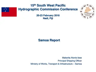
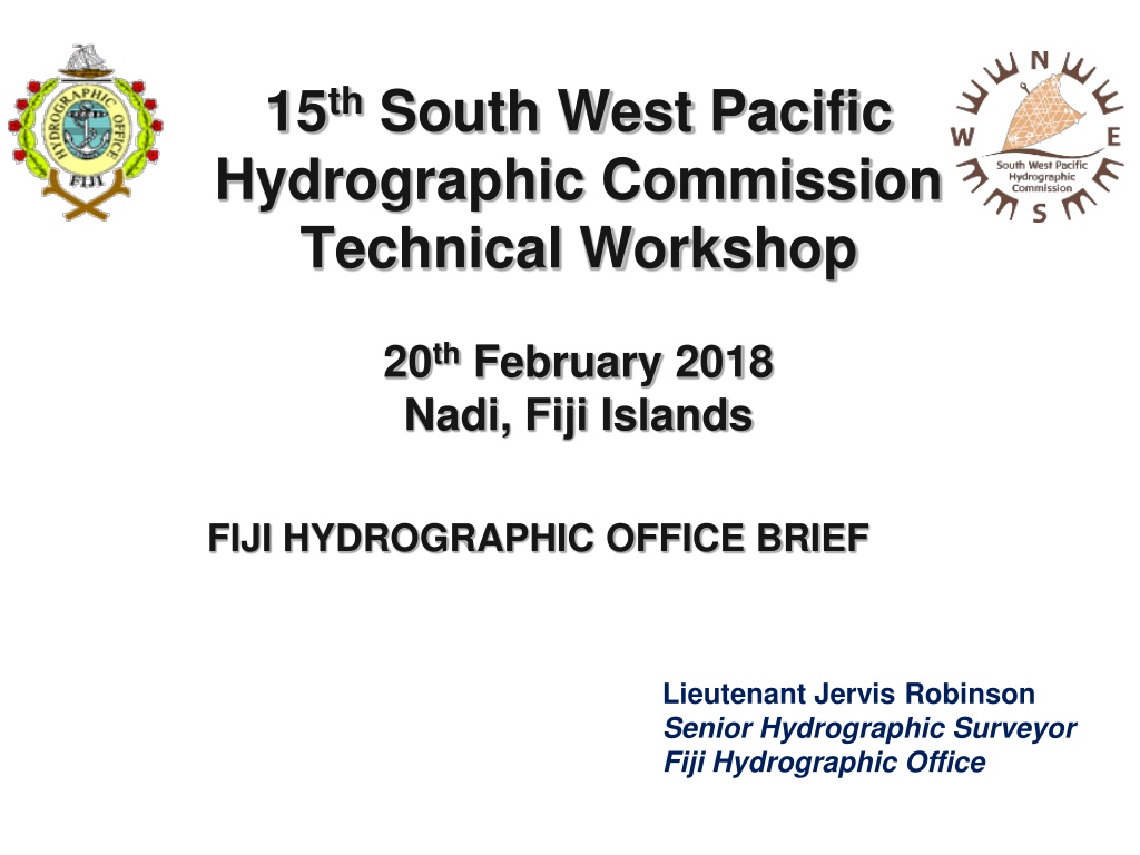
15thSouth West Pacific Hydrographic Commission Technical Workshop 20thFebruary 2018 Nadi, Fiji Islands FIJI HYDROGRAPHIC OFFICE BRIEF Lieutenant Jervis Robinson Senior Hydrographic Surveyor Fiji Hydrographic Office
Contents FHO Overview Projects Constraints Questions
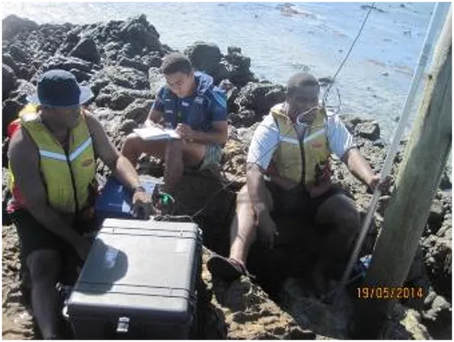
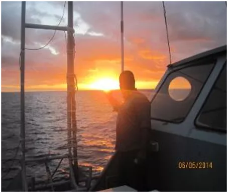
Roles & Responsibilities 1. To collect with systematic surveys at sea and along the coast geo - referenced data related to: Aids to navigation and port survey updates Depths of the area encompassed within Fiji s EEZ and of national interest Sea bottom composition Tides and currents Physical properties of water column Magnetic properties of the oceanic earths crust within Fiji waters 2. To process the information collected in order to create organized databases capable of feeding the production of thematic maps, nautical charts and other types of documentation for the following most common uses: Maritime navigation and traffic control Naval operations
Roles & Responsibilities Coastal Zone management and defence Marine environment preservation Exploitation of marine resources and laying of submarine cables/pipelines Maritime boundaries delimitation(Law of the Sea implementation) Scientific studies connected to the sea and near shore zone 3. To update databases through: Re-survey when and where needed Gathering supplementary information from other maritime authorities. 4. To ensure the: Production, distribution and updating of nautical charts and publications 5. To ensure the timely dissemination of marine safety information
Products and Services Hydrographic and Oceanographic Surveys Nautical Charts Navigational Charts Special Charts (showing 200 Mile EEZ and Maritime Baselines) Hydrographic Publications: Fiji Nautical Almanac (published annually) Fiji Chart Catalogue Maritime Safety Information: Fiji Notices to Mariners (periodical) Fiji Coastal Navigational Warning (MSAF) Nautical information (at the request of customer) Historical Archive research
Status of Nautical Charts Coverage of Hydrographic Surveying at Depths <200m / >200m (IHO Publication C55 23 Aug. 17)
FHO Current Strength Category Category A Hydrography Category B Hydrography Category B Marine/Nautical Cartography PO Q Diploma Hydrography Basic Hydrography Under Trainees No. 3 4 4 2 3 3
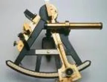
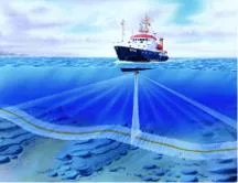
Equipments Data Acquisition 02 x R2Sonic MBES Odom MK III SBES together with a Side Scan Transducer Thales Differential GPS Trimble SPS DGPS Acquisition software and processing
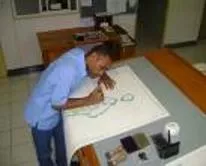
Cartography (Charting) Status FHO currently has a catalogue of 15 navigational charts to IHO Standards. Special Charts 3 (Fiji Marine Spaces and EEZ Chart) Printer Nation for 03 INT Charts Number of charts published to date 18 The last set of charts was published in 1999 Continue to Maintain and update to NtMs
FHO also publishes the annual Fiji Nautical Almanac. Contains tidal prediction data for Standard Port (Suva) Astronomical Data Fiji list of lights (K) Port of entry information Assist in the compilation, promulgation and distribution of Maritime Safety Information (MSI). Fiji Notices to Mariners Admiralty, AUS & NZ Notices to Mariners Fiji Coastal Navigational Warnings NAVAREA XIV Warnings
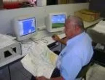
Developments Introduction of Digital Chart Production System (2015) FHO uses the Teledyne CARIS Software Package; Base Editor bathymetry data - Analyse and compile processed Paper Chart Composer - Produce and maintain INT1 / INT2 compliant paper charts and raster chart outputs including BSB-format RNCs S57 Composer - Produce and maintain S-57 products (ENC,AML,IENC) and in the future S-100 / S-101 products. Publications Module - Produce and maintain nautical publications including NtMs and List of Lights. Have received CARIS certified training in all modules
Projects Completion of chart INT747 Yasawa/Mamanuca Group Recompilation of Special charts (FMS) Developing a Vector database of all Fiji Chart Folio Final Checks to F13 Rovodrau Bay Approaches to Savusavu Valaga Bay
Capacity Building Training in Hydrography and Nautical Cartography is not available locally FHO dependant on overseas courses Previous/Current training are sourced from Course Marine Cartography and MSI Hydrography Country UK, Japan, NZ, Singapore Japan, India, Australia, Pakistan, NZ, SPC South Korea Oceanography Introduction of cross training for all officers
FHO & KHOA Official Development Project 1st ROK-Fiji bilateral meeting held on August 28, 2014. Feasibility study conducted and proposal submitted. Approval granted in 2015 with commencement beginning 2016 through to 2020. Purpose of Project To assist Fiji in strengthening its Marine Scientific Research Capability and present roles in contributing to national infrastructure. To support safe and efficient seaways, facilitate the protection of marine environment, to support the administration of sustainable development of national maritime zones.
FHO & KHOA Official Development Project Provision of professional Hydrographers and other personnel to participate in the planning and execution of ODA project on Oceanographic and hydrographic Operations; Provision of technical materials, equipment and data acquisition and processing systems; Provision of technical support; Provision of technical training in ROK.
FHO & KHOA Official Development Project 2016 ODA Project: 01 x 4WD Hyundai Tucson 6m Aluminum SMB with accessories 01 x SMB Trailer Tide gauge equipment Oceanography Training 2 officers (S/Korea) Conducted 2 weeks in-house training on DCP
FHO & KHOA Official Development Project ODA Project 2017: -MBES Handover -Joint Survey Rovodrau Bay, Pacific Harbor - Data Processing Training - ROK
FHO & KHOA Official Development Project Proposed Submissions for Aid Ocean Research Vessel MBES SSS ADCP Water Column Analysis Equipment Sub bottom profiler Magnetometer Geodetic GPS with processing software
FHO & KHOA Official Development Project Proposed Submissions for Aid Education and Training Cat B & Cat A Hydrographic Training Cartography Training Equipment 04 x Trimble Geodetic GPS Sets Ceescope Portable SBES 01 x Trimble S4 Total Station ARC GIS License
Current Difficulties Being Faced Constraints Survey vessel Solutions Concept of Deployable Geospatial Teams Proper equipment replacement plan in budget submission Procurement of survey equipment Contract for digitization of existing chart folio Replacement of equipment Equipment to conduct survey Unavailability of offset printing for F charts
Problems Survey vessel Solutions Concept of Deployable Geospatial Teams Proper equipment replacement plan in budget submission Procurement of survey vessel and equipment Contract for digitization of existing chart folio Restructure of FHO Replacement of equipment Equipment to conduct survey Unavailability of offset printing for F chart folio Current strength to operational area ratio


")