Site Analysis for Construction of Mixte Apartment Building at Gisenyi
Site analysis details the location, project analysis, owner information, neighboring plots, soil composition, hydrology, access to infrastructures like water supply and power, and more. The project is owned by Mr. Rutaganda Ignace and is planned for Gisenyi in Rubavu, Western Province. The site elevation is approximately 1400 meters above sea level with nearby wetlands and water bodies. Infrastructure access includes water supply from EUCL network and power from the national grid managed by REG.

Download Presentation

Please find below an Image/Link to download the presentation.
The content on the website is provided AS IS for your information and personal use only. It may not be sold, licensed, or shared on other websites without obtaining consent from the author. Download presentation by click this link. If you encounter any issues during the download, it is possible that the publisher has removed the file from their server.
E N D
Presentation Transcript
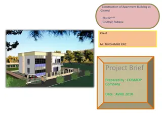
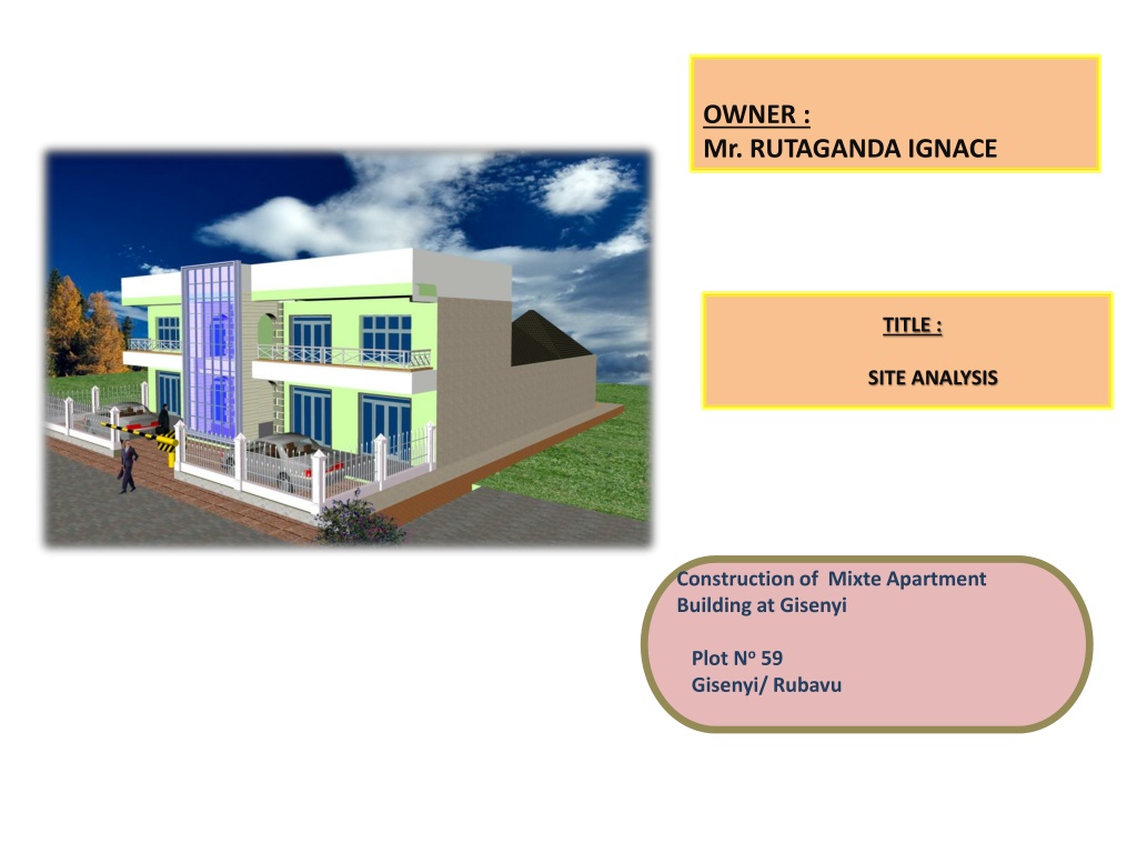
OWNER : Mr. RUTAGANDA IGNACE TITLE : SITE ANALYSIS Construction of Mixte Apartment Building at Gisenyi Plot No59 Gisenyi/ Rubavu
Project analysis Level Usage Area (m2) Ground floor area Apartment unit 228 First floor area Apartment units 127 TOTAL AREA 455 At maximum Capacity, the Project shall hold 18 Couple Number floors: 2FLOORS (G+1) Plot area : 475 sqm Total floor area :455 sqm Number of parking : 3
Project Location The project will be located in Gisenyi -Rubavu Neighbourhood context Western Province District : Rubavu Sector : Gisenyi Cell :Amahoro Plot No : 59 The project is located in an area with new developments as well as others that have been there for long time ago.. The plot neighbors also the ancient residential houses in the North and Est. , and the Road to the West . Project owner The project is owned by Mr. RUTAGANDA IGNACE NEIGBHOURING PLOTS - South : 58 - North : Plot 60 - East : Plot No 53 - West : Road The plot measures about 475 m2 and it is bordered by only one only road on one of its four sides . .
SITE ANALYSIS Hydrology, Soils and land cover and land tenure The elevation of the site is about 1400 above sea level The plot on there are some old constructions need to be demolished then to prepare the plot ;this means the preliminary works and including evacuation of all debris material on the ground. The soils of the site are composed of loamy soil with sandy soil in some places. There are some small cut trees on the area of the plot. There is no more natural vegetation on the plot . The surrounding area is comprised of buildings and roads. On the hydrological point of view , the nearby wetland is located to the South of the plot in around 1500m away. There is lake of kivu and Sebeya river in the south of the project site..
ACCESS TO INFRASTRUCTURES Water Supply / Sanitation The main water supply in settlements surrounding the study area is from the network managed by EUCL. Like the most of RUBAVU, the project area does not have a centralized sewerage network. The secondary water supply will be from the RC under ground water tank and plastic tank on area slab. Power Supply Like the existing houses the project has a direct connection to the national electricity grid managed by REG. It will be supported by a owner s standby generator in case of power cut off. Access road The project has a direct access to the secondary road and enough parking space for customers and visitors.