Discover the Exciting World of Latitude and Longitude
Dive into a virtual treasure hunt where you'll explore the concepts of latitude and longitude. Learn about the lines of latitude and longitude, hemispheres, coordinate choices, and how they help us pinpoint specific locations on a map. Test your skills with engaging activities and practice identifying coordinates in different hemispheres. Explore how coordinates are used to locate treasures and mark spots on a map for an exciting adventure!

Download Presentation

Please find below an Image/Link to download the presentation.
The content on the website is provided AS IS for your information and personal use only. It may not be sold, licensed, or shared on other websites without obtaining consent from the author. Download presentation by click this link. If you encounter any issues during the download, it is possible that the publisher has removed the file from their server.
E N D
Presentation Transcript
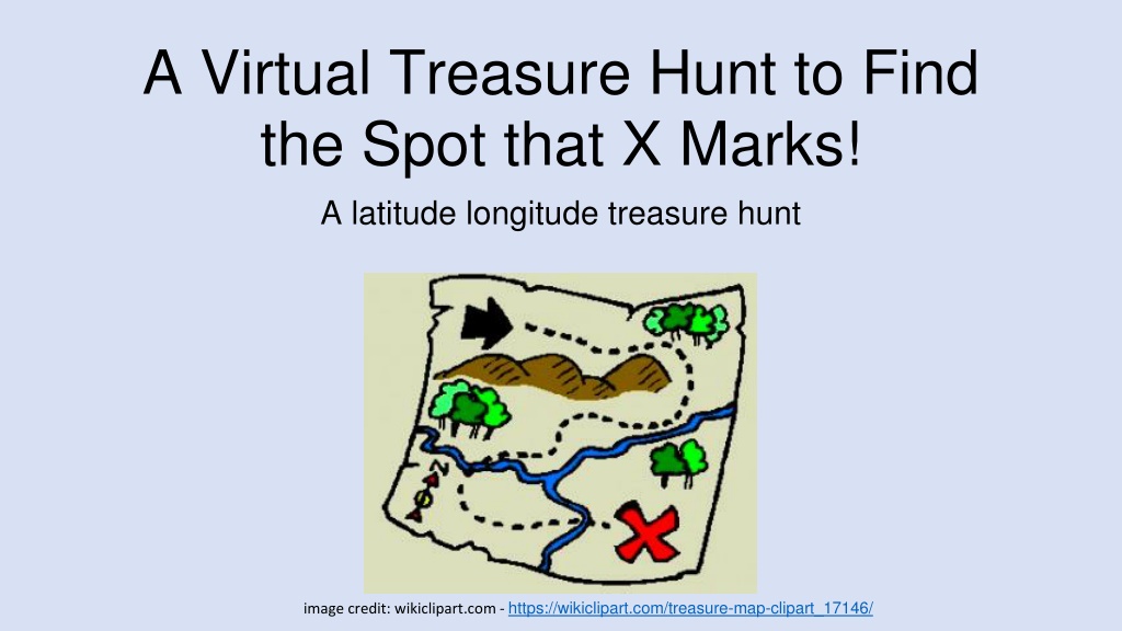
A Virtual Treasure Hunt to Find the Spot that X Marks! A latitude longitude treasure hunt image credit: wikiclipart.com - https://wikiclipart.com/treasure-map-clipart_17146/
Lines of Latitude 90oN 45oN EQUATOR 0o 45oS 90o S
Northern Hemisphere Southern Hemisphere
Lines of Longitude M E R I D I A N 180o 90oE 90oW 0o 180o
Western Hemisphere Eastern Hemisphere
Lines of Latitude and Longitude can overlay each other as a grid M E R I D I A N EQUATOR
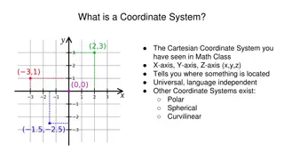
Latitude and Longitude lines together in a grid are called Coordinates
Coordinate Choices The numerical values for latitude and longitude can occur in a number of different units or formats: Degrees, minutes, and seconds (DMS) : 40 26 46 N and 79 58 56 W Degrees decimal minutes (DDM): 40 26.767 N 79 58.933 W Decimal degrees (DD): 40.446 N 79.982 W
Coordinates in a map can help us determine specific locations image credit: https://www.ncl.ucar.edu/Applications/mapgrid.shtml
What are the Coordinates of X X is located in what hemispheres? Western (W) Hemisphere Northern (N) Hemisphere X -125 W and 25 N
ACTIVITY: Practice Coordinates of X X is located in what hemispheres?
GLOBE Site Setup Application Name study site Zoom in on study site location Align red marker to (exact) location GLOBE uses degrees decimals Add elevation in meters (R) Click sphere (L)
ACTIVITY: Find the coordinates and map them STEP 3: STEP 1: Click on any cloud coverage symbol (a window pops up in the middle of the screen) Go to GLOBE.GOV Click GLOBE DATA Click DATA VISUALIZATION Click on Site Info Click ENTER VISUALIZATION SYSTEM STEP 2: Write down the latitude/longitude of that location (site) Pick any other cloud coverage symbol and repeat 2 more times CLICK LAYERS (L) Click ATMOSPHERE Place all 3 sites on the degree decimal grid based on the site s latitude and longitude Click CLOUDS Click CLOUD COVER Click SUBMIT(green) Put an X marking the spot of each site
One form of spatial skill is being able to use latitude and longitude coordinates to locate a study site
MyNASAData: NASA Earth System Data Explorer has maps you can interact with
Visit btc.montana.edu for some engaging mapping activities Potato World: http://btc.montana.edu/ceres/Worlds/Landform/potato.htm Mapping New Worlds: http://btc.montana.edu/ceres/Worlds/Landform/application.htm All Activities: http://btc.montana.edu/ceres/Worlds/Landform/planettrek.htm
Credit Kathleen Johnson, 2020 (kjohns12@bu.edu). Developed for Boston University GLOBE Mission Earth.


. Developed")