Understanding Latitude, Longitude, and Earth's Shape
Explore the concepts of latitude, longitude, and the shape of the Earth through informative content. Discover the significance of the troposphere, continental crust density, and proofs that the Earth is round. Learn how latitude is measured, the role of Polaris (North Star), and how these elements intersect in understanding our planet.
Download Presentation

Please find below an Image/Link to download the presentation.
The content on the website is provided AS IS for your information and personal use only. It may not be sold, licensed, or shared on other websites without obtaining consent from the author. Download presentation by click this link. If you encounter any issues during the download, it is possible that the publisher has removed the file from their server.
E N D
Presentation Transcript
Latitude and Longitude 29 September 2021
Do Now 1. What is the Troposphere? 2. What is the density of the continental crust? Bonus: What is today? The lowest layer of the atmosphere 2.7g/cm3
Shape of the Earth The actual shape of the earth is Oblate spheroid For our purposes in most cases we treat it as round
Proofs the earth is round Shadow on moon during a Lunar eclipse Ships disappear from bottom to top Angle to stars changes with position north and south especially Polaris Pictures from space Measurements of gravity Other planets are round
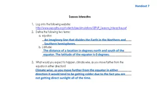
Latitude The equator is the imaginary line halfway between the poles Latitude is a measure north or south of the Equator Latitude is measured in degrees Each latitude degree is a uniform length (60 nautical miles) The angle Polaris is above the horizon (altitude of Polaris) is your latitude in the northern hemisphere
All points with the same angular distance have the same latitude and lie on the same parallels of latitude In the Northern hemisphere the angle of Polaris (North Star) above the horizon is the latitude The maximum a latitude can be is 90o The latitude can also be calculated from the angle of the noon Sun (90o angle of sun location of vertical ray) Latitude must include North or South
Latitude Latitude is the angle from the equator to the center of the earth to your position
Polaris Is also known as the North Star It is always in the northern nighttime sky. Is located above our Northern Celestial Pole (axis)
The angle to Polaris is your latitude Astrolabe cross stick The observer is at 66.5oN
***Polaris altitude (or height above the horizon) is EQUAL to an observer s latitude *** What would the altitude of Polaris be if you lived in Mt. Marcy NY?
As you move NORTH and your latitude increases, the altitude of Polaris also increases If you pass south of the equator, you can NO longer see Polaris As an observe travels east or west, the altitude of Polaris remains the same As an observe travels north or south, the altitude of Polaris changes b/c Earth has a curved surface
You are in Syracuse, NY. How high is Polaris? 43o ESRT The angle of Polaris is 45o, which city in New York are you located in? Massena You are in Buffalo. What is the angle of Polaris? 43o
How can you find Polaris in the night sky? The pointer stars in the Big Dipper point north towards Polaris
In the NORTHERN hemisphere all the stars appear to rotate around Polaris
NOW TRY THESE . . . 2. What is the latitude of each position? (a) 1. The diagram below shows the angular altitude of Polaris above the horizon at a certain location. What is the observers latitude? Latitude = _______________ NYS City = ______________ (b) Latitude = _______________


