Understanding the Paradox of Plankton and Biodiversity Correlates
The paradox of plankton challenges the theory that the number of species should match available resources, as seen in diverse plankton ecosystems. Explanations include resource partitioning, temporal and spatial heterogeneity, predation, adaptation to disturbance, and evolutionary processes. Biodive
3 views • 40 slides
Understanding Temperature Distribution and Differences in Heat
Explore the distribution of temperature across latitudes and elevations, and learn about the difference between heat and temperature. From horizontal to vertical variations, discover how factors like latitude influence temperature distribution patterns globally. Gain insights into the fundamental co
11 views • 19 slides
Climate and Climatic Regions of Pakistan
Pakistan exhibits diverse climatic regions ranging from sub-tropical continental mountains to arid desert plateaus. Factors like altitude, latitude, and distance from the sea greatly influence the country's climate. The country experiences weather conditions such as temperature variations, rainfall
0 views • 14 slides
Understanding Latitude, Longitude, and Earth's Shape
Explore the concepts of latitude, longitude, and the shape of the Earth through informative content. Discover the significance of the troposphere, continental crust density, and proofs that the Earth is round. Learn how latitude is measured, the role of Polaris (North Star), and how these elements i
2 views • 15 slides
Understanding the Spatial and Temporal Distribution of Temperature
The spatial and temporal distribution of temperatures plays a crucial role in determining weather patterns, climates, vegetation zones, and wildlife habitats. Factors such as latitude, altitude, distance from the coast, and prevailing winds influence the distribution of temperature both horizontally
2 views • 5 slides
Exploring Temperature Patterns on Earth: The Sun's Effect on Climate
Discover the fascinating relationship between the sun's effect on climate and temperature patterns on Earth at different latitudes and times of the year. This lesson delves into how temperatures vary with latitude from the equator, examining data for January and July to identify patterns and underst
4 views • 15 slides
Understanding Spatial Referencing Systems for Mapping
Spatial reference systems play a crucial role in defining geographic parameters and coordinate systems for mapping. They consist of components like orientation, latitude, longitude, and elevation, which help in representing spatial properties on maps. Reference surfaces such as the Geoid and ellipso
3 views • 13 slides
Understanding the Kӧppen Climate Classification System
The Kӧppen climate classification system, developed by Wladimir Kӧppen in 1884 and modified over the years, categorizes climates based on native vegetation as the best indicator. It recognizes five major climatic types designated by capital letters, reflecting temperature and precipitation pattern
0 views • 10 slides
Device-as-a-Service Lunch and Learn Event Overview
Explore the latest device models, leasing benefits, exemption processes, and device disposition options in this comprehensive lunch and learn event. Discover the updated 55xx and 74xx Latitude series laptops, 72xx 2-in-1 tablet, and 7080 OptiPlex desktop. Learn why leasing is a cost-effective soluti
0 views • 26 slides
Understanding Geolocation: What You Need to Know
Geolocation is a built-in browser functionality that allows web applications to be location-aware. It uses geographic latitude/longitude and is supported by all modern browsers, making it an integral part of the HTML5/W3C JavaScript API. With geolocation, you can show users their position on a map,
0 views • 16 slides
Coastal Ecosystems: Salt Marshes and Mangroves Overview
Explore the factors influencing coastal ecosystems like latitude, tidal cycles, wave energy, and geological characteristics. Dive into examples from the Pacific Northwest and southeastern U.S., focusing on salt marsh ecosystems. Learn about plant communities and zonation in salt marsh environments.
0 views • 22 slides
Variation of the Acceleration Due to Gravity with Latitude
Explore the variations in acceleration due to gravity with latitude through insightful images created by Shashi Kant Kumar, Assistant Professor of Physics at M.H.M. College, Sonbarsa. The images visually depict how gravitational acceleration changes with different latitudes, providing valuable insig
0 views • 11 slides
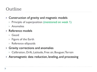
Understanding Gravity and Magnetic Models in Geophysics
Construction of gravity and magnetic models involves principles of superposition to isolate anomalies, reference ellipsoids, geoid, and various corrections like drift, latitude, free air, Bouguer, and terrain corrections. Gravity anomalies are determined by subtracting multiple factors from observed
0 views • 15 slides
Understanding Geopotential and Geopotential Height in Atmospheric Thermodynamics
This lecture discusses the concepts of geopotential and geopotential height in atmospheric thermodynamics, including their definitions, significance, and relationship with gravity. It explains how geopotential is a measure of potential energy relative to sea level and how geopotential height serves
0 views • 17 slides
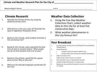
Climate and Weather Research Plan for the City
Meteorologist's research plan for a city including climate description, weather data collection, outdoor activities, best time to visit, living suitability, and latitude/longitude coordinates. The plan involves creating a script, visuals, video, and a weather forecast broadcast to showcase the city'
0 views • 5 slides
Understanding Jeans-Jeffreys Tidal Theory of Planet Formation
Tidal Theory posits that planets form from condensed materials close to the sun, a concept pioneered by Sir James H. Jeans and Sir Harold Jeffreys. Jeans proposed continuous matter creation in the universe, while Jeffreys explored the solar system's origin and latitude variation through astronomical
0 views • 5 slides
Understanding Latitude and Angular Distance on Earth
This content explains the concepts of latitude, angular distance, and distances on Earth using images and descriptions. It covers topics such as North Pole latitude, parallels of latitude, angular distance calculations, nautical miles, and great circle distances. Explore how these concepts relate to
0 views • 12 slides
Insights into the Low-Latitude Boundary Layer in Mercury's Magnetosphere
Study focuses on the low-latitude boundary layer (LLBL) in Mercury's magnetosphere, analyzing magnetosphere and magnetosheath plasma characteristics such as reconnection rates, IMF/magnetic shear, and plasma beta. Results show anti-correlation between LLBL and non-LLBL regions, with different reconn
0 views • 11 slides
Expanding Academic Vocabulary: Acquiring and Using Words Accurately
Today's focus is on acquiring and accurately using grade-appropriate academic vocabulary. Explore words like "inherit," "latitude," "loath," and "maintain" with clear explanations provided. Enhance your understanding of these terms to improve comprehension and expression skills.
0 views • 11 slides
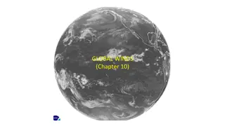
Understanding Large-Scale Winds and Atmospheric Circulation
Large-scale prevailing winds, such as the Hadley Cell, vary by latitude. These winds drive global atmospheric circulation, with rising air at the equator, sinking air at 30 degrees, and trade winds in between. By studying wind patterns, we gain insights into climate systems and weather phenomena.
0 views • 13 slides
Understanding Factors Influencing Climate Patterns
This informative content delves into various factors that influence climate, such as latitude, air masses, continentality, elevation, and mountain barriers. It explains why certain regions experience distinct weather patterns based on their geographical features, including temperature variations, pr
0 views • 20 slides
Understanding Basic Map Skills and Terms
Explore the essential map skills and terms such as map key/legend, compass rose, scale, latitude, longitude, Equator, Prime Meridian, hemispheres, and more to enhance your map reading and interpretation skills effectively.
0 views • 7 slides
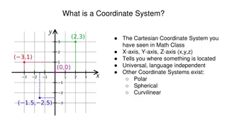
Understanding Coordinate Systems in Mathematics and Astronomy
Coordinate systems such as Cartesian, Polar, and Celestial serve as frameworks for locating points in space. They include dimensions like x, y, z axes in Cartesian, Latitude and Longitude on Earth, and various systems for astronomical observations. Different coordinate systems cater to specific purp
0 views • 11 slides
Understanding Map Concepts: An Overview
Exploring essential map-related terms and concepts such as map projection, hemisphere, latitude, longitude, scale, equator, prime meridian, map symbol, and globe. Enhance your understanding of how maps represent Earth's surface and the key elements involved in cartography.
0 views • 14 slides
Measurement Technique for Meridional Circulation in Solar Activity
In this research, time-distance measurements were conducted to study meridional circulation in solar activity. The east-west signal was found to be similar to the north-south signal, prompting analysis steps involving spherical harmonics computation, image reconstruction, filtering, cross-correlatio
0 views • 7 slides
Understanding the Significance of Latitude and Longitude Grid on Earth's Surface
Latitude and longitude form a grid of imaginary lines that are essential for pinpointing locations on Earth. The equator divides the planet into North and South hemispheres, while the prime meridian separates it into East and West hemispheres. With coordinates expressed using degrees, understanding
0 views • 9 slides
Understanding Earth's Geography: Location, Coordinates, and Hemispheres
Explore the concepts of absolute and relative locations, lines of latitude and longitude, GPS coordinates, and hemispheres in geography. Learn how to create a compass rose and label continents and oceans on a map. Understand how to describe locations using landmarks, direction, time, and distance.
0 views • 10 slides
Understanding Geography: The Study of Earth's Features and Human Interaction
Geography is the study of the Earth's physical and human features, their interaction, and how location impacts people's lives. It involves defining terms like longitude, latitude, equator, and prime meridian to understand relative and absolute locations. Geography helps us appreciate the nature of p
0 views • 14 slides
Understanding Photoperiodism in Plants
Photoperiodism is the ability of plants to detect day length, allowing them to know the season of the year and trigger specific physiological events. Earth's axis tilt and latitude influence day length variations, leading to distinct photoperiod responses in plants. This phenomenon plays a crucial r
0 views • 13 slides
Island Biogeography and Biodiversity Factors
Explore the relationship between island size, distance from other communities, latitude, and time in relation to species richness and biodiversity. Factors influencing biodiversity are discussed in the context of island biogeography hypothesis. Analysis of species vs. area curves is presented, highl
0 views • 33 slides
Discover the Exciting World of Latitude and Longitude
Dive into a virtual treasure hunt where you'll explore the concepts of latitude and longitude. Learn about the lines of latitude and longitude, hemispheres, coordinate choices, and how they help us pinpoint specific locations on a map. Test your skills with engaging activities and practice identifyi
0 views • 17 slides
Integrating Stochastic Weather Generator with Climate Change Projections for Water Resource Analysis
Exploring the use of a stochastic weather generator combined with downscaled General Circulation Models for climate change analysis in the California Department of Water Resources. The presentation outlines the motivation, weather-regime based generator description, scenario generation, and a case s
0 views • 20 slides
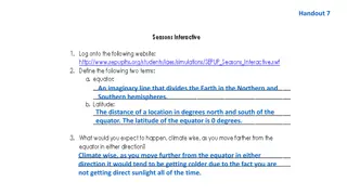
Understanding Earth's Hemispheres and Seasons
The Earth is divided into Northern and Southern hemispheres by the equator, affecting climate and seasons based on latitude. Locations near the poles experience significant sunlight changes, while equatorial areas have consistent daylight. Seasons differ between hemispheres due to the Earth's tilt,
0 views • 7 slides
Understanding Climatology for Building Design: Essentials and Applications
Explore the fundamentals of climatology for designing sustainable and comfortable built environments. Learn about the influence of climate on architecture, elements of climate, thermal comfort, natural ventilation, site climate, day lighting, shading devices, and more. Delve into the study of weathe
0 views • 9 slides
Understanding Geodetic Datums and WGS-84 Coordinates
Geodetic datums define the earth's shape and size, serving as reference points on coordinate systems. Vertical datums establish zero surface elevation, while horizontal datums form the basis for horizontal coordinates. The World Geodetic System 1984 (WGS-84) is the reference system used by GPS and l
0 views • 29 slides
Geographic Concepts Explained with Visuals
Explore various geographic concepts such as time zones, latitude, albedo, environmental spheres, and interactions between spheres through informative images and descriptions. Topics include longitude measurements, Tropic of Cancer location, hemispheres identification, time zone differences, environm
0 views • 34 slides
Understanding Factors Influencing Temperature Variations in US Cities
Solar zenith angle, location, specific heat, and axial tilt are key factors influencing temperature variations in US cities. Proximity to water bodies, altitude, and latitude also play significant roles. This lab explores why coastal cities experience different temperature patterns compared to inlan
0 views • 8 slides
Understanding Coastal Sand Dune Systems and Formations
Explore the intricate world of coastal sand dune systems, including the accumulation of windblown sediment, sand movement processes, dune formation stages, morphology classifications, and further categorization of dune types such as bay dunes and offshore island dunes. Learn about the vital role of
0 views • 7 slides
Understanding Latitude, Longitude, and Elevation for Weather Prediction
Latitude and longitude are used to locate places on Earth, while elevation represents the height above sea level. These geographical factors play a crucial role in determining temperature variations across different regions. The Equator, Prime Meridian, and other key lines help in dividing the Earth
0 views • 10 slides
Investigating Temperature Variations at Similar Latitudes
In this lesson, students explore why locations at the same latitude can experience different temperature patterns. By analyzing data and considering factors such as proximity to oceans and mountains, students develop an understanding of why latitude alone does not determine temperatures on Earth. Th
0 views • 12 slides


