Understanding Wind Patterns and Forces in Weather Forecasting
Wind plays a crucial role in weather forecasting, with different types of winds such as local, vertical, zonal, and meridional affecting atmospheric conditions. Forces like Pressure Gradient Force and Coriolis Force influence wind direction and speed. This article explores the science behind wind patterns and forces in the Earth's atmosphere.

Uploaded on Sep 23, 2024 | 0 Views
Download Presentation

Please find below an Image/Link to download the presentation.
The content on the website is provided AS IS for your information and personal use only. It may not be sold, licensed, or shared on other websites without obtaining consent from the author. Download presentation by click this link. If you encounter any issues during the download, it is possible that the publisher has removed the file from their server.
E N D
Presentation Transcript
Weather Forecasting by Dr. Vinay Kumar Class- B.Sc. (H) Physics, Section-I Semester-IV Department-Physics and Electronics Date: 19-03-2020
Wind, Wind speed direction and classification
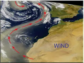
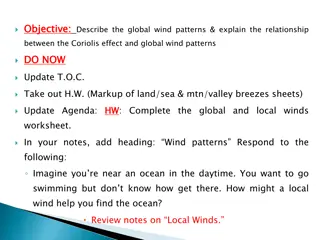
Wind Wind is the movement of air from an area of high pressure to an area of low pressure.Generally, these differences occur because of uneven absorption of solar-radiation at the Earth's surface. Wind speed tends to be at its greatest during the daytime when the greatest spatial extremes in atmospheric temperature and pressure exist. We have following type of wind available in earth s atmosphere: Local Wind: The movement of air mass from high to low pressure in a local area is called local wind. Local wind is the wind that below in small area. Vertical Wind: The atmospheric pressure decreases from low to high altitude so that the air mass moves vertical slowly from lower to upper part of atmosphere which is called vertical wind. Zonal Wind: Zonal wind is the movement of air along a latitudinal line. This flow can be from east to west or west to east. Meridional Wind: The wind along the meridional i.e. from one latitude line to another latitudinal line is called meridional wind.
Forces acting to produce wind The force which are responsible for wind are called driving force and described below: 1. Pressure Gradient Force (PGF) The pressure difference is mainly responsible for air mass flow which is known as wind. The change in pressure measured across a given distance is called a "pressure gradient". Figure Credit: University of Illinois at Urbana-Champaign. The pressure gradient results in a net force that is directed from high to low pressure and this force is called the "pressure gradient force (PGF) and corresponding acceleration is known as pressure gradient acceleration. Pressure gradient acceleration mathematically can describes with the following equation: Cont./
D = Density of air (average density of surface air is 1.29 kilograms per cubic meter) P2 = pressure at point 2 in netwons/m2 (N m-2) P1 = pressure at point 1 in netwons/m2 (N m-2) n = distance between the two points in meters Example: To determine the wind speed between two points for moving air with a density of 1.29 kilograms per cubic meter, a pressure difference of 400 Newtons/m2, and a distance of 300,000 meters. Using above formula:-
2. Coriolis force: The rotation of the Earth creates another force, termed Coriolis force, which acts upon wind and other objects in motion in very predictable ways. According to Newton's first law of motion, air will remain moving in a straight line unless it is influenced by an unbalancing force. The consequence of Coriolis force opposing pressure gradient acceleration is that the moving air changes direction. Instead of wind blowing directly from high to low pressure, the rotation of the Earth causes wind to be deflected off course. In the Northern Hemisphere, wind is deflected to the right of its path, while in the Southern Hemisphere it is deflected to the left. The magnitude of the Coriolis force varies with the velocity and the latitude of the object (see Below Figure). Coriolis force is absent at the equator, and its strength increases as one approaches either pole. Furthermore, an increase in wind speed also results in a stronger Coriolis force, and thus in greater deflection of the wind. Coriolis force only acts on air when it has been sent into motion by pressure gradient force. Finally, Coriolis influences wind direction and never wind speed. force only Figure Credit: University of Illinois at ww2010
3. Centripetal acceleration Centripetal acceleration is the third force that can act on moving air. It acts only on air that is flowing around centers of circulation. Centripetal acceleration is also another force that can influence the direction of wind. Centripetal acceleration creates a force directed at right angles to the flow of the wind and inwards towards the centers of rotation (e.g., low and high pressure centers). This force produces a circular pattern of flow around centers of high and low pressure. 4. Frictional Deceleration The last force that can influence moving air frictional deceleration . Friction can exert an influence on wind only after the air is in motion. Frictional drag acts in a direction opposite to the path of motion causing the moving air to decelerate (Newton's first and second laws of motion). Frictional effects are limited to the lower one kilometer above the Earth's surface.
Geostrophic Wind An air parcel initially at rest will move from high pressure to low pressure because of the Pressure gradient force (PGF). However, as that air parcel begins to move, it is deflected by the Coriolis force to the right in the northern hemisphere (to the left on the southern hemisphere). As the wind gains speed, the deflection increases until the Coriolis force equals the pressure gradient force. At this point, the wind will be blowing parallel to the isobars. When this happens, the wind is referred to as geostrophic. Figure Credit: University of Illinois at ww2010
The Figure below shows the two forces balancing to produce the geostrophic wind. Winds in nature are rarely exactly geostrophic, but to a good approximation, the winds in the upper troposphere can be close. This is because winds are only considered truly geostrophic when the isobars are straight and there are no other forces acting on it -- and these conditions just aren't found too often in nature. Figure Credit: University of Illinois at ww2010
Buy Ballot's Law Its states that when you stand with your back to a geostrophic wind in the Northern Hemisphere the center of low pressure will be to your left and the high pressure to your right. The opposite is true for the Southern Hemisphere.
Gradient Wind Wind above the Earth's surface does not always travel in straight lines. In many cases winds flow around the curved isobars of a high (anticyclone ) or low (cyclones) pressure center. A wind that blows around curved isobars above the level of friction is called a gradient wind. Gradient winds are slightly more complex than geostrophic winds because they include the action of yet another physical force. This force is known as centripetal force and it is always directed toward the center of rotation. Around a low, the gradient wind consists of the pressure gradient force (PGF) and centripetal force (Ce) acting toward the center of rotation, while Coriolis force (CF) acts away from the center of the low. In a high pressure center, the Coriolis and centripetal forces are directed toward the center of the high, while the pressure gradient force is directed outward. PGF = CF + Ce for the high CF = Ce + PGF for the low Figure Credit: University of Illinois at ww2010
Classification of Wind Speeds Generally wind can be classified according to speed. The Beaufort scale is the most common scale for classifying and naming winds according to their speed. Beaufort scale, in full Beaufort wind force scale, scale devised in 1805 by Commander (later Admiral and Knight Commander of the Bath) Francis Beaufort of the British navy for observing and classifying wind force at sea.
Beaufort Wind Scale Beaufort Scale- International Name Speed Observe d impact in atmosphere 0 --- Calm less than 1 mph (0 m/s) Smoke rises vertically 1 - 3 mph 0.5-1.5 m/s 1 --- Light air Smoke drifts with air, weather vanes inactive 4 - 7 mph 2-3 m/s Weather vanes active, wind felt on face, leaves rustle 2 --- Light breeze 8 - 12 mph 3.5-5 m/s 3 --- Gentle breeze Leaves & small twigs move, light flags extend 13 - 18 mph 5.5-8 m/s Small branches sway, dust & loose paper blows about 4 --- Moderate breeze 19 - 24 mph 8.5-10.5 m/s 5 --- Fresh breeze Small trees sway, waves break on inland waters 25 - 31 mph 11-13.5 m/s 6 --- Strong breeze Large branches sway, umbrellas difficult to use 32 - 38 mph 14-16.5 m/s 7 --- Moderate gale Whole trees sway, difficult to walk against wind 39 - 46 mph 17-20 m/s Twigs broken off trees, walking against wind very difficult 8 --- Fresh gale 47 - 54 mph 20.5-23.5 m/s Slight damage to buildings, shingles blown off roof 9 --- Strong gale 55 - 63 mph 24-27.5 m/s Trees uprooted, considerable damage to buildings 10 -- Whole gale 64 - 73 mph 28-31.5 m/s 11 -- Storm Widespread damage, very rare occurrence over 73 mph over 32 m/s 12 -- Hurricane Violent destruction
Wind Direction Winds are named according to the compass direction of their source. Thus, a wind from the north blowing toward the south is called a northerly wind. Below describes the sixteen principal bearings of wind direction. Most meterological observations report wind direction using one of these sixteen bearings. Figure Credit: University of Illinois at ww2010 Wind compass describing the sixteen principal bearings used to measure wind direction. This compass is based on the 360 degrees found in a circle.
Refrences: http://ww2010.atmos.uiuc.edu/(Gh)/wwhlpr/pressu re_gradient.rxml?hret=/guides/mtr/fw/geos.rxml http://www.physicalgeography.net/fundamentals/7 n.html