Location and Direction on Maps
Location and Direction are essential aspects of reading maps. Traditional methods use relative location descriptions, while modern approaches incorporate absolute coordinates. Maps utilize coordinate systems like Geographic Coordinate System (GCS) and Universal Transverse Mercator System (UTM) to pinpoint locations accurately. Understanding UTM coordinates, map scales, and reading methods is crucial for map interpretation.

Download Presentation

Please find below an Image/Link to download the presentation.
The content on the website is provided AS IS for your information and personal use only. It may not be sold, licensed, or shared on other websites without obtaining consent from the author.If you encounter any issues during the download, it is possible that the publisher has removed the file from their server.
You are allowed to download the files provided on this website for personal or commercial use, subject to the condition that they are used lawfully. All files are the property of their respective owners.
The content on the website is provided AS IS for your information and personal use only. It may not be sold, licensed, or shared on other websites without obtaining consent from the author.
E N D
Presentation Transcript
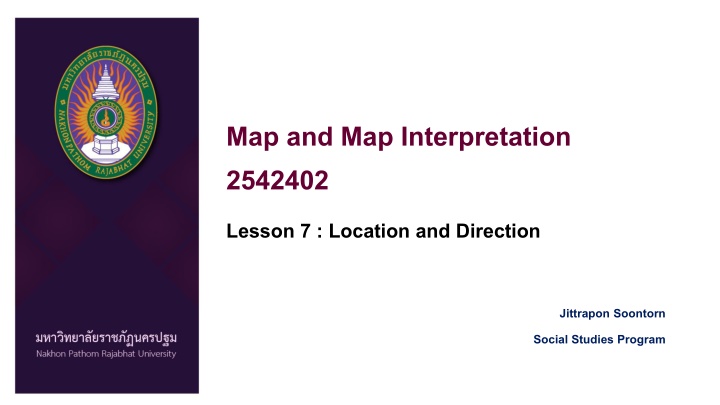
Map and Map Interpretation 2542402 Lesson 7 : Location and Direction Jittrapon Soontorn Social Studies Program
Location and Direction Location and Direction Location and Direction are the important function of the map Most of the map can provide Location of place Direction from 1 place to another place
Location and Direction Location and Direction How we can describe the location? In tradition way, Location can be told by relative location. Such as, Thailand is in S.E.A. Between Myanmar and Vietnam. Nakhon Pathom Rajabhat University is located in Nakhon Pathom Province, In front of Srivichai School. Nowadays, Location can be told by absolute location Using co-ordinate point. Suppose to which co-ordinate system used in each country. In Map we consider in telling the location by absolute location way.
Location and Direction Location and Direction Map Co-ordinate system in topographic map L7018 series has 2 systems Geographic Co-ordinate System (GCS) Latitude, Longitude Universal Transverse Mercator System (UTM) Easting, Northing X, Y
Reading UTM co Reading UTM co- -ordinate ordinate Co-ordinate is the crossing point of 2 line Which are vertical line and Horizontal line When reading or telling map co-ordinate We must using 2 groups of number (X,Y)
Reading UTM co Reading UTM co- -ordinate ordinate In L7018 map series, 1: 50,000 scale means 1 c.m. in the map equal 500 m. in the world Then the interval between 1 grid = 2 c.m. = 1 k.m.
Reading UTM co Reading UTM co- -ordinate ordinate Read Right Up We usually read number of X (Easting Direction) first. Then read number of Y (Northing Direction)
Reading UTM co Reading UTM co- -ordinate ordinate
Reading UTM co Reading UTM co- -ordinate ordinate If the co-ordinate does not stay on the grid line. We should divide the grid into 10x10 parts. The interval between 1 grid which used to be 1 k.m. long, will divide to 100 meters.
Reading UTM co Reading UTM co- -ordinate ordinate If the co-ordinate does not stay on the grid line. We should divide the grid into 10x10 parts. The interval between 1 grid which used to be 1 k.m. long, will divide to 100 meters. divide the grid into 10x10 parts.
Reading UTM co Reading UTM co- -ordinate ordinate Read > Right > Up X, Y 2101000 N 528000E
Reading UTM co Reading UTM co- -ordinate ordinate Read > Right > Up X, Y 2102300 N 528400E
Direction Direction We known the location Next We can find the Direction
Direction Direction The simple meaning of direction the measured angle of the places that measure from baseline Base line Direction B What is base line ? Base line is the line that we use to be the starting line for measuring the angle to each direction. A
Direction Direction From the principle of direction We define the North direction as the base direction 3 Type of North Direction True North Magnetic North Grid North
How to tell the direction How to tell the direction Basically way Divide the direction to 4 directions North South East West N E W S
How to tell the direction How to tell the direction Basically way Divide the direction to 8 directions North North East, North West South South East, South West East West N N.E. N.W. E W S.E. S.W. S
How to tell the direction How to tell the direction Bearing The way to tell the direction Measure from base direction North and South To East and West How to tell bearing direction. Bearing North xx degree, East N E W S
How to tell the direction How to tell the direction Example 1, Bearing Bearing North xx degree, East xx degree N 45 Bearing North 45 Degree, East. E W S
How to tell the direction How to tell the direction Example 2, Bearing Bearing North xx degree, East xx degree N 60 Bearing North 60 Degree, East. E W S
How to tell the direction How to tell the direction Example 3, Bearing Bearing North xx degree, East xx degree N 45 Bearing North 45 Degree, West. E W S
How to tell the direction How to tell the direction Example 4, Bearing Bearing North xx degree, East xx degree N Bearing South 45 Degree, West. E W 45 S
How to tell the direction How to tell the direction Example 5, Bearing Bearing North xx degree, East xx degree N Bearing South 30 Degree, East. E W 30 S
How to tell the direction How to tell the direction How about this? N Bearing North 30 Degree, East. 30 E W Bearing North 60 Degree, East. **Measure from base direction North and South To East and West S
How to tell the direction How to tell the direction How about this? **Measure from base direction North and South To East and West N E W 75 Bearing South 15 Degree, West. S
How to tell the direction How to tell the direction Azimuth The way to measure the direction from the origin to the observe point can cross-checking the angle value In Azimuth, we measure 2 type of azimuth Forward azimuth Backward azimuth
How to tell the direction How to tell the direction N How to measure Azimuth Azimuth is the way to measure the angle starting from North direction to clockwise direction. B E W N S E W A 60 S
How to tell the direction How to tell the direction N Forward azimuth A to B Measure from North of A point In clockwise direction to the observe line (blue line) B E W N S Forward Azimuth A to B = 60 Degree 60 E W A S
How to tell the direction How to tell the direction N Backward azimuth B to A Measure from North of B point In clockwise direction to the observe line (blue line) B E W 240 N S Backward Azimuth B to A = 240 Degree E W A S
How to tell the direction How to tell the direction Ex.1 Forward and Backward azimuth N 135 E W A S Forward Azimuth A to B = 135 Degree N B Backward Azimuth B to A = 315 Degree E W 315 S