Implementation of ENC Schemes in Arctic Region by ARHC & IHO
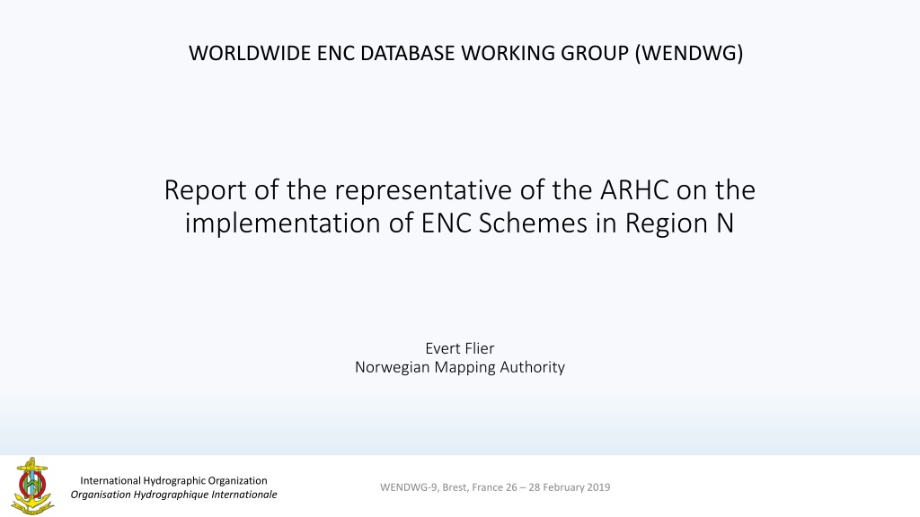


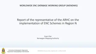
WORLDWIDE ENC DATABASE WORKING GROUP (WENDWG)
WENDWG-9, Brest, France 26 – 28 February 2019
Report of the representative of the ARHC on the
implementation of ENC Schemes in Region N
Evert Flier
Norwegian Mapping Authority


Background
•
Arctic Regional Hydrographic Commission (ARHC) established in October 2010.
•
Core Members: Canada, Denmark, Norway, Russian Federation, USA.
•
Associate Members: Finland, Iceland, Italy.
•
New INT Charting Region ‘N’ created 2011.
•
Arctic INT Chart Coordination Working Group (AICCWG) established October 2012.
•
AICCWG fully manned - Norway acting as regional charting coordinator.
WENDWG-9, Brest, France 26 – 28 February 2019


Overview of INT Region N
WENDWG-9, Brest, France 26 – 28 February 2019
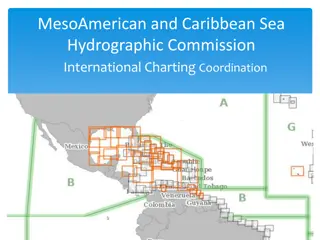
INT Region N
INT Region N covers the Arctic Ocean and
adjacent seas north of the Bering Strait (line
joining Mys Dezhneva and Cape Prince of
Wales) and north of the 69°N parallel in the
Nordic Seas
.
INT Region N
Status of the ENC Scheme UB1 in Region N
WENDWG-9, Brest, France 26 – 28 February 2019
Number of ENC’s
UB1 Overview: 8
Figures as of Feb 2019
Status of the ENC Scheme UB1 in Region N
WENDWG-9, Brest, France 26 – 28 February 2019
And three non-RENC
exclusive UB1 ENC’s
Figures as of Feb 2019
Status of the ENC Scheme UB2 in Region N
WENDWG-9, Brest, France 26 – 28 February 2019
Number of ENC’s
UB2 General: 90
Figures as of Feb 2019
Status of the ENC Schemes UB 3/4/5/6 in Region N
WENDWG-8, Buenos Aires, Argentina 20 – 22 March 2018
Number of ENC’s
UB3 Coastal: 162
UB4 Approach: 350
UB5 Harbour: 122
UB6 Berthing: 23
Figures as of Feb 2019
Existence of overlapping
ENCs that may have a possible impact on
safe navigation
WENDWG-9, Brest, France 26 – 28 February 2019
•
IC-ENC Overlap report – all overlaps assessed as ‘low’risk.
•
Significant progress has been made in eliminating overlaps most notably the collabarative efforts of The United States and The Russian Federation.
•
Norway in collaboration with Denmark and Germany - eliminated overlaps with the NO1A3000 cell.
•
Work completed on all but three overlapping issues.
The report highlights the status of ENC schemes in Arctic Region N, focusing on UB1, UB2, UB3, UB4, UB5, and UB6. It covers data such as the number of ENC charts and details of the ARHC and IHO efforts in the area. The presentation took place during the WENDWG-9 meeting in Brest, France, in February 2019.

Download Presentation

Please find below an Image/Link to download the presentation.
The content on the website is provided AS IS for your information and personal use only. It may not be sold, licensed, or shared on other websites without obtaining consent from the author.If you encounter any issues during the download, it is possible that the publisher has removed the file from their server.
You are allowed to download the files provided on this website for personal or commercial use, subject to the condition that they are used lawfully. All files are the property of their respective owners.
The content on the website is provided AS IS for your information and personal use only. It may not be sold, licensed, or shared on other websites without obtaining consent from the author.
E N D
Presentation Transcript
WORLDWIDE ENC DATABASE WORKING GROUP (WENDWG) Report of the representative of the ARHC on the implementation of ENC Schemes in Region N Evert Flier Norwegian Mapping Authority International Hydrographic Organization Organisation Hydrographique Internationale WENDWG-9, Brest, France 26 28 February 2019
Background Arctic Regional Hydrographic Commission (ARHC) established in October 2010. Core Members: Canada, Denmark, Norway, Russian Federation, USA. Associate Members: Finland, Iceland, Italy. New INT Charting Region N created 2011. Arctic INT Chart Coordination Working Group (AICCWG) established October 2012. AICCWG fully manned - Norway acting as regional charting coordinator. International Hydrographic Organization Organisation Hydrographique Internationale WENDWG-9, Brest, France 26 28 February2019
Overview of INT Region N INT Region N covers the Arctic Ocean and adjacent seas north of the Bering Strait (line joining Mys Dezhneva and Cape Prince of Wales) and north of the 69 N parallel in the Nordic Seas. INT Region N INT Region N International Hydrographic Organization Organisation Hydrographique Internationale WENDWG-9, Brest, France 26 28 February2019
Status of the ENC Scheme UB1 in Region N Number of ENC s UB1 Overview: 8 Figures as of Feb 2019 International Hydrographic Organization Organisation Hydrographique Internationale WENDWG-9, Brest, France 26 28 February 2019
Status of the ENC Scheme UB1 in Region N And three non-RENC exclusive UB1 ENC s Figures as of Feb 2019 International Hydrographic Organization Organisation Hydrographique Internationale WENDWG-9, Brest, France 26 28 February 2019
Status of the ENC Scheme UB2 in Region N Number of ENC s UB2 General: 90 Figures as of Feb 2019 International Hydrographic Organization Organisation Hydrographique Internationale WENDWG-9, Brest, France 26 28 February 2019
Status of the ENC Schemes UB 3/4/5/6 in Region N Number of ENC s UB3 Coastal: 162 UB4 Approach: 350 UB5 Harbour: 122 UB6 Berthing: 23 Figures as of Feb 2019 International Hydrographic Organization Organisation Hydrographique Internationale WENDWG-8, Buenos Aires, Argentina 20 22 March 2018
Existence of overlapping ENCs that may have a possible impact on safe navigation IC-ENC Overlap report all overlaps assessed as low risk. Significant progress has been made in eliminating overlaps most notably the collabarative efforts of The United States and The Russian Federation. Norway in collaboration with Denmark and Germany - eliminated overlaps with the NO1A3000 cell. Work completed on all but three overlapping issues. International Hydrographic Organization Organisation Hydrographique Internationale WENDWG-9, Brest, France 26 28 February 2019
")