Pan-Arctic Digital Elevation Map Workshop Overview
Learn about the Pan-Arctic Digital Elevation Map Workshop held in Waterloo, Canada in October 2015, where discussions revolved around data requirements, project backgrounds, major participants, and the importance of Digital Elevation Models (DEMs) in various Arctic applications. The workshop aimed to improve access to high-resolution Arctic elevation data and harmonize existing data into a Pan-Arctic DEM, addressing climate change impacts and enhancing Arctic climate science.
Download Presentation

Please find below an Image/Link to download the presentation.
The content on the website is provided AS IS for your information and personal use only. It may not be sold, licensed, or shared on other websites without obtaining consent from the author.If you encounter any issues during the download, it is possible that the publisher has removed the file from their server.
You are allowed to download the files provided on this website for personal or commercial use, subject to the condition that they are used lawfully. All files are the property of their respective owners.
The content on the website is provided AS IS for your information and personal use only. It may not be sold, licensed, or shared on other websites without obtaining consent from the author.
E N D
Presentation Transcript
Pan-Arctic Digital Elevation Map Workshop, Waterloo, Canada Tracy Fuller Alaska Mapping Program Manager U.S. Geological Survey, National Geospatial Program October 26-28, 2015
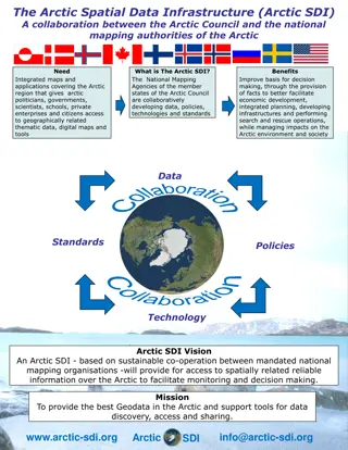
Pan-Arctic DEM Workshop Open Session Agenda Project Background, Major Participants, Discussion on Data Requirements Arctic Council s Pan-Arctic Digital Elevation Map Project Overview Conservation of Arctic Flora and Fauna Arctic Council Working Group Overview Arctic Spatial Data Infrastructure Overview Polar Geospatial Center s Pan-Arctic DEM Project Overview Requirements Questionnaire Review Data Requirements Open Discussion
Digital Elevation Model Primer Digital Surface Model (DSM) and Digital Terrain Model (DTM) DSM shows tops of trees and structures , DTM removes cover to show bare earth Both are important for modeling and mapping applications
Digital Elevation Model Primer Elevation Uses Primary layer for many Arctic applications Examples: Wildfire modeling, biomass calculation, storm surge and tsunami risk, coastal change monitoring, climate modeling, general map generation
U.S. Arctic Council Chairmanship Program 2015-2017 Addressing the Impacts of Climate Change Improving Arctic Climate Science: Arctic Digital Elevation Map Original Proposal Improve access to high resolution Arctic elevation data Publicly available data Single point of access Arctic Nations, through Arctic SDI, harmonize existing Arctic data into a Pan-Arctic DEM Series of workshops and intermediary steps would: research appropriate technical specs, including geographic coverage and resolution plan for implementation harmonize data assess quality coordinate data delivery
Announcements and Activities Since Proposal Acceptance Arctic SDI Board approves Arctic nation initial investigation - Initial requirements gathering and data inventory efforts - Support workshop scheduled in conjunction with the Second Polar Data Forum (PDF II) scheduled October 26-28 2015 in Waterloo, Canada U.S. President announces the Polar Geospatial Center s Pan-Arctic DEM project - Announced September 2, 2015 - Funded by the U.S. National Science Foundation - Use imagery licensed by the U.S. National Geospatial Intelligence Agency (NGA) - Imagery licensed (not public), but derivative DSM is Public Doman - Presents a single-source alternative to harmonization of disparate datasets - Presents opportunity for Arctic nations to collaboration NASA preparing to release a world-wide DSM generated from ASTER satellite imagery - March 2016 release of 20m resolution data - - -
Results from Information Gathering Efforts Data Inventory Gathering detailed information on Arctic Nation existing elevation data Many (but not all) nations have public domain DTM and DSM data nationwide Varying resolutions from 5m to 90m Some countries working to complete new acquisitions Requirements Gathering Current Pan-Arctic dataset generally in use is 1km resolution Wide range of resolutions requested 10m, 100m, 200m, 500m Requests for Pan-Arctic DEM solution to be well thought out, in consultation with the science community
National DEM Inventory to Support Harmonization Basic Assumption: Require Public Domain and Complete National Coverage Coverage Resolution DTM or DSM Source Age Source Process Canada 20-90 m Both a DTM and DSM varies Mix: hypso/RS, SRTM Finland 10 meter DTM varies Mix: hypso/lidar Greenland GIMP 30 meter DSM 2014 GIMP-stereo imagery Iceland Norway 10 meter DTM Russia Sweden US (Alaska) 60 meter DTM 1960s - 2015 Mix: ifsar, hypso Arctic GDEMv3 30 meter DSM 2014 ASTER processing
Polar Geospatial Center Arctic DEM Project Highlights PGC DEM Basic Characteristics 2m-8m point DSM (resolution depends on funding for supercomputer cycles) Some Artifacts recognized in the data
Polar Geospatial Center Arctic DEM Project Highlights Fully Automated System No human intervention by PGC to cartographically enhance the data Unprecedented capacity for REPEAT coverage image request/image delivery/DEM processing all automated, satellite overflight every 2 days (although competition for imagery and clouds can reduce acquisition opportunities) Cost: Estimated $3M-$5M U.S., full funding anticipated from U.S. NSF Timeline Deliver Alaska by spring 2016; full Pan-Arctic by spring 2017 Data Delivery Options U.S. NGA, ESRI, Inc., Google, Arctic SDI are in talks Arctic Nation, Permanent Participant and Observer Collaboration Opportunities Review satellite image stereo pair browse images to find improved imagery scenes Provide high resolution coastline data to improve masking of coastal imagery Provide Ground Control Points and lidar where available to PGC to improve the process Provide data assessment and editing capability
Workshops Critical to Review Options and Plan Implementation 1st Workshop October 26-28 in Waterloo Canada; 2nd Workshop proposed spring 2016 Requirements Analysis Review initial requirements feedback; finalize questions for upcoming international survey Great opportunity to network with and gather requirements from PDF II participants Data Inventory and Maintenance Review and finalize inventory of existing Arctic DEM data Consider use of existing data for a near-term solution and long term maintenance In-depth Review of Polar Geospatial Center Project Methodology and Deliverable PGC provided samples of data over Arctic nations suggested AOIs Participants reviewing samples, consider collaboration opportunities with PGC Data Delivery Review options for serving data (internet download, web coverage service) Pan-Arctic DEM Hackathon Participating technical practitioners will test data harmonization and delivery options
Workshop Goals Day 1 Introduction to the PGC methodology, deliverable, and timeline Hear from Arctic Mapping Organizations that are working with PGC data Review opportunities for Arctic nation collaboration to improve the product Review sample data over Areas of interest Day 2 Open session to consider general data requirements and characteristics Arctic SDI Technical Hackathon test PGC, Harmonization, and Delivery Develop recommendation(s) for Arctic SDI National Contact Points Day 3 Present and Discuss Pan-Arctic DEM recommendation Come to consensus on Path Forward Recommendation for Arctic SDI
Potential Roles for CAFF and Arctic SDI to Consider CAFF Provide contacts to improve requirements gathering effort Provide Arctic Council international advice and oversight Consider providing CAFF server space for data storage, depending on Arctic SDI suggestions and outcomes from the Waterloo workshop Arctic SDI Provide access to science and user contacts Provide data Attend workshops and provide technical expertise Provide storage and data delivery for a potential near-term harmonized data product Support PGC effort so product in 18 months is improved beyond the fully automated version
Science Requirements Questionnaire 1) Identify the primary application(s) you use that require elevation data; provide general field(s) of study and specific application name(s) as appropriate. Example: Climate Modeling; SNAP tool. 2) What elevation data format(s) would most easily be used in your application(s). (i.e. GeoTiff, BigTiff, ERDAS img, ArcGRID, GridFloat , raster PNG, ASCII delimited text, USGS DEM, JPEG, DTED, other). Check as many as applicable. 3) Focusing on the Arctic, what geographic coverage do you require? (i.e. 60-degrees and north, complete coverage of all or some of the 8 Arctic nations, other). 4) What resolution(s) do you require for your application or modeling efforts? (i.e 2m, 8m, 20m, 100m,250m, 500m, 1km, other). Check all that apply.
Science Requirements Questionnaire 5) There are two major categories of Digital Elevation Models. A Digital Surface Model (DSM) generally represents the surface seen in an image, such as the tops of trees and structures. Digital Terrain Models (DTMs) represent the bare earth with vegetation and structures stripped away. Is your application best served with a DSM or a DTM, or do you need both? 6) What access or delivery mechanisms would best suit your needs: - bulk delivery via portable hard drive: - internet download via viewer or FTP: - web coverage service:
Science Requirements Questionnaire 7) What DEM data do you now use for your application(s)? 8) How satisfied are you with the current elevation data you are using? 9) Please comment on any problems you face using currently available elevation data. 10) What are your requirements for periodic refresh of the digital elevation data you are using in your modeling? (How often would you like the data to be updated?) 11) Individual DEM tiles can be mosaicked into larger area files. What large area aggregates would best serve your modeling needs? Select any that apply or suggest your own: one- degree cell, watershed boundary, individual country, entire Pan-Arctic coverage
Science Requirements Questionnaire Other Considerations Affiliation of respondent (government, academia, private)? Would respondent use derivatives: slope, aspect, contours, shaded relief? Where do you access the Arctic DEM product you currently use?
Data Requirements Open Discussion Need for consistency in source age? (1960 2015) Need for consistency in source process? (lidar, image autocorrelation, contour conversion) Need for consistency in DEM source type (mix DTM with DSM) Data Resolution (application dependencies) Download Data Format Geographic Extent (national boundaries, large watersheds, latitude) Data Projection Mosaic Options Delivery Options
