Discovering Ocean's Challenges: Virtual Meetings with Researchers
Dive into the world of ocean exploration with your students through a series of virtual conferences with researchers and specialists, organized by the Tara Ocean Foundation. Explore topics such as ocean and climate, plastic pollution, plankton, and Arctic ice melting. Engage in presentations, Q&A se
0 views • 6 slides
Deep Ocean Circulation and Salinity Patterns
Explore the intricate relationship between ocean salinity, vertical structure, and deep-water currents in this informative collection of images and explanations. Discover how salt inputs and outputs influence ocean salinity levels, and learn about the factors that contribute to the vertical variatio
12 views • 21 slides
Ocean: Pre-Visit Lesson Plan
Dive into a creative educational journey to explore the significance of the ocean and ways to protect it. Students will engage in activities such as creating a poem and campaign poster, fostering a deeper connection with the ocean and understanding the importance of recycling for ocean conservation.
5 views • 8 slides
AG-Ocean Engagement Plan: Enhancing Collaboration for Ocean Infrastructure Development
The AG-Ocean Engagement Plan aims to establish long-term working arrangements between WMO and the ocean infrastructure community to advance Earth System Approaches. AG-Ocean focuses on advisory roles, prioritizing key areas for impact. The plan identifies observations, data, and prediction as essent
1 views • 21 slides
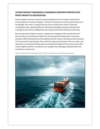
OCEAN FREIGHT INSURANCE | ENSURING SHIPMENT PROTECTION FROM ORIGIN TO DESTINATIO
Ocean freight insurance is vital for protecting shipments from origin to destination, ensuring peace of mind for shippers. This type of insurance covers potential risks such as damage, loss, theft, or delays that can occur during ocean transit. Given the complexities and unpredictability of internat
1 views • 1 slides
Relational Database Design and Mapping Techniques
Explore the process of mapping Entity-Relationship (ER) and Enhanced Entity-Relationship (EER) models to relational databases. Learn about relational model concepts, mapping algorithms, and the goals and steps involved in the mapping process. Discover how to preserve information, maintain constraint
3 views • 42 slides
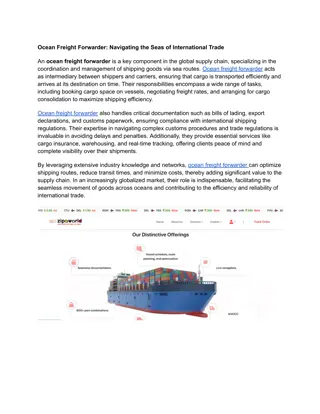
Ocean Freight Forwarder: Navigating the Seas of International Trade
An ocean freight forwarder is a vital player in the maritime logistics industry, specializing in the efficient and cost-effective transportation of goods across seas and oceans. Ocean freight forwarder manages the intricate logistics of ocean shippin
1 views • 1 slides
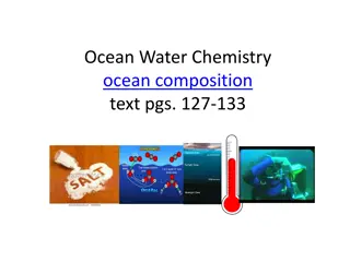
Ocean Water Chemistry: Salinity, Saltiest Body of Water, and Gases
Delve into the complexity of ocean water chemistry, including the significance of salinity levels, the saltiest body of water on Earth at Don Juan Pond in Antarctica, the composition of salts in ocean water, and the role of gases like oxygen and carbon dioxide. Discover how these factors shape the c
0 views • 11 slides
Ocean Acidification: Impact on Coral Reefs
Ocean acidification is the process where oceans become more acidic due to excessive carbon dioxide absorption. Human activities like deforestation and vehicle emissions contribute to this phenomenon. Coral reefs are crucial as many ocean species rely on them for survival. The pH scale measures acidi
0 views • 18 slides
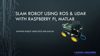
Mapping Robot using ROS, Lidar with Raspberry Pi & MATLAB
Turtle.bot is a popular product for home service robots, utilizing SLAM and navigation technologies. It features gyro, Kinect sensors, Lidar, and a laptop for mapping. The robot localizes and navigates using ROS in Raspberry Pi connected with MATLAB. ROS (Robot Operating System) is a set of software
0 views • 17 slides
National Labor Mapping Application User Roles and Access Overview
This detailed overview outlines the implementation plan, user roles, and access benefits of the National Labor Mapping Application. Users are assigned specific roles with established access through domain usernames, enhancing security measures. Different user roles such as VISN Coordinators, Site Te
1 views • 14 slides
Mapping Methodology for Establishing ESCO Relations
Learn how to set up teams, collect resources, compare classifications, and establish mapping relations for ESCO implementation projects. Get insights on using computer-assisted suggestions, updating mapping tables, and selecting mapping projects. Explore techniques for navigating classifications, br
1 views • 21 slides
Texture Mapping in Computer Graphics
Delve into the world of texture mapping as a solution to the smoothness of polygons in computer graphics. Learn how to create textured scenes using techniques such as bump mapping and environmental mapping. Discover the process of representing textures, working with curved surfaces, and mapping onto
2 views • 24 slides
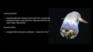
Bathymetric Features of the Ocean Floor
Explore the fascinating bathymetric features of the ocean floor, including the continental margin, ocean basin floor, deep-sea trenches, mid-ocean ridges, and abyssal plain. Learn about submarine canyons like the Cape Range Canyon near Ningaloo Reef in Western Australia, and discover rare marine lif
0 views • 37 slides
Evaluation of Ocean Color Inversion Models for Retrieving Marine IOPs
Evaluating and generalizing ocean color inversion models to retrieve marine inherent optical properties (IOPs) is essential for understanding ocean dynamics. This involves choosing the right algorithm and validating its effectiveness, as discussed in the Ocean Optics Summer Course at the University
0 views • 23 slides
The Biological Pump and Carbon Cycle in the Ocean
The biological pump in the ocean involves photosynthesis by phytoplankton, which removes carbon dioxide from the atmosphere, and respiration, where some CO2 is released back. Phytoplankton are crucial in the ocean's carbon cycle, with primary consumers like zooplankton depending on them for energy.
0 views • 20 slides
Coupled Ocean-Atmosphere Modeling on Icosahedral Grids
Coupled ocean-atmosphere modeling on horizontally icosahedral and vertically hybrid-isentropic/isopycnic grids is a cutting-edge approach to modeling climate variability. The design goals aim to achieve a global domain with no grid mismatch at the ocean-atmosphere interface, with key indicators such
3 views • 21 slides
Ocean Basins and Their Characteristics
Ocean basins are vast submarine regions that cover a significant portion of the Earth's surface, hosting the majority of the planet's water. These basins exhibit various features such as ocean ridges, deep-sea trenches, and seismic ridges. The ocean floor is constantly evolving due to plate tectonic
0 views • 18 slides
Seasonality of Particles Exported by the Southern Ocean Eddy Subduction Pump
The Southern Ocean Eddy Subduction Pump plays a crucial role in global carbon cycling, contributing significantly to the ocean's uptake of anthropogenic CO2. This research aims to characterize the seasonality and particle assemblage of the pump to better understand its role in carbon export. Various
0 views • 35 slides
Innovative LiDAR Cave Mapper for Cavers
Develop a portable and cost-effective LiDAR cave mapper to assist freelance cavers in mapping caves efficiently. The project aims to create a device that is affordable, DIY-style, and open-source, making cave mapping more accessible and accurate. The team from FAMU-FSU College of Engineering strives
0 views • 22 slides
Ocean Salinity and Freezing Points
Explore the world of ocean salinity and freezing points, from the formation of polar ice to the unique characteristics of the Arctic and Antarctica. Discover the composition of ocean water, the concept of salinity, measurement methods, average ocean salinity levels, and how both saltwater and freshw
0 views • 58 slides
Atlantic Seabed Mapping Workshop Summary
Workshop held in Dublin Castle on Dec 2, 2014, discussed current and future plans for seabed mapping in the Atlantic. Key topics included navigational charting, initiatives by various organizations, challenges of disjointed mapping efforts, and proposed actions to address issues. Recommendations inc
1 views • 5 slides
World Ocean Council: Industry Leadership and Collaboration for Sustainable Ocean Business
The World Ocean Council is an international alliance promoting leadership and collaboration among ocean industries for sustainable use and stewardship. By bringing together various sectors like shipping, oil/gas, fisheries, and tourism, the council aims to create a responsible ocean business communi
0 views • 22 slides
Atmosphere-Ocean Coupling in Madden-Julian Oscillation
Atmosphere-ocean coupled processes in the Madden-Julian Oscillation (MJO) play a crucial role in intraseasonal oscillations. This paper review by Shao Yun-Chuan explores how the ocean's Sea Surface Temperature (SST) influences surface fluxes, MJO convection, and energy balance dynamics. It delves in
0 views • 17 slides
Biophysical Feedbacks in the Global Ocean Research Overview
Biophysical feedbacks in the global ocean, including the impact of chlorophyll on solar radiation penetration, SST, and climate variability, are under-studied in climate models. This research assesses the effects of assimilating ocean color data and incorporating sea state in air-sea flux parameteri
0 views • 5 slides
An Ocean of Opportunity: Exploring Ocean Observing at Conference OceanObs 19
Discover the latest insights on air-sea heat flux, wind stress, and atmospheric ECVs at the OceanObs 19 conference in Hawaii. Engage with 1200 ocean observing scientists, program managers, and policy experts to chart the next decade of ocean observing and enhance international collaboration on ocean
1 views • 16 slides
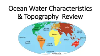
Ocean Water Characteristics and Topography
In 1992, a crate of rubber duck toys fell into the Pacific Ocean, leading to unexpected discoveries about ocean currents and pollution. The North Pacific Gyre, home to the Great Pacific Garbage Patch, plays a crucial role in understanding ocean dynamics. Learn about ocean water properties, distribut
0 views • 10 slides
Atmosphere, Ocean Currents, Weather Maps, & Air Mass TEKS Review
Explore key concepts related to atmosphere, ocean currents, weather maps, and air mass in this TEKS review. Understand the factors contributing to Earth's uneven heating, the role of convection in ocean currents, the energy sources that drive ocean convection, and the effects of heating on air densi
0 views • 21 slides
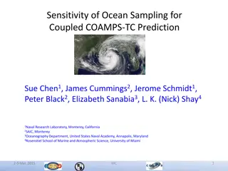
Sensitivity of Ocean Sampling for Coupled COAMPS-TC Prediction Study
This study explores the optimal ocean sampling strategy for Hurricane Isaac (2012) using high-resolution in-situ observations. It investigates the sensitivity of tropical cyclone intensity change through assimilation of AXBT, AXCTD, and AXCP observations. Results show significant impact areas along
0 views • 12 slides
Multidisciplinary Mitigations for Ocean Environment Conservation
Global ocean climate change poses significant threats to marine ecosystems, requiring multidisciplinary approaches for mitigation. Japanese research highlights expanding distributions of reef-building corals, deep-sea water temperature rise, ocean acidification impact on marine plankton, and thinnin
0 views • 4 slides
Power Mapping: A Visual Tool for Advocates to Influence Change
Power mapping is a visual tool used by advocates to identify key individuals to target in order to effect change. It involves mapping the community around an issue or campaign, identifying decision-makers, adversaries, and influential stakeholders. By following important steps and asking relevant qu
0 views • 10 slides
NEMO: European Ocean Modeling Software
NEMO (Nucleus for European Modeling of the Ocean) is a comprehensive software used for numerical simulation of the ocean. Its components include the blue ocean (NEMO-OPA) for dynamics, white ocean (NEMO-LIM) for sea-ice simulation, and green ocean (NEMO-TOP) for biogeochemistry. NEMO produces model
0 views • 10 slides
Insights on Ocean Climate Change: Observations and Implications
Observations in this chapter highlight significant changes in ocean properties related to climate over the past 40 years. These changes include shifts in temperature, salinity, sea level, carbon levels, pH, and oxygen content. The patterns of change observed suggest a link between surface and subsur
0 views • 35 slides
GEBCO Technical Sub-Commission on Ocean Mapping (TSCOM) Overview
Technical Sub-Commission on Ocean Mapping (TSCOM) is a key component of the GEBCO program, established in 2006 to provide expertise in seafloor mapping and discuss emerging technologies. TSCOM serves as an authoritative source for bathymetric and hydrographic data and offers ongoing advice to associ
0 views • 12 slides
Virtual Network Mapping: A Graph Pattern Matching Approach
Virtual Network Mapping (VNM) involves deploying virtual network requests in data center networks in response to real-time demands. It facilitates the deployment of virtual networks on physical machines by mapping virtual nodes and links onto substrate nodes and paths, ensuring constraints are met.
0 views • 15 slides
The Importance of Ocean Currents in Global Systems
Ocean currents play a vital role in transporting heat, nutrients, organisms, and influencing weather patterns and climates. They impact commerce, gas exchanges, nutrient exchanges, pollution dispersal, and fisheries. The interaction between surface and deep-sea currents forms the global ocean convey
0 views • 25 slides
Enhancing Curriculum Development through Mapping for Schools
Curriculum mapping in schools involves using electronic tools to input, track, and analyze data related to curriculum, enabling stakeholders to meet standards, align content, collect real-time data on instruction, and reflect on practices for continuous improvement. Software programs like Rubicon At
1 views • 15 slides
Marine Physics and Ocean Floor Features
Marine Physics is a sub-domain of oceanography focusing on physical conditions and processes in the ocean, including ocean waters' motions and properties. The ocean floor features various elements like the continental shelf, slope, rise, and abyssal plain. Sea mounts, guyots, abyssal hills, and mid-
0 views • 15 slides
Importance of Maps and GIS in Census Mapping: A Case Study from Nepal
Census mapping plays a crucial role in ensuring accurate population counts and territorial delineation. This case study from Nepal highlights the significance of Geographic Information Systems (GIS) in producing high-quality maps for census operations, data collection, analysis, and dissemination. T
0 views • 12 slides
Depths: Ocean Size and Importance
Dive into the fascinating world of the ocean with Lesson 1 of the Submarine STEM Science series. Discover the vastness and significance of our planet's oceans, how they impact life on Earth, and the essential role they play in our ecosystem and daily lives. Join Nekton Mission II as you embark on a
0 views • 13 slides

