
Master Your Smartphone GPS and Mapping Apps for Effortless Navigation
Unlock the true potential of your smartphone GPS with this comprehensive guide on navigation and mapping apps. Learn how to never get lost again, whether you're driving, hiking, or exploring off-road. Discover a range of apps for different activities, from vehicle navigation to sharing locations and
3 views • 14 slides

Hardware Demonstration and Improvements of the Stellar Positioning System
The Hardware Demonstration and Improvements of the Stellar Positioning System (SPS) involve utilizing ancient celestial navigation techniques for lunar exploration. SPS combines central-body-relative observation with star-field observation to determine absolute position, reducing mass/power impacts
5 views • 14 slides

Motorboat Training, testing, and licensing: Rules of the Road & Aids to Navigation Manual
This presentation covers essential information on motorboat training, testing, and licensing, focusing on rules of the road and aids to navigation. It includes details on navigation rules, the importance of following them to prevent accidents, and where the rules apply. The content also explains who
0 views • 34 slides
Understanding Global Navigation Satellite Systems (GNSS) in Geospatial Data for Public Health
Explore the key terms such as accuracy, GLONASS, GPS, precision, scale, and more in this session on GNSS technology. Understand how GNSS works, the constellation of satellites involved, and the different satellite navigation systems like GPS, GLONASS, BeiDou, and Galileo that provide autonomous geo-
6 views • 23 slides

Implementing In-App Navigation with Jetpack's Architecture Components
Discover how to easily implement in-app navigation using Jetpack's Navigation components. Learn to create a navigation graph, connect fragments, pass data, and set up your project efficiently. Check out essential steps like setting up dependencies, creating the navigation graph, and transitioning be
1 views • 16 slides
Evolution and Impact of GPS Technology
Explore the history, importance, and applications of GPS technology, including its significance in daily life, IT development, and various industries. Delve into the challenges faced by GPS systems and the sectors benefiting from GPS advancements like tourism, gaming, and expert services. Discover h
0 views • 12 slides
Revolutionizing Indoor Navigation: Anyplace IIN Service by Demetris Zeinalipour
Demetris Zeinalipour's groundbreaking work focuses on revolutionizing indoor navigation with the Anyplace Internet-based Indoor Navigation (IIN) Service. With a strong emphasis on modern localization technologies and a wide range of indoor applications, this service aims to enhance user experiences
2 views • 50 slides
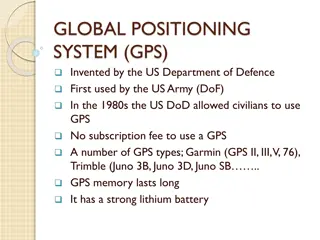
Understanding Global Positioning System (GPS) Technology
Explore the invention and evolution of GPS, its safe handling, examples of GPS receivers, how GPS works through satellite communication, and the role of satellites in GPS technology. Delve into receiver initialization methods for accurate location services.
0 views • 15 slides

Understanding Glaciers and Sea Level Rise Through GPS Monitoring
Delve into the intricacies of glaciers and their impact on sea level rise by exploring how GPS technology aids in tracking glacier mass changes. Learn about the effects of melting glaciers on sea levels, possible consequences, and methods for measuring glacier mass variations using GPS stations.
0 views • 9 slides
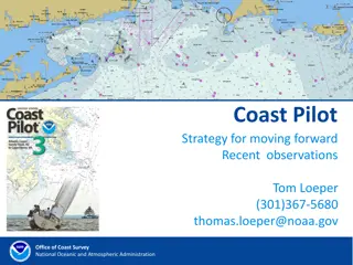
Coast Pilot Strategy for Enhanced Navigation Services
Recent observations and directives from Tom Loeper at the Office of Coast Survey, National Oceanic and Atmospheric Administration, highlight the need for developing new services to complement digital charts and electronic navigation. The focus is on providing navigation regulations, safety-related r
0 views • 14 slides
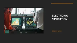
Exploring Electronic Navigation Technologies
Electronic navigation technologies, such as satellite navigation, radio navigation, and radar navigation, utilize electricity-powered systems for precise positioning and tracking. Satellite navigation systems rely on signals from satellites for autonomous geo-spatial positioning, while radio navigat
0 views • 9 slides
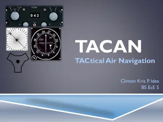
Understanding TACAN: Tactical Air Navigation System Overview
TACAN, Tactical Air Navigation, is a precise navigation system used by military aircraft, providing distance and bearing information from ground stations. It offers more accuracy than VOR-DME systems, catering to both military and civil aviation needs. Through TACAN equipment, pilots can determine t
0 views • 15 slides
GPS and Timetabling for Conflict-free Scheduling
GPS (Graduation Planning System) and Timetabling work together to provide students with clear degree paths and conflict-free schedules. GPS includes major components like student tracking and roadmaps, while timetabling ensures courses are scheduled efficiently. Principles of Timetabling guide the p
0 views • 46 slides
Practice Cruise Underway - Global Navigation
This content pertains to a practice cruise underway for global navigation, focusing on celestial positioning techniques, GPS usage, maintaining written logs, and traditional positioning methods. The navigator plans to rely on both electronic and manual methods for navigation, ensuring preparedness f
0 views • 48 slides
Implementation of Performance-Based Air Navigation Plan for SAM Region - Management of Navigation Service Personnel Competence
Seminar/workshop held in Lima, Peru in May 2011 focused on implementing the Performance-Based Air Navigation Plan for the SAM Region, emphasizing the management of navigation service personnel competence. The event highlighted the importance of training, awareness, infrastructure, budget, work envir
0 views • 6 slides
Understanding GPS Data Processing and RINEX Formats
Learn about the process of transferring GPS data from receivers to processing input, the importance of RINEX formats for universal data exchange, different raw data formats, motivation behind RINEX development, and details about RINEX versions. Explore RINEX 2 data format, its file naming convention
0 views • 13 slides
Judicial Review of GPS Monitoring in Sex Offender Cases
Study sponsored by the National Institute of Justice shows lower recidivism rates for sex offenders on GPS monitoring vs traditional supervision in California. Supreme Court cases like Grady v. North Carolina examined the legality of lifetime satellite-based monitoring, citing Fourth Amendment right
0 views • 23 slides

Understanding Buoyage Systems and Navigation Marks
Buoyage systems play a crucial role in maritime navigation, with IALA regions dividing the world into A and B regions. These systems use various marks such as lateral, safe water, isolated danger, special, and cardinal marks to indicate navigational pathways, hazards, and safe areas in the water. Ea
0 views • 13 slides

Strategies Used by General Practitioners to Manage Uncertainty in Practice
General Practitioners (GPs) encounter uncertainty in their practice and utilize various strategies to address it. These strategies include safety netting, seeking advice from colleagues, sharing uncertainty with patients, review/follow-up processes, investigations, building rapport, and more. Collea
0 views • 35 slides

Suriname Aton Academy - Providing Training for Aids to Navigation
The Suriname Aton Academy, established by the Maritime Authority of Suriname and accredited to deliver Aids to Navigation training, aims to enhance the knowledge and expertise of personnel responsible for navigation safety. Through its unique offerings and primary goals, the academy plays a crucial
0 views • 13 slides
Understanding Android Navigation: Menus, ActionBar/ToolBar, and Navigation Drawer
Explore the functionalities of ActionBar/ToolBar, menus, and navigation drawer in Android development. Learn about the transition from ActionBar to ToolBar, implementing multiple toolbars, and utilizing the Navigation Drawer layout for effective navigation in your app.
0 views • 53 slides
External GPS Setup for ArcPad on Mesa 2 Tutorial
Learn how to set up an external GPS for ArcPad on Mesa 2 by Juniper Systems. Follow a step-by-step guide to enable Bluetooth, pair with the GPS device, assign the outgoing COM port, configure NMEA settings, and confirm the connection in ArcPad. Ensure a seamless setup for accurate GPS tracking in yo
0 views • 11 slides
Complete Guide to GPS Training and Handling Sessions
Learn how to effectively use GPS devices for GIS training, including satellite search, marking waypoints, map interfaces, importing/exporting files, and transforming waypoints into polygons. Get familiar with GPS functions and computer interfaces for improved navigation and data management in this c
0 views • 11 slides
Understanding Global Positioning System (GPS) Technology in Satellite Communications
Introduced in the 1970s, the Global Positioning System (GPS) revolutionized location tracking worldwide. Consisting of 24 satellites in the space segment, GPS allows precise positioning on Earth by measuring distances from these satellites. The control segment, including master control stations and
0 views • 7 slides
Stanford GPS/GNSS Matlab Platform Overview
Stanford GPS/GNSS Matlab Platform (SGMP) is an integrated research platform developed at Stanford University for GPS research activities. The platform provides tools for utilizing GPS/GNSS measurements in various formats, converting positioning databases, simulation capabilities, and user interfaces
0 views • 21 slides

Understanding Geomatics and GPS Technology at College of Engineering Trivandrum
Geomatics is the discipline of gathering, storing, and processing geographic information using tools like GPS and GIS. GPS, a satellite-based navigation system, provides accurate positioning globally. Various global navigation systems like NAVSTAR GPS by USA and GLONASS by Russia play crucial roles
0 views • 50 slides
Feature-rich, Affordable GPS Tracking Device - The Dart
The Dart is a compact, economical, and feature-rich GPS/GLONASS tracking device suitable for vehicle tracking, tax reporting, asset security, and more. It features high sensitivity GPS with LNA, 3D accelerometer, internal backup battery, easy installation, geo-fencing, driver ID support, and various
0 views • 4 slides
Enhancing Smartphone Location Sensing Efficiency
This study delves into optimizing energy consumption in smartphone location sensing mechanisms like GPS and Network Based Triangulation. Comparisons of battery drainage rates with and without GPS provide insights. Additionally, the energy efficiency of Network Based Triangulation as a less accurate
0 views • 41 slides
Understanding Precision and Accuracy in GPS Data
Precision and accuracy play vital roles in interpreting GPS data effectively. Precision refers to how finely a value is described, while accuracy indicates the potential error in a reading. The content also highlights the significance of GPS data from phones, GPS precision in different decimal place
0 views • 25 slides
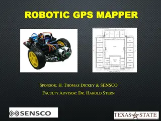
Robotic GPS Mapper Project Presentation
The Robotic GPS Mapper project aims to address the issue of water loss through leaks in city infrastructure by designing a GPS mapping robot that can locate unknown pipe system routes in real-time. The project overview includes goals such as remote communication with the robot, real-time mapping, wi
0 views • 19 slides
Understanding Deep-Draft Navigation Economic Analyses
This presentation discusses the requirements and procedures for conducting economic analyses in deep-draft navigation, particularly focusing on the National Economic Development (NED) criteria. It covers concepts, procedural steps, historical/existing conditions, sources of navigation and data, and
0 views • 12 slides
Understanding GPS and Precision Agriculture in Farming
Explore the vital role of GPS technology in precision agriculture, how GPS signals are utilized for accurate positioning, the implementation of Differential GPS (DGPS) to counteract errors, and the diverse agricultural applications of GPS, including guidance systems and Variable Rate Technology (VRT
0 views • 11 slides
Understanding GPS Technology and Augmentations
Global Positioning System (GPS) utilizes a constellation of satellites to accurately determine device locations on Earth. The system consists of 24 satellites orbiting the planet, with an orbital configuration ensuring worldwide coverage. GPS offers high accuracy, with advancements like Differential
0 views • 9 slides
GPS Applications in Research - GEOL 4408/5508 Course Information
Explore GPS applications in research in the GEOL 4408/5508 course offered by the Department of Geosciences. Taught by Instructor H. Carrie Bottenberg, the course covers topics like satellite positioning, GPS/GNSS theory, mapping, and data analysis. Engage in field trips to enhance practical skills i
0 views • 10 slides
Understanding GPS Data Processing from Receiver to RINEX Format
Explore the journey of GPS data from receiver input to RINEX format, bridging the gap between various manufacturer-specific file formats. Learn about the motivation behind the Receiver INdependent EXchange (RINEX) format and how it enables universal exchange of raw GPS data. Delve into RINEX formats
0 views • 13 slides
Understanding Gaussian Processes: A Comprehensive Overview
Gaussian Processes (GPs) have wide applications in statistics and machine learning, encompassing regression, spatial interpolation, uncertainty quantification, and more. This content delves into the nature of GPs, their use in different communities, modeling mean and covariance, as well as the nuanc
0 views • 50 slides
Civilian GNSS Signals Overview: GPS, GLONASS, Galileo
An insightful lecture on civilian GNSS signals by Dr. Ali Albu-Rghaif covers GPS, GLONASS, and Galileo signals. The content delves into GPS signal modulation, generation, receiving, and demodulation processes, highlighting the carrier wave, navigation data, and spreading sequences. It also discusses
0 views • 20 slides
Flexible Spatio-temporal Indexing Scheme for Large Scale GPS Tracks Retrieval
This research paper discusses a novel spatio-temporal indexing scheme optimized for managing large-scale GPS data. The study introduces a stochastic process model to simulate user behavior in uploading GPS tracks, leading to a more efficient indexing scheme with smaller size, minimal update efforts,
0 views • 24 slides

Customizing GPS through Python for Enhanced Integration
In this guide, we explore how to customize GPS using Python for better integration, particularly focusing on the GNATprove tool. By leveraging Python plugins and the Python Console within GPS, users can tailor their GPS experience to meet specific project requirements, enhancing the overall function
0 views • 8 slides
Garmin Vivosport Tracker: Smart GPS Fitness Bracelet
The Garmin Vivosport tracker is a smart GPS fitness bracelet packed with features to motivate you to stay active. With integrated GPS for precise outdoor activity tracking, it offers a wide range of indoor and outdoor monitoring capabilities. Once paired with your smartphone, you can access smart fe
0 views • 6 slides