Geology of Ogun State, Nigeria: Insights and Implications
The geology of Ogun State in southwestern Nigeria, particularly within the Dahomey or Benin Basin, holds significant value for understanding the region's origins and geological evolution. This includes insights on sedimentary basins, the Wilson Cycle, and the unique characteristics of the Dahomey or
3 views • 35 slides
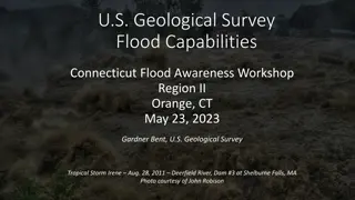
U.S. Geological Survey Flood Capabilities.
Explore the U.S. Geological Survey's flood capabilities in Connecticut, including real-time streamflow data, precipitation monitoring, groundwater levels, and more. Access tools for flood documentation, peakflow analysis, and national water monitoring through interactive dashboards. Stay informed an
3 views • 19 slides
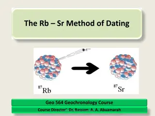
Understanding the Rb-Sr Method of Dating in Geochemistry
Explore the principles of the Rb-Sr dating method in geochemistry, focusing on radioactive decay of Rubidium and Strontium isotopes in geological materials. Learn about isotope data presentation, application in dating geological processes, and the significance of Rb and Sr in the periodic table.
3 views • 62 slides
Fulfilling FSP Responsibilities at US Geological Survey
Supervisors at the US Geological Survey play a crucial role in overseeing project proposal and plan development, ensuring compliance with Fundamental Science Practices (FSP). This involves managing USGS authors, deciding on research result categorization, releasing data, and adhering to open science
0 views • 19 slides
Glacial Landforms: Rock Steps, Truncated Spurs, Hanging Valleys, and Crag & Tail
Explore the formation of unique glacial landforms such as rock steps, truncated spurs, hanging valleys, and crag & tail. Discover how glaciers sculpt these distinct features through processes like erosion and deposition, leaving behind stunning geological formations exemplified in locations like Ble
8 views • 43 slides
Understanding Geological Maps: Interpretation and Description
Training in geological map interpretation aims to accurately identify features depicted on maps through careful examination of geological information. The description of a geological map involves a chronological synthesis of geological data, analysis of the geology of an area focusing on relief, suc
0 views • 15 slides
Understanding the Geological Time Scale and Earth's Evolution
Studying the geological time scale is crucial for comprehending Earth's history, evolution of life, and significant events that shaped our planet. Evidences like field observations, fossil records, and radioactive dating contribute to constructing this vast timeline. Major occurrences such as mass e
1 views • 46 slides
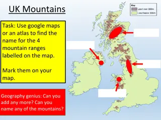
Exploring UK Mountains and Rock Formations: A Geographical Journey
Uncover the mysteries of UK mountains and rock formations through a fascinating exploration of mountain ranges, such as the Grampian Mountains and Pennines, and various rock types like Sedimentary, Igneous, and Metamorphic. Discover how the geological landscape is shaped by the type of rock present
1 views • 13 slides
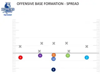
Flag Football Formations and Templates Collection
Explore a comprehensive collection of flag football formations, offensive and defensive templates, and playbook strategies through detailed images and descriptions. From spread formations to defensive setups, this resource provides insights for enhancing your flag football game. Dive into the world
0 views • 9 slides
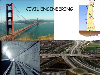
Understanding Civil Engineering: Dams, Reservoirs, and Geological Considerations
Civil engineering work encompasses various structures like dams, embankments, motorways, bridges, buildings, and more. Building dams and reservoirs involves considerations of geological factors, rock properties, and structural design. Different types of dams, such as gravity dams and arch dams, serv
0 views • 23 slides
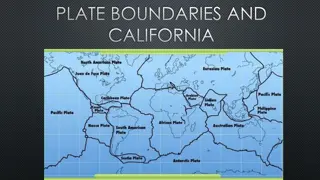
Plate Boundaries and Geological Events in California
California is located on a plate boundary experiencing major geologic events. The state's landforms are shaped by plate tectonic activity. Understanding stress types at plate boundaries can help prevent damage and save lives. The interaction at plate boundaries plays a crucial role in shaping Earth'
0 views • 14 slides
Year 7 Dance Unit Overview at Queen Elizabeth II High School
Students at Queen Elizabeth II High School in Year 7 are engaged in a comprehensive dance unit where they learn fundamental skills, choreographic devices, teamwork, and performance aspects. The curriculum emphasizes creating original dances, exploring formations, dynamics, and contact, and culminate
0 views • 20 slides
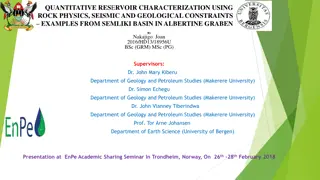
Integrated Reservoir Characterization in Semliki Basin, Albertine Graben
Quantitative reservoir characterization using rock physics, seismic, and geological constraints is crucial for hydrocarbon prospect evaluation. This study by Nakajigo Joan explores the integration of these disciplines in the Semliki Basin to improve reservoir property delineation and reduce uncertai
0 views • 24 slides
Farmington Tiger Football Youth Offensive Formations and Concepts
In the Farmington Tiger Football youth program, coordinated offensive formations and concepts are emphasized for players in grades 3-12. The program aims to maintain consistency in offensive strategies while allowing some flexibility for coaches to incorporate age-appropriate concepts. Various forma
0 views • 54 slides
Exploring Evolution and History: Fossils, Inventors, and More
Delve into the fascinating world of evolution, history, and inventions with a diverse range of topics covered, from fossil findings to the innovative creations of inventors like Garrett Augustus Morgan. Discover intriguing details about ancient species, geological formations, and remarkable individu
1 views • 41 slides
Geological Structures and Landscapes: A Detailed Overview
The illustrations and descriptions in the content depict various geological structures, including faults, folds, anticlines, and their effects on the landscape. The formation processes, such as folding, faulting, weathering, and erosion, are explained, highlighting how these natural phenomena shape
0 views • 9 slides
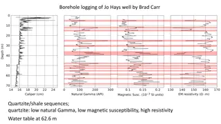
Borehole Logging of Jo Hays Well by Brad Carr - Geological Analysis
Explore the borehole logging results of Jo Hays Well conducted by Brad Carr, revealing quartzite/shale sequences with specific characteristics like low natural gamma, low magnetic susceptibility, and high resistivity. The water table is identified at 62.6 meters depth, offering insights into the geo
0 views • 4 slides
Unveiling the Fascinating World of Caves
Delve into the intriguing realm of caves, natural formations in the earth's surface that hold tales of geological wonders. Discover how caves are formed, their diverse types, and their significance in providing shelter for various species. Explore the art of speleology and the captivating formations
2 views • 5 slides
Exploring the Wonders of Yosemite National Park
Yosemite National Park, located in California, is renowned for its towering cliffs, majestic waterfalls, and pristine streams. The park's natural history boasts a temperate deciduous forest supporting a diverse range of wildlife. Geological origins reveal the park's unique granite formations and gla
0 views • 10 slides
The Plate Tectonic Story of Joyner's Find Greenstone Belt in Western Australia
The Joyner's Find Greenstone Belt in Western Australia lies near the Yilgarn Craton and offers insights into early Archean history through its geological mapping and stratigraphy. This small greenstone belt features mafic volcanic rocks, banded iron formations, and siliciclastic sediments, forming a
0 views • 21 slides
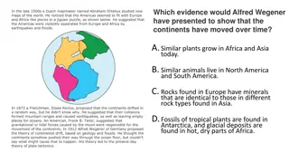
The Fascinating Theory of Continental Drift Explored
In the early 1900s, Alfred Wegener introduced the groundbreaking hypothesis of continental drift, suggesting that the continents were once part of a single landmass before drifting apart to their current locations. This theory is supported by evidence such as the alignment of continents, shared foss
0 views • 25 slides
Earth's Geological Processes and Environmental Impact of Mining
Earth's geological processes involve the formation and movement of tectonic plates, creating divergent and convergent boundaries, leading to events like earthquakes and volcanic eruptions. Gold mining, a process that extracts small amounts of gold from large quantities of rock using cyanide leaching
0 views • 51 slides
Geological Information System for Europe: EGDI-Scope Progress Meeting 2014
Toward a Geological Information System for Europe (GISE), the EGDI-Scope project aims to support European Commission policies on mining wastes, Water Framework Directive (WFD), INSPIRE, biodiversity, water, air, and geology. By organizing an information system instead of a data infrastructure, it pr
0 views • 11 slides
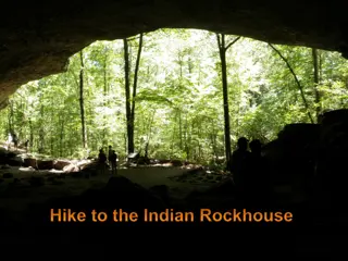
Experience the Indian Rockhouse Hiking Trail Adventure
Explore the challenging Indian Rockhouse hiking trail that offers stunning views of Panther Creek valley, diverse plant and animal species, and unique geological formations. Discover the rich history of human presence in the area and learn about the National Park Service's mission to protect and pre
0 views • 5 slides
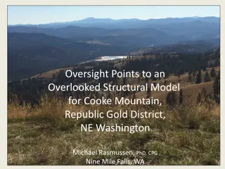
Structural Model for Cooke Mountain in Republic Gold District, NE Washington
This article presents an overlooked structural model for Cooke Mountain in the Republic Gold District of NE Washington. It covers various geological aspects such as the Quesnel Terrane, growth of metamorphic core complexes, and the geology of the Republic, WA area. Detailed descriptions and images o
0 views • 19 slides
Understanding Plate Tectonics and Earth's Crust
Explore the differences between oceanic and continental crust, the distinctions of lithosphere and asthenosphere, the dynamics of convergent and divergent boundaries, as well as the concepts of folding and faulting in geological formations. Delve into the characteristics of oceanic crust versus ocea
0 views • 10 slides
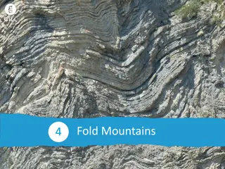
Understanding Fold Mountains: Formation and Impacts
Learn how fold mountains are formed at plate boundaries, explore the three major periods of fold mountain formation, and understand the economic and social impacts of mountains like the Alps. Discover the geological processes, historical formations, and current significance of these majestic natural
0 views • 9 slides
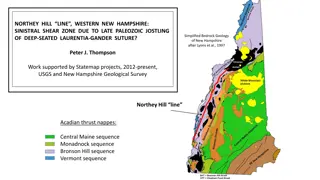
Bedrock Geology of Western New Hampshire: Northey Hill Line and Geological Features
The Northey Hill Line in Western New Hampshire is a sinistral shear zone resulting from Late Paleozoic tectonic activities. The area showcases a complex geological history with Acadian thrust nappes, Oliverian domes, and Mesozoic faults, providing insights into the region's structural evolution. Thi
0 views • 34 slides
Understanding Earth's Structure and Continental Drift Theories
Dutch mapmaker Abraham Ortelius noted the jigsaw fit of continents, leading to the theory of continental drift. Alfred Wegener proposed the movement of continents based on geological evidence, influencing plate tectonics theory. Earth's layers vary from the thick mantle to the solid inner core due t
0 views • 27 slides
Unraveling Plate Tectonics: Impact of Earth's Geological Formations
Exploring the intricate relationship between plate tectonics and significant geological events such as Permian-Triassic extinctions, lava eruptions, and bolide impacts. Delve into the origins of Earth's tectonic movements and their profound impact on the planet's history.
0 views • 28 slides
Understanding Volcanoes: Structure, Caldera Formation, and Characteristics
Volcanoes are geological formations with vents, craters, and slopes. The structure of a volcano includes a vent for lava emission and a crater connected to a magma chamber. Understanding the difference between a caldera and a crater is crucial - calderas are much larger, around 50 km in diameter, fo
0 views • 5 slides
Understanding Aeolian Processes and Erosional Landforms
Aeolian processes, driven by wind, shape landscapes through erosion and deposition. This presentation by Pranati Manna explores wind erosion methods like deflation, corrasion, and attrition, as well as transportation and deposition mechanisms. Aeolian landforms, including deflation basins, mushroom
0 views • 19 slides
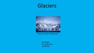
Understanding Glaciers: Formation, Movement, and Impact on Land
Explore the formation, movement, and impact of glaciers. Learn about where glaciers are found, how they move, and the features they exhibit. Discover how glaciers change the land and the role of glaciologists in studying these massive ice formations. Gain insights into geological features created by
0 views • 8 slides
Understanding Biomarkers and Maturity Parameters in Petroleum Exploration
Biomarkers and maturity parameters play crucial roles in characterizing source materials and assessing the thermal maturity of organic matter in petroleum exploration. Specific biomarkers and non-biomarker maturity parameters are utilized to determine the relative maturity of source rocks and oils.
0 views • 17 slides
Hydro-Geological Survey Report in Mirsharai Upazila
This draft final report presents the findings of a hydro-geological survey conducted under the Mirsharai Upazila Development Plan by the Urban Development Directorate in Bangladesh. The report includes digital elevation models, aquifer architecture, isopach maps, cross-sections, aquifer frameworks,
0 views • 27 slides
Analysis of Model Issues in Naval Operations
The images and descriptions provided offer insights into model issues such as submarine automatic fire logic, acceptance of Chinese/foreign characters, naval formations over land, and unnecessary HRU patrols in JTLS-GO. The content explains why submarines do not automatically fire back at surface sh
0 views • 13 slides
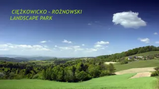
Discover the Beauty of Cikowicko-Ronowski Landscape Park
Cikowicko-Ronowski Landscape Park, established in 1995, is a stunning natural reserve in the Małopolska province. Spanning 24,130 hectares, the park showcases diverse geological formations, rare flora, and a variety of wildlife. The park is home to unique rock outcrops, sandstones, and a Petrified
0 views • 15 slides
Exploring Earth's Structure and Continental Drift
Delve into the fascinating layers of the Earth, including the crust, mantle, and core, while understanding how rocks are classified and the processes of weathering, erosion, and rock formation. Discover the concept of continental drift through evidence such as fossil similarities and geological form
0 views • 10 slides
A Comparative Study of Mount Rainier and Mount Fuji
Mount Rainier and Mount Fuji are two geologically significant volcanoes, both born of fire but shaped differently by the forces of nature. Mount Rainier, located in Washington, USA, is a young volcano eroded by glaciers, while Mount Fuji in Japan remains conically shaped due to minimal glacial erosi
0 views • 16 slides
Various Landscapes and Geological Features in Washington and Montana
Explore a diverse collection of images showcasing the unique geological formations and landscapes found in Washington and Montana. From sand deposition along the Columbia River to talus slopes at the base of basalt colonnades, witness the beauty of nature's creations in these stunning photographs.
0 views • 19 slides

