Tower Hamlets Annual Resident Survey 2023 Results Overview
The Tower Hamlets Annual Resident Survey 2023 provides insights into residents' feedback and opinions on various aspects. Conducted by MEL Research, the survey aims to capture a representative sample of residents in Tower Hamlets, highlighting statistical significance and methodology details. The su
1 views • 32 slides
Instructions for Completing GLAAS Country Survey 2024
In Module 4 of GLAAS information, you will find guidance on filling out the country survey for GLAAS 2024. Topics covered include an overview of the survey package, instructions for completing the survey either as a PDF or online (eGLAAS), general tips for successful completion, advice on governance
4 views • 42 slides
Progress Update and Activities of PGSC Working Group
The PGSC Working Group has been actively supporting the implementation of Goal 2 of the PGSC Strategy by advancing a modern Geodetic Reference Frame in the Pacific region. Key activities include capacity mapping, legal framework reviews, strategic planning, and stakeholder engagement efforts. The gr
1 views • 10 slides
Geodetic Surveying and Triangulation System Overview
Geodetic surveying involves determining precise positions on the Earth's surface, while triangulation is a method that uses interconnected triangles for accurate measurements. The principles of the triangulation system aim to establish horizontal points for various surveys and assist in determining
2 views • 23 slides
Dialysis Center Practices Survey Update for 2023
The National Center for Emerging and Zoonotic Infectious Diseases has announced changes to the Outpatient Dialysis Center Practices Survey and the Home Dialysis Center Practices Survey for 2023. The updated surveys include a new layout, clarified questions, and modifications to various sections. Fac
0 views • 20 slides
Understanding Spatial Referencing Systems for Mapping
Spatial reference systems play a crucial role in defining geographic parameters and coordinate systems for mapping. They consist of components like orientation, latitude, longitude, and elevation, which help in representing spatial properties on maps. Reference surfaces such as the Geoid and ellipso
3 views • 13 slides
Understanding Cadastral Mapping Components and Data Sources
Cadastral mapping involves geodetic control networks, parcel identification, and various overlays like zoning and floodplains. City maps are categorized into base, derived, and thematic maps. Data sources include spatial and non-spatial data for property assessment. Layers in cadastral maps cover to
1 views • 16 slides
University Partnership Forum 2018: Survey Results & Feedback Analysis
The UK's European University Partnership Forum 2018 presents survey findings from the Partner Institution Survey 2016/17 conducted by Matthew Redmond. The survey aims to gather direct feedback from partner students on teaching, assessment, support, resources, and personal development. It highlights
0 views • 18 slides
Overview of Non-Point Survey Training and Updates
This content provides detailed information and resources related to the Non-Point Survey Training Program, including modules, topics covered, process flow for completing the survey, reasons for conducting the survey, and changes made in the survey since the 2014 inventory. It also addresses common i
1 views • 13 slides
Understanding the VLA Sky Survey and Its Scientific Goals
The VLA Sky Survey (VLASS) is a comprehensive radio survey covering the sky visible to the VLA, conducted in three epochs with a focus on imaging galaxies, detecting transient events, exploring Faraday tomography, and uncovering hidden phenomena in the universe. The survey employs innovative strateg
1 views • 22 slides
Understanding Tropospheric Delays in Geodetic Techniques
Explore the fundamentals of troposphere delays in geodetic measurements, including refractivity, modeling techniques, and impact on positioning accuracy. Discover the complexities of radio signal delays and bending effects due to atmospheric interactions. Gain insights into the Vienna troposphere mo
0 views • 80 slides
Understanding the ACGME Resident Survey: Insights and Guidelines
The ACGME Resident Survey is conducted annually to gather confidential data on residents' clinical and educational experiences. The survey aids in program accreditation and identifies areas for improvement. Answer honestly as it does not impact accreditation. The survey covers experiences from July
0 views • 27 slides
Understanding Society: Wealth and Assets Survey Research
The Wealth and Assets Survey (WAS) conducted by Oliver Tatum and Angie Osborn at the Understanding Society Research Conference in 2013 focuses on longitudinal issues, experiment design, research findings, and future plans related to the survey. The WAS background includes collecting data on personal
3 views • 28 slides
Oregon Statewide Assessment System Student Educational Equity Development Survey (SEED Survey)
The SEED Survey is a student survey in Oregon aimed at understanding educational experiences, providing insights for local investments, and enhancing data interpretation. Administered for Grades 3-11, it helps gather feedback to support student outcomes and interpret test results effectively. With c
0 views • 20 slides
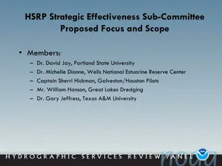
Strategies for Enhancing PORTS System Effectiveness and Resilience
Proposed by the HSRP Strategic Effectiveness Sub-Committee, this focuses on improving the PORTS system, addressing water level changes, enhancing NOAA's products and services, and strengthening outreach and branding. Key issues identified include inconsistent funding for PORTS systems, inadequate co
0 views • 10 slides
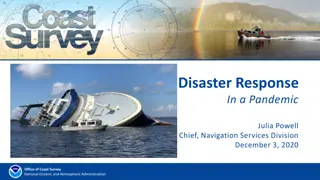
Coast Survey Disaster Response in a Pandemic: Operations Overview
This presentation showcases the Coast Survey's response to hurricanes and disaster situations in the year 2020, detailing the challenges faced and the innovative strategies implemented amidst the ongoing pandemic. From virtual tasking and survey planning to on-the-fly reporting and night processing,
0 views • 11 slides
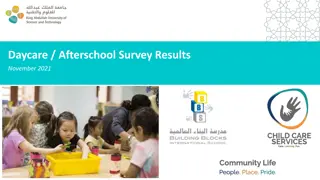
November 2021 Daycare & Afterschool Survey Results
Overall satisfaction rate for the November 2021 Daycare & Afterschool survey stood at 97.6%. The survey method involved Formstack with a completion rate of 50.2%, showing a 1% increase compared to the previous June 2021 survey. The survey gathered responses from 166 participants out of 331 unique pa
0 views • 8 slides
Safety Survey Readiness for Joint Commission Meeting
A call to action for Joint Commission safety survey readiness with a focus on identifying and mitigating patient and provider safety risks. Highlights include known risks from the 2021 survey findings, Vizient mock survey findings, and the purpose of the upcoming survey to ensure patient and provide
0 views • 18 slides
Student Preferences for Spring 2022 Instructional Modality Survey Results
A districtwide student survey was sent out via text to gather preferences for the preferred instructional modality for Spring 2022. The survey targeted currently enrolled SMCCCD students who opted-in to receive text messages, resulting in a 38% response rate. Preferences by primary campus showed var
0 views • 4 slides
National Geodetic Survey Modernization Overview
The National Geodetic Survey (NGS) is modernizing the National Spatial Reference System (NSRS) to enhance accuracy, accessibility, and efficiency. This involves updating coordinates, replacing datums, simplifying services, and ensuring compatibility with time changes. The goal is to provide a reliab
0 views • 31 slides
Understanding Geodetic Datums - A Comprehensive Overview
Delve into the world of geodetic datums with a detailed exploration of concepts, historical developments, and future perspectives. Learn about NAD 83, WGS 84, terminology shifts, and the significance of geodetic datums in modern mapping and Earth measurements.
0 views • 22 slides
New York Statewide Center for Independent Living 2021 Consumer Satisfaction Survey Methodology
The New York Statewide Center for Independent Living conducts an annual Consumer Satisfaction Survey to gather feedback from consumers served by the center. The survey can be conducted online via Survey Monkey or through direct mail. Detailed instructions are provided on the NYSILC website for condu
0 views • 8 slides
Survey Design Training for Effective Data Collection
Learn how to conduct surveys effectively by understanding the purpose, developing survey objectives, research questions, and survey questions. Explore survey implementation options, data analysis techniques, and available resources to enhance your data collection process. The iterative nature of the
0 views • 15 slides
Turkish Statistical Institute Tobacco Health Survey Overview
The Turkish Statistical Institute conducted a comprehensive survey on tobacco use in health interviews in May 2016. The survey process included questionnaire development, historical background, and implementation in households. Data analysis, translation tasks, and collaborating with public institut
0 views • 19 slides
Understanding Geodetic Datums and WGS-84 Coordinates
Geodetic datums define the earth's shape and size, serving as reference points on coordinate systems. Vertical datums establish zero surface elevation, while horizontal datums form the basis for horizontal coordinates. The World Geodetic System 1984 (WGS-84) is the reference system used by GPS and l
0 views • 29 slides
California Public Libraries Survey 2020-2021 Overview
The California Public Libraries Survey for 2020-2021 provides an in-depth look at the state of libraries in California. This webinar covers the survey process, data elements, resources, and the importance of the survey in understanding and meeting community needs. Learn about the National Public Lib
0 views • 25 slides
Advancements in Geodetic Reference Systems and CORS Networks at XXV FIG Congress
Explore the latest updates from the XXV FIG Congress regarding the role of National Mapping Organisations in providing Positioning Infrastructure and ensuring Precision Navigation and Timing Integrity. Key highlights include NAD 83 replacement, CORS enhancements, alignment strategies, transformation
0 views • 17 slides
A Comparison of Injury Estimates from Population-Based and Provider-Based Surveys
This study compares injury estimates obtained from a population-based health survey with estimates from two provider-based surveys. Data from the National Health Interview Survey (NHIS), National Hospital Ambulatory Medical Care Survey (NHAMCS-ED), and National Hospital Discharge Survey (NHDS) are a
0 views • 18 slides
Understanding the People Matter Survey in Victorian Public Sector
The People Matter Survey conducted by the Victorian Public Sector Commission aims to gather independent employee opinions from public sector organizations. It helps in understanding employee engagement, career development, diversity, inclusion, and overall workplace experience. The survey results ar
0 views • 13 slides
Northern Utah GIS Workforce Survey 2014 Results Overview
The Northern Utah GIS Workforce Needs Survey Results for 2014 provide insights into the demographics, industry experience, survey respondents by county in Utah, and educational requirements for GIS/geospatial technicians. The survey highlights the distribution of position titles, length of experienc
1 views • 26 slides
2023 Fulton County Youth Health Survey Results Community Release Event
The 2023 Fulton County Youth Health Survey Results will be presented at a community release event on Tuesday, January 30. The survey covers various aspects such as weight status, tobacco use, alcohol consumption, drug use, perceptions of substance use, sexual behavior, mental health, social determin
0 views • 71 slides
Optical Clocks for Gravity Field Observation and Geodetic Applications
Optical clocks play a crucial role in observing gravity fields and have various geodetic applications. From comparing space-to-ground and space-to-space clocks to detecting mass loss in Greenland, these clocks offer high-frequency sampling data for precise measurements. They also aid in unifying hei
0 views • 10 slides
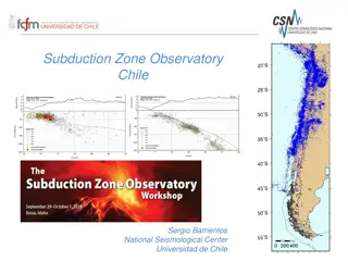
Monitoring Chile's Geological and Volcanic Activity: Subduction Zone Observatory and IPOC Network
Chile's Subduction Zone Observatory, led by Sergio Barrientos at the National Seismological Center, University of Chile, focuses on observing seismic and geological events with cutting-edge technology and networks. The IPOC Chile Volcanological Network monitors around 40 volcanoes, utilizing various
0 views • 4 slides
Geodetic Survey and Reference Frames in Canada
The Canadian Geodetic Survey plays a crucial role in the publication of coordinates, utilizing frames like NAD83(CSRS) and CGVD2013. The adoption of geoid-based vertical datums reflects advancements in technology and the need to maintain accurate reference systems. The transition from older referenc
0 views • 15 slides
Four Options Survey Initial Results by Tyler Lefevor, Ph.D. & Ron Schow, Ph.D.
Explore the findings of the Four Options Survey conducted by Tyler Lefevor, Ph.D., and Ron Schow, Ph.D. The survey delves into various aspects such as relationship status, mental health, satisfaction, and religion/spirituality, providing insights into the viewpoints and life directions of the partic
0 views • 27 slides
Greater Manchester Residents Survey 2023 Summary Report
This report provides summary findings from a quantitative survey conducted between 5th and 22nd May 2023, with a sample of 1,488 residents across all ten Greater Manchester local authority areas. The survey covers various key topics such as health and wellbeing, cost of living, digital inclusion, an
0 views • 91 slides
Maryland Special Education Parent Involvement Survey FAQ
The Maryland Special Education Parent Involvement Survey aims to assess parental engagement with schools in supporting special education students. Parents/guardians of children aged 3 to 21 receiving special education services are required to complete the survey either online or on paper. Feedback f
0 views • 9 slides
Essex County Council Care Worker Survey 2020 Key Findings
The Essex County Council Care Worker Survey 2020 provides insights into care workers' motivations, likes and frustrations, roles, future intentions, training, and technology usage. Enventure Research conducted the survey to inform ECC's workforce strategy. The methodology involved an online survey a
0 views • 25 slides
Virtual Trauma Center Survey Presentation in Florida
The Department of Health in Florida organized a successful virtual survey for trauma centers, with Trauma Section Administrator Kate Kocevar leading the presentation. Participating trauma centers and program managers were recognized for their dedication. Survey teams, including medical professionals
0 views • 16 slides
Automated Road Condition Survey Using Laser Imaging and Ranging Detection - June 2022
Infrastructure Committee conducted an Automated Road Condition Survey using Laser Imaging and Ranging Detection in June 2022. The survey covered 5835 km of roads with a value of $7B. It included sub-arterial, arterial roads, and industrial access, with key indicators for performance criteria. The su
0 views • 9 slides

