Office Of State Grants
The Flood Control Local Match Participation Program (LMPP) provides grants to help local governments meet non-Federal cost-share requirements for flood-related projects, flood control planning, and mitigation activities. Funding can be used as matching funds with various federal agencies and program
2 views • 9 slides
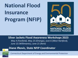
The National Flood Insurance Program (NFIP) and Floodplain Management
Explore the National Flood Insurance Program (NFIP) and its workshops across Connecticut, covering topics such as flood awareness, certified floodplain management, flood maps, roles and responsibilities, and the significance of the 100-year floodplain. Learn how FEMA, the State NFIP Coordinator, and
0 views • 37 slides

Introduction to Flood Risk Assessment with HEC-FDA Overview
This presentation delves into flood risk assessment using HEC-FDA software, covering topics such as defining flood risk, components of uncertainty, consequences of flood risk, and methods to assess flood risk including hydrology, hydraulics, geotechnical, and economics. It explores the intersection
7 views • 39 slides
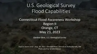
U.S. Geological Survey Flood Capabilities.
Explore the U.S. Geological Survey's flood capabilities in Connecticut, including real-time streamflow data, precipitation monitoring, groundwater levels, and more. Access tools for flood documentation, peakflow analysis, and national water monitoring through interactive dashboards. Stay informed an
3 views • 19 slides
Understanding Urban Flood Risk and Community Response Behavior
Flood risk assessment in urban systems involves complex interactions among natural, physical, and social elements. Factors such as population vulnerabilities, disparities in socioeconomic status, and post-disaster recovery challenges impact how communities respond to flood events. This research expl
3 views • 4 slides
Flood Routing and Hydrology of Ungauged Catchments
This publication by Mesfin M. explores the important aspects of flood routing and hydrology in ungauged catchments. The content covers various topics related to analyzing and managing floods, especially in areas without monitoring stations. With detailed insights and informative slides, this resourc
2 views • 41 slides
Study on Flood Disaster in Kampur Revenue Circle: Causes, Effects, and Remedial Measures
This field study research project focuses on exploring the causes, effects, and remedial measures of flood disasters in the Kampur Revenue Circle of Assam. The study aims to understand the impacts of floods on the environment, agriculture, and human society, providing insights for effective preventi
1 views • 15 slides
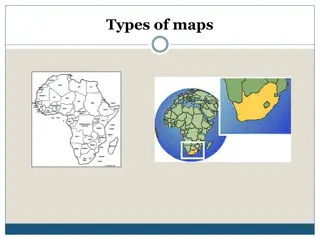
Eight Types of Maps and Their Uses in Tourism
Explore eight different types of maps and how they are utilized in the tourism industry. From general reference maps to political maps, each type serves a specific purpose in providing valuable information to tourists for better navigation and understanding of different areas. Learn about electronic
1 views • 21 slides
Probabilistic Risk Analysis: Assessing Risk and Uncertainties
Probabilistic Risk Analysis (PRA) involves evaluating risk by considering probabilities and uncertainties. It assesses the likelihood of hazards occurring using reliable data sources. Risk is the probability of a hazard happening, which cannot be precisely determined due to uncertainties. PRA incorp
2 views • 12 slides

Create a Flood Warning System with Micro:bit and Moisture Sensor
A design brief for constructing a flood warning system using micro:bit to detect rising water levels and alert homeowners, aiming to mitigate damage caused by flooding. The project involves selecting suitable input sensors, such as a moisture sensor, and programming the micro:bit to trigger a warnin
3 views • 9 slides
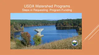
USDA Watershed Programs for Local Communities
USDA Watershed Programs offer assistance in addressing natural resource issues such as flood control, repairing flood damages, and rehabilitating flood control dams. The three major components - Emergency Watershed Program (EWP), Watershed Protection and Flood Control Program (WPFO), and Watershed R
0 views • 15 slides
Addressing Flooding Issues in Chehalis River Basin: Formation of Flood District
Formation of a multi-county flood district in the Chehalis River Basin to combat repeated major flooding events, which have caused significant damages and disruptions over the years. The establishment of the Flood Authority as a temporary entity to address flood issues and the steps taken to mitigat
0 views • 24 slides
Chehalis River Basin Flood Authority's Local Projects and Achievements
The Chehalis River Basin Flood Authority, established in 2008, focuses on flood mitigation strategies informed by science to protect residents and communities. Through various projects like the Raymer Street Pump Station in Hoquiam, the authority has significantly reduced flood damage, enhanced comm
0 views • 17 slides
Chehalis River Basin Flood Authority Update and Collaboration Highlights
The Chehalis River Basin Flood Authority is making significant progress in reducing flood damage and restoring aquatic species through a Basin-wide strategy. The key messages focus on collaboration among various entities and the importance of a multi-phased approach to protect communities. The backg
0 views • 48 slides

Economic Analysis of Climate-Induced Flood Adaptation in Koshi Basin, Nepal
This project aims to assess the impact of climate-induced floods on agriculture in the Koshi basin of Terai, Nepal. By evaluating flood risk, economic costs, and different adaptation options, the study seeks to enhance resilience in the face of increasing flood occurrences catalyzed by climate chang
0 views • 9 slides

Ancient Flood Narratives: Sumerian, Babylonian, and Hebrew Accounts
Ancient flood narratives from Sumerian, Babylonian, and Hebrew sources depict stories of divine displeasure, flood planning, and survival through boat-building. Enlil, Enki, and Yahweh play key roles in warning individuals like Uta-napishtim, Atrahasis, and Noah to build boats and save life forms du
0 views • 8 slides

Flood Warning Program of Urban Drainage & Flood Control District
Since 1979, the Federal/Regional/Local Early Warning Partnership of the Urban Drainage & Flood Control District has been providing the greater Denver/Boulder metropolitan area with early flood threat notifications, primarily for flash floods. Working in collaboration with NOAA's National Weather Ser
2 views • 23 slides
Flood Control Local Match Program Information
Flood Control Local Match Participation Program provides grants to assist local governments in meeting cost-share requirements for flood-related projects and mitigation activities. The program offers funding for both traditional (USACE, FEMA) and non-traditional projects, with a focus on achieving a
0 views • 9 slides

SmartBright Outdoor LED Flood Light - Reliable Savings and Lasting Brightness
SmartBright Flood BVP161 and LED Flood 30W, 50W, 70W offer reliable energy savings of up to 90% compared to traditional lighting, lasting brightness with high system efficacy, and robust features like surge protection, IP65 rating, and long lifespan. With a compact design, multiple color temperature
0 views • 10 slides
Floodplain Management Policies and Regulations
The provided content highlights key information regarding floodplain management, including the National Flood Insurance Act of 1968 and 1994, Executive Order 11988, 23 USC 650 Subpart A, and updated SEO Floodplain Guidance. These regulations aim to provide flood insurance, establish flood hazard zon
0 views • 25 slides
Central Valley Flood Protection Board Meeting Executive Officer Report
The Central Valley Flood Protection Board Meeting Executive Officer Report discusses various key topics including personnel, urban and rural levee protection criteria, flood system improvement projects, major proposals, and future projects like the Sutter Bypass 2D Hydraulic Model. The report covers
0 views • 4 slides

Flood Definitions and Impacts on Insurance Claims
Understanding various aspects of riverine and coastal flooding, along with related politics, can shed light on the importance of FEMA flood definitions in determining insurance claim payouts. Topics include floodplain areas like floodway and flood fringe, types of buildings with insurance rates, and
0 views • 27 slides
National Flood Insurance Program Overview
Explore the details of the National Flood Insurance Program (NFIP) from a regional webinar series, covering policy refresher, rating factors, definitions of flood and building, and more. Gain insights into coverage limits, waiting periods, eligibility criteria, and factors affecting policy qualifica
0 views • 25 slides
Chehalis Basin CFAR Program Overview
The Chehalis Basin Strategy Community Flood Assistance & Resilience (CFAR) Program aims to address flood-related challenges in the Chehalis River Basin through multiple reports and recommendations, emphasizing the need to reduce damage to residences, prevent new development in floodplains, and enhan
0 views • 11 slides
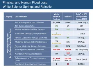
Analysis of Flood Loss and Damage in White Sulphur Springs and Rainelle
This data analysis focuses on the physical and human flood loss in White Sulphur Springs and Rainelle, West Virginia. It includes information on building damage estimates, displaced population figures, building loss ratios, and structural damage details from past flood events. The analysis sheds lig
0 views • 8 slides

Flood Insurance Coverage in Detail
This comprehensive presentation delves into the intricacies of flood insurance coverage, from primary sources to specific rules and regulations. Key topics include federal flood coverage, property eligibility criteria, private flood insurance limitations, important flood zone measurements, average f
0 views • 22 slides

The Hydrological Cycle and Flood Hazards
This session with Dr. Patrick Asamoah Sakyi delves into the hydrologic cycle, causes of flooding, and ways to mitigate flood hazards. Topics covered include the hydrologic cycle, stream systems, flood consequences, factors affecting flood severity, and strategies for reducing flood risks. Recommende
0 views • 37 slides
Comprehensive Collection of Dubai City Maps for May 2020
Explore a diverse range of Dubai city maps including editable PowerPoint templates, outline maps, sector maps, maps with sectors and districts, as well as blank framed maps. These maps cover various sectors and districts of Dubai, providing detailed insights and information for a comprehensive under
0 views • 19 slides
Factors Affecting Flood Zones in Wake County, North Carolina
Analyze the factors influencing flood impacts in Wake County, North Carolina with a focus on proximity to water bodies, land cover, and impervious surfaces. Explore how county growth affects these factors, potential changes in flood zone areas, and implications for property risks. Consider using hyd
0 views • 15 slides

Enhancing Flood Disaster Management through Integrated River Basin Approach
Explore the framework for effective Flood Disaster Management through a holistic approach, focusing on river basins' characteristics, environmental impacts, flood triggers, and sustainable solutions. Emphasizing the importance of urbanization management and governance for Disaster Risk Reduction to
3 views • 24 slides
Central Valley Flood Control Association - Addressing Flood Challenges in California
The Central Valley Flood Control Association (CCVFCA) works to mitigate the impact of regular floods that occur in California, causing significant damages and evacuations. With a history dating back to 1926, the CCVFCA addresses funding needs, state responsibilities, and challenges in ensuring publi
2 views • 12 slides
Public Exhibition on Flooding in Comrie at Community Centre
A public exhibition is being held at Comrie Community Centre to address flooding issues in the area. The presentation will cover topics such as the Tay Local Flood Risk Management Plan, actions on flooding, and next steps. The Tay FRM Strategy and Local FRM Plan outline measures to manage flood risk
0 views • 19 slides

Enhanced Flood and Tax Map Tools in West Virginia
Explore the upgraded WV Flood Tool, offering 3D flood visualizations, building-specific risk assessments, and improved data layers. Additionally, access individual finished tax maps with detailed parcel information and contextual data for 30 counties statewide. The tools provide dynamic web maps, ae
0 views • 8 slides
Near Real-Time Flood Inundation Mapping Using Sentinel-1 Data During Hurricane Florence
A study by Shen, Xinyi and colleagues from the University of Connecticut has developed the RAdar Produced Inundation Diary (RAPID) algorithm for near real-time flood inundation mapping using Synthetic Aperture Radar (SAR) data from Sentinel-1 during Hurricane Florence. The analysis revealed large in
0 views • 8 slides

Social Flood Risk and Vulnerability in Edinburgh: A Climate Justice Workshop Analysis
Dive into an in-depth analysis of the social flood risk and neighborhood flood vulnerability in Edinburgh through a workshop presentation. Explore how climate change will impact flood risks, identify vulnerable groups at high risk, and make a compelling case for action towards climate justice.
0 views • 6 slides
Hydrology and Communities: Understanding Flood Events in Boulder 2013
Explore the intersection of hydrology and community data in the context of the 2013 Boulder floods. Discover the various data sources, visualizations, and strategies used to map and assess flood risk in the St. Vrain Watershed. Learn about FEMA's NFHL mapping and the importance of tracking events to
0 views • 17 slides
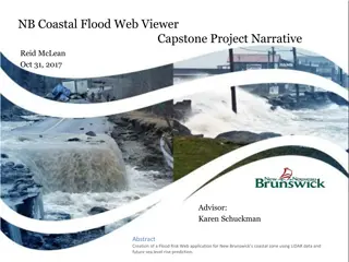
Creating a Coastal Flood Risk Web Application in New Brunswick
Addressing flood risk reduction in New Brunswick, this project utilizes LiDAR data and sea level rise predictions to identify flood hazards, plan for community resilience, and communicate mitigation strategies. With a focus on coastal zones, the initiative aims to provide accurate flood hazard maps
0 views • 18 slides
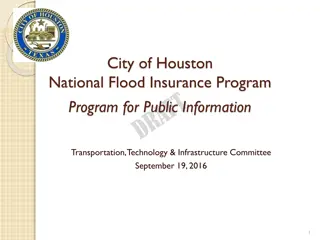
Houston National Flood Insurance Program Overview
The City of Houston's participation in the National Flood Insurance Program includes enrollment since 1979, adherence to FEMA floodplain maps, and setting local construction standards. The Community Rating System (CRS) is utilized to enhance flood loss reduction, improve insurance rating accuracy, a
0 views • 11 slides
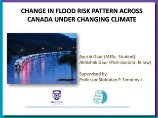
Analyzing Flood Risk Pattern Changes in Canada Under Climate Shift
The study delves into the evolving flood risk patterns across Canada amidst a changing climate scenario. By employing advanced models and methodologies, the research aims to project future flood occurrences and assess the associated risks. Through meticulous data collection and analysis, the team is
0 views • 15 slides
Flood Control Acts and Related Legal Cases
Explore the history and implications of flood control acts like the Flood Control Act of 1928, including the immunity provisions for the United States in case of flood-related damages. Learn about the Compensation Clause and the procedures for suing the government for flood damages under the FTCA. D
0 views • 37 slides