The National Flood Insurance Program (NFIP) and Floodplain Management
Explore the National Flood Insurance Program (NFIP) and its workshops across Connecticut, covering topics such as flood awareness, certified floodplain management, flood maps, roles and responsibilities, and the significance of the 100-year floodplain. Learn how FEMA, the State NFIP Coordinator, and local agencies work together to mitigate flood risks, regulate development through zoning, and provide federal flood insurance to property owners in participating communities.

Download Presentation

Please find below an Image/Link to download the presentation.
The content on the website is provided AS IS for your information and personal use only. It may not be sold, licensed, or shared on other websites without obtaining consent from the author.If you encounter any issues during the download, it is possible that the publisher has removed the file from their server.
You are allowed to download the files provided on this website for personal or commercial use, subject to the condition that they are used lawfully. All files are the property of their respective owners.
The content on the website is provided AS IS for your information and personal use only. It may not be sold, licensed, or shared on other websites without obtaining consent from the author.
E N D
Presentation Transcript
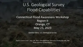
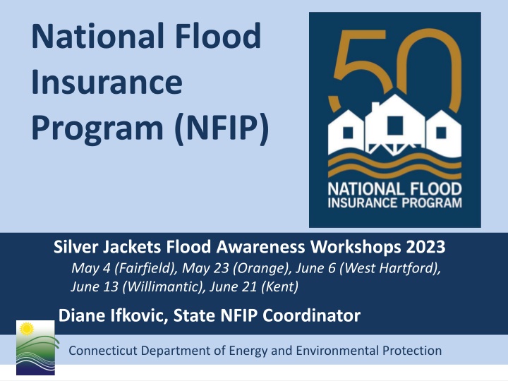
National Flood Insurance Program (NFIP) Silver Jackets Flood Awareness Workshops 2023 May 4 (Fairfield), May 23 (Orange), June 6 (West Hartford), June 13 (Willimantic), June 21 (Kent) Diane Ifkovic, State NFIP Coordinator Connecticut Department of Energy and Environmental Protection
Certified Floodplain Manager (CFM) This workshop is pre-approved for 6 Continuing Education Credits (CEC) from Association of State Floodplain Managers (ASFPM)
National Flood Insurance Program Programtory and Flood Maps Billion Dollar Betsy, hurricane 1965 National Flood Insurance Act of 1968 Flood Maps FEMA produces flood maps Flood Regulations Communities must adopt the flood maps and minimum FEMA construction requirements into local zoning regulations Flood Insurance FEMA makes federal flood insurance available to property owners in NFIP participating communities NFIP Connecticut Department of Energy and Environmental Protection Connecticut Department of Energy and Environmental Protection
Roles and Responsibilities Federal Emergency Management Agency State NFIP Coordinating Agency - CTDEEP Community(Town, City, Borough, Fire District, Association regulates development through zoning) Connecticut Department of Energy and Environmental Protection Connecticut Department of Energy and Environmental Protection
Flood Maps and Flood Studies Flood Insurance Rate Map (FIRM) Primary floodplain management tool. It all starts with the FIRM. Product of the Flood Insurance Study (FIS). Identifies flood zones in your community Product is used by many audiences Government Officials Lenders Insurance Agents Surveyors Design Professionals Realtors Residents The NFIP is administered by the Federal Emergency Management Agency (FEMA). Connecticut Department of Energy and Environmental Protection Connecticut Department of Energy and Environmental Protection
What is the 100-Year Floodplain? 100 Year Floodplain Flood Fringe Flood Fringe Floodway Flood Zone AE & Zone A Base Flood Elevation (BFE) 1 ft The 100-year floodplain is the land subject to a 1% or greater chance of flooding in any given year. It is also called the Special Flood Hazard Area (SFHA) by FEMA. Floodway is the channel and adjacent land reserved in order to discharge the base flood.
Connecticut Department of Energy and Environmental Protection Connecticut Department of Energy and Environmental Protection
Coastal (VE and Coastal AE Zones) Connecticut Department of Energy and Environmental Protection Connecticut Department of Energy and Environmental Protection
Connecticut Department of Energy and Environmental Protection Connecticut Department of Energy and Environmental Protection
Mapping Process Timeline Congressional Appropriation $ Consultation Coordination Officer (CCO) meeting Letter of Final Determination (LFD) FEMA Resolves Appeals Discovery Meeting Preliminary FIRM/FIS Work Maps Effective FIRM/FIS Newpaper Notices 90-Day Appeal Period 6 Months Ordinance/Reg Review FEMA Public Open House 6 months Connecticut Department of Energy and Environmental Protection Connecticut Department of Energy and Environmental Protection
CT Flood Map Updates - Watersheds Quinebaug River Watershed New London County Griswold, Jewett City, Lisbon, North Stonington, Preston, Voluntown Effective Maps August 1, 2023 Windham County Brooklyn, Danielson, Killingly, Plainfield, Pomfret, Putnam, Sterling, Thompson Effective Maps September 7, 2023 Connecticut Department of Energy and Environmental Protection Connecticut Department of Energy and Environmental Protection
CT Flood Map Updates - Watersheds Saugatuck River Watershed 20 communities in Fairfield County Preliminary maps/study end of May 31, 2023 Farmington River Watershed 23 communities in Hartford & Litchfield Counties Hartford County prelim maps/study June 1, 2023 Litchfield County prelim maps/study April 14, 2024 Connecticut Department of Energy and Environmental Protection Connecticut Department of Energy and Environmental Protection
CT Flood Map Updates - Watersheds Thames River Watershed 16 communities in New London County Work maps June 20, 2023 Shetucket River Watershed 23 communities in New London, Tolland and Windham Counties Work maps June 20, 2023 Connecticut Department of Energy and Environmental Protection Connecticut Department of Energy and Environmental Protection
CT Flood Map Updates - Watersheds Housatonic River Watershed 54 communities in Fairfield, Hartford, Litchfield & New Haven Counties Includes levee study on Naugatuck River (Ansonia & Derby) Work maps December 6, 2023 Lower Connecticut River Watershed 45 communities in Hartford, Middlesex, New London and Tolland Counties Work maps September 12, 2023 Connecticut Department of Energy and Environmental Protection Connecticut Department of Energy and Environmental Protection
CT Flood Map Updates Coastal Coastal Erosion Study Non-regulatory product to be used for planning purposes. Covers all coastal towns in Connecticut. FEMA Contractor doing field work in New London County week of May 22, 2023, and other counties June-July 2023. Coastal Re-Mapping Study FEMA will be staring a new coastal remapping study soon, final effective maps are years away Connecticut Department of Energy and Environmental Protection Connecticut Department of Energy and Environmental Protection
Where can I get a FIRM or FIS? https://msc.fema.gov/portal/home Hard copy in town hall- planning, zoning, engineering, building, town clerk, can reprint from MSC Connecticut Department of Energy and Environmental Protection Connecticut Department of Energy and Environmental Protection
Floodplain Regulations To participate in the NFIP, municipality must adopt and enforce floodplain management regulations or ordinance that meet FEMA minimum standards Currently, ALL Connecticut municipalities participates in the NFIP! Mortgages (Mandatory Purchase Requirement) Federal Disaster Assistance for community (Public Assistance PA $$$) Connecticut Department of Energy and Environmental Protection Connecticut Department of Energy and Environmental Protection
Permits and Enforcement Municipality enforces the federal NFIP standards through local zoning and building permit process Zoning Permit Development Permit Building Permit Land Use Permit Floodplain Permit Connecticut Department of Energy and Environmental Protection Connecticut Department of Energy and Environmental Protection
State Building Code Update 2015 International Residential Code (IRC) adopted October 1, 2018 2021 IRC adopted October 1, 2022 Section R322, Flood-Resistant Construction AE and A Zones Lowest floor elevated to BFE plus 1 foot Coastal AE and VE Zones Bottom of the lowest horizontal structural member supporting the lowest floor elevated to BFE plus one foot on pier, post or pile foundation. Coastal AE zone breakaway walls must also contain flood vents. Coastal High Hazard Area now includes VE zones and Coastal AE zones Coastal AE zone defined by the Limit of Moderate Wave Action (LiMWA) line on a FIRM. Area with wave action between 3.0 - 1.5 ft. Connecticut Department of Energy and Environmental Protection Connecticut Department of Energy and Environmental Protection
Hydrostatic Forces Weight of standing water on a structure exerts a horizontal force. The deeper the water, the more it weighs and the greater the hydrostatic pressure. Installation of flood vents allow pressure to equalize so foundation does not collapse.
Hydrodynamic Forces Moving water creates hydrodynamic forces that can create frontal impacts, drag effects, and negative pressure (suction). This can destroy the foundation or move a structure off its foundation.
Buoyant Forces Upward force, up thrust
Debris Impact Forces Tanks, logs, lumber, ice, boats, vehicles
Elevated Residential Structures in Riverine AE & A Zones Lowest floor must be elevated at or above BFE BFE+1
Fully Enclosed Areas Below BFE FEMA Technical Bulletin 1, Openings in Foundation Walls and Walls of Enclosures FEMA Technical Bulletin 2, Flood Damage Resistant Materials FEMA Technical Bulletin 7, Wet Floodproofing Requirements Wet Floodproofing, relieves hydrostatic pressure Area below BFE fay be used for: 1) Parking 2) Building Access 3) Limited Storage No utilities or finishings BFE+1 Flood Vents Minimum 2 vents on adjacent walls Sq. inches vent = square feet of enclosed area Openings may be equipped with screens, louvers, valves or other coverings or devices provided they allow automatic entry and exit of flood water Bottom of vent no higher than 1 ft above grade At Least One Side at Grade
FEMA Technical Bulletin 11- Crawlspace Construction for Buildings in the Special Flood Hazard Area Below grade crawlspaces are considered basements under the FEMA definition. They can only be allowed if specific language is adopted into your local ordinance. Below grade crawlspaces will also incur increased insurance costs. Wet Floodproofing Connecticut Department of Energy and Environmental Protection Connecticut Department of Energy and Environmental Protection
Inland Non-Residential (A & AE) FEMA Technical Bulletin 3 Non-Residential Floodproofing FEMA 102, Floodproofing Non-Residential Structures FEMA P-936, Floodproofing Non-Residential Buildings Dry Floodproofing BFE+1 ft BFE Connecticut Department of Energy and Environmental Protection Connecticut Department of Energy and Environmental Protection
UPLIFT ON STRUCTURE VE & Coastal AE Zone Construction 16,772 LBS FEMA Technical Bulletin 5 Free of Obstruction FEMA Technical Bulletin 4 Elevator Installation FEMA Technical Bulletin 9 Design and Construction Guidance for Breakaway Walls 2/3 (8) 68/2 = 34 16,169LBS 10/2 = 5 120,560 LBS Lowest horizontal structural member above BFE. No utilities below BFE. Parking, access, storage. Pier, post, or pile foundation and no fill for structural support. No alteration of sand dunes. Breakaway walls, lattice or open design (free of obstruction). Building be certified to withstand both wind and water loads acting on it (engineer, architect).
Homeowners versus Flood Insurance Water that falls from the sky that damages your home is covered by your Homeowner s Insurance Policy. Broken pipe, sewer backflow covered by homeowner s policy or separate policy rider. If water flows over the ground from a watercourse or ocean, it is covered by a separate flood insurance policy. Connecticut Department of Energy and Environmental Protection Connecticut Department of Energy and Environmental Protection
Risk Rating 2.0 October 1, 2021 Fundamental change to rating flood risk. Individualized property risk. Many more data points used in rating algorithm. Federal and commercial data sets. Rates that are easier to understand for agent and policyholder. New policies rated with RR 2.0 on October 1, 2021. Renewed policies rated with RR 2.0 on April 1, 2022. Previous grandfathering rules/rates slowly phased out to actuarial rate. Connecticut Department of Energy and Environmental Protection Connecticut Department of Energy and Environmental Protection
Risk Rating 2.0 - Rating Criteria Distance to the flooding source/water Stream order Broader range of flood frequencies (10, 50, 100, 500 year) Flood type (coastal, riverine, ponding) Ground elevation (topography) First floor height (not basement floor height) Number of floors Foundation type (slab on grade, crawlspace, basement, elevated) Construction type (wood, masonry) Building occupancy (residential, commercial) Prior claims Cost to rebuild (affordability) Connecticut Department of Energy and Environmental Protection Connecticut Department of Energy and Environmental Protection
Legacy Rating (Old Rating Structure) Flood zone from the flood map Base flood elevation ( BFE) Lowest floor elevation Foundation Type Date of Construction Elevation Certificate is optional for rating under RR2.0 but can be helpful for proper rating Connecticut Department of Energy and Environmental Protection Connecticut Department of Energy and Environmental Protection
Risk Rating 2.0 - Mitigation Discounts Flood Vents Elevation of machinery and equipment to first floor or above Dry floodproofing of non-residential structure Connecticut Department of Energy and Environmental Protection Connecticut Department of Energy and Environmental Protection
Questions? Diane Ifkovic, State NFIP Coordinator Phone: (860) 424-3537 Email: diane.Ifkovic@ct.gov Connecticut Department of Energy and Environmental Protection

")


")


")


")