Understanding Indexing: Key Concepts and Methods
Indexing plays a crucial role in organizing and retrieving information efficiently. It simplifies data, enhances accuracy, and enables quick access. This comprehensive guide explores the concept of indexing, different methods like pre-coordinate and post-coordinate indexing, factors affecting indexi
1 views • 18 slides
Electrical Field Theory: Vector Analysis in Different Coordinate Systems
Explore the principles of Vector Analysis in Cartesian, Cylindrical, and Spherical coordinate systems as applied to Electrical Field Theory. Learn how to calculate differential lengths, areas, and volumes, and solve practical examples under the guidance of Prof. Dr. Ahmed Mohamed El-Sawy.
5 views • 10 slides
Understanding Information Systems in Organizational Management
Management in organizations is divided into three levels: operational, tactical, and strategic. Each level requires different information systems to support various activities. Operational systems focus on routine transactions and control processes, while middle-level systems aid in semi-structured
9 views • 39 slides
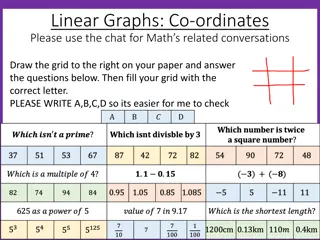
Understanding Coordinate Geometry in Mathematics
Coordinate geometry, a system developed in 1637 by Descartes and Fermat, allows for locating points in a Cartesian plane using x and y coordinates. This concept involves recalling coordinate axes, plotting points, understanding quadrants, and solving real-life problems. The history, introduction, an
2 views • 27 slides
Understanding Enterprise Resource Planning (ERP) Systems
Enterprise Resource Planning (ERP) systems are comprehensive business management systems designed to coordinate resources, information, and activities within an organization. From integrated systems to non-integrated ones, ERP offers various advantages such as customization, increased data security,
1 views • 17 slides
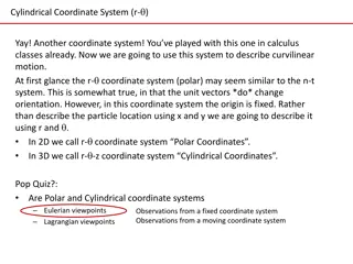
Understanding Curvilinear Motion with Cylindrical Coordinates in Physics
Cylindrical coordinates, specifically the r- coordinate system, are useful in describing curvilinear motion. This system helps explain motion in relation to a fixed origin, making it ideal for scenarios involving rotation or changes in angle. By using radial and transverse unit vectors, positions, v
1 views • 16 slides
Understanding Equivalent Ratios and Tables in Math
Learn how to write equivalent ratios, determine unknown terms in ratios and tables, plot equivalent ratios on a coordinate plane, and understand key vocabulary related to ratios such as ratio tables, scaling up/down, and coordinate planes. Discover how equivalent ratios are formed by scaling up or d
0 views • 28 slides
Understanding Rotations on the Coordinate Plane
Rotations on the coordinate plane involve turning points either clockwise or counterclockwise around the origin. Different rotations like 90, 180, 270, and 360 degrees have specific rules and effects on the coordinates. It's important to know how to symbolically represent rotations and understand th
1 views • 8 slides
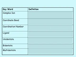
Understanding Complex Ions and Coordinate Bonds in Chemistry
Complex ions in chemistry are formed when transition metals or their ions bond with ligands through coordinate bonds. Ligands utilize their lone pairs of electrons to form dative covalent bonds with transition metals, determining the coordination number of the cation. Complex ions play a crucial rol
1 views • 29 slides
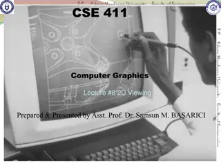
Understanding 2D Viewing in Computer Graphics
Exploring the concept of 2D viewing in computer graphics, this lecture covers the 2D viewing pipeline, including clipping, window normalization, viewport transformations, and OpenGL 2D viewing functions. It explains how a picture is defined using a Cartesian coordinate system, selecting views within
2 views • 84 slides
Interactive Mathematics Activities for Year 7: Plotting Coordinates and More
Engage in a series of nine checkpoint activities focusing on plotting coordinates, including scenarios like ant movements, pirate treasure hunts, high and low points, and understanding coordinate axes. Dive into fun challenges and develop key skills in mathematics while exploring various coordinate
0 views • 29 slides
Understanding Transformations in Coordinate Plane
Learn about transformations in a coordinate plane, including translations, rotations, reflections, and dilations. Discover methods to perform translations and understand how to determine the new prime points. Explore examples and step-by-step instructions to master the concept of transformations.
1 views • 9 slides
Understanding the Coordinate Plane: Unit 1 Lesson 12
Engage in learning about the coordinate plane, axes, quadrants, and coordinates to accurately position points and understand their locations in this comprehensive lesson. Practice naming quadrants and interpreting ordered pairs to navigate the coordinate plane effectively.
1 views • 22 slides
Exploring Polygons in the Coordinate Plane
This content delves into the classification of polygons in the coordinate plane, specifically focusing on triangles, parallelograms, and quadrilaterals. Through visual aids and problem-solving scenarios, learners can deepen their understanding of geometric shapes and their properties.
0 views • 7 slides
Midpoint and Distance in Coordinate Plane
This content covers the concepts of finding midpoints and distances in the coordinate plane. It explains how to calculate the midpoint of line segments on a number line and in a coordinate plane using the midpoint formula. Additionally, it discusses finding the distance between two points using the
0 views • 7 slides
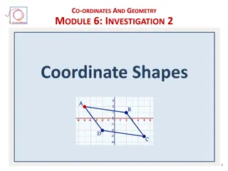
Coordinate Shapes Investigation: Module 6 Activity 6.2.1
Explore coordinate geometry and shapes in Module 6 Investigation 2 Activity 6.2.1. Learn how to build scripts for sprites, spell words using coordinates, and complete coordinate challenges with letters. Get hands-on experience with letters, coordinates, and grid points within a fun and interactive l
0 views • 27 slides
Creating Coordinate Systems in Creo Parametric
Learn how to create a coordinate system in a specific location and orientation within a Creo Parametric assembly. Follow step-by-step instructions to set external references, activate the desired widget, and redefine the coordinate system without external dependencies. Enhance your design process by
0 views • 11 slides
Fun Math with Coordinate Geometry Challenges
Engage in a series of coordinate geometry challenges involving plotting points, identifying shapes like rectangles and kites, and exploring geometric properties such as equal line lengths and triangle types. Test your skills and observation with these interactive exercises.
0 views • 18 slides
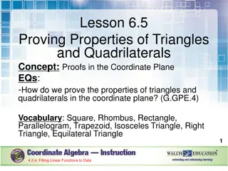
Proofs in Coordinate Plane: Triangles & Quadrilaterals
Explore how to prove the properties of triangles and quadrilaterals utilizing coordinates, slopes, and distances in the coordinate plane. Learn about different types of triangles and quadrilaterals, key concepts like parallel and perpendicular lines, and the distance formula to establish geometric t
0 views • 34 slides
Analysis of Network Coordinate Systems and Security Vulnerabilities
This presentation explores the concept of network coordinate systems, their limitations, efficient measurement of distance between nodes, and existing systems like Vivaldi and Pyxida. It delves into embedding errors in network coordinates, updates to reduce errors, secure mechanisms like Mahalanobis
0 views • 23 slides
Information Systems in Organizations: Overview and Implementation
Information systems play a crucial role in organizations, encompassing transaction processing systems, functional area information systems, and enterprise resource planning systems. This content delves into the purpose of transaction processing systems, the support provided by information systems ac
0 views • 30 slides
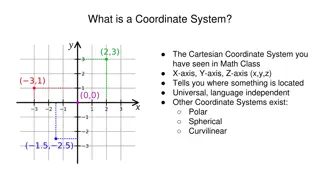
Understanding Coordinate Systems in Mathematics and Astronomy
Coordinate systems such as Cartesian, Polar, and Celestial serve as frameworks for locating points in space. They include dimensions like x, y, z axes in Cartesian, Latitude and Longitude on Earth, and various systems for astronomical observations. Different coordinate systems cater to specific purp
0 views • 11 slides
Measurement Technique for Meridional Circulation in Solar Activity
In this research, time-distance measurements were conducted to study meridional circulation in solar activity. The east-west signal was found to be similar to the north-south signal, prompting analysis steps involving spherical harmonics computation, image reconstruction, filtering, cross-correlatio
0 views • 7 slides
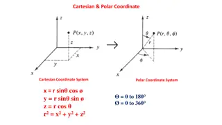
Understanding Cartesian and Polar Coordinate Systems
Explore the concepts of Cartesian and Polar coordinate systems, including their formulas and visual representations. Dive into the relationships between Cartesian and Polar coordinates, as well as their applications in mathematics and physics. Discover orbital shapes such as Px, Py, Pz, and dz2 orbi
0 views • 12 slides
Introduction to Polar Coordinates: A Different Coordinate System
Exploring the concept of polar coordinates, a coordinate system introduced in the mid-seventeenth century by notable mathematicians independently. Learn about measuring angles in radians, converting between degrees and radians, and drawing graphs in polar coordinates by considering length and angle
0 views • 34 slides
Understanding the Coordinate Plane and Graphing Techniques
Explore the basics of the coordinate plane, including quadrants and graphing ordered pairs. Learn how to identify the x and y coordinates, plot points accurately, and graph polygons in the coordinate plane. Enhance your understanding of geometry and spatial reasoning through practical examples and v
1 views • 8 slides
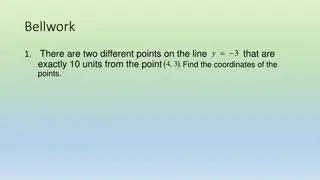
Geometry in the Coordinate Plane
The content discusses various topics related to geometry in the coordinate plane, including finding points on a line that are a specific distance apart, classifying polygons by their sides, determining perimeters of polygons with given vertices, and calculating areas of triangles and polygons. It pr
0 views • 12 slides
Network Coordinate-based Web Service Positioning Framework for Response Time Prediction
This paper presents the WSP framework, a network coordinate-based approach for predicting response times in web services. It explores the motivation behind web service composition, quality-of-service evaluation, and the challenges of QoS prediction. The WSP framework enables the selection of web ser
0 views • 30 slides
Understanding Important Terms Related to Parabola in Coordinate Geometry
Learn about key concepts related to the parabola in coordinate geometry including the axis of the parabola, vertex, chord, focal chord, focal distance, latus rectum, and more. This comprehensive guide covers definitions, properties, and equations associated with parabolas, providing a solid foundati
0 views • 9 slides
Understanding Horizontal Coordinate System in Astronomy
Explore the Az/Alt and Equatorial coordinate systems in astronomy, based on the celestial sphere surrounding Earth. Learn about azimuth, altitude, cardinal directions, and how coordinates change with locations. Understand the components, measurements, and directions used in the horizontal coordinate
0 views • 15 slides
Understanding Coordinate Systems, Map Projections, and GIS Applications
Explore the intricacies of Geographic Coordinate Systems, Projected Coordinate Systems, and different types of map projections as part of the Remote Sensing and GIS Application course taught by Lecturer Ruba Yousif Hussain in the third year. Dive into the properties of map projections like conforman
0 views • 13 slides
Understanding Location and Direction on Maps
Location and Direction are essential aspects of reading maps. Traditional methods use relative location descriptions, while modern approaches incorporate absolute coordinates. Maps utilize coordinate systems like Geographic Coordinate System (GCS) and Universal Transverse Mercator System (UTM) to pi
0 views • 30 slides
Understanding Vectors, Matrices, and Rotations in Euclidean Space
Explore the fundamentals of vectors, matrices, rotations, and coordinate transformations in Euclidean space. Learn about points, tensors, and the significance of vectors in representing physical quantities. Discover the Parallelogram Law and Coordinate Frames for effective visualization and computat
0 views • 46 slides
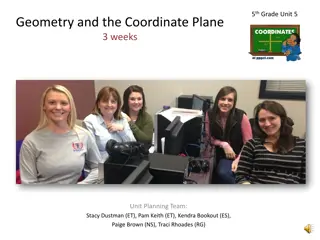
Exploring Geometry and Coordinate Plane in 5th Grade
Delve into the world of geometry and the coordinate plane with 5th-grade students. The unit focuses on graphing on the coordinate grid, properties of shapes, real-world problem-solving, and numerical patterns. Students will classify shapes, plot points, and explore multiplication and division concep
0 views • 15 slides
Understanding Embedded Systems and Cyber-Physical Systems
Embedded systems are specialized computer systems embedded within larger systems, such as control systems and car controllers. This lecture covers real-time aspects, applications of Cyber-Physical Systems (CPS), and examples like the Boeing 777/Airbus A380 cockpit. It discusses the design process of
0 views • 22 slides
Introduction to Lagrangian and Hamiltonian Mechanics: A Comprehensive Overview
This course provides a detailed introduction to Lagrangian and Hamiltonian Mechanics, covering topics such as the nature of physics, differentiation, calculus of variation, coordinate systems, and getting ready for Lagrangian Mechanics. It explores the relationship between math and physics, utilizin
0 views • 15 slides
Understanding the Shoe Lace Method for Finding Polygon Areas
The Shoe Lace Method is a mathematical process used to determine the area of any polygon by employing coordinate geometry. By following specific steps, including organizing coordinates, multiplying diagonally, and adding columns in a certain manner, the method allows for a straightforward calculatio
0 views • 8 slides
Understanding Three-Dimensional Coordinate Systems in Engineering Mathematics
Exploring how points are located in a plane and in space using ordered pairs and triples of real numbers, respectively. Discusses the use of coordinate axes, orientation, and the right-hand rule in representing points in three-dimensional space.
0 views • 42 slides
Understanding Graphics Output Primitives and Coordinate Reference Frames
Graphics output primitives and coordinate reference frames play a crucial role in describing scenes and drawing basic geometric structures in 2D space. These concepts involve defining points, drawing lines, and understanding pixel coordinates within a coordinate system. Absolute and relative coordin
1 views • 35 slides
Understanding Divergence and the Divergence Theorem in Vector Fields
This content discusses the concept of divergence and the divergence theorem in vector fields through detailed examples and explanations. It covers topics such as finding divA in different coordinate systems, calculating charge density in regions based on given vector fields, and applying the diverge
0 views • 8 slides

