Visuospatial Ability and Geologic Mapping Study
Explore the relationship between expertise levels in geosciences and visuospatial ability through a comprehensive five-year research project involving novice and expert geologists. Tasks, measures, and mapping techniques were utilized to assess domain knowledge and visuospatial skills.

Uploaded on Sep 21, 2024 | 0 Views
Download Presentation

Please find below an Image/Link to download the presentation.
The content on the website is provided AS IS for your information and personal use only. It may not be sold, licensed, or shared on other websites without obtaining consent from the author. Download presentation by click this link. If you encounter any issues during the download, it is possible that the publisher has removed the file from their server.
E N D
Presentation Transcript
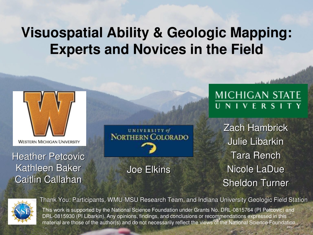
Visuospatial Ability & Geologic Mapping: Experts and Novices in the Field Zach Hambrick Julie Libarkin Tara Rench Nicole LaDue Sheldon Turner Heather Petcovic Kathleen Baker Caitlin Callahan Joe Elkins Thank You: Participants, WMU-MSU Research Team, and Indiana University Geologic Field Station This work is supported by the National Science Foundation under Grants No. DRL-0815764 (PI Petcovic) and DRL-0815930 (PI Libarkin). Any opinions, findings, and conclusions or recommendations expressed in this material are those of the author(s) and do not necessarily reflect the views of the National Science Foundation.
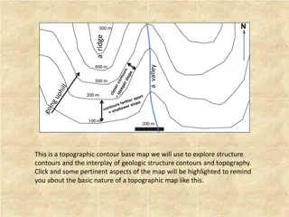
WHY STUDY EXPERT AND NOVICE GEOSCIENTISTS? www.dinojim.com/structures.htm
WHY STUDY MAPPING? Geologic mapping is a complex and cognitively demanding task. What is the role of visuospatial ability?
THE RESEARCH STUDY Five-year project in which N=67 novice (undergraduate) through expert (professional) geologists completed a suite of lab and field tasks in summer 2009 and 2010. Construct Expertise Domain Content Knowledge Visuospatial Ability Task or Measure Domain Experience Questionnaire (General and Mapping) Geoscience Concept Inventory (GCI+) (Libarkin & Anderson, 2005) VSR - Paper Folding, Form Board, Space Relations (Ekstrom et al., 1976; Bennett et al., 1972) WMC - Matrix Span, Arrow Span (Hambrick & Oswald, 2005) PS - Pattern Comparison (Salthouse & Babcock, 1991) Bedrock geologic map (scanned and digitized) GPS track during mapping (ArcGIS) Post-mapping Interview Field Problem- Solving Geologic Mapping Task
THE RESEARCH STUDY Five-year project in which N=67 novice (undergraduate) through expert (professional) geologists completed a suite of lab and field tasks in summer 2009 and 2010. Construct Expertise Domain Content Knowledge Visuospatial Ability Task or Measure Domain Experience Questionnaire (General and Mapping) Geoscience Concept Inventory (GCI+) (Libarkin & Anderson, 2005) VSR - Paper Folding, Form Board, Space Relations (Ekstrom et al., 1976; Bennett et al., 1972) WMC - Matrix Span, Arrow Span (Hambrick & Oswald, 2005) PS - Pattern Comparison (Salthouse & Babcock, 1991) Bedrock geologic map (scanned and digitized) GPS track during mapping (ArcGIS) Post-mapping Interview Field Problem- Solving Geologic Mapping Task
THE RESEARCH STUDY Five-year project in which N=67 novice (undergraduate) through expert (professional) geologists completed a suite of lab and field tasks in summer 2009 and 2010. Construct Expertise Domain Content Knowledge Visuospatial Ability Task or Measure Domain Experience Questionnaire (General and Mapping) Geoscience Concept Inventory (GCI+) (Libarkin & Anderson, 2005) VSR - Paper Folding, Form Board, Space Relations (Ekstrom et al., 1976; Bennett et al., 1972) WMC - Matrix Span, Arrow Span (Hambrick & Oswald, 2005) PS - Pattern Comparison (Salthouse & Babcock, 1991) Bedrock geologic map (scanned and digitized) GPS track during mapping (ArcGIS) Post-mapping Interview Field Problem- Solving Geologic Mapping Task
THE BEDROCK MAPPING TASK METHODS Cohorts of 9-10 participants (2009=29; 2010=38) 54% male, mean 36.5 yrs, 55% professional experience Group guided introduction to rock types (4 major types) Individual mapping Unlimited time (5-7 hrs) Air photo and topo map Rocky Mountains (MT)
SUCCESS = MAP SCORE Participant map Digitized map Answer key PARTICIPANT MAP ANALYSIS TWO SCORES SURFACE ROCK DISTRIBUTION = ArcGIS accuracy of % of 1 m digitized participant pixels matching key GEOLOGIC STRUCTURE = presence and accuracy of major fold and fault in map area (rubric)
STUDY 1: KEY FINDINGS COGNITIVE DATA ANALYSIS Accuracy of rock distribution correlates positively with expertise, geologic knowledge, and visuospatial ability Hierarchical regression analysis to test for interaction FINDINGS At low knowledge (novice) visuospatial ability has a positive effect on accuracy of rock distribution At high knowledge (expert) visuospatial ability has little effect Rock Distribution (%) Do experts see the geology? Hambrick et al., 2012
STUDY 2: KEY FINDINGS GPS TRACK ANALYSIS Principle Component Analysis Statistical correlation (Spearman s & Pearson s) *p<.05; **p<.01 FINDINGS Visiting more of the field area produced a more accurate map Fast novices are less thorough and have poorer interpretations Fast experts had higher quality interpretations Rock distribution .55** Geologic structure Thorough- ness Geologic structure Thorough- ness Speed .46** .27* NC .36* -.53** -.35 Do experts see the geology? Baker et al., 2012
STUDY 3: KEY FINDINGS MAP VS. MENTAL MODELS Most participants could articulate a better understanding of the geology than shown on their paper maps INTERVIEWER: Can you just give me a general overview of the map itself? what did you draw? VACHOT: Okay, I mapped out according to the three rock unit types that were identified for us in the walk-through. INTERVIEWER: If someone asked you what was going on in the subsurface, what could you say? VACHOT: I m trying to make sense three dimensionally, you know, like a cross section. ... And I would have thought that maybe there was some kind of a syncline going like this [gestures with hands striking parallel and dipping toward the center of the map area]. But then underneath that a fault in uplift and the gneiss or the basement cutting through that. And so the rest of this syncline would have been elevated and eroded away [uses hands to demonstrate a thrust/reverse fault uplifting the Precambrian]. And that s kind of what I suspect may be the case here. VACHOT (NOVICE) Hand-drawn map
STUDY 3: KEY FINDINGS GEOLOGIC MENTAL MODEL Compile model from all data sources (final paper map, draft map, sketches, field notebook, interview) Re-score the geologic structural interpretation (same rubric) FINDINGS Experts report forming a model immediately to early in the task Novices form models during the task Map vs Model Geologic Structure 1.20 1.00 0.80 Model Score 0.60 0.40 Experienced mappers 0.20 Novice mappers How does this relate to visuospatial ability? 0.00 0.00 0.20 0.40 0.60 0.80 1.00 1.20 Map Score Geologic Structure Score
MODELS & VISUOSPATIAL ABILITY Novices (N=37) 0.66** Experienced (N=30) 0.59** NEW ANALYSIS Statistical correlation (Spearman s) *p<.05; **p<.01 Higher quality model correlates with: Understanding of rock distribution Understanding of geologic structure Geologic knowledge Rock distribution Geologic structure Mapping expertise Geologic knowledge Spatial ability1 Distance covered Distance in 1st hour 0.75** 0.82** 0.23 0.39* 0.39* 0.52* 0.38* -0.13 0.14 0.35* 1Correlation was only found with form board. No correlation with visuospatial composite (r=0.19) 0.07 0.51**
MODELS & VISUOSPATIAL ABILITY NEW ANALYSIS: Path Model Two factors: geoscience experience & spatial ability FINDINGS Both influence knowledge Experience and knowledge predicts mental model Spatial ability does not predict mental model Mental model predicts rock distribution Rock Dist
WHAT DOES THIS ALL MEAN? Summary: Visuospatial ability is important, BUT appears more important for novices Novices (lower geologic knowledge) rely on visuospatial ability to construct their understanding of rock distribution and structures in the field, during the task Experts (higher knowledge) generate immediate mental models and test hypotheses EDUCATIONAL IMPLICATIONS: Spatial ability may be important for geology students Train students to use multiple working hypotheses technique