Enhancing Geospatial Imaging Solutions with CARIS Tools for Seabed Mapping
CARIS offers a suite of tools including CARIS Cloud and BDB Server, facilitating the seamless upload, processing, and transfer of bathymetric data to support initiatives like Seabed 2030 and GEBCO. The integration of CARIS tools enables stakeholders to manage, disseminate, and access hydrospatial data efficiently, enhancing collaboration in the marine mapping domain. Through REST APIs and customizable viewers, users can automate data pipelines, schedule data transfers, and discover new datasets seamlessly. Teledyne Geospatial Imaging Solutions further complement these capabilities, providing a comprehensive solution for land and water mapping projects.
Uploaded on Sep 12, 2024 | 0 Views
Download Presentation

Please find below an Image/Link to download the presentation.
The content on the website is provided AS IS for your information and personal use only. It may not be sold, licensed, or shared on other websites without obtaining consent from the author. Download presentation by click this link. If you encounter any issues during the download, it is possible that the publisher has removed the file from their server.
E N D
Presentation Transcript
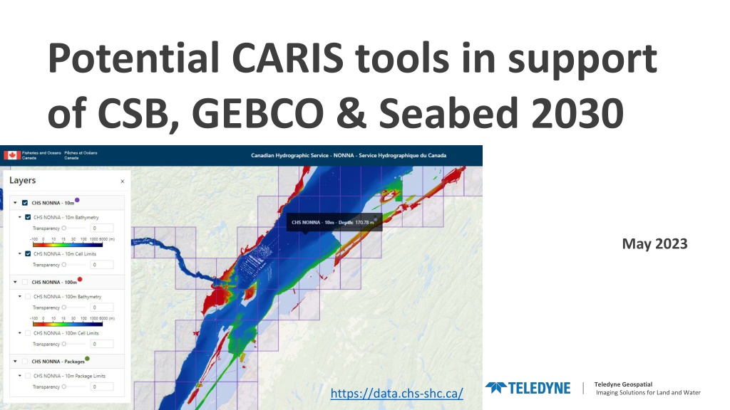
Potential CARIS tools in support of CSB, GEBCO & Seabed 2030 May 2023 Teledyne Geospatial Imaging Solutions for Land and Water | https://data.chs-shc.ca/
Overview CARIS Cloud can be the link between stakeholders interested in sharing their data and Seabed2030. Selected BDB data can be uploaded, processed and transferred to Seabed2030 data holdings automatically at specifications configured by the user. CARIS BDB Server CARIS Cloud Account Upload & Process data Data transfer Seabed2030 Teledyne Geospatial Imaging Solutions for Land and Water |
BDB Server 5.4 BDB Server 5.4 with connection to CARIS Cloud account to schedule and configure data pipeline to automatically upload and process BDB data and make it available to CARIS Cloud users Select gridded data to upload Configure processes to execute when uploading data. For example: Generate gridded tile products with resolution, extent and formats (CSAR, ASCII, BAG, S- 102, GeoTIF) specified by users Update raster mosaic distributed as OGC services (WMS, WMTS) Run process manually or automatically at some cadence CARIS BDB Server CARIS Cloud Account Upload & Process data Data transfer Seabed2030 Teledyne Geospatial Imaging Solutions for Land and Water |
CARIS Cloud with Bathy Data Service app Cloud hosted solution to upload & process, manage, disseminate hydrospatial data and products Several applications can be activated, notably Bathy Data Service to enable gridded bathymetry pipeline REST API to define and execute jobs (chains of processes) CARIS BDB Server CARIS Cloud Account Upload & Process data Data transfer Seabed2030 Teledyne Geospatial Imaging Solutions for Land and Water |
Transfer to GEBCO / Seabed 2030 / DCDB CARIS Cloud has a modern REST API, which can be used by other systems to receive notifications when new data is available and to download the data. CARIS Cloud also has a simple and customizable Discovery Viewer to find and download data CHS NONNA portal is an example: https://data.chs-shc.ca/dashboard/map CARIS BDB Server CARIS Cloud Account Upload & Process data Data transfer Seabed2030 Teledyne Geospatial Imaging Solutions for Land and Water |
