Understanding Benthic Substrate Characterization Through Multibeam Bathymetry
Utilizing multibeam bathymetry and backscatter data, this project focuses on mapping potential benthic substrates in marine environments. The history, procedures, and possible classification schemes are discussed, highlighting the importance of analyzing backscatter data for sediment classification. The unsupervised procedure for sediment classification is outlined, emphasizing the need for careful data processing and clustering based on statistical breaks. The study aims to enhance our understanding of benthic environments for conservation and management purposes.
- Benthic Substrate
- Multibeam Bathymetry
- Backscatter Analysis
- Marine Environment
- Sediment Classification

Download Presentation

Please find below an Image/Link to download the presentation.
The content on the website is provided AS IS for your information and personal use only. It may not be sold, licensed, or shared on other websites without obtaining consent from the author. Download presentation by click this link. If you encounter any issues during the download, it is possible that the publisher has removed the file from their server.
E N D
Presentation Transcript
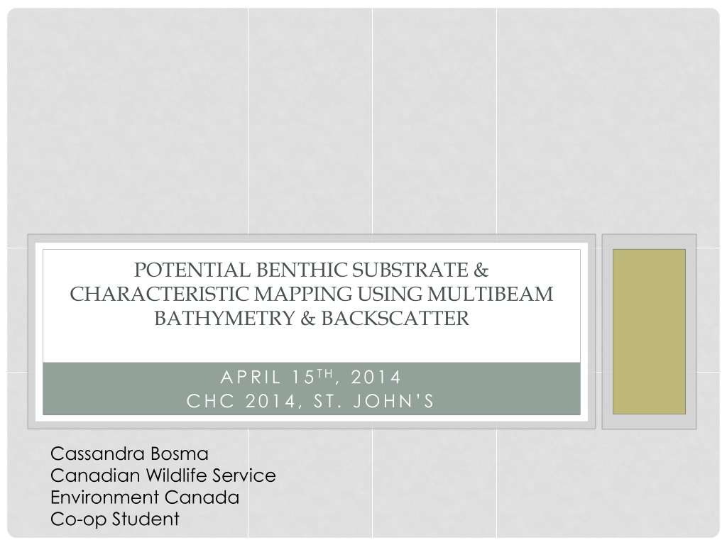
POTENTIAL BENTHIC SUBSTRATE & CHARACTERISTIC MAPPING USING MULTIBEAM BATHYMETRY & BACKSCATTER APRIL 15TH, 2014 CHC 2014, ST. JOHN S Cassandra Bosma Canadian Wildlife Service Environment Canada Co-op Student
OUTLINE History of Project Procedure Applications & Results Conclusion Future Plans
BACKGROUND 2007 - NRCan began collecting data/samples and classifying MBES data in the Scott Islands region of BC (proposed marine National Wildlife Area, EC) 2012 - CHS & EC continued classifying more recently collected data in the same region (Co-op student Stephen Finnis) 2013 - Classification of Gil Island rectangle near Kitimat, BC 2013/2014 CHS & EC collaborated to collect more MBES data (Rockfish Conservation Area of Scott Islands) and expand classification of the Scott Islands region
POSSIBLE CLASSIFICATION SCHEMES Folk Classification Scheme Greene Classification Coastal & Marine Ecological Classification Standard (CMECS) San Juan Islands Potential Habitat Chart
PROCEDURE ANALYZING POTENTIAL SUBSTRATES FROM BACKSCATTER
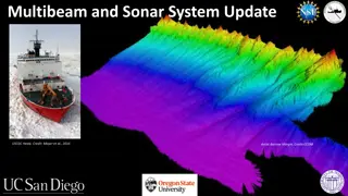
BACKSCATTER Returning signal intensity varies depending on the kind of material the signal hits and reflects High intensity: Hard Substance - Rock or gravel Low intensity: Soft Substance - Mud, silt, sand, etc. Scott Islands, BC Backscatter 5m grid cell size
UNSUPERVISED PROCEDURE FOR SEDIMENT CLASSIFICATION Acquire processed bathymetry and backscatter data sets - Smooth and filter backscatter Cluster backscatter based on statistical breaks in the backscatter mosaic -Number of clusters determined by preliminary studies, or trial-and-error to find meaningful groups Generalize/Clean the data clusters with neighbourhood statistics - Clustering without rock layer
ROCK LAYER Rock is not differentiated from other hard sediment classes using the cluster method Extract rock from bathymetry using slope, neighbourhood statistics and modified terrain complexity (rugosity) This method finds areas with greater terrain variation compared with neighbouring cells Add rock layer into sediment classes
FINISHED POTENTIAL SUBSTRATE MAP Scott Islands BC Vancouver Island Next - Build accompanying characterized layers for slope, depth, morphology, etc.
MORPHOLOGY Use Benthic Terrain Modelling (BTM) Toolbox developed by NOAA Build Bathymetric Position Index (BPI much like Topographic Position Index, TPI, for land) and classify into broad benthic zones
SLOPE Slope ranges are flexible and can be determined based on user defined ranges from the bathymetry data
DEPTH Depth ranges are flexible and can be determined based on user defined ranges from the bathymetry data
LAYER COMBINATIONS Possible database of polygons or rasters for: -overlaying -querying -combining In order to answer habitat questions Substrate & Morphology
APPLICATIONS CURRENT & FUTURE
POSSIBLE USES Seafloor classification Provide base layers for habitat mapping - Supporting World Class Response Locating potential forage sites for seabirds (Pacific Sand Lance habitat) Locating potential habitat for specific marine biota (Rockfish, etc.) Potential to contribute to Pacific Marine Ecological Classification (PMECS) - Federal-Provincial government Marine Protected Areas Implementation Team
SCOTT ISLANDS PROPOSED MARINE NATIONAL WILDLIFE AREA CHARACTERIZATION Support management decisions regarding the proposed area and aid in research
SUPPORT HABITAT MAPPING FISHERIES AND OCEANS CANADA CANADIAN HYDROGRAPHIC SERVICE Completed Substrate Classification -North Central Coast BC
Sand Waves & Pacific Sand Lance (Ammodytes hexapterus) Habitat The pink ovals represent areas where potential sand waves have been located Sand waves are associated with Pacific Sand Lance, a forage fish species
RESULTS PRELIMINARY VERIFICATIONS
PRELIMINARY VERIFICATIONS NRCan 2007 - completed bottom sampling and correlation in the northeast corner of the surveyed region 65% correlation with grab sample 75% correlation with sediment core (Unpublished report Finn, 2007)
EDGE MATCHING Surveys completed over several years with different equipment Classification done by different people using similar but slightly different parameters Edges naturally aligned with matching classification between the surveys
PRELIMINARY UNDERWATER ROV COMPARISON ROV transects in the Scott Islands are overlaid onto substrate layer An analysis of correlation is ongoing and preliminary visual comparisons are promising ROV Credit: Lynne Yamanaka; Pacific Biological Station; Nanaimo; Department of Fisheries and Oceans
CONCLUSIONS & FUTURE PLANS
CONCLUSIONS Shows potential for habitat mapping and as a management decision making tool Can differentiate minor changes not discernable to the human eye as with manual backscatter classification Adequate method for complete coverage classifying large data sets Repeatable and with reasonably rapid results Needs verification
RECOMMENDATIONS 1. Ground-truth with adequate sample sizes to obtain coverage of all potential substrate types 2. Coordinate with national & international partners for standardization (GeoHab working group) 3. Collect more data in shallow and near-shore waters (GeoSwath in Gwaii Haanas) 4. Support GIS - build and manage a database for characterized layers 5. Expand coverage of classification 6. Compare with LIDAR and create similar process with LIDAR data (Collaboration with Trent University)
FUTURE PLANS Ground-truth (2014) - Sediment grabs, cores and video transects (planned & opportunistic) Identify possible Pacific Sand Lance (Ammodytes hexapterus) habitat signature in backscatter and extrapolate to find habitat throughout Pacific coast in support of seabird research (Cliff Robinson, Stephane Gauthier, Doug Bertram) Ongoing classification of existing MBES data and collection of more during future surveys
DISCUSSION QUESTIONS? ACKNOWLEDGEMENTS David Dodd, Kalman Czotter, Dave Jackson, Greg Jones, Doug Bertram, Vaughn Barrie, Robert Kung, Lynne Yamanaka, Stephen Finnis The Canadian Wildlife Service, Environment Canada, Canadian Hydrographic Service, Fisheries and Oceans Canada, Natural Resources Canada For valuable contributions and support