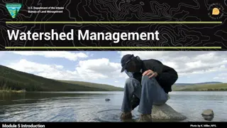
Analysis of Different Watershed Management Approaches in Various Agro-Ecoregions
This study examines six different watershed management approaches implemented in diverse agro-ecoregions, focusing on the commonalities, success, and failures of interventions. The case study of Adarsh Gaon Yojana (AGY) in Maharashtra highlights the principles and approach towards sustainable village development through watershed management. The program involved collaboration between government departments, NGOs, and local communities to address water scarcity and promote holistic village development.

Download Presentation

Please find below an Image/Link to download the presentation.
The content on the website is provided AS IS for your information and personal use only. It may not be sold, licensed, or shared on other websites without obtaining consent from the author. Download presentation by click this link. If you encounter any issues during the download, it is possible that the publisher has removed the file from their server.
E N D
Presentation Transcript
Criteria for selection of case studies The main purpose of the case studies was to examine the commonalities among watersheds located in different agro-ecoregions, developed through various approaches to watershed management by different agencies, and identify factors that contribute to the success or failure of different watershed development interventions. Using the above selection criteria, the following six watershed management approaches were identified for the study: 1. Adarsh Gaon Yojana (AGY): Watershed program initiated by the Maharashtra Government, funded by the State Government and implemented jointly by government departments and NGOs. 2. Rajiv Gandhi Watershed Mission (RGWM): Watershed management program funded by the Central Government and driven by a state-level mission approach, and implemented by the State Government and NGOs. 3. Mysore resettlement and development agency (MYRADA): program initiated and implemented by an NGO with government and non-government funding. 4. Sukhomajri Model: program implemented by ICAR, State Government, and local-level institutions, with funding from Ford Foundation. 5. ICAR Model: Watershed management program implemented and funded by ICAR and partly shared by the Ford Foundation and stakeholders. 6. Consortium Model: Watershed management approach developed by ICRISAT and implemented by a consortium of organizations including research institutes, NGOs, government departments, and farmers and implemented with funding from DPAP (now District Water Management Agency (DWMA)), Andhra Pradesh and Asian Development Bank (ADB).
Analysis of Selected Case Studies Adarsh Gaon Yojana (AGY) Background The State Government of Maharashtra launched the AGY (Adarsh Gaon Yojana meaning Model Village Program) in 1991. The aim of the program was to create one model village in each taluk of the state with an emphasis on development and regeneration of land and water resources. The five principles of Ralegan Siddhi were nasbandi (restriction of family size), nashabandi (ban on alcohol), charaibandi (ban on free grazing), kurhadbandi (ban on tree felling), and shramdan (donation of voluntary labor for community welfare).it has demonstrated the importance of these principles and their contribution to sustainable development. Approach to watershed management Villages selected for funding under the AGY program had following characteristics: (i) located in a drought-prone area; (ii) scarcity of water was the key problem; (iii) irrigated area was less than 30%; and (iv) population was less than 4000. The funds sanctioned under the AGY were made available to the villages for two main types of activities: (1) watershed development as the core activity; and (2) other non-core development activities. The watershed development activities were undertaken by the NGO while other by the respective government departments. The AGY aimed to bring about all round development of the village by combining the finances and resources of government with the skills of the NGOs and motivation for participation of villagers.
The administrative structure form of the AGY consisted of several Committees appointed at various administrative levels such as the state, district, taluka and village. The Chairman of the State Level Committee was appointed by the Chief Minister and was given the authority to set up and manage the entire administrative structure for the program. The government officials at each administrative level in these departments were members of the AGY Committee at each corresponding administrative level of the program. The government departments associated were: soil and water conservation, rural development, agriculture, horticulture, health, social forestry, education, women and child welfare, Groundwater Survey and Development Agency, Khadi and Village Industries and Maharashtra Energy Development Agency. The responsibility for financial planning and management and disbursement of funds was with the State Level Committee of the AGY. The State Government had agreed to dedicate funds for the program. The funds were routed through the Department of Soil and Water Conservation and Watershed Development. The funds were maintained in this department Currently, there are 222 villages under the program at various stages of completion. About 50 villages have shown good progress in terms of achieving the objectives of the program. Two villages were identified for the field study; Hiwre Bazar, which is recognized as one of the best villages under the AGY and Ambadvet, where the AGY program has met with limited success.
Hiwre Bazar village Background. Hiwre Bazar, a village of 210 households, is situated in Ahmednagar district.The watershed development project under the AGY began in this village on 15 August 1994. The total watershed area in the village is 977 ha, divided into three micro- watersheds of 612 ha, 123 ha and 242 ha. The average rainfall in the village is 300 330 mm. The soil depth is 50 60 cm in the watershed. The watershed project is implemented by a locally formed NGO known as Yashwant Krishi Gram and Panlot Vikas Sanstha (YKGPVS) This Committee is responsible for planning and implementing the project. The Committee guides the villagers in the construction of structures with the help of technical assistants. The decisions about building new structures or repairing old structures are taken in Gram Sabha . The Watershed Committee and the Committee formed by the Forest Department work together to manage the resources in the watershed. During 1993 94, about 40000 continuous contour trenches were dug and about 0.6 million trees were planted in the land belonging to the Forest Department. by the practice of charaibandi (ban on tree grazing) and kurhadbandi (ban on tree felling), this area over the years has developed good forest cover. About 300 t of grass fodder was harvested during the first year itself. Under the AGY watershed development project, several new structures were constructed and old ones built earlier by the Agriculture Department were repaired.These structures include check-dams to arrest soil erosion and surface water flow,earthen structures,loose boulder structures, percolation tanks and continuous contour trenches.The villagers contributed voluntary labor during construction, and continue to contribute labor towards repair and maintenance of these structures.
Benefits. Over the past few years, the groundwater table has increased from a depth of 35 50 feet to 10 15 feet. Prior to project implementation, water was available in the village at a depth of 35 to 50 feet during the monsoons and about 55 to 60 feet during summer. The number of wells in the village increased from 97 in 1993 to 217 in 2000 . The farmers in this part of the village could harvest two crops a year, while farmers in other parts of the village could only harvest one rainfed crop per year. The farmers are now able to cultivate high-value cash crops like onions, potatoes, other vegetables and fruits The acceptance of the AGY principles increased the production of fodder greatly. This in turn increased the milk production in the village. The forestland, which was barren initially, is now getting transferred into a healthy forest with significant changes in the ecosystem. About 98% of soil erosion has been checked effectively through the construction of structures on the slopes, combined with controlled grazing. As a result of project interventions, about 280 to 300 mm of annual rainfall is enough to maintain the groundwater levels and the surface water levels in the percolation tanks for the whole year. The local migration of the villagers to irrigated areas has stopped completely. Even with comparatively smaller landholding, the farmers can utilize their limited resources to the fullest due to availability of water.
To control and regulate use of groundwater and surface water, the following important management decisions were taken in the Gram Sabha Bore wells would not be installed for irrigation purposes. Water intensive crops such as sugarcane and banana would not be grown. Resident villagers will not sell their land to non-residents.
Rajiv Gandhi Watershed Mission (RGWM) Background The RGWM7, launched on 20 August 1994 by the Government of Madhya Pradesh, has become India s largest watershed management program targeting to cover nearly 3.5 million ha. The objectives of the Mission are to: (i) conserve soil and water resources for sustaining livelihoods and reducing vulnerability to droughts; (ii) develop an easily accessible repository of scientific and technological inputs for planning and implementation; (iii) maximize people s participation for sustainable resources development; and (iv) improve environmental resources. The watersheds under the RGWM were classified into three zones: 1. Recharge zone, which usually has lands having high gradients 2. Transition zone, which has gradients requiring in situ moisture conservation 3. Discharge zone, which has flat lands requiring efficient water spreading techniques At the start of the Mission in 1994, key tasks were: (i) poverty reduction and environmental regeneration (ii) focus action on degraded areas and dryland areas to build environmental and food security; and (iii) improve agricultural production and incomes. The Pani Roko Abhiyan (community-led campaign to conserve water) was launched after the drought in 2001, by promoting community-led water harvesting structures through local water harvesting committees). Under this program, do-it-yourself methods for water harvesting were developed. The Government provided funds through the drought relief and rural development programs. The community also contribute towards the costs. Between January to June 2001, Rs 4150 million were spent under this program, of which the community contributed Rs 990 million.
Approach to watershed management The mission intensified the implementation of the centrally-funded programs such as the DPAP and Integrated Watershed Development Program.A Mission Director with a Mission Office at the state level was appointed to oversee the Mission activities. The program at the local level was planned and implemented by the Watershed Committees. The work is executed through Watershed Committees consisting of UGs, SHGs and Women Thrift and Credit Groups, while the State Government provides technical and financial support through the Mission. For the purpose of planning and implementation the watersheds are divided into project areas covering an area of 5000 to 10000 ha, which are known as Milli Watersheds. The implementing agencies are both government departments and NGOs. Monitoring and evaluation In addition to evaluation by Government agencies, the Mission has introduced participatory evaluation by the community itself. In every village, which has undergone more than 3 years of work, a public display board is maintained in a central place in the village on which information regarding the progress of activities is recorded. External evaluations have also been commissioned through agencies such as UNICEF.
Impact of the mission The area targeted for coverage is 3.438 million ha, of which work has been completed in 1.426 million ha. About 7600 villages are under the Mission, whereas all 51086 villages in the State are covered. Since pre-Mission period, groundwater level has improved in 3294 villages, area under tree cover has increased by 23579 ha, area under irrigation has increased by 59%, degraded lands have decreased by 34% and area under fodder production has increased by 52311 ha. Area under winter cropping increased by 16%, while production by 30%. Similarly, area under rainy season expanded by 21% and production by 37%.
ICAR model The ICAR launched few watersheds as research projects under its ORP.Theaimwastotest and demonstrate the improved technologies in actual farm conditions. The main focus was dissemination of new information to the farming community. Background Fakot watershed is in Dehradun district, which is located in the western lower and middle Himalayas of Uttaranchal. It has an area of 370 ha with a population of 912 in 1975. the region was severely prone to the degradation of ecosystem, with poor resources and poverty-stricken inhabitants and have no basic infrastructure, like road, markets etc. Agriculture was dominated by women as the men migrate in search of jobs to other parts of country. Tiny landholdings, massive unemployment, poverty and severe degradation of natural resources were posing challenge to the sustainability of agriculture. To conserve soil, water and biodiversity, augment farm income, and generate employment opportunities, the concept of watershed was introduced in Fakot watershed in 1975. The project was conceived, developed, executed, monitored and evaluated by CSWCRTI, Dehradun.
The purpose was to demonstrate the technologies that raise farm income through conserving soil, water and biodiversity and involving the beneficiaries. The project was started in 1974 75, initially funded by the Ford Foundation, with seed money of US$50000. Later, the project was financially supported through the ORP of the CSWCRTI. The watershed is located in the hilly terrain (slope 72%) with elevation ranging between 650 m and 2015 m above mean sea level. The watershed receives annual rainfall ranging from 1500 to 2600 mm. The size of landholding was too low (0.85 ha per household), with about 4 5 parcels distributed around 1 1.5 km distance. The majority of the farmers were poor and in debt. The crop and livestock production was at subsistence level to meet food security. There was not enough marketable surplus. Rainfall and perennial natural streams were the important sources of water for agriculture, livestock and domestic purposes. Almost 42% of the rainfall was lost as surface runoff before implementation of the watershed. The watershed was developed as per the farmers preferences and priorities with refinement of indigenous technologies and as a resource sharing pattern. Participation of local beneficiaries was ensured in problem identification, determining solutions, implementing, and monitoring and evaluation.
The aim was to conserve soil and water resources by utilizing maximum rain and natural stream water to enhance agricultural productivity. Besides these measures, improved cropping systems, agricultural technologies (including high-yielding varieties of suggested crops and fertilizer application) and management practices were developed and demonstrated by CSWCRTI to the farmers. The technologies included combination of erosion control and leguminous crops to improve soil fertility. Pulses (lentil and chickpea), horticultural crops (mango, citrus, jack fruit, banana, apple, apricot, plum) and farm forestry (Grewia optiva,Dalbergia sisoo, Eucalyptus hybrid, Leucaena leucocephala) were also included in the cropping system with the objectives of improving soils and enhancing farm income. Mandua, jhingora and wheat were the principal crops in rainfed areas, while rice and wheat were important in the irrigated areas. The yield levels were too low. For example, the average wheat yield was 895 kg ha-1, ranging from 600 650 kg ha-1 in rainfed areas to 900 950 kg ha-1 in irrigated areas. The yields of mandua
Benefits of watershed The benefits of the watershed activities were quite impressive; increased water availability as a result of check-dams and nala plugs was important. Availability of water was responsible for shift in cropping pattern from coarse cereals (mandua and jhingora) to superior cereals (rice, wheat and maize), legumes and vegetable crops. The yield levels of different crops increased phenomenally: maize from 530 to 1480 kg ha-1; paddy from 298 to 878 kg ha-1; wheat from 896 to 1550 kg ha-1; and chickpea from 327 to 693 kg ha-1. The cropping intensity increased from 111% in 1983/ 84 to 130% in 1994/95 due to the introduction of new cropping systems and availability of water (Table 12). The area under wheat and mustard increased from 12 ha in 1988/89 to 49 ha in 1994/95) and summer cropping started since 1993 by cultivation of summer maize and mung bean. About one- fourth of the watershed area, which used to be single cropped in 1983/84, was double cropped


")