Distribution Pattern of River Zones in China
China has a vast network of rivers with different characteristics and distribution patterns. The country is divided into five zones based on factors like precipitation and runoff levels, ranging from abundant to deficit zones. These zones play a crucial role in understanding the water resources and ecosystem of China. The rivers in China, including the famous Chang Jiang and Huang He, contribute significantly to the global river runoff. Understanding the unique features of these river zones is essential for environmental management and sustainable development in the region.

Download Presentation

Please find below an Image/Link to download the presentation.
The content on the website is provided AS IS for your information and personal use only. It may not be sold, licensed, or shared on other websites without obtaining consent from the author. Download presentation by click this link. If you encounter any issues during the download, it is possible that the publisher has removed the file from their server.
E N D
Presentation Transcript
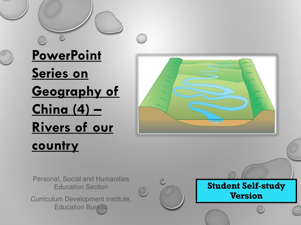
PowerPoint Series on Geography of China (4) Rivers of our country Personal, Social and Humanities Education Section Student Self-study Version Curriculum Development Institute, Education Bureau
CHARACTERISTICS OF RIVERS IN OUR COUNTRY Our country has many rivers and lakes. Two prominent features of the rivers in our country are their large number and the long distances over which they flow. There are tens of thousands of rivers, with a total length of 420,000km, of which there are more than 20 rivers with more than 1,000km in length. There are more than 50,000 rivers with drainage area over 100km , more than 1,580 rivers with drainage area over 1,000 km , and 79 rivers with drainage area over 10,000km . Among the longest rivers in the world, Chang Jiang (6,300 km) and Huang He (5,464 km) rank third and fifth, respectively.
In addition, Lancang River and Heilongjiang River are also among the ten longest rivers in the world. The average annual total runoff of rivers in our country is 2,711.5 billion m , accounting for 5.8% of the global river runoff and is ranking sixth in the world. Although rivers in our country are abundant in water volume, their water volume varies over the year with seasons and is prone to flooding in summer. In addition, the general trend of river runoff is decreasing from the southeast coast to the northwest inland.
According to factors such as precipitation and runoff, our country can be divided into five regions (Figure 1): 1) Abundant zone: Annual precipitation of this zone is more than 1,600mm and annual runoff depth is greater than 900mm 2) Relatively abundant zone: Annual precipitation of this zone is about 800-1,600mm with annual runoff depth of about 200-900mm 3) Intermediate zone: Annual precipitation of this zone is about 400-800mm with annual runoff depth of about 50-200mm.
4) Shortage zone: Annual precipitation of this zone is about 200-400mm with annual runoff depth of about 10-50mm 5) Deficit zone: Annual precipitation of this zone is less than 200mm with annual runoff depth of less than 10mm. According to Figure 1, describe the distribution pattern of the five zones of our country classified by factors such as precipitation and runoff
Harbin Urumqi Shenyang Beijing Lanzhou Xian Shanghai Chengdu Wuhan Lhasa Hangzhou Changsha Nanchang Abundant Zone Relatively Abundant Zone Intermediate Zone Shortage Zone Deficit Zone Guiyang Taipei Kunming Guangzhou *No data for Nan Hai Islands Figure 1 Distribution map of precipitation and runoff in our country (Source: P.126 of the book Learning the Geography of China through Reading (Part 1): The physical environment published by the Education Bureau (Hong Kong) in 2013.)
THE ENDORHEIC ZONE AND EXORHEIC ZONE OF RIVERS Rivers where river water eventually flows into oceans are called exorheic rivers (coastal rivers), and their catchment areas are called exorheic basins. On the contrary, if rivers cannot flow into oceans eventually (or disappear in the desert, or flow into inland lakes), they are called endorheic rivers (inland rivers). They are mostly located in deserts and other areas where evaporation is strong, so the amount of river water is small, the number of rivers is few and their distance of flow is short. The catchment areas of these rivers are called endorheic basins.
The exorheic zone and endorheic zone of rivers in our country can be seen in Figure 2, and most of the rivers in the exorheic zone flow into the Pacific Ocean and Indian Ocean respectively.
Harbin Urumqi Changchun Beijing Endorheic Zone LanzhouXian Shanghai Wuhan Lhasa Exorheic Zone Guangzhou Kunming Figure 2 The exorheic zone and endorheic zone of rivers in our country (Source: P.129 of the book Learning the Geography of China through Reading (Part 1): The physical environment published by the Education Bureau (Hong Kong) in 2013.)
THE DISTRIBUTION OF RIVERS The distribution of river systems in our country is uneven. The vast majority of rivers are distributed in the exorheic basins in the southeast, and there are relatively few rivers in the inland drainage basins (Figure 3). The difference in climate between different regions is the main reason for this situation. The main water source of rivers in the exorheic zone is precipitation, and the amount of water is relatively abundant. From upstream to downstream of a river, many tributaries flow in which increase the water volume and the density of the river network.
Glacial snowmelt water is the major source of water for rivers in the endorheic zone. In general, the water volume of these rivers is small, and their number of tributaries is also small. As a result, the water volume decreases continuously from the upstream to the downstream of the rivers in this zone. Drying up of the rivers may occur with change of seasons.
In comparison, the rivers in South China and those in North China have the following significant differences: 1) Rivers in South China have more water. 2) River flows in North China fluctuate dramatically between high and low flow seasons, causing severe floods. On the contrary, seasonal variations in river flows in South China are small and floods there normally rise and fall slowly.
3) The sediment content of the rivers in North China is much higher than that of rivers in South China, e.g. the sediment content of Huang He is the highest in the world, with an annual mean sediment content of 37.7kg/m . 4) Rivers in North China often freeze up in winter but this is not the case for rivers in South China.
Rivers in the northeastern part of our country are different from the rivers in the South and North China. Their water volume is higher than rivers of North China, but it is not as high as rivers in South China. In addition, both the rivers in Northeast and South China have less sands / sediment content. The humus content in the river water in the northeastern part of our country is generally very high, and the water color is darker. Therefore, names of rivers in the northeastern part of our country is generally very high, and the water color our country include "black dragon" and "duck green . Freezing can be found in both the rivers of the northeastern part and North China.


 Shortage zone: Annual precipitation of this")


 The sediment content of the rivers")