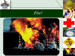
Wildland Fire Emergency Preparedness at Kidder Creek Camp

Detailed preparation, consultation with Cal Fire, fire simulations, and robust planning efforts have been undertaken to ensure the safety and evacuation readiness of Kidder Creek Camp in the event of a wildland fire emergency. Various resources and consultations have been utilized, and simulations run to model different conditions, all aimed at mitigating risks and safeguarding the community.

Uploaded on Aug 01, 2024 | 0 Views
Download Presentation

Please find below an Image/Link to download the presentation.
The content on the website is provided AS IS for your information and personal use only. It may not be sold, licensed, or shared on other websites without obtaining consent from the author. Download presentation by click this link. If you encounter any issues during the download, it is possible that the publisher has removed the file from their server.
E N D
Presentation Transcript
Fire Emergency Plan Kidder Creek Camp
Outline The Big Question Cal Fire Consultation Fire Simulation Modeling Prevention and Safeguarding Wildland Fire Emergency Plan for Kidder Creek Camp Benefits to Community Conclusion
The Big Question When you have a fire will you be able to keep everyone safe?
Preparation of a robust plan Have spent many hours in review of wildland fire fighting manuals and online resources The Red Book (Interagency Fire Standards for Fire and Fire Aviation Operations) The Incident Response Pocket Guide (IRPG) National Fire Coordinating Group (NWCG) These documents were useful in leading us to a robust plan. These documents are intended specifically for wildland firefighters going into a dangerous situation and so not all information contained therein pertains to our evacuation plan. **See appendix 1, 2**
Preparation of robust plan Cal Fire Consultation We have had numerous consultations with Cal Fire staff, including an on-site tour and review of our fire emergency plans. Through their review and on-site consultation they agree that: We meet the requirements of PRC 4290 - outlined and defined through the EIR process. Our wildland fire emergency plan is a good workable plan for evacuation. Our safety zone for hunkering down is of ample size, if needed. **We are in Cal Fire State Responsibility Area (SRA) in the Wildland Urban Interface (WUI)
Fire Simulations Multiple different simulation models were run. Normal Conditions Catastrophic Conditions Multiple and typical start points **Simulations were run using Cal Fire Wildfire Analyst Simulations
Fire Simulations Normal Conditions based on conditions the same as the day the Shackleford Fire Started which started on 7/30/2022 and contained on 8/5/2022, it grew to 31 acres. Start Location - Mid-slope, afternoon lighting strike with normal weather patterns for a day in August. The edge of the wilderness These simulations were run using a 24 hour period. Within that time the fire would be more than 3-4 miles from camp.
Fire Simulations Normal Conditions with Westerly Winds of 3-8 m.p.h. Start Location - Mid-slope, afternoon lighting strike with normal weather patterns for a day in August. This simulation was run using a 8 hour period. Within that time the fire would still be 3-4 miles from camp.
Fire Simulations Catastrophic Conditions Simulation 1 20 m.p.h. constant winds blowing toward camp depending on fire start location. 1 p.m. start on the South Side of Kidder Creek Drainage at the edge of the wilderness. Under these conditions the simulation shows that it would likely take between 4 and 8 hours for the fire to reach the safety zone area. **This model shows the direction of a fire coming from the Wooley Creek drainage.
Fire Simulations Catastrophic Conditions Simulation 2 20 m.p.h. constant winds blowing toward camp depending on fire start location. 1 p.m. start on the North Side of Kidder Creek Drainage at the edge of the wilderness. Under these conditions the simulation shows that it would likely take between 4 and 8 hours for the fire to reach the safety zone area.
Fire Simulations Catastrophic Conditions Simulation 3 20 m.p.h. constant winds blowing toward camp depending on fire start location. 1 p.m. start in the residential area off of Valley Pines Dr. Under these conditions the simulation shows that it likely would take over 8 hours for the fire to reach the safety zone area.
Fire Simulations Catastrophic Conditions Simulation 4 20 m.p.h. constant winds blowing toward camp depending on fire start location. 1 p.m. start in the residential area in Greenview. Under these conditions the simulation shows that it would likely take as little as 2-4 hours for the fire to reach the safety zone area.
Fire Simulations All simulations were done without suppression tactics which, when implemented, gives us more time!
Fire Simulations Conclusion Under Normal Conditions there is ample time for evacuation with hours to spare. Under Catastrophic Conditions in all but the very worst scenario we have ample time for a 2 hour evacuation. **The chance of these catastrophic conditions existing are very low. **When suppression tactics and interventions are implemented, this adds to the time available for evacuation.
Prevention and Safeguarding Management by staff of ongoing fuel reduction work, specifically along roadways, program areas and around the safety zone . In collaboration with Neighbors for fuel reduction and fire break projects. Working with Forester Dan Larivee, through the California Forest Improvement Program (CFIP) on fuel reduction projects. Have completed our Forest Management Plan and have applications for funding for key projects as designated through our plan. We manage Defensible Space around all buildings and in program areas and receive yearly inspections by the local fire chief.
Emergency Plan LCES is an acronym used by firefighters when they go in to an area to fight fire. This acronym is the standard used to keep firefighters safe and it includes 4 key components. Lookout Communication Escape Route which we will call Evacuation Safety Zone
Lookout There are multiple managed lookout sites watching for fire starts in our area. Duzel Rock managed by Cal Fire being the main lookout which has a clear view right up the Kidder Creek drainage. All Kidder Creek Camp Staff are trained in child safety and keeping The Big Eye the big eye means that staff are constantly on the lookout for anything that would be unsafe to the campers, including fire.
Communication Use of apps for information about lightning strikes and fires. County Alert Systems. Cell phone use to communicate with outside resources as well as with on site staff. Alarm system at camp to alert staff and campers of a emergency situation. If there is a evacuation notice, we immediately implement our evacuation procedures.
Evacuation Our primary evacuation route is down South Kidder Creek Road. If the primary option is compromised, the Secondary evacuation route will be used out Taylor Divide, connecting to Patterson Creek Road. (This secondary route will be completed before approval of the permit.) **See Fire Evacuation Plan map appendix 3.
Evacuation Immediate Actions Alarm will be used for Emergency Fire Evacuation Church is called immediately Support Staff go immediately to the office to get vehicle and driving assignments.
Current Evacuation All Campers are evacuated within 2 hours. Within 30 minutes All Campers Assemble in program area, head count and walk to Temporary Refuge Area . Programs with vehicles depart immediately. Campers and counselors stay at church, program leads drive back to camp to pick up another load of campers. Outdoor Day Camp is evacuated and to home immediately by onsite transportation.
Current Evacuation Drive Time and distance to Scott Valley Berean Church is 8.7 miles and a 13 minute drive one way.
Current Evacuation Current 2023 - Vehicle Capacity for use in Emergency Vehicle Rental Van Rental Van KC Yukon Sequoia Ford F250 - Black River Truck Silverado Ford F250 -Tim's Old Truck Expedition 10 Pass Van - Blue 10 Pass Van - Oregon Yukon XL(White) KC Yukon XL(Silver) 10 Pass Van - Yreka Sienna Admin Vehicle Capacity Main Use Wilderness 10 10 8 8 6 6 6 8 10 10 9 8 10 7 5 MTB Wilderness MTB River/Staff River/Staff River/Staff High Adventure High Adventure High Adventure High Adventure High Adventure High Adventure Admin Admin 121
Current Evacuation Current Program Max Occupancy with staff MTB 16 Wilderness 16 Ranch 48 Timberline 96 Support Staff/Other 40 216 Evacuation Timing Cap Timing Notes Campers and Staff leave within 30 minutes of evacuation notice from the TRA 12130 minute mark Evacuation 1 Group 2 is Picked up and Depart for church 1211 hour mark Evacuation 2 Remaining Staff are evacuated Evacuation 3 - if needed 1211.5 hour mark Evacuation 4 if needed 1212 hour mark
Current Evacuation Within 2 Hours All campers and staff have been safely evacuated to the designated offsite location.
Evac Plan for Max. Occupancy Evacuation Timing Evacuation 1 Campers and Staff leave within 30 minutes of evacuation notice from the TRA 15030 minute mark KC Vehicles 220 **Groups with Personal Transportation Staff/Volunteers/Guests 50 Evacuation 2 Group 2 is Picked up and Depart for church 1501 hour mark KC Vehicles Evacuation 3 1501.5 hour mark 150 Remaining Staff are evacuated KC Vehicles 3 Busses All staff and campers evacuated safely Evacuation 4 - If needed 2 hour mark 30 minute flex to allow for unknowns 870
Evacuation Plan for New Max. Occupancy All Campers are safely evacuated within 2 hours.
Safety Zone Our job is to: Get People Out. In the Event it s needed we have a maintained Safety Zone of ample size to hunker down in.
Safety Zone Our goal is to never have to use the Safety Zone . Our evacuation plan and fire behavior simulations have shown that under normal fire and most catastrophic fire conditions we will have plenty of time to evacuate our campers in a safe manner. In the event of a catastrophic fire where we cannot get out Cal Fire has recommended that we stay put and hunker down , so they know where we are and can send resources our way.
Safety Zone In the event that we do need to hunker down in the safety zone we have ample space using the **Safety Zone Guideline of: SSD = 8 * Slope Wind Factor * Height of the surrounding vegetation Using 80 for average vegetation height with a slope wind factor of 1 we need 640 of safety zone. With slope wind factor of 2 we need 1,280 which with our safety zone and surrounding ***shaded fuel break area for our safety zone is ample. **See Fuels Reduction and Safety Zone map **Information gathered from www.firelab.org and www.firescience.gov Article info: International Journal of Wildland Fire Butler, BW (2014) Wildland firefighter safety zones: a review of past science and summary of future needs. ***Article Creating a Safety Zone for use in a wildfire emergency by bkvc; May 20, 2017; Preparing for fire. See comment about increasing safety zone by thinning around your safety zone.
Benefits to Community Secondary Access Road available to neighbors on Patterson Creek Road and Valley Pines Area if needed in an emergency. Water Source for firefighting in the new and existing ponds. Good and pro-active forest management through regular maintenance and implementation of CFIP program on Kidder Creek Camp property which is a benefit to our neighbors.
Conclusion When taking into account: Simulations of fire behavior (including worst case scenarios) Cal Fire suppression (which was not factored in sims) Fuel break areas surrounding camp and ongoing forest management Evacuation plan and Safety zone space (if needed in a worst case scenario) The Kidder Creek Wildland Fire Emergency Plan exceeds the requirements of the PRC 4290, Cal Fire has reviewed and provided feedback and agree that we have an adequate emergency plan.