Revised Administrative Updates to CRMC Aquaculture Notification Process
CRMC has revised its aquaculture application process by increasing the notification distance to 1000 feet and including inland properties. Scoping sessions are no longer required, but applicants are encouraged to engage with the community. The PD process now includes a second meeting if necessary, with USDA mediation services available if needed. The application checklist has been updated to reflect the new notification requirements and Gear Siting Guidelines. Notifications will be sent to property owners and leaseholders within 1000 feet, and a public online permit database and GIS tool are available to assist applicants.
Download Presentation

Please find below an Image/Link to download the presentation.
The content on the website is provided AS IS for your information and personal use only. It may not be sold, licensed, or shared on other websites without obtaining consent from the author.If you encounter any issues during the download, it is possible that the publisher has removed the file from their server.
You are allowed to download the files provided on this website for personal or commercial use, subject to the condition that they are used lawfully. All files are the property of their respective owners.
The content on the website is provided AS IS for your information and personal use only. It may not be sold, licensed, or shared on other websites without obtaining consent from the author.
E N D
Presentation Transcript
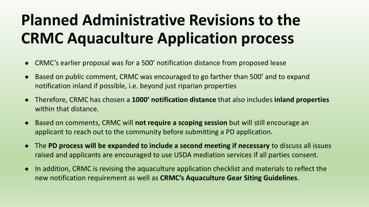
Planned Administrative Revisions to the CRMC Aquaculture Application process CRMC s earlier proposal was for a 500 notification distance from proposed lease Based on public comment, CRMC was encouraged to go farther than 500 and to expand notification inland if possible, i.e. beyond just riparian properties Therefore, CRMC has chosen a 1000 notification distance that also includes inland properties within that distance. Based on comments, CRMC will not require a scoping session but will still encourage an applicant to reach out to the community before submitting a PD application. The PD process will be expanded to include a second meeting if necessary to discuss all issues raised and applicants are encouraged to use USDA mediation services if all parties consent. In addition, CRMC is revising the aquaculture application checklist and materials to reflect the new notification requirement as well as CRMC s Aquaculture Gear Siting Guidelines.
CRMC Notification CRMC will notify all property owners and aquaculture leaseholders within 1,000 feet of the proposed boundary of any new or expanded aquaculture application The notification requirement applies to: Preliminary Determinations (PD), 30 Day Public Notices (PN), and CRMC Public Hearings related to an aquaculture application. All notifications, including notice of a SAP/MFC meeting*, will also be published on the CRMC Aquaculture Listserv *CRMC consults with RI Marine Fisheries Council s (MFC) and it s Shellfish Advisory Panel (SAP) during the PD process and, following a subsequent 30 day public notice, the SAP is required to review an application for consistency with the pursuit of the marine fisheries at their next regularly scheduled meeting.
CRMC Notification (cont) PD Notification and Timing: Minimum 30 days before the scheduled date of the meeting Minimum notification includes: Property owners within 1,000 ft Aquaculture leaseholders within 1,000 ft Municipality(ies) CRMC Aquaculture Listserve Other resources CRMC is working on for applicants and the public: A public aquaculture online permit database where anyone can: Lookup or find out about a pending or past aquaculture application; and Follow an application throughout the review process SHELLFAST-RI an interactive GIS siting tool which can help an applicant identify all stakeholders and other required information within the 1000 Contiguous Area. This tool will help an applicant generate a map of the notification range and property list as required by the new CRMC Aquaculture Application checklist.
Demonstration of siting tool for landowner notification within the 1000 Contiguous Area (Draft) Bay SAMP Constraints Maps Siting Tool https://crc- uri.maps.arcgis.com/apps/webappviewer/index.html?id=10964485b21641dcaa1f2b2509183266 Draft siting tool can be found on the Bay SAMP Hard Constraints Map: Step 1: Click the draw mode icon in the Landowner Notification box on the home screen of the Hard Constraints Map. Step 2: Draw a proposed lease on the map with the drawing tool and the program will auto- generate the 1000 area around the site with a yellow line. Step 3: Identify properties, aquaculture leases, and other necessary information within the 1000 Contiguous Area. Step 4: Bring property list to town for confirmation of accurate contact information and to CRMC to verify aquaculture leaseholder contact information.
CRMC Aquaculture Application Revision: Defining the Contiguous Area(s) for notification and identification of necessary information Existing Category B Application Requirements: Provide such other information as may be necessary for the Council to determine: (AA) The compatibility of the proposal with other existing and potential uses of the area and areas contiguous to it, including navigation, recreation, and fisheries; - For the purposes of an aquaculture application, the area(s) contiguous to a proposal is, at minimum, the area within 1000 of the project s boundaries. - CRMC will require the applicant to identity necessary information within this area as described in the following slides. - Other existing RI CRMP (Red Book) regulations in support of the information requirements will be cited throughout the presentation as appropriate.
Necessary Information within the 1000 Contiguous Area of an Aquaculture Application: Property owner(s) within 1000 feet; Aquaculture lease(s) within 1000 feet; CRMC Designated ROW(s) within 1000 feet; CRMC Water Use Types within 1000 feet; and Shoreline sites within 1000 feet which have been preserved for conservation, recreation and/or public access through easements, purchase by the state or municipality, or are owned by a land trust or state-recognized conservation organization. CRMC will use the information above for purposes of stakeholder identification and notification, as well as, application review for consistency with CRMC s Aquaculture Gear Siting Guidelines and the requirements of CRMC s Aquaculture Application Checklist.
Expanded Preliminary Determination Process Pre-Application (ie: conceptual) Before submitting a PD application, applicants are highly encouraged to consult with the CRMC Aquaculture Coordinator concerning their ideas and/or site selection. The applicant is also highly encouraged to conduct outreach or hold informational meeting(s) in the nearby community, but is not required to hold a scoping meeting as previously proposed by CRMC. During this pre-application phase (ie: before the formal PD application is submitted) CRMC staff is available to: arrange a meeting (whether in-person or virtually) with the town officials, stakeholder group(s) and/or local residents. recommend specific town officials or bodies that the applicant should talk to (such as the Harbor Commission or Harbormaster) recommend that the applicant reach out to specific stakeholders, such as nearby property owners, associations or organized groups, such a RISSA, RISA, or the MFC/SAP.
Expanded PD process (cont) Preliminary Determination Application is submitted CRMC will send notification to all parties and hold a PD meeting in the town closest to the proposal At the PD meeting, the applicant introduces his/her proposal to the local community, cooperating agencies, and other stakeholders, in order to: identify any potential use conflicts and/or regulatory issues, and to discuss any recommendations or alternatives that would resolve any such issues. If issues are explored satisfactorily, the CRMC may recommend that a FULL application may be submitted at this time However, CRMC may require that a SECOND PD meeting be held at another date in order to fully explore: any issues raised and not fully vetted, alternative sites identified at the initial PD meeting, or any other alternative measures that might address any issues raised and/or identified by CRMC. If there is not a satisfactory path forward at the conclusion of the PD meeting(s), CRMC may recommend that the applicant and stakeholders take advantage of the free USDA mediation service*, offered by the RI Center for Mediation and Collaboration and available to all RI farmers and aquaculturists, in order to find compromise solution(s) to any of the issues raised during the PD process and/or identified by CRMC staff. *Please note, mediation is entirely voluntary and also requires participation from all parties. Therefore, mediation will not always be possible as part of the CRMC PD process. However, CRMC recognizes the value of this service and that the likely result is often a more favorable outcome for all involved.
CRMC Revised Aquaculture Application and Checklist (in addition to current requirements): Distance of the proposal to nearest shoreline(s) within 1000 and a general description of the current use and character of the shoreline Location and distance of the proposal to the nearest residential structure within 1000 Location and distance within 1000 of the proposal to any: CRMC Designated ROWs; Site(s) which has been preserved for conservation, recreation and/or public access through easements, purchase by the state or municipality, or are owned by a land trust or state-recognized conservation organization CRMC approved mooring fields, boating facilities (docks or marinas), and/or town permitted riparian moorings
CRMC Revised Aquaculture Application and Checklist (con t) A mailing list of property owners within 1000 of the proposed site A list of all currently approved aquaculture operations within 1000 of the proposal for purposes of 1.3.1 (K)(3)(a)(4)(EE) A map showing the location of the proposal with reference to all CRMC water use type(s) within 1000 A list of any past CRMC file numbers related to the current application, i.e. PD#, original assent#, and/or past expansion#
CRMC revised aquaculture application package and checklist (con t): A Detailed Operations Plan that demonstrates, among all other requirements: how the site will be initially built out, accessed, and maintained how the site will be operated including the handling, landing and sale of product and/or any other upland activities necessary for the success of the operation the projected per unit area yield of harvestable product the expected level of seasonally, weekly an/or daily activities the applicant's ability to undertake the proposed activities
CRMC Revised Aquaculture Application and Checklist (con t) A demonstration of the degree of exclusivity required by the applicant to effectively undertake the aquaculture activities on the proposed site A plan for the public s reasonable ingress and egress to and from the area of the proposal for traditional water activities such as boating, swimming, and fishing A Storm Preparedness and Response Plan that accounts for the safety and security of all aquaculture equipment including measures to be taken in the event of a significant storm or other adverse weather conditions impacting the site
Guidelines for the Siting of Aquaculture Gear Floating gear should be a minimum of 750 feet from the nearest residential structure; Low profile floating gear shall be required (maximum 4 above still water elevation) unless the application can demonstrate a significant reason and need for a larger profile; Floating gear is discouraged in areas where the fetch from the prevailing wind is greater than three (3) nautical miles; Floating gear and all corner marker buoys should be secured with helical (screw) anchors; Floating gear shall have a minimum $15,000 proof of performance bond
Guidelines for the Siting of Aquaculture Gear Initial floating gear or submerged gear leases maximum of two (acres) in the upper Narragansett Bay (defined as the area north of latitude 41 35 ) maximum of three (3) acres elsewhere; Floating gear is discouraged in Type 1 waters; Floating gear should not be located in areas which contain significant boat traffic or significant water based recreational activities, including but not limited, to sailing, kayaking, paddle boarding, kiteboarding, windsurfing or swimming;
Guidelines for the Siting of Aquaculture Gear Floating gear should be at least 200 feet from an existing CRMC approved recreational mooring field Aquaculture gear shall not be permitted over or within 25 feet of protected submerged aquatic vegetation (SAV) ; Aquaculture gear shall not be permitted in areas of significant recreational or commercial fishing activity; Towns may recommend areas where floating gear should be discouraged and/or encouraged;
Guidelines for the Siting of Floating Gear Floating gear should be discouraged within 400 feet along shorelines which have been Preserved for conservation, recreation and/or public access through easements, purchase by the state or municipality or are owned by a land trust or conservation organization and have been recognized by the CRMC; Floating gear should not be located within 400 feet along shorelines where Public access is provided through CRMC rights-of-way, public land where the primary purpose is intended for public access, or by CRMC easements and/or where there is evidence of significant public usage and access; Leases approved for direct bottom plant or submerged cages may receive a stipulation preventing modification to the use of floating gear.
Demonstration of the (Draft) Bay SAMP Constraints Maps Siting Tool Bay SAMP Hard Constraints Map: https://crc- uri.maps.arcgis.com/apps/webappviewer/index.html?id=10964485b21 641dcaa1f2b2509183266
