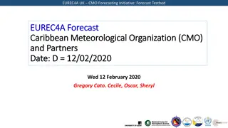
EUREC4A UK CMO Caribbean Weather Forecasting Initiative: Forecast Testbed Overview
The EUREC4A UK CMO Caribbean Weather Forecasting Initiative's Forecast Testbed provides detailed insights into surface analyses, soundings, airmass observations, visible imagery, and outlooks for the Caribbean region. The forecast includes information on pressure gradients, wind patterns, cloud formations, and upper-level dynamics, aiming to enhance the understanding of weather conditions in the area.
Download Presentation

Please find below an Image/Link to download the presentation.
The content on the website is provided AS IS for your information and personal use only. It may not be sold, licensed, or shared on other websites without obtaining consent from the author.If you encounter any issues during the download, it is possible that the publisher has removed the file from their server.
You are allowed to download the files provided on this website for personal or commercial use, subject to the condition that they are used lawfully. All files are the property of their respective owners.
The content on the website is provided AS IS for your information and personal use only. It may not be sold, licensed, or shared on other websites without obtaining consent from the author.
E N D
Presentation Transcript
EUREC4A UK CMO Caribbean Weather Forecasting Initiative: Forecast Testbed EUREC4A Forecast EUREC4A Forecast Caribbean Meteorological Organization (CMO) Caribbean Meteorological Organization (CMO) and Partners and Partners Thursday 06thFebruary 2020 Lawrence Pologne And Carolyn Peck
EUREC4A UK CMO Caribbean Weather Forecasting Initiative: Forecast Testbed 0600 z Surface 0600 z Surface analysis analysis chart chart Ridge pattern across E. Caribbean with a tight pressure gradient Brisk winds (15 to 20 kts) from the ENE pushing shallow clouds 02/04/2020
EUREC4A UK CMO Caribbean Weather Forecasting Initiative: Forecast Testbed Slide 1c: Soundings Slide 1c: Soundings BDS 060000 Z Sounding Mid level dry air and subsident inversion base near 820 mb Minimal CAPE Wind 10 to 15 knots in the low levels from ENE to ESE Sub Tropical Jet near 200 mb (75 kt) 9/17/2024
EUREC4A UK CMO Caribbean Weather Forecasting Initiative: Forecast Testbed Airmass Airmass RGB RGB Dry air in vicinity SAL intrusion 9/17/2024
EUREC4A UK CMO Caribbean Weather Forecasting Initiative: Forecast Testbed Visible Imagery 10:50Z Visible Imagery 10:50Z Shallow cumulus cloud lines pushing across island chain, but with occasional build-ups. 9/17/2024
EUREC4A UK CMO Caribbean Weather Forecasting Initiative: Forecast Testbed 48 48 Hr Hr Outlook Outlook Ridge dominates across E. Caribbean maintaining a tight pressure gradient Winds are expected to remain brisk 9/17/2024
EUREC4A UK CMO Caribbean Weather Forecasting Initiative: Forecast Testbed Upper Levels: 24 Upper Levels: 24 Hr Hr Forecast 250 Forecast 250 mb mb Upper level trough just east of island chain could induce taller clouds 9/17/2024
EUREC4A UK CMO Caribbean Weather Forecasting Initiative: Forecast Testbed 36 36 Hr Hr Significant Wave Height Forecast Significant Wave Height Forecast Wave hgt 7 to 10 ft from the ENE
EUREC4A UK CMO Caribbean Weather Forecasting Initiative: Forecast Testbed Wave Period Forecast (48 Wave Period Forecast (48 Hr Hr) ) Dominant waves from the ENE every 9 to 10 seconds
EUREC4A UK CMO Caribbean Weather Forecasting Initiative: Forecast Testbed Summary Summary Strong ridge pattern over E. Caribbean generating tight pressure gradient. Large scale subsidence over area. Upper level trough in the vicinity can induce some instability. Slight haze continues. Winds remain brisk blowing from the ENE at 15 to 20 kts 9/17/2024
EUREC4A UK CMO Caribbean Weather Forecasting Initiative: Forecast Testbed Verification of previous forecast Verification of previous forecast Summary of previous forecast Satellite images or Meteogram or Synoptic analysis, etc.. . 9/17/2024
EUREC4A UK CMO Caribbean Weather Forecasting Initiative: Forecast Testbed General guidance on preparing Briefing PowerPoint General guidance on preparing Briefing PowerPoint 1. Make sure that key points are written as annotation in the document. So that it can be understood even if telecon quality is poor; So that it can be understood as part of an archive in future years. 2. Try to be as precise as possible in predictions (for instance, locations and timings). 9/17/2024
EUREC4A UK CMO Caribbean Weather Forecasting Initiative: Forecast Testbed Slide 2: Convective fields Slide 2: Convective fields Summarise: Radar show light precipitation west and south of the area. Precipitation none in 12 hr- 1 to 2 mm 24 hr. Shower to the east expected to move this afternoon into evening. <Figure here> 9/17/2024
