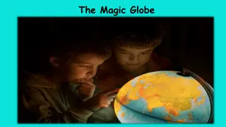
Earth's Representation: Globe vs. Map

 undefined

Based on Chapter –2
Representation of Earth
PRESENTED BY – V. SUDHARANI
TEACHER (PRT)
Globe; A model showing the accurate shape of the earth.
Map: A representation of the earth or a part of it, drawn on a flat
surface as per the scale.
Three-dimensional: An object that has height,width and depth.
Two-dimensional: An object with length andwidth.
Cartography: The science of map- making.
Scale: The ratio of distance between two points on a map with the
actual distance between the same points on the ground.
Direction: Indicator of the location and position of the places in
relation to each other.
Thematic map: A map representing a particular theme or feature.
Political map: A map showing cities, towns, states and countries of
the world.
Physical map: A map representing relief features like mountains,
plains, plateaus etc.
Atlas: A collection of maps of the world, the continents and
selected countries.
Plan: A layout of very small area.
Q1) What is a globe?
Ans. A model showing the accurate shape of the earth.
Q2) Why is globe a correct representation of the earth? Give one reason?
Ans. Because it represents the three dimensional view of the earth.
Q3) What are the limitations of a globe?
Ans. A globe does not show details such as towns, villages, roads, railways
etc.of a country. Also it is difficult to carry away.
Q4) Why is a globe considered a perfect representation of the earth? Give any
three reasons?
Ans. a) A globe represents the three dimensional view of the earth. It
shows the shape of the oceans and the continents correctly.
b) It gives us a better idea of parallels i.e., latitudes and meridians i.e.
longitudes.
c) It helps us to understand how day and night occur and how seasons are
caused.
Q1) What is a map?
Ans. It is a representation of the earth or a part of it, drawn on a flat surface according to
the scale.
Q2) State any four uses of a map.
Ans. a) It is useful for showing large areas as well as very small areas.
b) Very minute details can also be shown on a map.
c) Several geographic, natural and cultural elements such as mountains, hills, rivers etc. can
be shown on a map.
d) A map can be folded, rolled or bound in a book and carried easily.
Q3) Give the main demerits of a map as compared to a globe?
Ans.a) A map does not give us a three dimensional view of the earth.
b) It does not show the shape of the oceans and the continents correctly.
c) It does
not give us a clear idea of latitudes and longitudes . It does not help us to
understand how day and night occur and how seasons are caused.
d) A map does not give us an idea about the tilt of the earth,s axis.
Q1) When and where the earliest map was made?
Ans. The earliest map was made in 2300B.C. in Mesopotamia(Iraq).
Q2) Explain about the earliest map?
Ans. It was made on a clay tablet. But the maps of the earliest period
were not clear. They only showed the boundary of the land.
Q3) Who was the first cartographer?
Ans.Ptolemy, an Egyptian, was the first cartographer.
Q4) Why is Ptolemy called the father of map- making?
Ans. He made the map of the world according to scale and direction. He
was the first person to represent the earth as a sphere.
Q5) How did Eskimos make maps?
Ans. They made maps by sewing skins of animals of different colours.
Q6) The ancient maps were mere sketches. How?
Ans. The ancient maps were based on memory and information. They
were not drawn using a scale.
Q1) What is a scale ?
Ans. A scale refers to the ratio between the distance on a map and the
actual distance on the ground.
Q2) Name the cardinal points along with intermediate directions.
Ans. North, South, East and West are the cardinal points of the compass.
Other intermediate directions are North-west, South-west, South-east and
North-east.
Q3) What is a compass?
Ans. A compass is an instrument used to find directions.
Q4) Why is the scale an important component of a map?
Ans. A map shows a large area on a small sheet of paper. Each map
is drawn according to a scale. The map scale is the ratio of distance
between two points on a map with the actual distance between the
same points on the ground. For example: if the distance of 5km on
ground is represented as 1cm on the map, the scale written on the
map shall be 1cm = 5km. The same can be represented on a scale,
which is called linear scale.
Q1) Why do we use symbols in a map?
Ans. In a map, forests, rivers, hills, railway lines and roads are shown by some
common symbols. With the help of common symbols we find it easy to read a
map made in any country without knowing the languages of that country. The
symbols make the map reading easy and quick.
Q2) How do conventional symbols help in reading maps?
Ans. With the help of conventional symbols, we can read a map made in any
country without knowing the languages of that country. These symbols make the
map reading easy and quick.
Q3) Define colour scheme.
Ans. There is a common colour scheme used to show different relief features on
a map. For example: blue colour is used for showing water bodies, green colour
is used for showing low lands and plains, plateaus and hills are showing by
yellow and orange colours, while brown colour is used for showing mountains.
Snow-capped areas are shown by using white colour.
Q1) Distinguish between large scale map and
small scale map.
Ans. Small scale map: A small scale map
represents large area on a small scale.
A continent or a country can be shown in a small
scale map.
In this map details are not shown.
Large scale map: A large scale map represents a
small area on a large scale.
A wall map of a town, city or village is called a
large scale map.
In this map more details about a small area
are shown.
Q1) What is a plan or sketch?
Ans. A plan is a layout of very small area like a building, a
factory, a playground etc. It is drawn on a comparatively large
scale and some directions.
Q2) What is an atlas?
Ans. An atlas is a collection of maps of the world, the
continents and selected countries. It may also include information
and diagrams dealing with various topics like the solarsystem,
geographical features of the earth, population data etc.
Q3) Mention one feature of the computer generated map.
Ans. The computer generated map is very accurate, sharp and
neat.
Q1) Distinguish between a physical and a
political map.
Ans. Physical map: These maps represent relief
features like mountains, plains and plateaus,
rivers, lakes etc.
Political map: These maps show cities, towns,
states and countries of the world.
Q2) What is a thematic map?
Ans. A thematic map emphasises a particular
theme or special topic, such as average
distribution of rainfall, distribution of crops,
minerals, population, lines of transport etc. In
an area.
.
Help box: globe, sketch, compass, cartography, snow- capped, North,
physical map, small area, A map, political map.)
1)
A______ represents the three dimensional view of the earth.
2) The technique or skill of making maps is called ____.
3) ______ is a drawing of a small area drawn from one’s observation
and memory without directions.
4) A______ is a device consisting of a magnetic needle, which always
points to the north.
5) _______ areas are shown by using white colour on maps.
6)
The top of an arrow in a map indicates_____________.
7)
_________ map represents relief features like mountains, plateaus,
plains and deserts.
8) Large scale maps are used for ________________.
9) ________ is a representation of the earth drawn on a flat surface.
10) ________ map showing cities, towns, states and countries of the
world.
Explore the representations of Earth through globes and maps, understanding their differences, limitations, and significance. Discover the world of cartography, from three-dimensional globes to two-dimensional maps, and learn about the history and development of map-making from ancient times to modern methods.

Download Presentation

Please find below an Image/Link to download the presentation.
The content on the website is provided AS IS for your information and personal use only. It may not be sold, licensed, or shared on other websites without obtaining consent from the author. Download presentation by click this link. If you encounter any issues during the download, it is possible that the publisher has removed the file from their server.
E N D
Presentation Transcript
Based on Chapter 2 Representation of Earth PRESENTED BY V. SUDHARANI TEACHER (PRT)
Globe; A model showing the accurate shape of the earth. Map: A representation of the earth or a part of it, drawn on a flat surface as per the scale. Three-dimensional: An object that has height,width and depth. Two-dimensional: An object with length andwidth. Cartography: The science of map- making. Scale: The ratio of distance between two points on a map with the actual distance between the same points on the ground. Direction: Indicator of the location and position of the places in relation to each other. Thematic map: A map representing a particular theme or feature. Political map: A map showing cities, towns, states and countries of the world. Physical map: A map representing relief features like mountains, plains, plateaus etc. Atlas: A collection of maps of the world, the continents and selected countries. Plan: A layout of very small area.
Q1) What is a globe? Ans. A model showing the accurate shape of the earth. Q2) Why is globe a correct representation of the earth? Give one reason? Ans. Because it represents the three dimensional view of the earth. Q3) What are the limitations of a globe? Ans. A globe does not show details such as towns, villages, roads, railways etc.of a country. Also it is difficult to carry away. Q4) Why is a globe considered a perfect representation of the earth? Give any three reasons? Ans. a) A globe represents the three dimensional view of the earth. It shows the shape of the oceans and the continents correctly. b) It gives us a better idea of parallels i.e., latitudes and meridians i.e. longitudes. c) It helps us to understand how day and night occur and how seasons are caused.
Q1) What is a map? Ans. It is a representation of the earth or a part of it, drawn on a flat surface according to the scale. Q2) State any four uses of a map. Ans. a) It is useful for showing large areas as well as very small areas. b) Very minute details can also be shown on a map. c) Several geographic, natural and cultural elements such as mountains, hills, rivers etc. can be shown on a map. d) A map can be folded, rolled or bound in a book and carried easily. Q3) Give the main demerits of a map as compared to a globe? Ans.a) A map does not give us a three dimensional view of the earth. b) It does not show the shape of the oceans and the continents correctly. c) It does not give us a clear idea of latitudes and longitudes . It does not help us to understand how day and night occur and how seasons are caused. d) A map does not give us an idea about the tilt of the earth,s axis.
Q1) When and where the earliest map was made? Ans. The earliest map was made in 2300B.C. in Mesopotamia(Iraq). Q2) Explain about the earliest map? Ans. It was made on a clay tablet. But the maps of the earliest period were not clear. They only showed the boundary of the land. Q3) Who was the first cartographer? Ans.Ptolemy, an Egyptian, was the first cartographer. Q4) Why is Ptolemy called the father of map- making? Ans. He made the map of the world according to scale and direction. He was the first person to represent the earth as a sphere. Q5) How did Eskimos make maps? Ans. They made maps by sewing skins of animals of different colours. Q6) The ancient maps were mere sketches. How? Ans. The ancient maps were based on memory and information. They were not drawn using a scale.
Q1) What is a scale ? Ans. A scale refers to the ratio between the distance on a map and the actual distance on the ground. Q2) Name the cardinal points along with intermediate directions. Ans. North, South, East and West are the cardinal points of the compass. Other intermediate directions are North-west, South-west, South-east and North-east. Q3) What is a compass? Ans. A compass is an instrument used to find directions. Q4) Why is the scale an important component of a map? Ans. A map shows a large area on a small sheet of paper. Each map is drawn according to a scale. The map scale is the ratio of distance between two points on a map with the actual distance between the same points on the ground. For example: if the distance of 5km on ground is represented as 1cm on the map, the scale written on the map shall be 1cm = 5km. The same can be represented on a scale, which is called linear scale.
Q1) Why do we use symbols in a map? Ans. In a map, forests, rivers, hills, railway lines and roads are shown by some common symbols. With the help of common symbols we find it easy to read a map made in any country without knowing the languages of that country. The symbols make the map reading easy and quick. Q2) How do conventional symbols help in reading maps? Ans. With the help of conventional symbols, we can read a map made in any country without knowing the languages of that country. These symbols make the map reading easy and quick. Q3) Define colour scheme. Ans. There is a common colour scheme used to show different relief features on a map. For example: blue colour is used for showing water bodies, green colour is used for showing low lands and plains, plateaus and hills are showing by yellow and orange colours, while brown colour is used for showing mountains. Snow-capped areas are shown by using white colour.
Q1) Distinguish between large scale map and small scale map. Ans. Small scale map: A small scale map represents large area on a small scale. A continent or a country can be shown in a small scale map. In this map details are not shown. Large scale map: A large scale map represents a small area on a large scale. A wall map of a town, city or village is called a large scale map. In this map more details about a small area are shown.
Q1) What is a plan or sketch? Ans. A plan is a layout of very small area like a building, a factory, a playground etc. It is drawn on a comparatively large scale and some directions. Q2) What is an atlas? Ans. An atlas is a collection of maps of the world, the continents and selected countries. It may also include information and diagrams dealing with various topics like the solarsystem, geographical features of the earth, population data etc. Q3) Mention one feature of the computer generated map. Ans. The computer generated map is very accurate, sharp and neat.
Q1) Distinguish between a physical and a political map. Ans. Physical map: These maps represent relief features like mountains, plains and plateaus, rivers, lakes etc. Political map: These maps show cities, towns, states and countries of the world. Q2) What is a thematic map? Ans. A thematic map emphasises a particular theme or special topic, such as average distribution of rainfall, distribution of crops, minerals, population, lines of transport etc. In an area.
Help box: globe, sketch, compass, cartography, snow- capped, North, physical map, small area, A map, political map.) 1) A______ represents the three dimensional view of the earth. 2) The technique or skill of making maps is called ____. 3) ______ is a drawing of a small area drawn from one s observation and memory without directions. 4) A______ is a device consisting of a magnetic needle, which always points to the north. 5) _______ areas are shown by using white colour on maps. 6) The top of an arrow in a map indicates_____________. 7) _________ map represents relief features like mountains, plateaus, plains and deserts. 8) Large scale maps are used for ________________. 9) ________ is a representation of the earth drawn on a flat surface. 10) ________ map showing cities, towns, states and countries of the world.


 What is a globe?")
 What is a map?")
 When and where the earliest map was made?")
 What is a scale ?")
 Why do we use symbols in a map?")
 Distinguish between large scale map and")
 Distinguish between large scale map and")
 What is a plan or sketch?")
 Distinguish between a physical and a")