Hands-On Exercises with Kobo Toolbox for Data Collection
Master the use of Kobo Toolbox for data collection with step-by-step exercises covering basic and advanced features. Learn to create projects, upload forms, collect data on ODK Collect, visualize and download data entries, and adapt forms to your specific needs. Practice error correction, deployment
0 views • 5 slides
Updates on OMI and OMPS Data Products
Status and future developments of OMI and OMPS data products include the preparation of new algorithms, upcoming releases, incorporation into LANCE, validation processes, and delivery timelines. Updates range from OMI Total Ozone algorithm version (OMTO3) to OMPS-NPP LANCE Data Products and OMPS SNP
4 views • 9 slides
Innovative LiDAR Cave Mapper for Cavers
Develop a portable and cost-effective LiDAR cave mapper to assist freelance cavers in mapping caves efficiently. The project aims to create a device that is affordable, DIY-style, and open-source, making cave mapping more accessible and accurate. The team from FAMU-FSU College of Engineering strives
0 views • 22 slides
Advanced Analysis of SAGE III Limb Scatter Retrievals
The proposed effort focuses on enhancing LaRC operational retrieval codes for SAGE LS data, correcting Level 1 radiances, and recommending LS operational scenarios. OMPS LS retrieval algorithms for aerosol and ozone, as well as the SAGE/M3 LS ozone retrieval approach, are detailed. Out-of-field stra
0 views • 12 slides
Advanced Satellite Systems for Environmental Monitoring
The Joint Polar Satellite System (JPSS) utilizes advanced instruments like ATMS, CrIS, VIIRS, OMPS, and CERES to provide crucial data for weather forecasting, ozone monitoring, and Earth radiation studies. The Suomi NPP and JPSS-1 instruments offer high-resolution temperature, water vapor, and image
0 views • 30 slides
Monitoring Data Quality via Satellite Integrated Calibration/Validation System (ICVS)
Explore the OMPS ICVS, a system designed to monitor and evaluate the performance of OMPS and its SDR, aiding in anomaly investigation and resolution. The ICVS team collaborates to establish best practices for performance evaluation and visualization of instrument status. Discover how high-level inst
0 views • 13 slides
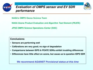
Evaluation of OMPS Sensor and EV SDR Performance by NASA
NASA's OMPS Ozone Science Team conducted an evaluation of the OMPS sensor and EV SDR performance, concluding that the sensors are performing well with good calibrations and no signs of degradation. There were troubling differences between the IDPS and PEATE SDRs, leading to a recommendation against
0 views • 29 slides
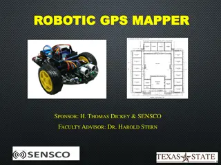
Robotic GPS Mapper Project Presentation
The Robotic GPS Mapper project aims to address the issue of water loss through leaks in city infrastructure by designing a GPS mapping robot that can locate unknown pipe system routes in real-time. The project overview includes goals such as remote communication with the robot, real-time mapping, wi
0 views • 19 slides
Suomi NPP OMPS EV SDR Provisional Product Review
Review of the Suomi NPP OMPS EV SDR Provisional Product by Fred Wu and the OMPS SDR Team at NOAA/NESDIS/STAR on October 23, 2012. The product includes monitoring of ozone and other constituents using various instruments like Nadir Mapper, Nadir Profiler, and Limb Profiler. The operational evaluation
0 views • 25 slides
Enhancing Curriculum Development through Mapping for Schools
Curriculum mapping in schools involves using electronic tools to input, track, and analyze data related to curriculum, enabling stakeholders to meet standards, align content, collect real-time data on instruction, and reflect on practices for continuous improvement. Software programs like Rubicon At
1 views • 15 slides
Understanding OMPS: Ozone Mapping Profiler Suite and its Applications
OMPS is a vital tool for monitoring global ozone levels, offering precise measurements through its mapper, profiler, and limb profiler components. This advanced suite builds on decades of ozone monitoring heritage, providing valuable insights for researchers and policymakers. By comparing with exist
0 views • 18 slides
Analysis of County-to-County Migration Patterns in the United States
The U.S. Census Bureau has released new data and tools allowing users to explore migration patterns across counties. The products include County-to-County Migration Flows Package with Excel tables and Census Flows Mapper for analyzing migration patterns at national and regional scales. Detailed tabl
0 views • 32 slides
Truth Value Analysis of Financial Data in Firms
Analyzing the financial data of Acme Computer, Nadir Software, and Quixote Media from the most recent fiscal year to determine the truth value of various propositions based on annual revenue and net profit. The solutions to the logic exercises for each proposition are provided.
0 views • 4 slides
Advanced Topics in Topological Data Analysis: Research Highlights
Explore cutting-edge research in Topological Data Analysis (TDA) through topics such as Mapper Stability Measures, Deep Learning advancements, Vectorization techniques, Generalized Persistence modeling, Stochastic Aspects analysis, Formal Properties of Persistence, and Complement Problems in TDA app
0 views • 8 slides
OMPS Nadir Mapper Provisional Maturity Findings
This compilation presents findings on the OMPS Nadir Mapper's 1stGuess Total Column Ozone (INCTO) and Nadir Mapper Total Column Ozone EDR (OOTCO) in support of promotion to provisional maturity. It outlines performance requirements, internal evaluations, comparisons, deficiencies, and recommendation
0 views • 100 slides
