
Sphinx Marine - Offshore Marine Company in UAE
Sphinx Marine is an offshore marine company based in Ajman, UAE, established in 2006. They specialize in providing maritime navigation, communication, safety equipment, and services in the Gulf Area and Middle East. With a focus on customer-centricity, safety, and quality, Sphinx Marine is ISO 9001:
0 views • 20 slides
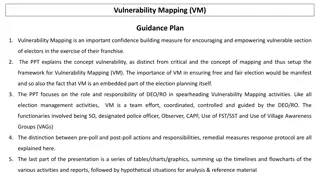
Vulnerability Mapping (VM).Guidance Plan
Vulnerability Mapping (VM) is crucial in empowering vulnerable voters by identifying and addressing potential threats to their exercise of franchise. This guide explains the concept of vulnerability mapping, its role in ensuring free and fair elections, and the responsibilities of election officials
2 views • 42 slides
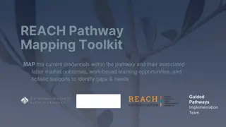
REACH Pathway Mapping Toolkit
Explore the REACH Pathway Mapping Toolkit to analyze credentials in pathways, labor market outcomes, work-based learning, and holistic support to identify gaps and needs for improved guidance. Learn about different mapping examples and types to enhance educational pathways effectively.
0 views • 19 slides
Relational Database Design and Mapping Techniques
Explore the process of mapping Entity-Relationship (ER) and Enhanced Entity-Relationship (EER) models to relational databases. Learn about relational model concepts, mapping algorithms, and the goals and steps involved in the mapping process. Discover how to preserve information, maintain constraint
3 views • 42 slides
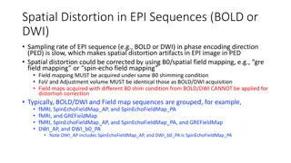
Spatial Distortion Correction in EPI Sequences: Field Mapping Examples
Spatial distortion artifacts in EPI sequences (BOLD or DWI) due to slow sampling rates in the phase encoding direction can be corrected using B0/spatial field mapping techniques. This correction requires obtaining field maps under the same B0 shimming conditions and with identical FoV and adjustment
2 views • 4 slides
Creating a Curriculum Map for Competency-Based Education
This presentation aims to guide faculty and staff in competency-based curriculum mapping at the program level. It covers the definition of curriculum mapping, a recommended framework, steps for identifying program competencies, developing a matrix, and mapping courses to competencies. Utilize this r
0 views • 11 slides
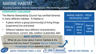
Marine Habitats and Their Diverse Ecosystems
Marine habitats vary in characteristics such as temperature, current, tide, seafloor substrate, and light, influencing the communities of organisms that live within them. The certification of fisheries by the Marine Stewardship Council ensures minimal impact on local habitats, emphasizing the import
0 views • 6 slides
Marine Novel Medicinal Agents from Marine Sources Compiled by Dr. Nisha Sharma
Oceans, covering more than 70% of the Earth's surface, harbor a plethora of invertebrates and algal species, providing a rich source of medicinal compounds. Marine organisms have yielded commonly used drugs like shark and cod-liver oils, sodium alginate, agar-agar, and chitin. Various classification
1 views • 9 slides
Marine Conservation Governance in Raja Ampat, West Papua, Indonesia
Explore the dynamics of marine conservation governance in Raja Ampat, West Papua, Indonesia, with a focus on Sasi practices and the preliminary findings in the West Misool and South Misool districts. Discover the potential resources in Raja Ampat and the various types of marine conservation areas in
1 views • 22 slides
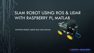
Mapping Robot using ROS, Lidar with Raspberry Pi & MATLAB
Turtle.bot is a popular product for home service robots, utilizing SLAM and navigation technologies. It features gyro, Kinect sensors, Lidar, and a laptop for mapping. The robot localizes and navigates using ROS in Raspberry Pi connected with MATLAB. ROS (Robot Operating System) is a set of software
0 views • 17 slides
National Labor Mapping Application User Roles and Access Overview
This detailed overview outlines the implementation plan, user roles, and access benefits of the National Labor Mapping Application. Users are assigned specific roles with established access through domain usernames, enhancing security measures. Different user roles such as VISN Coordinators, Site Te
1 views • 14 slides
Impacts of Climate Change on Oceans and Marine Resources in the United States
The Fourth National Climate Assessment highlights the disruption of ocean ecosystems due to increasing global temperatures, leading to loss of habitats, changes in species composition, and food web structure. Marine fisheries face high risks from climate-driven changes, impacting distribution, timin
1 views • 10 slides

Mapping Methodology for Establishing ESCO Relations
Learn how to set up teams, collect resources, compare classifications, and establish mapping relations for ESCO implementation projects. Get insights on using computer-assisted suggestions, updating mapping tables, and selecting mapping projects. Explore techniques for navigating classifications, br
1 views • 21 slides
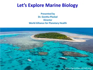
Marine Biology: Importance, Scope, and Responsibilities
Exploring the realm of marine biology reveals its crucial role in understanding and preserving marine ecosystems under threat. This field offers diverse career opportunities, from research to conservation efforts. Marine biologists play a pivotal role in studying, monitoring, and protecting marine l
0 views • 14 slides

Nautilus Marine Insurance Australian Sailing Program Overview
Nautilus Marine Insurance offers a comprehensive suite of insurance products tailored for Australian Sailing clubs, providing top-notch claims services, expert staff, and innovative solutions. With a strong focus on underwriting and customer service, Nautilus Marine is a trusted partner for marine i
0 views • 10 slides
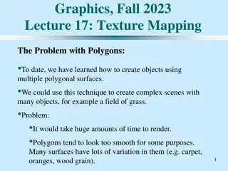
Texture Mapping in Computer Graphics
Delve into the world of texture mapping as a solution to the smoothness of polygons in computer graphics. Learn how to create textured scenes using techniques such as bump mapping and environmental mapping. Discover the process of representing textures, working with curved surfaces, and mapping onto
2 views • 24 slides
Innovative LiDAR Cave Mapper for Cavers
Develop a portable and cost-effective LiDAR cave mapper to assist freelance cavers in mapping caves efficiently. The project aims to create a device that is affordable, DIY-style, and open-source, making cave mapping more accessible and accurate. The team from FAMU-FSU College of Engineering strives
0 views • 22 slides
Enhancing Geospatial Imaging Solutions with CARIS Tools for Seabed Mapping
CARIS offers a suite of tools including CARIS Cloud and BDB Server, facilitating the seamless upload, processing, and transfer of bathymetric data to support initiatives like Seabed 2030 and GEBCO. The integration of CARIS tools enables stakeholders to manage, disseminate, and access hydrospatial da
0 views • 5 slides
Atlantic Seabed Mapping Workshop Summary
Workshop held in Dublin Castle on Dec 2, 2014, discussed current and future plans for seabed mapping in the Atlantic. Key topics included navigational charting, initiatives by various organizations, challenges of disjointed mapping efforts, and proposed actions to address issues. Recommendations inc
1 views • 5 slides
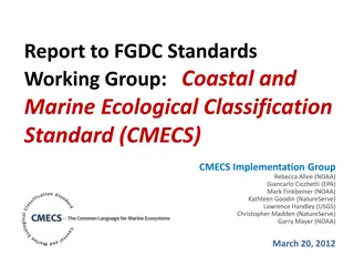
Coastal and Marine Ecological Classification Standard (CMECS) Implementation Progress
The report highlights the development, timeline, objectives, and importance of the Coastal and Marine Ecological Classification Standard (CMECS) along with its implementation progress. It discusses the need for a national standard for classifying coastal and marine habitats, the objectives of CMECS,
1 views • 38 slides
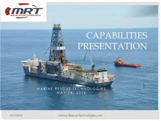
Marine Rescue Technologies: Innovating Ocean Safety Solutions
Marine Rescue Technologies (MRT) is a leading provider of maritime survivor locating devices, retrieval systems, and rescue products. Founded in 1993, MRT serves a wide range of clients in the oil & gas industry, commercial marine sector, and maritime agencies worldwide. Their products cater to the
3 views • 15 slides
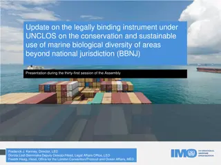
Update on Legally Binding Instrument under UNCLOS for Marine Biological Diversity Conservation
United Nations General Assembly is developing a treaty under UNCLOS for conservation of marine biological diversity in areas beyond national jurisdiction since 2015. The objective is sustainable use of marine genetic resources, area-based management tools, environmental impact assessments, capacity-
1 views • 18 slides

Recent Developments in Marine Geospatial Information Management
The Baltic Sea Hydrographic Commission and related activities highlight significant developments in marine geospatial information management, including upcoming council meetings, GEBCO initiatives, and UN-GGIM endorsements of integrated marine geospatial frameworks. These efforts aim to enhance data
4 views • 8 slides
Tracking Marine Fauna: Examples from ProDelphinus Peru Leatherback Tracking Project
ProDelphinus is dedicated to conserving endangered marine fauna like sea turtles, marine otters, cetaceans, seabirds, and sharks. They use the Darwin Core Archive format and collaborate with Marine TLO for ontology mapping. The project involves tracking leatherback sea turtles and making occurrence
1 views • 8 slides
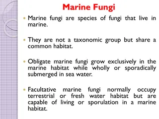
Overview of Marine Fungi and Their Habitats
Marine fungi are diverse species that inhabit marine environments, with some being obligate marine fungi while others can adapt to various habitats. They play essential roles in marine ecosystems by decomposing organic matter and interacting with other organisms. Factors affecting their distribution
2 views • 13 slides
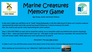
Dive into the Marine Creatures Memory Game and Fun Facts
Embark on an oceanic adventure with a marine creatures memory game featuring two challenging levels. Test your memory skills by matching pairs of marine animals while uncovering fascinating facts about these underwater wonders. Discover unique traits of various creatures like clownfish, dolphins, an
1 views • 5 slides
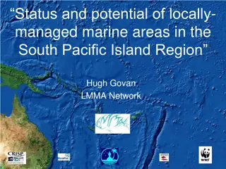
Evolution of Locally Managed Marine Areas in the South Pacific Island Region
This content discusses the status, potential, and objectives of Locally Managed Marine Areas (LMMAs) in the South Pacific Island Region, highlighting the evolution from traditional purposes to modern conservation and fisheries management practices. It also provides insights into the inventory of Mar
0 views • 27 slides
Power Mapping: A Visual Tool for Advocates to Influence Change
Power mapping is a visual tool used by advocates to identify key individuals to target in order to effect change. It involves mapping the community around an issue or campaign, identifying decision-makers, adversaries, and influential stakeholders. By following important steps and asking relevant qu
0 views • 10 slides
GEBCO Technical Sub-Commission on Ocean Mapping (TSCOM) Overview
Technical Sub-Commission on Ocean Mapping (TSCOM) is a key component of the GEBCO program, established in 2006 to provide expertise in seafloor mapping and discuss emerging technologies. TSCOM serves as an authoritative source for bathymetric and hydrographic data and offers ongoing advice to associ
0 views • 12 slides
Virtual Network Mapping: A Graph Pattern Matching Approach
Virtual Network Mapping (VNM) involves deploying virtual network requests in data center networks in response to real-time demands. It facilitates the deployment of virtual networks on physical machines by mapping virtual nodes and links onto substrate nodes and paths, ensuring constraints are met.
0 views • 15 slides
Evolution of Marine Insurance in Australia: A Review of Historical Context and Reform Provisions
Exploring the evolution of marine insurance in Australia, this review delves into historical frameworks such as the Marine Insurance Acts of 1906 and 1909, as well as modern reforms influenced by the United Kingdom. Key principles adopted by the MLAANZ Committee and current recommendations surroundi
0 views • 33 slides
Decades of Marine RNA Virosphere Research
Research spanning over two decades has delved deep into the marine RNA virosphere, shedding light on the complex marine ecosystem and the characteristics of RNA viruses. Discoveries in deep marine virus taxonomy have led to significant taxonomic changes and advancements in virus classification and g
0 views • 10 slides
European Union Regulations and Directives on Marine Litter and Waste Management
Marine litter poses a significant threat to the marine environment, prompting the adoption of various international, regional, and national instruments to address the issue. Key directives such as the Marine Strategy Framework Directive and Waste Framework Directive set out measures to achieve good
1 views • 16 slides
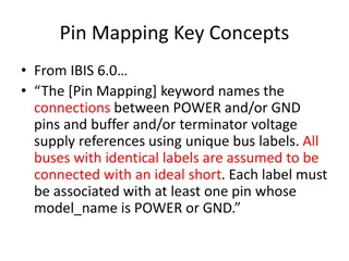
Pin Mapping and Interconnect in IBIS 6.0
Pin Mapping in IBIS 6.0 defines the connections between POWER/GND pins and buffer/terminator voltage supplies using unique bus labels. Interconnects between VDD pins and buffer supply terminals are crucial, with all pins associated with a named supply being shorted together. Draft 9 Interconnects an
0 views • 6 slides
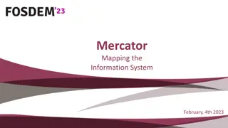
Mercator Mapping: A Key Tool for Information System Management
Mercator is a web application designed for managing the mapping of an organization's information system, allowing for a comprehensive representation of its components and connections with the outside world. Mapping is crucial for controlling, protecting, and defending the information system, as well
0 views • 21 slides
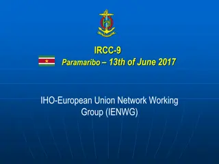
European Hydrographic Activities and Marine Data Initiatives
IRCC-9 in Paramaribo discussed the IHO-EU Network Working Group's efforts to monitor and manage hydrographic aspects. The Coastal Mapping project aims to enhance digital mapping in the EU while EMODNet provides access to marine data. Improving cooperation with EU Directorates-General and monitoring
0 views • 8 slides
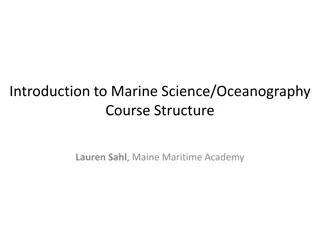
Marine Science and Oceanography Course Structure
This marine science and oceanography course dives into the traditional structure of understanding oceans, from Earth-building processes to human interactions. It also introduces a unique approach focusing on the oil/plastics cycle, engaging students in active learning and discussions on geoethics. T
0 views • 11 slides
Enhancing Curriculum Development through Mapping for Schools
Curriculum mapping in schools involves using electronic tools to input, track, and analyze data related to curriculum, enabling stakeholders to meet standards, align content, collect real-time data on instruction, and reflect on practices for continuous improvement. Software programs like Rubicon At
1 views • 15 slides
Importance of Maps and GIS in Census Mapping: A Case Study from Nepal
Census mapping plays a crucial role in ensuring accurate population counts and territorial delineation. This case study from Nepal highlights the significance of Geographic Information Systems (GIS) in producing high-quality maps for census operations, data collection, analysis, and dissemination. T
0 views • 12 slides
Dr. Seyyed Aliakbar Hedayati - Marine Biology and Fisheries Expert
Dr. Seyyed Aliakbar Hedayati holds a Ph.D. in Marine Biology and is currently an Assistant Professor of Marine Biology at Gorgan University. His research interests include marine biology and fisheries. He has published various research papers on topics such as plasma metabolites in fish and length-w
0 views • 15 slides