
Sphinx Marine - Offshore Marine Company in UAE
Sphinx Marine is an offshore marine company based in Ajman, UAE, established in 2006. They specialize in providing maritime navigation, communication, safety equipment, and services in the Gulf Area and Middle East. With a focus on customer-centricity, safety, and quality, Sphinx Marine is ISO 9001:
0 views • 20 slides
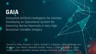
Revolutionizing Marine Mammal Detection using Geospatial Artificial Intelligence
Delve into the groundbreaking development of an operational system utilizing geospatial artificial intelligence to detect marine mammals in very high-resolution satellite imagery. Explore the global interest, monitoring platforms, proof of concept, limitations, future possibilities, and innovative a
0 views • 20 slides

Geospatial Knowledge: Shaping the Future of Digital Society
Exploring the pivotal role of geospatial knowledge in tomorrow's global digital society, the Geospatial Knowledge Infrastructure (GKI) Project aims to advance the integration of digital economies, societies, and citizens through location-based services and technologies. With a focus on stakeholder e
0 views • 23 slides

Overview of AFRIGIST's Capacity Building Activities
AFRIGIST, the African Regional Institute for Geospatial Information Science and Technology, aims to provide quality training and education in geospatial science to enhance sustainable development in Africa. Established under the United Nations Economic Commission for Africa, AFRIGIST focuses on deve
1 views • 20 slides
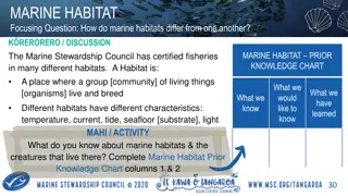
Understanding Marine Habitats and Their Diverse Ecosystems
Marine habitats vary in characteristics such as temperature, current, tide, seafloor substrate, and light, influencing the communities of organisms that live within them. The certification of fisheries by the Marine Stewardship Council ensures minimal impact on local habitats, emphasizing the import
0 views • 6 slides
Marine Novel Medicinal Agents from Marine Sources Compiled by Dr. Nisha Sharma
Oceans, covering more than 70% of the Earth's surface, harbor a plethora of invertebrates and algal species, providing a rich source of medicinal compounds. Marine organisms have yielded commonly used drugs like shark and cod-liver oils, sodium alginate, agar-agar, and chitin. Various classification
1 views • 9 slides
Marine Conservation Governance in Raja Ampat, West Papua, Indonesia
Explore the dynamics of marine conservation governance in Raja Ampat, West Papua, Indonesia, with a focus on Sasi practices and the preliminary findings in the West Misool and South Misool districts. Discover the potential resources in Raja Ampat and the various types of marine conservation areas in
0 views • 22 slides

Evolution of ASPRS Positional Accuracy Standards for Geospatial Data
New technological advancements have prompted the need for updated ASPRS positional accuracy standards for digital geospatial data. Legacy standards from the 1990s are no longer sufficient given the shift towards modern mapping technologies. The new era of mapping involves factors like camera calibra
0 views • 21 slides

Geospatial Technology Services at University of Edinburgh
The University of Edinburgh, through its Information Services, specializes in developing and delivering projects involving geospatial technology. They offer the Digimap Service, providing online access to maps and geospatial data. The university subscribes to the Eduserv Chest Agreement for Esri pro
0 views • 29 slides
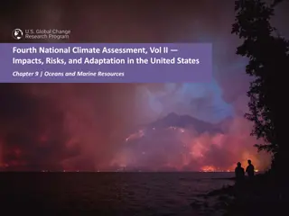
Impacts of Climate Change on Oceans and Marine Resources in the United States
The Fourth National Climate Assessment highlights the disruption of ocean ecosystems due to increasing global temperatures, leading to loss of habitats, changes in species composition, and food web structure. Marine fisheries face high risks from climate-driven changes, impacting distribution, timin
1 views • 10 slides

International Hydrographic Organization Report Summary
The report highlights the activities and achievements of the NATO Geospatial Maritime Working Group (GMWG) in 2018/19, focusing on providing maritime geospatial standards, governance, production support, and operational information. It discusses the progress and key outcomes of the NATO AML Co-Produ
0 views • 13 slides
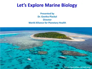
Marine Biology: Importance, Scope, and Responsibilities
Exploring the realm of marine biology reveals its crucial role in understanding and preserving marine ecosystems under threat. This field offers diverse career opportunities, from research to conservation efforts. Marine biologists play a pivotal role in studying, monitoring, and protecting marine l
0 views • 14 slides

National Geospatial Information Management Strategy Action Plan Update
The National Geospatial Information Management Strategy Action Plan Update outlines five strategic goals focusing on governance, data, access, interoperability, and development. Under each goal, multiple action points are detailed, including reviewing council roles, updating legislation, coordinatin
3 views • 13 slides

Empowering Women in Geospatial Information: A Look at Fiji and the Pacific
Explore the impactful role of women in geospatial information management in Fiji and the Pacific region through the leadership, achievements, and future prospects highlighted in the article. From Meizyanne Hicks leading the way to the significant contributions by women in the geospatial industry, th
0 views • 6 slides

NGAC Geospatial Workforce Development Subcommittee Activities Overview
The NGAC Geospatial Workforce Development Subcommittee's purpose is to provide recommendations for developing a skilled geospatial workforce. The subcommittee members are actively involved in various activities such as examining STEM education synergies, reviewing federal job classification codes, a
0 views • 12 slides

Nautilus Marine Insurance Australian Sailing Program Overview
Nautilus Marine Insurance offers a comprehensive suite of insurance products tailored for Australian Sailing clubs, providing top-notch claims services, expert staff, and innovative solutions. With a strong focus on underwriting and customer service, Nautilus Marine is a trusted partner for marine i
0 views • 10 slides

Geospatial Database Development for KRISHI Portal: Nodal Officers Workshop
Geospatial databases play a crucial role in providing location-specific agricultural services through the KRISHI Portal. This workshop focuses on the core objective of the portal, simple GeoPortal architecture, main services offered, the significance of geospatial data, and the utilization of spatia
0 views • 45 slides

Evolution of Geospatial Governance in the United States
Geospatial governance in the United States has evolved over the years, with key milestones such as the establishment of the Geographic Board, the National Spatial Data Infrastructure, and the role of Federal agencies in surveying and mapping activities. Significant reports have highlighted the need
1 views • 11 slides

Geospatial Portfolio Management and NGDA Themes Overview
Explore the roles and responsibilities of Theme Leads, Dataset Managers, and the Investment Collaboration Process in Geospatial Portfolio Management. Understand the significance of National Geospatial Data Assets (NGDA) Themes, Theme Lead Agency roles, and the proposed NGDA Themes for effective port
0 views • 17 slides
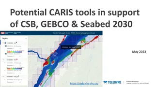
Enhancing Geospatial Imaging Solutions with CARIS Tools for Seabed Mapping
CARIS offers a suite of tools including CARIS Cloud and BDB Server, facilitating the seamless upload, processing, and transfer of bathymetric data to support initiatives like Seabed 2030 and GEBCO. The integration of CARIS tools enables stakeholders to manage, disseminate, and access hydrospatial da
0 views • 5 slides
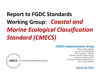
Coastal and Marine Ecological Classification Standard (CMECS) Implementation Progress
The report highlights the development, timeline, objectives, and importance of the Coastal and Marine Ecological Classification Standard (CMECS) along with its implementation progress. It discusses the need for a national standard for classifying coastal and marine habitats, the objectives of CMECS,
1 views • 38 slides
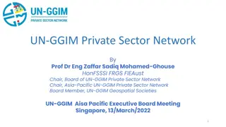
UN-GGIM Private Sector Network: Enhancing Global Geospatial Initiatives
The UN-GGIM Private Sector Network (PSN) serves as a platform for private sector collaboration with Member States on geospatial initiatives. The PSN aims to enhance the world's geospatial capabilities, support policy development, and address global challenges. It operates independently while alignin
0 views • 17 slides

Geospatial Private Sector in Africa: Opportunities and Challenges
The geospatial private sector in Africa faces challenges due to its small and disjointed nature, with a focus mainly on multinational corporations. Initiatives like UN-GGIM are encouraging private sector participation at national and continental levels. Efforts are being made to include the private
0 views • 6 slides
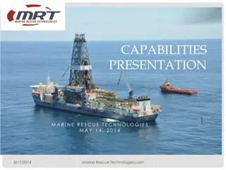
Marine Rescue Technologies: Innovating Ocean Safety Solutions
Marine Rescue Technologies (MRT) is a leading provider of maritime survivor locating devices, retrieval systems, and rescue products. Founded in 1993, MRT serves a wide range of clients in the oil & gas industry, commercial marine sector, and maritime agencies worldwide. Their products cater to the
3 views • 15 slides

Geospatial and Statistical Data Integration in Rwanda: A Closer Look at RCMRD's Role
Explore the evolution of geospatial and statistical data integration in Rwanda, focusing on the initiatives led by Dr. Emmanuel Nkurunziza, General Director of RCMRD. Discover how advancements in geospatial technologies and statistical systems are shaping sustainable development in the region.
0 views • 14 slides

Cloud-based Geospatial Query Processing Using MapReduce and Voronoi Diagrams
This research paper presents a cloud-based approach for processing geospatial queries efficiently using MapReduce and Voronoi diagrams. The motivation behind the study, related works in the field, preliminary concepts of MapReduce, Voronoi diagram creation, query types, performance evaluation, and f
0 views • 30 slides
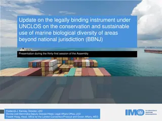
Update on Legally Binding Instrument under UNCLOS for Marine Biological Diversity Conservation
United Nations General Assembly is developing a treaty under UNCLOS for conservation of marine biological diversity in areas beyond national jurisdiction since 2015. The objective is sustainable use of marine genetic resources, area-based management tools, environmental impact assessments, capacity-
0 views • 18 slides

Recent Developments in Marine Geospatial Information Management
The Baltic Sea Hydrographic Commission and related activities highlight significant developments in marine geospatial information management, including upcoming council meetings, GEBCO initiatives, and UN-GGIM endorsements of integrated marine geospatial frameworks. These efforts aim to enhance data
4 views • 8 slides
Tracking Marine Fauna: Examples from ProDelphinus Peru Leatherback Tracking Project
ProDelphinus is dedicated to conserving endangered marine fauna like sea turtles, marine otters, cetaceans, seabirds, and sharks. They use the Darwin Core Archive format and collaborate with Marine TLO for ontology mapping. The project involves tracking leatherback sea turtles and making occurrence
1 views • 8 slides
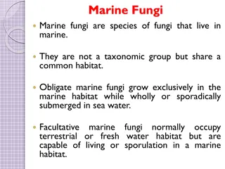
Overview of Marine Fungi and Their Habitats
Marine fungi are diverse species that inhabit marine environments, with some being obligate marine fungi while others can adapt to various habitats. They play essential roles in marine ecosystems by decomposing organic matter and interacting with other organisms. Factors affecting their distribution
2 views • 13 slides
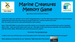
Dive into the Marine Creatures Memory Game and Fun Facts
Embark on an oceanic adventure with a marine creatures memory game featuring two challenging levels. Test your memory skills by matching pairs of marine animals while uncovering fascinating facts about these underwater wonders. Discover unique traits of various creatures like clownfish, dolphins, an
1 views • 5 slides
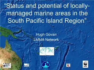
Evolution of Locally Managed Marine Areas in the South Pacific Island Region
This content discusses the status, potential, and objectives of Locally Managed Marine Areas (LMMAs) in the South Pacific Island Region, highlighting the evolution from traditional purposes to modern conservation and fisheries management practices. It also provides insights into the inventory of Mar
0 views • 27 slides
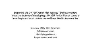
Development of UN-IGIF Action Plan in Cameroon: Addressing Geospatial Data Governance Challenges
The journey of developing a UN-IGIF Action Plan at the country level in Cameroon begins with identifying stakeholders and common strategic priorities, mobilizing support, setting up project teams, drafting action plans, and organizing workshops. The lack of coordination among geospatial information
0 views • 4 slides
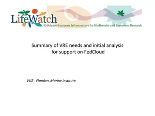
Summary of VRE Needs and Initial Analysis for Support on FedCloud VLIZ - Flanders Marine Institute
Lifewatch Marine VRE has undergone significant developments and meetings since 2014 to establish a virtual research environment supporting marine research. The concept involves constructing a flexible infrastructure for virtual laboratories based on existing components. Needs for support on FedCloud
0 views • 9 slides
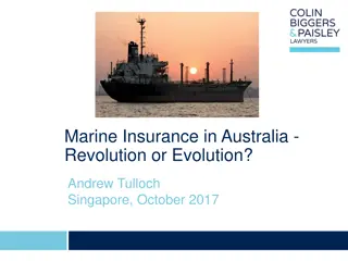
Evolution of Marine Insurance in Australia: A Review of Historical Context and Reform Provisions
Exploring the evolution of marine insurance in Australia, this review delves into historical frameworks such as the Marine Insurance Acts of 1906 and 1909, as well as modern reforms influenced by the United Kingdom. Key principles adopted by the MLAANZ Committee and current recommendations surroundi
0 views • 33 slides
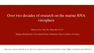
Decades of Marine RNA Virosphere Research
Research spanning over two decades has delved deep into the marine RNA virosphere, shedding light on the complex marine ecosystem and the characteristics of RNA viruses. Discoveries in deep marine virus taxonomy have led to significant taxonomic changes and advancements in virus classification and g
0 views • 10 slides
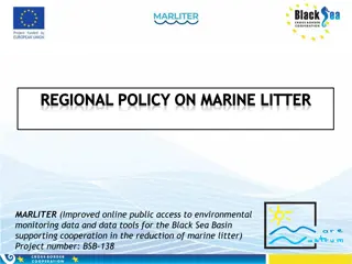
European Union Regulations and Directives on Marine Litter and Waste Management
Marine litter poses a significant threat to the marine environment, prompting the adoption of various international, regional, and national instruments to address the issue. Key directives such as the Marine Strategy Framework Directive and Waste Framework Directive set out measures to achieve good
1 views • 16 slides

Northern Utah GIS Workforce Survey 2014 Results Overview
The Northern Utah GIS Workforce Needs Survey Results for 2014 provide insights into the demographics, industry experience, survey respondents by county in Utah, and educational requirements for GIS/geospatial technicians. The survey highlights the distribution of position titles, length of experienc
0 views • 26 slides
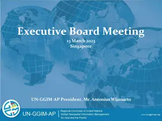
Recent Developments in Geospatial Information Management in the Asia-Pacific Region
Key events include the Executive Board Meeting in Singapore, the 11th Plenary Meeting in India, Fourth Ministerial Conference on Space Applications in Indonesia, workshops on geospatial information sharing, and UN-GGIM-AP's contribution to the global geodesy agenda. Activities such as elections, wor
0 views • 9 slides
Exploring Marine Science and Oceanography Course Structure
This marine science and oceanography course dives into the traditional structure of understanding oceans, from Earth-building processes to human interactions. It also introduces a unique approach focusing on the oil/plastics cycle, engaging students in active learning and discussions on geoethics. T
0 views • 11 slides