DRM-ATF Jan 2024 Regional Updates
Drought worsens in Afar, Amhara, and Tigray regions, leading to livestock migration and shortage of water and pasture. Floods in Somale region displace households and damage crops. Unseasonal rain in South Ethiopia brings relief, while crop production and livestock conditions vary across different r
0 views • 9 slides
Guidelines for Selection of Unskilled Workforce in Gulf of Guinea Northern Regions Social Cohesion Project
This draft trainer's manual outlines the purpose and structure of the manual designed for providing capacity building training to community structures involved in the Gulf of Guinea Northern Regions Social Cohesion (SOCO) Project. The manual aims to enhance the effectiveness of community-level train
0 views • 16 slides
HSE & Security Organization Structure Overview
This document outlines the hierarchical structure of the HSE and Security organization as of October 1, 2023. It includes details on key personnel, regions of responsibility, and specific roles within the organization. The organization's chart provides a comprehensive view of the leadership team and
7 views • 4 slides
Innovative solutions for the future of cities and regions.
Innovative solutions for the future of cities and regions emphasize a bottom-up approach, inclusive governance, and local empowerment in initiatives like the Global Gateway. Prioritizing decentralized decision-making, fostering partnerships, and investing locally are essential for ensuring sustainab
0 views • 4 slides
Georgia Studies Test Prep Essentials for 8th Grade
Explore Georgia's physical features and regions, such as the Blue Ridge Mountains and Coastal Plain. Learn about the economic opportunities each region offers, the impact of climate on Georgia's development, and historical significance. Test your knowledge with questions on geographic regions and th
1 views • 65 slides
OIML-CS Update Meeting Highlights - October 8, 2020
Highlights from the OIML-CS update meeting held on October 8, 2020, featuring participation from various metrology organizations and issuing authorities. The meeting covered updates from AFRIMETS, APLMF, COOMET, SIM, and GULFMET regions, showcasing the collaboration and advancements in metrology sta
0 views • 17 slides
The Pace of Landform Changes
Exploring how landforms transform over time, this lesson delves into the speed at which geological features evolve. By comparing examples like the Grand Canyon and the Mississippi River delta, students learn how scientists collect data to determine the rate of change through measurements and photogr
5 views • 18 slides
Glacial Landforms: Rock Steps, Truncated Spurs, Hanging Valleys, and Crag & Tail
Explore the formation of unique glacial landforms such as rock steps, truncated spurs, hanging valleys, and crag & tail. Discover how glaciers sculpt these distinct features through processes like erosion and deposition, leaving behind stunning geological formations exemplified in locations like Ble
9 views • 43 slides
Climate and Climatic Regions of Pakistan
Pakistan exhibits diverse climatic regions ranging from sub-tropical continental mountains to arid desert plateaus. Factors like altitude, latitude, and distance from the sea greatly influence the country's climate. The country experiences weather conditions such as temperature variations, rainfall
0 views • 14 slides
Regions in Geography
Regions in geography are defined by common features such as climate, landscape, language, or religion. They serve as basic units of geography, with the Middle East being a notable example encompassing political, environmental, and religious characteristics. Regions can be classified based on physica
1 views • 10 slides
Regional Planning and Economic Regions in Geography
Regional planning involves defining regional units, planning regions, and economic regions to ensure sustainable development. It focuses on creating suitable areas for population and employment distribution. The characteristics of planning regions include resource homogeneity, internal coherence, an
0 views • 16 slides
Population Resource Regions and Zelinsky's Classification
Geographers have long studied the relationship between population growth and resource adequacy, leading to the concept of Population Resource Regions (PRR) by W. Zelinsky. Zelinsky identified five types of PRR based on population-resource ratios, ranging from Type A with high resource utilization po
0 views • 8 slides
Population Distribution in Different Regions of Pakistan
The population distribution in Pakistan varies significantly among different regions, with certain provinces like Punjab and Sindh having higher population densities compared to Baluchistan and FATA. The rural areas are also categorized into different population density regions based on the number o
0 views • 14 slides
A Comparative Overview of World Cultural Regions
Explore the various types of cultural regions and their characteristics around the world, including North America, Latin America, the Middle East, Sub-Saharan Africa, and Europe. Discover how these regions differ in terms of language, religious beliefs, customs, and art forms, providing insight into
1 views • 22 slides
Geography and Five Regions of Wisconsin: Key Points and Natural Features
Wisconsin's geography is influenced by the Great Lakes and the Mississippi River, affecting population distribution based on topography, soil, and climate. The state's historical reliance on soil resources for fur trade, lumber, farming, and manufacturing is evident. Varied regions like the Driftles
3 views • 9 slides
EU Coal Regions Exchange: Pitch Presentation Guidelines for Matchmaking Session
In the upcoming matchmaking session on December 10th, 2021, representatives from EU coal regions will have the opportunity to pitch their ideas for potential exchanges and engage in discussions. Participants are required to prepare a formal pitch slide by December 6th, stick to a strict 90-second ti
0 views • 4 slides
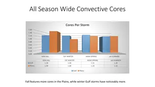
Comparison of Convective Cores in Gulf and Plains Regions
A detailed comparison of convective cores between Gulf and Plains regions across different seasons reveals interesting patterns. Gulf storms have more cores in the fall, with larger sizes and more cores in winter. The Plains see more cores in the spring season and have generally bigger storms year-r
1 views • 4 slides
Euroscepticism in Border Regions: The Identity Crisis of Europe
Euroscepticism in border regions reflects frustration, disillusionment, and disengagement with the European idea at the borders of the EU. The identity crisis of Europe is showcased through sentiments of dissatisfaction and detachment towards the EU, as evidenced in various border regions. This phen
0 views • 29 slides
Analysis of Longest Instrumental Rainfall Series in Indian Regions
This study by Yamini Kulkarni analyzes the longest instrumental rainfall series in Indian regions from 1848 to 2006. It includes the development of rainfall series for different zones using a network of rain gauge stations and statistical methods to understand fluctuations in precipitation over a 15
0 views • 9 slides
Analysis of CHyM Model Performance in Different Regions
The study evaluates the performance of the CHyM model in humid and arid regions, specifically focusing on Tropical South America and Central America. Through analyzing simulated values, seasonal behavior, and response to ENSO phases, the study provides insights into water resource management in thes
0 views • 16 slides
Enhancing Region Search Queries with Content and Spatial Similarity Measures
This project focuses on developing a system to provide top-k similar regions on a map based on user-specified query regions. By incorporating content and spatial similarity measures, the algorithm aims to accurately retrieve regions with similar shapes, scales, and representative categories. Challen
0 views • 12 slides
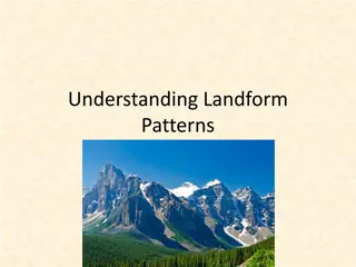
Unveiling Earth's Landform Patterns Through History
Explore the fascinating journey of Earth's landforms, from the formation of continents to the theory of Plate Tectonics. Delve into the rich history of geology, uncovering insights from notable scientists like James Hutton and Alfred Wegener. Witness the dynamic processes of earthquakes, volcanoes,
0 views • 52 slides
The Impact of Artists and Creatives in Border Regions on Culture and Economy
Artists and creatives play a crucial role in the cultural and economic landscape, particularly in border regions where diverse cultures intersect, fostering creativity and innovation. Despite facing challenges, they significantly contribute to social cohesion, the European economy, and the cultural
2 views • 21 slides
Plate Tectonics and Earth's Surface Features
The study of plate tectonics reveals how the Earth's crust is divided into tectonic plates, leading to various types of plate boundaries like divergent, convergent, and transform. These movements result in earthquakes, volcanic eruptions, and landform changes such as folding and faulting. Different
0 views • 15 slides
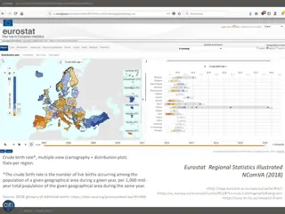
Visualization of Crude Birth Rates in European Regions
Explore the visualization of crude birth rates in different European regions using cartography and distribution plots. The data, sourced from Eurostat Regional Statistics, illustrates variations across regions, with France showing both the lowest and highest rates relative to other European countrie
0 views • 4 slides
Fundamental Concepts of Geomorphology: Exploring Earth Forms and Evolution
Geomorphology, derived from Greek roots for earth and study, focuses on the origin and evolution of Earth's surface features. Geomorphologists study landforms above sea level and the interface between solid Earth, Hydrosphere, atmosphere, and Lithosphere. The fundamental concepts of geomorphology in
0 views • 12 slides
Landform Changes Over Time
Explore the speed at which landforms change and how scientists gather data to track these transformations. Learn about examples like the Grand Canyon and the Mississippi River delta, and understand the role of flowing water in shaping landforms. Engage in activities to analyze the pace of change in
0 views • 13 slides
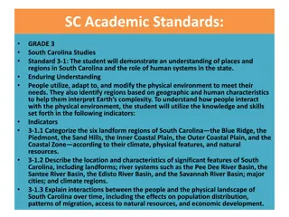
South Carolina's Geography and Human Systems
Explore South Carolina's diverse landform regions, river systems, major cities, and interactions between people and the physical landscape. Learn about the significance of Cheraw, Camden, Columbia, and North Augusta along the Fall Line and Sand Hills regions, as well as the Santee River and Edisto R
0 views • 8 slides
Quantitative Morphometric Analysis in Geomorphology
Quantitative morphometric analysis in geomorphology focuses on measuring and mathematically analyzing the earth's surface configuration and landform dimensions. It involves using GIS techniques to assess terrain parameters and drainage systems, providing valuable insights into watershed characterist
0 views • 8 slides
Ionospheric Absorption Laws and Regions
The principles of the ionosphere at middle and low latitudes, Lambert-Beer exponential absorption law, and characteristics of E and F regions are discussed. The absorption of solar radiation, recombination reactions in different regions, and ionization processes are highlighted, providing insights i
0 views • 15 slides
Collaborative College Regions Mapping Tool for Educational Improvement
Explore the collaborative efforts between various colleges and regions in Scotland through this comprehensive mapping tool. Gain insights into partnerships, initiatives, and regions working together for educational improvement. Visualize the connections and collaborations enhancing the educational l
0 views • 7 slides
Biologically Important Evening Element in Promoter Regions: Insights from Research by Leila Shokat
The research explores the significance of the Evening Element as a motif in gene promoter regions regulated by CCA1. Understanding the importance of motif positions in promoters reveals insights into gene regulation and biological relevance. The study highlights the relevance of consistent motif pos
0 views • 6 slides
Euroscepticism in Border Regions: A Deep Dive into Cross-Border Practices and Perceptions
Explore the phenomenon of Euroscepticism in border regions, delving into cross-border practices and perceptions at the EU's internal borders. This study sheds light on how border regions emerge both functionally and institutionally, emphasizing the importance of understanding Euroscepticism in these
0 views • 16 slides
The Behavior of Spotless Active Regions During Solar Minimum
In this work presented at the SPAnet Workshop on Radio Astronomy in 2017, the study analyzed the physical parameters of spotless active regions observed during the solar minimum period from 2007 to 2010. Radio maps at 17 GHz from the Nobeyama Radioheliograph and magnetograms from the Michelson Doppl
0 views • 14 slides
Overview of ERCOT Renewable Regions and Zone Map
ERCOT, managed by Bill Blevins, divides into seven solar and wind regions including North, South, East, West, Panhandle, Coast, and Houston. This division aids operations planning and management. The Renewable Regions Map and Zone Map play key roles in GIS status reporting and meeting presentations,
0 views • 4 slides
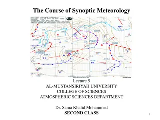
Air Masses in Synoptic Meteorology
Air masses are large bodies of air with uniform temperature and moisture conditions, influencing weather patterns across vast regions. Source regions play a key role in determining the characteristics of air masses, with factors such as stability of atmospheric circulation and surface properties sha
1 views • 17 slides
Review of MEPAG Report on Mars Special Regions Committee
The MEPAG Report on Mars Special Regions Committee was established by joint requests from ESA, ESF, and NASA to review planetary protection requirements for Mars. The Academies and ESF play a crucial role in providing independent scientific advice. The Joint Committee comprises experts from various
0 views • 14 slides
Colonial Life in the Mid-Atlantic and Southern Regions
Explore the intricate details of colonial life in the Mid-Atlantic and Southern regions during the early periods of American history. Discover the geographical landscapes, religious practices, social structures, political systems, economic activities, and community arrangements that shaped the daily
0 views • 19 slides
TEN Testing in Cochlear Implant Candidacy
Discover the significance of Threshold Equalizing Noise (TEN) testing in evaluating cochlear implant candidacy for patients with potential dead regions in the auditory system. Learn about dead regions, absolute threshold levels, diagnosis using TEN test, interpretation of results, and step-by-step g
0 views • 17 slides
Anatomical Terminology Practice Exam: Body Regions and Landmarks
Test your knowledge of anatomical terminology by identifying various body regions and landmarks in this interactive practice exam. Practice naming cranial, cervical, thoracic, pubic, pectoral, axillary, brachial, and antecubital regions with the help of visual aids. Improve your understanding of ana
0 views • 32 slides
