Mastering Surveying with Prismatic Compass
Learn the art of determining positions on Earth's surface using a prismatic compass. Explore its parts, functions, and application in surveying, enabling precise measurements and mapping. Enhance your skills in angular and linear distance measurements with this comprehensive guide.
2 views • 21 slides
Prismatic Compass Survey: A Comprehensive Guide
A prismatic compass is a vital tool in surveying, used to determine bearings, traverse lines, and included angles. This guide covers the principles of compass surveying, the components needed, and the method of compass traversing. Detailed images showcase the prismatic compass, its stand, measuring
0 views • 11 slides
Understanding the Basic Principles of Surveying for Building and Structural Projects
Surveying plays a crucial role in ensuring accurate positioning and alignment of structures such as buildings, bridges, and roads. This article delves into the definition of surveying, stages in the surveying process including reconnaissance, field work and measurement, and office work. Understandin
1 views • 60 slides
Electromagnetic Surveying Methods and Applications
Electromagnetic surveying, conducted by Dr. Laurent Marescot, utilizes various methods like resistivity, induced polarization, and high-frequency techniques for exploration and investigation purposes. The electromagnetic method involves generating primary fields and detecting secondary fields to ana
2 views • 55 slides
Understanding Cadastral Systems in Land Management
Cadastral systems play a crucial role in land management by handling land registration, property taxation, and land tenure. These systems involve private conveyancing, registration of deeds, cadastral surveying, and mapping to maintain records efficiently. They provide information on parcel index ma
1 views • 16 slides
Geodetic Surveying and Triangulation System Overview
Geodetic surveying involves determining precise positions on the Earth's surface, while triangulation is a method that uses interconnected triangles for accurate measurements. The principles of the triangulation system aim to establish horizontal points for various surveys and assist in determining
2 views • 23 slides
Reliable Land Survey Services in Ontario
Konanorth.com offers precise and trustworthy land surveying services in Ontario. For all of your surveying requirements, put your trust in our knowledge and accuracy.\n\n\/\/ \/construction-survey-layouts
5 views • 1 slides
Evolution of Land Law Systems in Trinidad and Tobago
Trinidad and Tobago's land law systems consist of the Common Law System and the Registered Land System. The Common Law system governs unregistered land where title passes upon execution and delivery of the deed. In contrast, the Registered Land System confers ownership upon registration and offers c
0 views • 28 slides
Effective Study Methods: SQ3R Reading Technique by Modibo SANGARE, M.D., Ph.D.
SQ3R method, introduced by Francis Robinson, emphasizes Survey, Question, Read, Recite, and Review steps for effective reading. This method advocates careful surveying before reading, questioning while surveying, and active reading techniques to enhance comprehension. It focuses on structured readin
0 views • 28 slides
Understanding Chain Surveying: Principles and Operations
Chain surveying is a method used for small, flat areas while traversing is preferred for larger, undulated terrains. Principles involve dividing areas into triangles for accurate plotting, with well-conditioned triangles being ideal. Operations such as chaining, ranging, and offsetting are essential
2 views • 23 slides
Understanding the Essentials of Surveying Classification
Surveying is the art and science of determining relative positions on the earth's surface. This presentation delves into why classification of surveying is crucial, discussing the various parts of classification based on instruments, methods, purposes, and nature of the field. Through categorization
4 views • 53 slides
Understanding Differential Leveling in Surveying
Differential leveling is a crucial aspect of surveying that involves determining the elevation of points with respect to a reference datum. This process includes various key elements such as benchmark, back sight, fore sight, and change points. By utilizing methods like the Height of Instrument and
1 views • 12 slides
Understanding Land, Soil, and Water Resources
Natural resources such as land, soil, and water are crucial for human activities. Land comprises the lithosphere and is utilized for various purposes based on land use patterns. The study of land use patterns is essential for economic planning, as the availability of land is limited, leading to conf
5 views • 25 slides
Understanding Cadastre and Cadastral Surveying
Cadastre is a system containing land information, while cadastral surveying involves defining property boundaries and land ownership rights. Cadastral surveys subdivide land parcels for ownership and document property ownership with geometric descriptions. Real property ownership denotes the authori
2 views • 17 slides
Understanding Contour Surveying in Land Assessment
Contour surveying involves determining the elevation of points on the ground to create contour maps, aiding in land assessment and design work. The process includes defining contour lines, establishing vertical and horizontal controls, determining contour intervals, and employing methods for surveyi
2 views • 19 slides
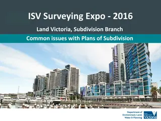
Insights into ePlan Implementation and Collaboration in Surveying Expo 2016
In Surveying Expo 2016, discussions revolved around common issues with Plans of Subdivision, ePlan updates, Subdivision Branch status focusing on retirement of Neil Coupar, and ePlan implementation progress since May 2013. Additionally, a collaborative project with the University of Melbourne aimed
1 views • 30 slides
Understanding Bench Marks in Surveying
Bench Marks (B.M) serve as fixed reference points with known elevations, essential for starting any leveling work. They can be categorized into GTS, Permanent, Temporary, and Arbitrary types, each serving specific purposes in surveying projects.
1 views • 8 slides
Challenges in Land Allocation and Administration by Traditional Authorities and Communal Land Boards
The Communal Land Reform Act of 2002 introduced Communal Land Boards to assist Traditional Authorities in land administration. However, challenges such as misconceptions of powers, limited technical capacity, inadequate resources, and unclear procedures have hindered smooth registration and resoluti
0 views • 15 slides
Understanding Surveying Principles and Instruments
Surveying involves determining and recording earth features' relative positions, utilizing instruments like total stations, digital levels, and GPS for linear, angular, and height measurements. Different types of surveys include traverse, triangulation, and plane table. Advantages of digital levels
5 views • 26 slides
Study Guide for Surveying and Leveling Course
This study guide provides an overview of topics covered in a Surveying and Geomatics course, including definitions, instruments, ranging methods, scales, and verniers. It delves into the art and science of surveying for determining positions on Earth's surface, as well as the principles and practice
0 views • 9 slides
Update Reports: Baroka Ba Nkwana, Bakoni-Ba-Mmamaro CPA, and Enquiry from Mr. C. Mathebe Presentation to the Portfolio Committee on Agriculture, Land Reform, and Rural Development
This report provides updates to the Portfolio Committee on Agriculture, Land Reform, and Rural Development regarding Mr. Collen Mathebe's matter, Bakoni-Ba-Mmamaro CPA, and Baroka Ba Nkwana Land Claim. Mr. Mathebe's issue cannot be resolved through the Land Title Adjustment Act, and alternative opti
0 views • 38 slides
Land Governance in Malawi: Challenges and Progress
Malawi's land governance system has evolved significantly since the colonial era, with a framework that includes institutional and legal aspects. The country has faced challenges in managing land disputes, valuation, taxation, and public land use. The institutional setup involves the central governm
0 views • 23 slides
Understanding Electronic Distance Measurement in Surveying
Electronic Distance Measurement (EDM) is a precise method for measuring distances between two points using electromagnetic waves. It offers speed and accuracy, especially useful for long or inaccessible distances. EDM, a type of surveying instrument, measures phase changes in energy waves traveling
0 views • 7 slides
Land Governance Framework in Botswana: A Country Scoping Study
Botswana, a landlocked middle-income country in Southern Africa, faces challenges such as high population growth, unemployment, poverty, and a less skilled workforce. This study examines the land governance framework in Botswana, focusing on key challenges in land administration, dispute resolution,
0 views • 15 slides
Implications of Land Reform in Namibia: Social and Economic Insight
Land reform in Namibia is crucial for inclusive growth and shared prosperity, with access to land being a key factor. Productive land usage can lead to wealth creation and social development. The importance of agriculture in the economy is highlighted, along with the need for skilled farmers and a s
0 views • 7 slides
Enhancing Land Degradation Neutrality Targets in Lebanon's National Action Programme
Integrating LDN targets into Lebanon's National Action Programme, led by Dr. Chadi Mohanna, aims to align the NAP with the UNCCD's 10-Year Strategy, set national targets for Land Degradation Neutrality, and implement measures to combat land degradation aggravated by climate change. The project focus
0 views • 23 slides
Introduction to Plane Table Surveying in Civil Engineering
Plane table surveying is a graphical and cost-effective method used for surveying small-scale areas. This method involves simultaneous plotting of the survey while in the field, ensuring accuracy and efficiency. Key principles, instruments, setting up procedures, advantages, disadvantages, and commo
1 views • 37 slides
Understanding Land Records and Surveying Practices
Explore topics such as re-locating section corners, working with corner data in GIS, and the importance of accurate survey control in managing GIS systems. Learn about the challenges surveyors face in maintaining section corners and the significance of finding original markers. Discover educational
0 views • 17 slides
Overview of Compass Surveying and Prismatic Compass in Engineering Technology Research
Explore the world of compass surveying and the prismatic compass in engineering technology research. Learn about the instruments used, principles of surveying, and the parts of a prismatic compass. Discover how these tools are essential for area calculation and accurate measurements in various engin
0 views • 22 slides
Overview of the Mizoram Land Revenue Act, 2013
The Mizoram Land Revenue Act, 2013 replaced several previous regulations and came into effect on June 1, 2013. It establishes authorities for land management, outlines control and powers over land, and provides guidelines for land allotment for specific purposes. The Act designates the Government of
0 views • 18 slides
Basics of Compass Surveying and Magnetic Bearings
Compass surveying involves the use of compasses to determine directions and bearings during surveying activities. This method utilizes tools like prismatic compasses and magnetic needles to establish true and magnetic meridians, as well as arbitrary and grid meridians. Understanding concepts like wh
0 views • 17 slides
Update on Northeast Land Transfers: Presentation to Roundtable Members
Ministry of Indigenous Relations and Reconciliation provided an update on land transfers in Northeastern British Columbia, focusing on Treaty Land Entitlement, stakeholder engagement, and communication methods. The presentation highlighted the historical land debt, final settlement agreements, and t
0 views • 8 slides
Land Reform in the Context of Devolution in Kenya
Kenya, with a land area of 582,646 sq. Km, has undergone land reform in the context of devolution since gaining independence in 1963. The country's adoption of the Constitution in 2010 led to the establishment of a system with 1 national government and 47 devolved governments. Kajiado County, inhabi
0 views • 33 slides
Challenges of Implementing Digital Land Survey for Department of Land Records and Surveys
Digital Land Survey involves the use of advanced technology for accurate mapping and boundary delineation. The transition from manual to digital surveying comes with various requirements such as specialized equipment and software. The process includes establishing control points, conducting traverse
0 views • 13 slides
Importance of Land Records in Preventing Land Disputes
Land records play a crucial role in documenting ownership, facilitating land-related transactions, and preventing costly litigation. They serve as a lifeline for effective governance and provide legal status to landowners, ensuring clarity and transparency in land ownership. Without proper land reco
0 views • 15 slides
Impact of Land Policies in Georgia: Headright System, Land Lotteries, and Yazoo Land Fraud
Georgia pursued various land policies post-Revolutionary War to allocate land obtained from Native Americans. The headright system granted land to soldiers and white men, aiming to boost population and state power. Land lotteries distributed land through random draws. The Yazoo land fraud scandal ta
0 views • 20 slides
5 Steps Questionnaire on Mapping Land Degradation and Sustainable Land Management
Preparation for mapping land degradation and sustainable land management involves steps such as preparing the base map, identifying contributing specialists, assessing land use systems, understanding land degradation types, and providing expert recommendations. The process includes analyzing area tr
0 views • 32 slides
Ashumet Park Common Land Project Overview
The Ashumet Park Common Land Project aims to transform Lot 8 into a multi-use community area in Ashumet Valley. The project includes three phases: Land Survey, Land Clearing, and Grass Installation. Phase 1 involved conducting a land survey, while Phase 2 focused on land clearing by removing trees a
0 views • 7 slides
The Importance of Women Empowerment in Engineering and Surveying Industries
Women power is crucial for the success of the NEB as it addresses prevalent issues such as gender stereotypes, salary gaps, and lack of role models in engineering and surveying fields. Initiatives like the CLGE Women in Surveying project aim to empower women through education, entrepreneurship, and
0 views • 14 slides
Native Land Stewardship: Path to Climate Equity
Stephanie Leon-Rodriguez presents a proposal focused on promoting land back initiatives, including federal support programs like the Land Buy-Back Program for Tribal Nations and conservation easements. State support through initiatives like the Mass Conservation Land Tax Credit Program is also highl
0 views • 13 slides
