Understanding Differential Leveling in Surveying
Differential leveling is a crucial aspect of surveying that involves determining the elevation of points with respect to a reference datum. This process includes various key elements such as benchmark, back sight, fore sight, and change points. By utilizing methods like the Height of Instrument and Rise and Fall methods, accurate elevations can be calculated for different points. This comprehensive guide covers the basic principles, equipment involved, and essential calculations in differential leveling.
Download Presentation

Please find below an Image/Link to download the presentation.
The content on the website is provided AS IS for your information and personal use only. It may not be sold, licensed, or shared on other websites without obtaining consent from the author. Download presentation by click this link. If you encounter any issues during the download, it is possible that the publisher has removed the file from their server.
E N D
Presentation Transcript
HEBA KADHM SALMAN Differential leveling
Leveling: is a branch of surveying, the object of which is to find or establish the elevation of a given point with respect to the given or assumed Datum (reference point). 1.422
Basic Principle of Leveling Leveling rods Line of sight Back sight Fore sight Fs Bs h = Bs - Fs Gravity Gradient
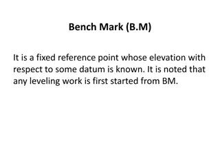
Benchmark (BM): A relatively permanent object, natural or artificial, having a marked point whose elevation above or below a reference datum is known or assumed. Back sight (BS): It is the sight taken on the level staff, of a known elevation with the intention to obtain the elevation of plane of collimation. It is called PLUS sight because it is added to elevation of that point to get height of instrument or plane of collimation. Intermediate sights(IS): These are the sight taken after back sight and before sighting the final point. These are called MINUS sights. These are subtracted from plane of collimation to find the reduced level of different points.
Fore sight (FS): The last reading taken from the instrument.. Change point (CP) or turning point (TP): The point at which both BS and FS are taken. Reduced level (RL): The elevations of the points with respect to assumed datum.
Station: A point where the levelling staff is kept. Height of instrument: It is the elevation of the plane of sight with respect to assumed datum. It is also known as plane of collimation. There are two methods for obtaining the elevations at different points: Height of instrument (or plane of collimation) method Rise and fall method
Height of Instrument method The basic equations are Height of instrument for the first setting= RL of BM + BS(at BM) Subtract the IS and FS from HI to get RL of intermediate stations and change points. Checking: BS - FS = Last RL First RL. This is ve (fall) and +ve for ( rise)
When: the difference in the elevation of two nearby points is required then simple levelling is performed. Assume the elevation of BM Rock is known to be 820.00 ft. The BS at BM Rock is 8.42ft. So HI = (820 + 8.42)ft. Now the FS on X is 1.2ft. So the RL at X = HI FS = 828.42ft Note that the RL of the instrument station will never comes in the calculation.
Differential levelling Performed when the final point is very far from the final point. We have to find RL at B. It is given that RL at A is 100m and BS at A is 2.45m So, HI at L1=(100+2.45)=102.45m FS at CP1=2.14m RL at CP1=(102.45-2.14)=100.31m Now BS at CP1=1.43m HI at L2=(100.31+1.43)=101.74m FS at CP2=2.18m RL at CP2=(101.74-2.18)=99.56m BS at CP2=1.38m HI at L3=(99.56+1.38)m=100.94m FS at B=1.54m RL at B= (100.94-1.54)=99.4m (ans)
H.W: The following staff reading observed by level, the instrument having been moved after the second, fifth and eight reading, all reading staff were as follows 0.675, 1.230, 0.750, 2.565, 2.225, 1.985, 1.835, 3.220, 3.115 and 2.875 The first staff reading was taken the staff held on B.M=100.00m . Enter the reading in level list and find R.L of all points and check the results.
