
Oklahoma Transportation GIS Cabinet Overview
Oklahoma's Transportation Cabinet consists of three agencies responsible for managing federal aid highways, county roadway data aggregation, Turnpike infrastructure, and aeronautics. The GIS infrastructure includes 18 full-time staff primarily using Esri Enterprise GIS tools for data integration and
1 views • 10 slides

GIS Data Management in Hydrologic Engineering Center (HEC) Software
Efficiently manage GIS data in HEC software by organizing background shapefiles, saving files in relevant directories, and utilizing relative pathnames. Understand the contents of basin files, GIS directories, and the step-by-step process involved in the delineation of elements within a project.
10 views • 5 slides

Marc Majors, Deputy Commissioner for Workforce Development
Minnesota's recent legislative session saw historic investments in workforce development, including funding for the Drive for 5 Workforce Fund, Targeted Population Workforce Programs, Youth Workforce Development, and Clean Economy Equitable Workforce initiatives. These programs aim to prepare the wo
0 views • 9 slides

Applications of GIS in Urban Planning and Spatial Operations
This presentation explores the wide range of applications of Geographic Information Systems (GIS) in urban planning, transportation management, utility management, environmental sciences, political science, civil engineering, business, education, real estate, healthcare, and more. GIS facilitates ta
2 views • 19 slides
Workforce Management Market
The growth of this market can be attributed to several factors, including the increasing adoption of cloud-based workforce management solutions, growing inclination towards workforce scheduling and optimization, and increasing adoption of workforce management solutions in various sectors. Moreover,
1 views • 3 slides

Introduction to Enterprise Databases for GIS Professionals
Explore the world of enterprise databases through a GIS perspective with a focus on concurrent clients, database administration, creating databases/tables, checking service names, unique features, numeric data types, data type parameters in ArcGIS, and character data types. Gain insights into managi
1 views • 52 slides
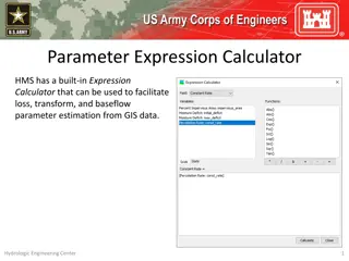
Parameter Expression Calculator for Efficient Parameter Estimation from GIS Data
Parameter Expression Calculator within HEC-HMS offers a convenient tool to estimate loss, transform, and baseflow parameters using GIS data. It includes various options such as Deficit and Constant Loss, Green and Ampt Transform, Mod Clark Transform, Clark Transform, S-Graph, and Linear Reservoir. U
2 views • 5 slides

Arkansas Workforce Education Reporting Update
Reporting requirements for non-credit workforce education in Arkansas have been updated to include student-level reporting starting in AY2019. Changes apply to the Arkansas Workforce Challenge Scholarship Act 605/606 of 2009, with a new file format for student reporting and required data elements fo
0 views • 10 slides

Evolution of Data Processing Systems in Geographic Information Science
Data processing systems in Geographic Information Science have evolved from manual, analogue methods to advanced software and hardware components. The incorporation of Geographic Information Systems (GIS) has revolutionized the handling and analysis of geo-referenced data, making tasks like data cap
3 views • 20 slides

Geographic Information System in Sud Nouvelle Calédonie
The province of Sud Nouvelle Calédonie utilizes an open-source-based Geographic Information System (GIS) to serve its territorial administration, with a focus on applications such as land administration, environment, agriculture, and urban planning. The system is supported by a team of engineers, g
0 views • 15 slides
GIS Application for EPC Asset Damage Assessment post-2009 Tsunami
Utilizing Geographic Information Systems (GIS) for assessing damage to EPC assets after the 2009 Tsunami event. Explore worst-hit and affected areas, query assets, evaluate damage, and derive secondary results for the National Emergency Operations Center (NEOC).
0 views • 8 slides
Spatial Analysis in GIS for Effective Decision-Making
Spatial analysis in GIS involves modeling geographic problems, processing data, and exploring results to understand spatial relationships, patterns, and suitability for various purposes. GIS tools offer unique capabilities for handling geographically referenced data, data entry, storage, manipulatio
3 views • 21 slides
Implementing Workforce Strategies for Strategic Planning
In the Implement stage of strategic workforce planning, it is crucial to consider various workforce strategies for meeting organizational goals effectively. This involves analyzing workforce options, building plans, and utilizing the 6 B's model - Build, Buy, Borrow, Bind, Bounce, and Boost. Tailori
1 views • 10 slides

Foundations of Image Sensing and Acquisition in GIS
Understanding the process of image acquisition is crucial for digital image processing in GIS. It involves using physical devices sensitive to different energy bands to convert images into digital form through digitizers. Various methods such as single sensors, sensor strips, and sensor arrays are u
3 views • 16 slides
The Components of GIS for Spatial Planning
A geographic information system (GIS) is a powerful tool for capturing, storing, analyzing, and presenting spatial data. This training program explores the fundamentals of GIS, including software and hardware components, data considerations, and the importance of people and policies in utilizing GIS
6 views • 16 slides

Enhancing Fiji Police Operations with GIS Implementation
The Fiji Police Force is integrating Geographic Information Systems (GIS) to enhance policing operations through improved situational awareness, crime trend analysis, resource deployment, and cost savings. By investing in GIS technology, the force aims to optimize efficiency, decision-making, and ov
2 views • 17 slides

GIS Data Models for Spatial Planning Training in Maputo, Mozambique
Explore the concepts of GIS data models including vector vs. raster, spatial relationships, spatial operations, and representation of real-world entities in a spatial database. Understand how spatial data models are used to manipulate spatially-referenced information and define the spatial location
1 views • 32 slides

ELC Workforce Engagement and Financial Strategies Overview
The content discusses the workforce engagement sessions, financial context, impact on the ELC workforce, workforce considerations, next steps, and wellbeing supports for employees in the Early Learning and Childcare sector. It addresses budget cuts, workforce reduction strategies, communication plan
2 views • 6 slides

Pacific Climate Change Centre Seminar on GIS and FOSS4G
The Pacific Climate Change Centre in Apia organized a seminar focusing on the importance of GIS and FOSS4G technology. The event included discussions on open GIS data, user group meetings, and keynote speakers. Various local hubs from the Pacific region were involved in the event, showcasing the gro
0 views • 5 slides

Future Directions for GIS in Samoa
Enhancing GIS practices in Samoa involves establishing a Samoa GIS User Group, improving spatial data management, developing a national spatial data infrastructure framework, and implementing GIS applications in various sectors like emergency response, public access, and natural resource management.
3 views • 12 slides

Wetland Prediction Model Assessment in GIS Pilot Study for Kinston Bypass
Wetland Prediction Model Assessment was conducted in a GIS pilot study for the Kinston Bypass project in Lenoir County. The goal was to streamline project delivery through GIS resources. The study focused on Corridor 36, assessing various wetland types over a vast area using statistical and spatial
0 views • 16 slides

Linking BIM and GIS Standard Ontologies with Linked Data
Introduction to the need for seamless data interpretation between Building Information Model (BIM) and Geographic Information System (GIS), focusing on aligning BIM and GIS standard ontologies for semantic interoperability. Addressing the challenges of data interoperability layers and the characteri
0 views • 15 slides
GIS Data Collection and Sources
Exploring various data sources for GIS projects, this information discusses the importance of data collection, different types of data (primary, secondary, administrative records), formats (digital, hardcopy), and the value of spatial data. Emphasizing the significance of in-house data and major GIS
1 views • 35 slides

GIS Data Preparation and Joining in ArcGIS
Learn the step-by-step process of preparing and joining data in ArcGIS for mapping projects. From eliminating unnecessary fields in Excel to loading and joining data in GIS, this guide provides detailed instructions to ensure accurate data representation. Exporting the finalized data allows users to
1 views • 9 slides

Insights from 2022 Indiana Chamber Employer Workforce Survey
The 15th annual Indiana Chamber Employer Workforce Survey presents findings based on 922 responses, highlighting workforce statistics, organizational types, future workforce projections, challenges faced, and strategies employed by Indiana businesses. Key insights include workforce size distribution
1 views • 43 slides
Workforce Initiatives Identification Tool for Strategic Planning Cycle
This tool assists in identifying workforce initiatives during the strategic planning cycle. It helps organizations align current capabilities with future requirements, identify strategic objectives, and implement initiatives to bridge workforce gaps. The tool emphasizes gathering insights, analyzing
0 views • 9 slides

Regional GIS User Group Meeting & Cooperative Purchase Agreement
Join the Regional GIS User Group Meeting on September 9th to discuss GIS initiatives and attend the Cooperative Purchase Agreement meeting thereafter to delve into project specifics. Learn about GIS training opportunities at ARC and stay updated on important announcements.
0 views • 6 slides
GIS, IEM, and Other Acronyms in Earth Observation
Daryl Herzmann from Iowa State University delves into GIS, IEM, and other acronyms related to Earth Observation Day. He discusses his background in meteorology, Open-GIS, and the Iowa Environmental Mesonet, shedding light on web traffic, types of GIS requests serviced, and PNG file usage in georefer
2 views • 18 slides

Transforming Education with Technology: Connecting American Students to Broadband and GIS Resources
In 2013, the White House initiated a program to connect 99% of American students to broadband service, supported by companies like FCC, Sprint, Verizon, Microsoft, Apple, and others. Additionally, Esri is offering $1 billion worth of ArcGIS access for K-12 schools, enhancing students' mapping and da
0 views • 4 slides
Enhancing Emergency GIS Capacity in Ghana through Tabletop Exercises
This study explores the use of tabletop exercises to evaluate and enhance the emergency management GIS needs in Ghana, focusing on the National Disaster Management Organization (NADMO). The research identifies critical needs for GIS capacity building, stakeholder involvement, personnel training, and
0 views • 21 slides

Northern Utah GIS Workforce Survey 2014 Results Overview
The Northern Utah GIS Workforce Needs Survey Results for 2014 provide insights into the demographics, industry experience, survey respondents by county in Utah, and educational requirements for GIS/geospatial technicians. The survey highlights the distribution of position titles, length of experienc
1 views • 26 slides
GIS Events and Training Updates in Atlanta Region
Learn about upcoming GIS events and training sessions in the Atlanta region, including the ARGIS user group meetings, ESRI Certified Training Program, GISP points system, and various conferences happening in the area. Stay informed about opportunities to enhance your GIS skills and network with prof
0 views • 5 slides

Enhanced Parcel Queries in Kansas by Kristen Jordan
Project aims to provide expanded tools and services for statewide parcel queries in Kansas. Background includes the Kansas Data Access and Support Center's existing project and the implementation of a REST web service. Specific goals involve accessing services through desktop and web applications, p
0 views • 20 slides
NG911 GIS User Group 2018 Q4 Meeting Highlights
The NG911 GIS User Group 2018 Q4 Meeting held during the Kansas Association of Mappers (KAM) Annual Conference discussed updates on GeoMSAG, Geospatial Call Routing, NG911 Toolbox, and PSAP transitions. The meeting also covered Kansas NG911 GIS data submission, imagery QA/QC updates, and news items
0 views • 23 slides
Enhancing GIS Outputs: Visualization, Design, and Advantages
Explore the importance of effective GIS outputs in conveying analysis results in a clear and concise manner to aid decision-makers. Learn about visualizing data, designing map outputs, and the advantages of using GIS technology for dynamic and interactive displays.
0 views • 9 slides
NG911 GIS User Group Meeting Highlights
The NG911 GIS User Group meeting held on May 24, 2018, covered various updates and projects related to geospatial call routing, GIS data preparation, and NG911 system enhancements. Discussions included project submissions, PSAP migrations, hosted solutions, mapping software updates, imagery acquisit
0 views • 20 slides
Maximizing Efficiency Through GIS in the 2013 Population and Housing Census
The 2013 Population and Housing Census in The Gambia marked the first implementation of Geographic Information Systems (GIS) technology, streamlining data collection processes and ensuring comprehensive coverage of populated areas. GIS tools facilitated easy access to enumeration areas, data process
0 views • 5 slides
NG9-1-1 GIS Data Model Workshop Overview
This workshop provides an in-depth look into the Kansas NG9-1-1 GIS Data Model, covering standards, data remediation, and the essential components of Next-Generation 9-1-1 systems. Topics include the role of GIS in NG9-1-1, the differences from traditional 9-1-1 systems, the use of GIS databases for
0 views • 36 slides

Workforce Development Program in Kane, Kendall, and DeKalb Counties
The Workforce Development Program in Kane, Kendall, and DeKalb Counties is part of the federally funded Workforce Innovation and Opportunity Act (WIOA) Title 1 Program. It is administered by the Illinois Department of Commerce and Economic Opportunity, with Local Workforce Development Areas providin
0 views • 13 slides

SunGuide Software Users Group Meeting Summary
SunGuide Software Users Group Meeting on November 3, 2022, discussed current system behavior, proposed enhancements using GIS mapping, considerations related to GIS implementation, implications for system changes, and support queries. The meeting highlighted the need to migrate event records, addres
0 views • 19 slides