Early Warning and Data Analytics Strategy, Policy and Action for People, Places and Planet
Explore the innovative Early Warning and Data Analytics Strategy introduced by the UN, focusing on leveraging early warning systems (EWS) to prepare for and manage hazardous climate-related events. This strategy aims to save lives, protect economies, and enhance sustainability by identifying, monito
1 views • 32 slides
Urgent Support Needed: Nepal Earthquake Relief Efforts
A devastating 7.8 magnitude earthquake hit Nepal, causing widespread damage and leaving 2.8 million people homeless. Families are desperate for shelter as monsoon rains approach. Habitat is mobilizing engineers to assess damage, provide emergency shelter kits, and support long-term rebuilding effort
2 views • 16 slides
Earthquake Safety and Design Considerations for Building Structures
Earthquake forces can lead to structural failure in buildings, posing a risk to lives and properties. Proper planning, reinforcement, and design elements such as bracing walls and tied members are essential for ensuring safety against earthquake forces. Additionally, consideration of soil type, qual
1 views • 22 slides
The Ultimate Guide to Warning Tape
In the bustling landscape of the United Arab Emirates (UAE), where construction, manufacturing, and logistics thrive, safety remains a top priority. Among the myriad safety tools and equipment employed in various industries, warning tape stands out as a simple yet indispensable tool for hazard ident
1 views • 4 slides
How Do I Troubleshoot The BMW Stability Control Warning Light
Go through this presentation to find out why your BMW's stability control warning behaves strangely and how to fix it. Learn about the function of stability control and common causes of warning light activation, from low tire pressure to sensor issues. Follow troubleshooting tips and prioritize safe
3 views • 14 slides
Comprehensive Building Safety and Emergency Preparedness Training
Enhance your safety preparedness with Building Safety Coordinator Training, Emergency Preparedness resources, Communication Resources, Fire Safety procedures, and Earthquake Safety measures. Learn about fire extinguisher use, fire response procedures, earthquake safety considerations, and the seven
1 views • 30 slides
Create a Flood Warning System with Micro:bit and Moisture Sensor
A design brief for constructing a flood warning system using micro:bit to detect rising water levels and alert homeowners, aiming to mitigate damage caused by flooding. The project involves selecting suitable input sensors, such as a moisture sensor, and programming the micro:bit to trigger a warnin
3 views • 9 slides
Lessons Learned from Papua New Guinea's 2015-16 Drought in Dealing with the 2018 Earthquake
Exploring the correlation between the 2015-16 drought and the 2018 earthquake in Papua New Guinea offers valuable insights into disaster management strategies. Comparisons in impact, response, and long-term consequences highlight the importance of proactive measures and effective coordination in mit
0 views • 15 slides
Emergency Response SOP for Typhoon Watch and Warning Scenarios
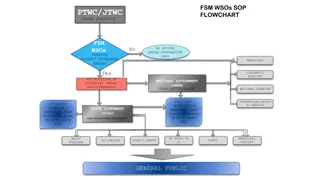
This article outlines the standard operating procedures (SOP) to be followed by relevant agencies in response to typhoon watch and warning scenarios. It includes a flowchart depicting the steps to be taken at different stages of the situation, discussion questions for planning, and specific details
0 views • 18 slides
Update on Section and Warning Notice Reporting - December 2020 Quality Committee
This update covers progress on Section and Warning Notices, including the approval and closure of Section 31 Conditions for Maternity Services, ongoing actions for remaining notices, review with CQC relationship manager, and status of Warning Notices. The report indicates 91% of conditions have been
0 views • 13 slides
The Role of Concrete in Earthquake-Resistant Buildings
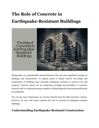
Discover how concrete enhances earthquake resilience in buildings. Learn key design features that make structures safer during seismic events.\n
6 views • 7 slides
Understanding Seismic Source Parameters in Earthquake Dynamics
The seismic source parameters in earthquake dynamics involve describing a fault as a discontinuity causing displacements, requiring a complex treatment of forces. The Earth's equilibrium necessitates a specific system of forces to explain displacements along faults. The seismic moment tensor, consis
4 views • 32 slides
Support for Earthquake-Affected Population in Rasuwa District, Aug 2015-Apr 2016
Support earthquake-affected population in Rasuwa District with shelter upgradation, material support, cash-for-work, livestock shed assistance, and earthquake-resistant techniques verification. Activities include distribution of shelter kits and tool kits, DRR training, mason training, construction
0 views • 13 slides
LED Emergency Light Bars & Siren Warning Contract Rollout Webinar Overview
The webinar provides an overview of Master Agreements for LED Emergency Light Bars, Siren Warning Accessories, and Related Accessories. It covers contract details, pricing, delivery requirements, and vendor responsibilities. The purpose is to establish a source for various emergency warning products
0 views • 22 slides
Enhancing the Synergy Between Astroparticle Physics and Geoscience: APPEC-GEO8 Workshop Insights
The workshop discussion highlighted the growing synergy between Astroparticle Physics and Geoscience, emphasizing the importance of precise understanding of the Geosphere for studying the Cosmos. Topics included Neutrino tomography, deep life exploration, optical fibers coupled with sensors, seismic
1 views • 4 slides
Eastern Mediterranean Centre for Oceanography and Limnology (EMCOL): Research Focus and Facilities
EMCOL, led by M. Namik A. Atay, focuses on natural hazards, environmental changes, and earthquake risk assessment. Their research fields include earthquakes, submarine landslides, tsunamis, sea-level changes, climate change, and paleoclimatology. The center conducts fieldwork using various equipment
0 views • 13 slides
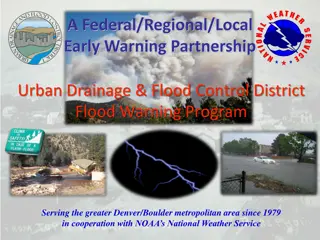
Flood Warning Program of Urban Drainage & Flood Control District
Since 1979, the Federal/Regional/Local Early Warning Partnership of the Urban Drainage & Flood Control District has been providing the greater Denver/Boulder metropolitan area with early flood threat notifications, primarily for flash floods. Working in collaboration with NOAA's National Weather Ser
2 views • 23 slides
Workshop on Future Instruments for Gravity Earthquake Early Warning
Explore the cutting-edge research and developments in instruments for gravity-based early warning systems for earthquakes. Experts like M. Barsuglia, J.-P. Montagner, and K. Juhel are leading the way in this crucial field. Discover the latest projects and collaborations shaping the future of earthqu
0 views • 8 slides
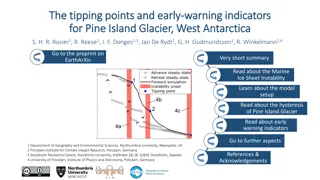
Early Warning Indicators for Pine Island Glacier in West Antarctica
The study examines the tipping points and early warning indicators for Pine Island Glacier in West Antarctica, a key contributor to sea-level rise. Through an advanced ice flow model, the research reveals three tipping points and their associations with ocean warming. The findings also introduce ear
0 views • 8 slides
Prepare and Stay Safe: A Comprehensive Guide for Earthquake Preparedness
This comprehensive guide covers various aspects of earthquake preparedness, including potential risks, necessary precautions, and steps to take during and after an earthquake. It emphasizes the importance of personal, family, and community preparedness, along with valuable insights on how to reduce
0 views • 102 slides
Board of Directors Meeting Highlights - December 2, 2020
Discussions during the Board of Directors meeting revolved around crucial topics such as Earthquake Insurance, On-Site Manager updates, CC&Rs, Financial Studies, and General Board matters. Key decisions were made regarding appointments, resignations, and handling earthquake insurance issues. The mee
0 views • 9 slides
KnowRISK Project - Kick-Off Meeting and Objectives Overview
The KnowRISK project aims to reduce seismic risks through non-structural elements in buildings. The kick-off meeting highlighted the project framework, partners, objectives, and the importance of addressing non-structural elements for earthquake resilience. Objectives include bridging the gap betwee
0 views • 10 slides
Pediatric Evacuation in Response to 7.7 Magnitude Earthquake
Central Arizona Fire and Medical Authority Fire Chief, Scott Freitag, coordinates pediatric evacuation efforts following a 7.7 magnitude earthquake in Southern California. Numerous hospitals report structural damages necessitating the evacuation of pediatric patients who require specialized care and
0 views • 19 slides
Environmental Impact Assessment and Recovery Planning After the 2010 Chile Earthquake
The presentation discusses the Rapid Environmental Impact Assessment (REA) process conducted by a team of Chileans post the 2010 earthquake. It emphasizes the incorporation of assessment results into post-disaster recovery planning to address key issues such as disaster debris management, transition
0 views • 6 slides
Understanding Earthquake Magnitudes and Seismic Measurements
Delve into the fundamentals of engineering seismology and earthquake magnitudes, exploring topics such as fault dimensions, slip distribution, spectral shapes, Richter's observations, and logarithmic scales. Gain insights into how seismic measurements are characterized and understand the significanc
0 views • 69 slides
Climate Information & Early Warning System Project Managers Workshop - Addis Ababa, Ethiopia
The Climate Information & Early Warning System (CI/EWS) project, managed by Dr. Bonizella Biagini of CIRDA, aims to support 11 countries in Africa, focusing on providing reliable weather and climate data for early warning systems and adaptation. The project emphasizes capacity building, technology t
0 views • 8 slides
Impact-Based Forecasting and Warning Services in Mauritius: Successes and Challenges
The experience of the Mauritius Meteorological Services in implementing Impact-Based Forecasting and Warning Services is detailed, highlighting successes and challenges encountered in November 2016. The article discusses the main weather hazards faced by Mauritius, such as tropical cyclones, heavy r
0 views • 21 slides
Southern California Earthquake Center Overview
The Southern California Earthquake Center (SCEC) is a large consortium of institutions dedicated to coordinating earthquake research in Southern California. Their mission involves communicating earthquake understanding to reduce risk and improve community resilience, integrating information for a co
0 views • 22 slides
Seismic Site Characterization in Metropolitan Vancouver
The Greater Vancouver area faces high seismic risk due to its population density and critical infrastructure. Ground shaking during large earthquakes depends on various factors including the earthquake source, material properties, and site conditions. Efforts are being made to map seismic hazards, u
0 views • 13 slides
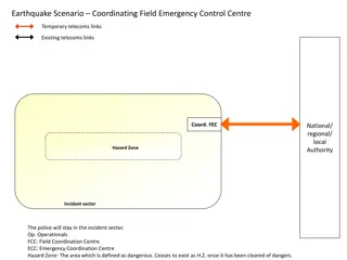
Comprehensive Earthquake Emergency Response Scenarios
This detailed content outlines various earthquake emergency response scenarios including coordinating field control centers, temporary and existing telecoms links, national/regional/local authorities' roles, hazard zones, incident sectors, and specific tasks for different emergency teams such as sea
0 views • 9 slides
Earthquake Response and Recovery Exercise Overview
This presentation outlines the objectives, goals, and purpose of a tabletop exercise focused on evaluating response and recovery efforts after an earthquake. It emphasizes educating decision-makers, defining roles, coordinating operations, sharing information, and enhancing community resilience to e
0 views • 15 slides
Warning Verification and Scoring Guidelines in Weather Forecasting Workshop
Learn about the verification of warnings, classical contingency scoring, false alarm ratio, hits, false alarms, missed alarms balance, threshold-based warning verification, and impact-based warning verification discussed in the IMS Warning workshop at KNMI Block III. Understand the importance of mai
0 views • 13 slides
Innovative Earthquake Monitoring Application PDL2AQMS in Action
PDL2AQMS is a Python application designed for injecting QuakeML data into AQMS databases, supporting both Oracle and Postgres systems. Developed by a team including Ellen Yu, Mike Hagerty, and Aparna Bhaskaran, this tool enables comparison of earthquake solutions and automates association processes.
0 views • 13 slides
Improving Early Warning Systems for Natural Hazards through Public Participation
Investigating innovative approaches to enhance monitoring and early warning systems by engaging the public in data collection and analysis. The project aims to integrate public observations into existing networks for more timely warnings, comprehensive damage assessments, and increased hazard awaren
0 views • 5 slides
Disaster Mitigation & Local Safety Training for Nepali Communities
This training program focuses on understanding disaster risks, particularly earthquakes, in Nepal. It covers topics such as the geographical structure of Nepal, responding to earthquake disasters, local safety mapping, types of disasters (natural and man-made), major disasters in Nepal, and historic
0 views • 26 slides
Advancing Earthquake Prediction with CSEP2: Principles, Experiments, and Collaboratory
Explore the pivotal planning and design concepts behind the Collaboratory for the Study of Earthquake Predictability (CSEP). Discover the guiding principles of CSEP2, objectives for experiment planning, and the framework for testing regions and centers. Delve into the roadmap for community-driven de
0 views • 11 slides
Understanding Early Warning Systems and Student Success Indicators
Early Warning Systems are crucial in identifying students at risk of dropping out and providing timely interventions. By tracking Early Warning Indicators, schools can implement targeted interventions to support students on their academic journey. Characteristics of these indicators include reliabil
0 views • 49 slides
Open Source Mapping for Earthquake Risk Assessment and Reduction
This study explores the use of open-source mapping tools for earthquake risk assessment and reduction, emphasizing the importance of utilizing Free and Open Source Software (FOSS) in disaster management. By leveraging freely available geospatial data and software, individuals can identify vulnerable
0 views • 18 slides
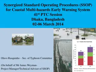
Enhancing Coastal Multi-Hazard Early Warning Systems through Synergized Standard Operating Procedures
The SSOP project aims to strengthen community resilience to coastal multi-hazards by developing integrated standard operating procedures for early warning systems. The initiative targets various countries in the Asia-Pacific region to improve policy and institutional frameworks for disaster prepared
1 views • 28 slides
Innovative Traffic Sign Technologies Enhancing Road Safety
Explore the latest technologies in traffic signs such as truck parking management, dynamic speed display, curve warning system, truck rollover warning system, over-height warning system, and water on road system. These advancements aim to improve traffic flow, reduce accidents, and provide real-time
0 views • 9 slides
