Development of Bar and Bet Lands in Punjab
The development of Bar and Bet lands in Punjab, with Bar lands located between rivers and benefiting from British planning, contrasts with the older, flood-prone Bet lands. Settlement patterns vary between the two, with Bar lands featuring planned villages and efficient infrastructure while Bet lands lack proper development. Mandi towns emerged as important marketing centers for agricultural surplus, reflecting the progress in agricultural expansion. The Dehat Sudhar Programme in Punjab from 1922 to 1928 aimed at further development in these regions.

Download Presentation

Please find below an Image/Link to download the presentation.
The content on the website is provided AS IS for your information and personal use only. It may not be sold, licensed, or shared on other websites without obtaining consent from the author. Download presentation by click this link. If you encounter any issues during the download, it is possible that the publisher has removed the file from their server.
E N D
Presentation Transcript
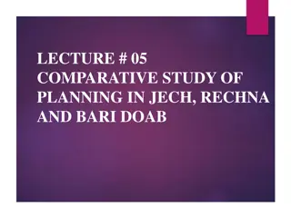
LECTURE # 04 BAR AND BET LANDS OF PUNJAB
BAR LAND Bar land between two rivers planned, irrigated with chakbandi planning by the British. Away and upland from river banks (Bar land safer than Bet land in flood catchment area). Land with efficient road and railway transport network on dendritic markets and marketing linkages.
BET LAND Before the British these are old areas developed on river banks within catchment areas of flood zones. With deficient road network, neither with proper transport network nor with proper spatial linkages
SETTLEMENTS IN THE BAR AND BET LAND The land which is along the river represents unplanned Bet settlements. On the other hand, planned villages the chaks in the planned schemes, represent different patterns to the irregularly laid out agglomerated settlements and wells in the Bet land. Bar land and chaks representing new development that emerged in the planned colonies, nearby the unplanned Bet areas
INTRA CHAK PATTERN A chak represents settlement and its vast agricultural hinterland. Achak has main parts Settlement (planned area of chak) Vast hinterland (farmland), may be the size about 2,000 acres. A village abadie comprised a square (called murrabba=25 acres) up to 2 squares.
Cont.. Four squares into which each square is divided are further subdivided to a number of sub areal blocks. Colonists were given from 0.5 kanals (10 Marlas) to 2 kanals (40 Marlas) Shopkeepers and lower class were provided plots from 5 to 20 Marlas in such housing schemes.
MANDI TOWN The agricultural expansion in Bar lands also required the development of marketing centres. It was planned that agricultural surplus from the rural hinterlands of the these mandi towns would be collected and distributed for export. mandi towns represents Marketing System These efficient Dendritic
DEVELOPMENT IN BAR AND BET LAND Dehat Sudhar Programme was launched in Punjab during 1922 to 1928. To implement this Dehat Sudhar (Rural Reconstruction), development officers were transport links, trade and commerce. They were assisted by village level workers (VLW). These village people worked in their specified zail and tasks to be completed under the slogans as Reform Yourselves Follow the official leader employed to improve
Cont.. Gandhi Gee was disagreed with the non-participatory approach (implemented under the orders of top level officials) to dehat sudhar program. Gram Sevak Programme initiated in 1923 continued (1928-1937). and later It was developed under participatory approach. However after the partition of Indian Sub continent into Pakistan and India the methods of colonial rural development have been maintained in terms of V-AID (VillageAgricultural and Industrial development).
Cont.. The objectives of V-AID are To raise rapidly agricultural production and trade through efficient transport links. To involve women in social and health development. After V-AID Programme the Islamic concept of mutual consultation and participation was adopted as the base for any rural planning project. Local people, local government and planners to work together for planning ,construction and constant repair and maintenance outcomes by administration themselves. the community and local