Evolution of Maps Through History: A Detailed Exploration

Discover the fascinating journey of maps from ancient times to the present day, highlighting the evolution of map-making techniques, the significance of spatial data recording, and the role of maps in shaping geographical understanding across different eras. Explore the transitions in mapping methods from early cartographers' experiences to modern surveying practices, and the impact of maps on trade, exploration, and navigation.
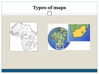
- Evolution of Maps
- Historical Cartography
- Geographic Thought
- Spatial Data Recording
- Map Making Techniques

Download Presentation

Please find below an Image/Link to download the presentation.
The content on the website is provided AS IS for your information and personal use only. It may not be sold, licensed, or shared on other websites without obtaining consent from the author. Download presentation by click this link. If you encounter any issues during the download, it is possible that the publisher has removed the file from their server.
E N D
Presentation Transcript
Map and Map Interpretation 2542402 Lesson 2 : Historical of the maps Jittrapon Soontorn Social Studies Program
Historical of the maps Historical of the maps Map is the tool to recording Spatial Data. Improving from past until now. Maps in each time can linked to Geographical thought of human in each era. Technical of map making in each era.
Historical of the maps Historical of the maps
Revolution of world maps Revolution of world maps 1st : Primary Era. 2nd : Map from surveying. 3rd : Map from academic principle.
1st : Primary Era. People were wrote spatial data on the plain such as, floor, ground, cave, animal leather. Did not collected data from surveying. Most of data came from Cartographers experience in traveling. Sailors and Traders note. Estimation about distances from place to place by the spent time.
1st : Primary Era. The world first map were written, about 5,000 years ago. Wrote on Clay Tablet. As a Cadastral Map of Babylonians Empire. Showing Nile river basin and its landscape.
1st : Primary Era. Cartographers made the maps without surveying. Then the data were collected in only small place around the towns or villages. Farther place were not been written into the map These type of maps were lack of Spatial correction.
1st : Primary Era. After the Europeans making more surveying, they found new lands. More spatial data were recorded. Traders used maps to lead the direction. And wrote the location of new found place into the maps. These kind of maps called Nautical Chart or Navigation Chart .
1st : Primary Era : The Famous Cartographer Strabo, (64 B.C. A.D. 20) Greek geographer and historian made the map from travellers note, without self surveying. The continent that showed in his map Europe Asia Africa
1st : Primary Era : The Famous Cartographer Strabo s map Shape of the continents were wrong. But location of the continents were correct. He was called world s first cartographer. Mondal P., 2016
1st : Primary Era : The Famous Cartographer Ptolemy, (90 - 160 A.D.) Made a map called Geographia and World Atlas Divided the world as 26 regions. Described about continents and oceans. Atlantic ocean to Indian ocean. Giving details of European Empire. China and India were not showed.
1st : Primary Era : The Famous Cartographer Ptolemy s map Thailand can be seen but, the figure was not correct. The way he made the map still be the basically way to making the map in the present time. The first map using graticule.
2nd : Map from surveying Making map by surveying. In those time, Greek and Roman frequently making war. During the war, most of lands were surveyed. Then the maps should be more correct.
2nd : Map from surveying Anyway, Religious perception was the obstrucle of the improvement of map making. We can called these era as dark ages of map making. The Christian perceived that the world was flat. Most people fear to travel by the sea Because they might fall apart.
2nd : Map from surveying T in O map The famous map in these time But was the unusefulness tools Can not navigated way. Can not showed the direction. Can not Calculated area.
2nd : Map from surveying T in O map Making to praise the religion Institutions. Place that showed in these map consist of Jerusalem at the central of the map. Asia, Africa and Europe were located at the rim of the map.
2nd : Map from surveying The Renaissance of map making. In the 16 centuries, surveyors such as, Vasco da Gama Magelland Christopher Columbus were found new lands. Then the new spatial data were updated and can improved the map for Nautical.
2nd : Map from surveying Christopher Columbus
2nd : Map from surveying French marines Had calculated the length of meridian by used triangulation to made the boundary map. English cartographer Had calculated the length of longitude line that merely correct.
2nd : Map from surveying Map were widely use especially in the Wars. In these time, cartographer can showed the topology of each place into the map Map can describe the height of the earth s surface. Using Contour line, Hachure or Hill shade.
3rd : Map from academic principle Academic or Modern map Since 19 centuries, map can described more details such as, The height of earth s surface France made the slope map of the plain. England and Italy made the map showing depth of the seashore.
3rd : Map from academic principle Nowadays, aerial photogrammetry and remote sensing technical can be using as the tools for surveying. Data in the map are more correct Up to date
Figure Reference https://en.wikipedia.org/wiki/Nautical_chart#/media/File:Fern%C3%A3o_Vaz_Dourado_1571-1.jpg https://upload.wikimedia.org/wikipedia/commons/e/e7/Bertini_fresco_of_Galileo_Galilei_and_Doge_of_Venice.jpg https://commons.wikimedia.org/wiki/File:T_and_O_map_Guntherus_Ziner_1472_bw.jpg https://upload.wikimedia.org/wikipedia/commons/8/88/Westindies.jpg https://commons.wikimedia.org/wiki/File:Ouachitas_color_hillshade_only.jpg https://eros.usgs.gov/image-of-the-week/nasa-imagery-eros