Exploring Water Resources with Digital Maps: A River Exploration Lesson
Digital maps are powerful tools for exploring water resources, such as rivers. Learn how to use online mapping resources to find your local river, understand river catchments, and visualize environmental features through map layers. Click, zoom, and navigate your way to discovering the waterways around you.

Download Presentation

Please find below an Image/Link to download the presentation.
The content on the website is provided AS IS for your information and personal use only. It may not be sold, licensed, or shared on other websites without obtaining consent from the author. Download presentation by click this link. If you encounter any issues during the download, it is possible that the publisher has removed the file from their server.
E N D
Presentation Transcript
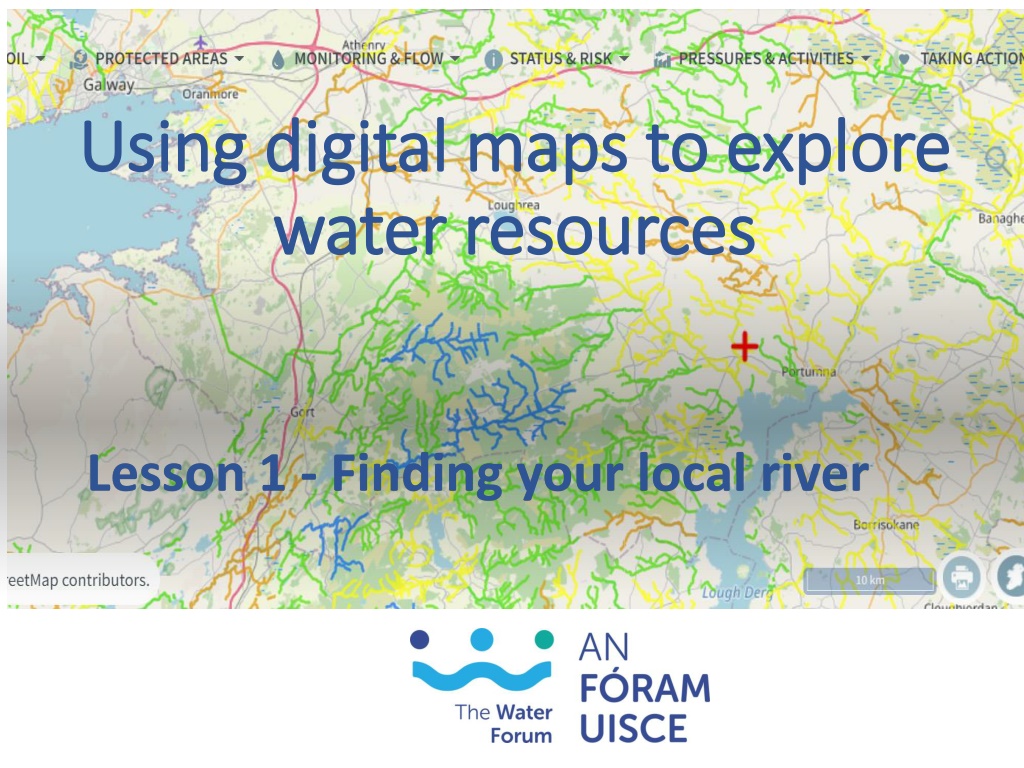
Using digital maps to explore Using digital maps to explore water resources water resources Lesson 1 - Finding your local river
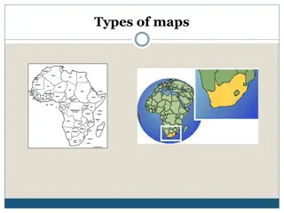
Maps Maps inform us about our surroundings. Different colours, symbols and lines represent environmental features, e.g. rivers, mountains, towns, roads, boundaries, etc. From a measuring scale and a compass orientation we can figure out the size, distance and direction of features from a specific point. A map legend will tell us what different symbols mean.
Digital Maps Nearly all modern mobile phones have a map applications that we use daily. Google Maps or Apple Map From reading a map we can extract information that allows us to visualize what things on the ground look like, the distances between different points and the location and size of a feature.
Digital maps of rivers www.catchments.ie is a free online mapping resources provided by the EPA that provides information on rivers, lakes, and coastal areas across Ireland. In this lesson you are going to use the EPA maps to find your local river.
What is a River Catchment? A catchment is the area of land, including the hills and mountains, from which surface and underground water flows into streams, rivers and wetlands, and eventually to the sea. Dublin Galway In Ireland, 46 catchments composed of 583 sub- catchments are identified for management purposes. Limerick Waterford Cork Source: https://gis.epa.ie/EPAMaps/Water
Task 1.1 Find your local river Log on to https://www.catchments.ie and click on Maps
Find your local river (cont.) Using the + button on the screen, or with a mouse scroll wheel, zoom into your county. Locate your school on the map by left clicking, holding down the mouse and dragging your target area to the centre of the screen.
Digital Maps Have Layers Digital maps have different layers to show different features We are going to turn on two layers of the map to see our local rivers. Click on WATER, LAND & SOIL Select River Waterbodies and River Flow Direction by sliding the button across. The buttons will turn green
Your screen will now look like below. All the purple lines represent all the streams and rivers in the area. Use your mouse to scroll in and out for different magnifications to see more or less detail.
Find local rivers and streams 1. Go to the icons on the far left of the screen, use your mouse to hover over the second icon and click on Tools A Tools pop-up will appear 2. Select Search Tools A Search Tools pop-up will appear 3. Enter the school address or eircode
Zoom in and out to view different details. A zoom resolution of 2 km or less will show the river names. Note the rivers Zoom resolution
Zoom in and out to view different levels of details. 1000m or less will show the river flow direction. Zoom resolution
Save your map of local rivers 1. To save the map of the rivers near your school, click on the printer icon in the bottom right-hand corner. Don t worry, you will not be asked for a printer, the catchments.ie app will create a myMap.png file that you can see in the bottom left-hand corner of the screen. If you are using a Windows operating system, the file will probably automatically save to the Downloads folder. You will need this map for your final project.
Task 1.2 Draw a map of your local river in your workbook 1st identify on the map the river source (also called the headwater) or the starting point location of the river. 2nd identify on the map where the river enters the sea or joins a larger river (it is then a sub-catchment). Draw the course of the river in your workbook and mark in the villages and towns the river passes through. Mark in other features, e.g. old mills, water amenities, bridges, etc. Be creative! Aim to create a map that tells the reader what they can expect to see along the river.


")