Advanced Satellite Systems for Environmental Monitoring
The Joint Polar Satellite System (JPSS) utilizes advanced instruments like ATMS, CrIS, VIIRS, OMPS, and CERES to provide crucial data for weather forecasting, ozone monitoring, and Earth radiation studies. The Suomi NPP and JPSS-1 instruments offer high-resolution temperature, water vapor, and imagery products for improved meteorological predictions. Product calibration and validation processes ensure data accuracy, with incremental improvements ongoing. Early release products allow users to familiarize themselves with data formats before operational use.
- Satellite Systems
- Environmental Monitoring
- Weather Forecasting
- Data Validation
- Instrument Calibration
Download Presentation

Please find below an Image/Link to download the presentation.
The content on the website is provided AS IS for your information and personal use only. It may not be sold, licensed, or shared on other websites without obtaining consent from the author. Download presentation by click this link. If you encounter any issues during the download, it is possible that the publisher has removed the file from their server.
E N D
Presentation Transcript
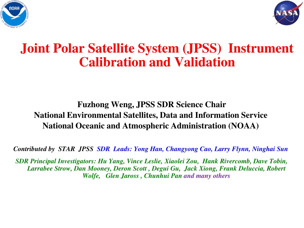
Joint Polar Satellite System (JPSS) Instrument Calibration and Validation Fuzhong Weng, JPSS SDR Science Chair National Environmental Satellites, Data and Information Service National Oceanic and Atmospheric Administration (NOAA) Contributed by STAR JPSS SDR Leads: Yong Han, Changyong Cao, Larry Flynn, Ninghai Sun SDR Principal Investigators: Hu Yang, Vince Leslie, Xiaolei Zou, Hank Rivercomb, Dave Tobin, Larrabee Strow, Dan Mooney, Deron Scott , Degui Gu, Jack Xiong, Frank Deluccia, Robert Wolfe, Glen Jaross , Chunhui Pan and many others
Suomi NPP and JPSS-1 Instruments Instrument Type Measurement ATMS and CrIS together provide high vertical resolution temperature and water vapor information needed to maintain and improve forecast skill out to 5 to 7 days in advance for extreme weather events, including hurricanes and severe weather outbreaks ATMS -Advanced Technology Microwave Sounder CrIS - Cross-track Infrared Sounder VIIRS provides many critical imagery products including snow/ice cover, clouds, fog, aerosols, fire, smoke plumes, vegetation health, phytoplankton abundance/chlorophyll VIIRS Visible Infrared Imaging Radiometer Suite OMPS - Ozone Mapping and Profiler Suite Ozone spectrometers for monitoring ozone hole and recovery of stratospheric ozone and for UV index forecasts CERES - Clouds and the Earth s Radiant Energy System Scanning radiometer which supports studies of Earth Radiation Budget 2
Suomi NPP TDR/SDR Algorithm Schedule Sensor CrIS ATMS OMPS VIIRS Beta Provisional February 6, 2013 February 12, 2013 March 12, 2013 March 13, 2013 Validated March 18, 2014 March 18, 2014 April , 2015 April 16, 2014 February 10, 2012 May 2, 2012 March 7, 2012 May 2, 2012 C C C C C C C C C C C C C C Beta Early release product. Initial calibration applied Minimally validated and may still contain significant errors (rapid changes can be expected. Version changes will not be identified as errors are corrected as on-orbit baseline is not established) Available to allow users to gain familiarity with data formats and parameters Product is not appropriate as the basis for quantitative scientific publications studies and applications Provisional Product quality may not be optimal Incremental product improvements are still occurring as calibration parameters are adjusted with sensor on-orbit characterization (versions will be tracked) General research community is encouraged to participate in the QA and validation of the product, but need to be aware that product validation and QA are ongoing Users are urged to consult the SDR product status document prior to use of the data in publications Ready for operational evaluation Validated On-orbit sensor performance characterized and calibration parameters adjusted accordingly Ready for use in applications and scientific publications There may be later improved versions There will be strong versioning with documentation 3
Suomi NPP Calibration/Validation Schedule Four Phases of Cal/Val: 1. Pre-Launch; all time prior to launch Algorithm verification, sensor testing, and validation preparation 2. Early Orbit Check-out (first 30-90 days) System Calibration & Characterization 3. Intensive Cal/Val (ICV); extending to approximately 24 months post-launch xDR Validation 4. Long-Term Monitoring (LTM); through life of sensors after ICV For each phase: Exit Criteria established Activities summarized Products mature through phases independently Build Team Build Team Joint Polar Satellite System Sensor Sensor Characterization Characterization Estab. Sensor Stability Stability Estab. Sensor NPP Launch NPP Launch Post-Launch Post-Launch Plan Dev. Plan Dev. SDR Validation SDR Validation SDR/EDR Alg. Tuning Tuning SDR/EDR Alg. Resource ID & Development & Development Resource ID Key EDR Validation Validation Key EDR Quick-Look Analysis SDRs/EDRs SDRs/EDRs Quick-Look Analysis Alg. Assessment Alg. Assessment & Verifications & Verifications EDR Validation EDR Validation Mission Integration Integration Mission Sens or Charar. &Calibration &Calibration Sens or Charar. Cal/Val Tool Development Development Cal/Val Tool Monitor Sensor Monitor Sensor Stability Stability Product Ops Product Ops Viability Viability LAUNCH LAUNCH PRE-LAUNCH PRE-LAUNCH EOC EOC ICV ICV LTM LTM 4 10-28-2011 10-23-2012-Provisional Review 12-18-2013 Validated Review
NOAA Integrated CalVal System (ICVS) for Long Term Monitoring (LTM) of Operational Satellites http://www.star.nesdis.noaa.gov/icvs 5
SNPP Advanced Technology Microwave Sounder (ATMS) TDR/SDR Status TDR/SDR data have reached a full validated maturity level ATMS has a stable instrument performance and calibration ATMS instrument noises (NEDT) are characterized and all channels meet or exceed the requirements All the ATMS channels have noises much lower than specification ATMS processing coefficients table (PCT) are updated with nominal values Quality flags (e.g. spacecraft maneuver and scanline, calibration) are updated and monitored Geolocation errors for all the channels are quantified and meet specification Instrument performance and SDR uncertainties are well characterized and documented (e.g. ATBD, peer-reviewed publications, user s guide, error budget analysis) Both TDR and SDR products are used in NOAA operations Innovated sciences have been made for instrument calibration 6
ATMS Channel Weighting Functions Pressure (hPa) Weighting Function 8
ATMS Noise Equivalent Differential Temperature (NEDT) NE T (K) 1 2 3 4 5 6 7 8 9 10 11 12 13 14 15 16 17 18 19 20 21 22 Channel Number SNPP ATMS noise equivalent differential temperature (NEDT) from prelaunch and postlaunch data is much smaller than specification. Currently, the oversampling ATMS data (3x3) are re-sampled by users for noise reductions and the actual ATMS noises at the temperature sounding channels after resampling are much lower than the AMSU-A values. 9
Impacts of US Microwave Sounders in NCEP GFS 500 hPa Southern Hemisphere AC scores for 20140101 20140131 00Z Assimilation of ATMS radiances in NCEP GFS produces a largest impact on global medium range forecast, especially over southern hemisphere. With respect to the baseline experiment that includes the conventional and GPSRO data, 75% forecast skill increase is attributed to ATMS radiance assimilation. 10
ATMS Impacts on Hurricane Sandy Forecast 2012 NCEP HWRF Version Control Run Control Run +ATMS Predicted vs. observed track for Hurricane Sandy during October 22 to 29. NCEP 2012 HWRF is revised with a high model top and is initialized with its own background 6 hour forecast for direct satellite radiance assimilation in GSI. Control Run: All conventional data and NOAA/METOP/EOS/COSMIC. It is clearly demonstrated that assimilation of Suomi NPP ATMS radiance data reduces the forecast errors of Hurricane Sandy s track 11
Atmospheric River Depicted from ATMS Atmospheric water vapor retrieved from SNPP ATMS using NOAA microwave integrated retrieval system (MIRS). MIRS is developed for all US and European microwave sounding instruments and meets the enterprise product lifecycle standards (e.g. common interface, CRTM, JPSS L1RD performance). 12
Warm Core - Temperature Anomaly Typhoon Neoguri 07/07/2014 13
Biases in the Tropics (NOAA-15, MetOp-A, SNPP) before after Bias (K) ATMS channel 10 Bias (K) ATMS channel 11 Bias (K) ATMS channel 13 Bias (K) ATMS channel 14 NOAA-18 is subtracted. The pentad data set within 30o latitudinal band. 14
SNPP Cross-Track Infrared Sounder (CRIS) SDR Status CRIS SDR data have reached a full validated maturity level On-orbit instrument performance is stable and well within specification SDR uncertainties meet requirements, with NEdN and uncertainties of radiometric and spectral calibration well below specifications Spectral uncertainty: < 3 ppm, well below specification Radiometric uncertainty: ~0.1K, well below specification Geolocation error: < 1.2 km below specification ILS and NL correction algorithms/code and coefficients are improved and adjusted All the important SDR quality flags are functioning as expected 99.98% of the SDR data are in good quality IDPS capability to process full resolution RDRs is implemented and tested Instrument performance and SDR uncertainties are well characterized and documented (e.g. ATBD, peer-reviewed publications, user s guide, error budget analysis) CrIS SDR team developed lots of innovative algorithms for full resolution SDR processing 21
Example of Data Quality after Mx8.0 Radiance (900 cm-1) Overall SDR quality flag (Blue good) CrIS data monitoring website: http://www.star.nesdis.noaa.gov/icvs/status_NPP_CrIS.php 22
Validated CrIS SDR Product CrIS SDR uncertainties (blue) vs. specifications (black) Radiometric Uncertainty @287K BB (%) Frequency Uncertainty (ppm) NEdN @287K BB mW/m2/sr/cm-1 Geolocation Uncertainty (km) * Band 0.098 (0.14) 0.12 (0.45) 3 (10) 1.2 (1.5) LW 0.036 (0.06) 0.15(0.58) 3 (10) 1.2 (1.5) MW 0.003 (0.007) 0.2 (0.77) 3 (10) 1.2 (1.5) SW Requirements Instrument & SDR performances exceed requirements by large margins SDR software Stable & free of errors that could impact data quality since 11/14/2013 (Mx8.0) Documentation SDR User s Guide (55 pages) Revised ATBD Peer-review Journal papers 23
CrIS Noise Equivalent Differential Radiance (NEdN) Note: MWIR7 (Green) is known to have excess NEdN (expected) NEdN On-Orbit data is consistent with Ground Test Data (Black Lines); Much Better Than Spec Limits (Dashed Lines) No Ice Contamination Signatures Slide courtesy of Joe Predina, ITT EXELIS 24
SNPP Visible Infrared Imaging Radiometer Suite (VIIRS) SDR Status VIIRS SDR products have reached a validated maturity level Multiple code/LUT updates have been implemented or are being implemented into the SDR processing, including the scan-by-scan calibration, and have led to higher quality SDRs and EDRs. VIIRS on-orbit performance is well characterized and meets specifications Noise is small and stable, meet specification Bias (accuracy) is well characterized for both reflective solar and thermal emissive bands. with the exception of M11 due to low signal (known prelaunch with waiver) Calibration coefficients are automatically updated RSB Autocal is implemented and reduce calibration latency and improve performance. DNB straylight correction works well. Geo-location uncertainties for I-/M-bands are ~ 70 m at nadir, meeting specifications at nadir and edge-of-scan (DNB terrain corrected geo-location product is expected in Mx8.3 in March 2014) Instrument performance and SDR uncertainties are well characterized and documented (e.g. ATBD, peer-reviewed publications, user s guide, error budget analysis) 27
VIIRS On-orbit Performance -SNR and NEDT (all values are stable since provisional) Excellent noise performance for all VIIRS bands Noise values stable since launch 29
VIIRS Reflective Solar Band (RSB) Calibration F: RSB Calibration coefficient. H: SD degradation factor. + + 2 ( ) F c c dn c dn = 0 1 2 EV EV L EV RVS EV L _ Computed L _ Sun Model = = Sun F _ L Observed L _ Sun Observatio n Sun cos( ) c ( ) E + BRDF + t RVS = inc sun c sds SD F 2 SD dn c dn 0 1 2 SD = ( ) ( ) ( ) BRDF t H t BRDF t 0 Norm ( t ) H t = ( ) H t Norm ( ) H 0 dn: VIIRS bias removed response dc: SDSM bias removed response dc ( 0 = ( ) SD ) SDSM H t cos( ) dc BRDF t SUN SDS inc SDSM 30
VIIRS RTA and Solar Diffuser Degradation VIIRS RTA mirror responsivity degradation (1/F-factor) is leveling off For M7, initially > 2% per week; Currently <0.1% per week Solar diffuser (1/H-factor) degradation continues Both H and F factor degradation flattened in the spring of 2014, which disrupted the trend. As a result, the calibration model has to be revised Automated calibration of the solar bands using the RSB Autocal is currently being tested 31
VIIRS Performance at 30 Vicarious Sites Worldwide VIIRS calibration is monitored at 30 Vicarious sites with time series analysis for all bands DCC and Lunar are recognized as a unique sites and have been used to diagnose calibration anomalies The DCC time series are capable of detecting sub-percent calibration changes. Bands M5 and M7 are stable, with calibration of stability better than 0.4% (1-sigma); Bands M1-M3 show noticeable calibration changes, especially since early 2014, due to the SD anomaly Time series available at: https://cs.star.nesdis.noaa.gov/NCC/VSTS. Feb 2014 30 vicarious sites for VIIRS calibration monitoring Nadir VIIRS DCC observation time series 32
SNPP Ozone Mapping and Profiling Suite (OMPS) SDR Status OMPS Earth View SDR products have reached a validated maturity level Excellent OMPS instrument performance, as validated by STAR ICVS monitoring. Calibration coefficients have been adequately updated. OMPS and GOME-2 inter-sensor biases are well characterized. Good agreements with existing knowledge of GOME-2 calibration. Excellent outreach to and feedback from NOAA and NASA user community. OMPS SDR on-orbit performance is well characterized. Exceptional performance in terms of noise, stability, and data completeness. Further improvements in stray light correction is being implemented. Current performance meets requirements. A new wavelength correction is being implemented, after which performance will meet requirements. Need a plan to correct for wavelength cross-track variation, e.g. by improved pixel-to- pixel cal. in scan direction or soft cal. Good documentation in peer-reviewed papers and presentations for this review. 33
OMPS Nadir Mapper Instrument Performance Specification/Prediction Value Requirement On-Orbit Performance Non-linearity < 2% full well < 0.46% Non-linearity Knowledge < 0.5% ~0.1% On-orbit Wavelength Calibration < 0.01 nm 0.01 nm # Stray Light NM average ~ 0.5% ^ 2% Out-of-Band + Out-of-Field Response Intra-Orbit Wavelength Stability <0.02 nm < 0.01 nm * SNR >1000 > 1000 from SV and EV Inter-Orbital Thermal Wavelength Shift <0.02 nm <0.01 nm CCD Read Noise <60 e RMS < 25 e RMS Detector Gain >46 ~51 Absolute Irradiance Calibration Accuracy < 7% <7% (< 8% on wavelengths <306 nm) Absolute Radiance Calibration Accuracy < 8% < 5% # After new analysis for Day 1 wavelength scale. ^ After measurement-based correction using prelaunch characterization. * After measurement-based intra-orbit adjustments. 36
OMPS NP Instrument Performance Requirement Specification/Prediction Value On-Orbit Performance Non-linearity < 2% full well < 0.46% Non-linearity Knowledge < 0.5% ~0.1% On-orbit Wavelength Calibration < 0.01 nm < 0.01 nm # Stray Light NM Out-of-Band + Out-of-Field Response average ~ 1% * 2% Intra-Orbit Wavelength Stability <0.02 nm < 0.02 nm SNR Channel Dependent As good as SBUV/2 at Alg. Channels & Inter-Orbital Thermal Wavelength Shift CCD Read Noise <0.02 nm 0.03-nm amplitude annual cycle ^ <60 e RMS < 25 e RMS Detector Gain >43 ~47 < 7% for most of the channels (Up to ~10% on wavelength s > 305 nm and wavelengths < 250 nm) Absolute Irradiance Calibration Accuracy Absolute Radiance Calibration Accuracy # After analysis of a new Day 1 Solar * After measurement-based correction using prelaunch characterization ^ Regular annual cycle affects accuracy and stability & Information concentration possible by using near-by channels. < 7% < 8% < 5% 37
JPSS-1 ATMS Status J1 ATMS TVAC calibration data were provided to the government for independent assessment Testing performed for 4 redundancy configurations at each calibration step For each calibration step, 278 scans of data processed to yield 271 scans of derived accuracy data Major findings from TVAC data Except Chs.16 and 17, the performances (accuracy, NEDT and nonlinearity) at all other channels meet the requirements Overall, redundancy configuration 1 (RC1) is recommended to use. To avoid the NEDT and striping abnormal in Ch.16, a higher (~ 13-14oC) instrument temperature could be considered to use. J1 ATMS is now undergoing a rework and PSR will take place in August, 2015 J1 ATMS SDR algorithms will most inherit SNPP ATMS algorithms with some updated sciences. Calibration will be done in radiance space and the outputs will be converted to brightness temperature (see next slide) JPSS ATMS Post Launch Tests (PLT) is being developed. J1 ATMS SDR data will be operational at L+90 Days. 38
JPSS-1 CrIS Status The PSR successfully completed on 10 February 2015 Cross-track Infrared Sounder (CrIS) Instrument environmental test campaign successfully completed Only one science-related waiver with negligible impact to Environmental Data Record (EDR) performance All program review actions are closed J1 CrIS is on the way to BATC for satellite level test campaigns 41
JPSS-1 VIIRS Status J1 VIIRS Pre-Ship Review Review (PSR) was held 2/3-2/4 at Raytheon, El Segundo, CA PSR provides a systematic review of the instrument, performance, waivers, and risk mitigation The independent review panel found no impediment to the shipment of J1 VIIRS STAR SDR and EDR teams contributed greatly to the waiver studies prior to the PSR, and will continue to develop mitigation for the waivers J1 VIIRS relative spectral response functions (RSR) is made available by the SDR team Birthday cake celebrating the JPSS J1 VIIRS shipping on February 2015 43
Summary and Conclusions Suomi NPP instrument calibration and validation tasks have been completed successfully and all the SDR products have been used in NOAA operations NOAA has developed an Integrated CalVal System (ICVS) for long-term monitoring (LTM) of all SNPP/JPSS/GOES-R/METOP instruments CrIS, ATMS, VIIRS and OMPS have stable performance with the key instrument parameters (e.g. noise, bias) meeting or exceeding the requirements SDR teams developed innovative sciences and algorithms for improving and refining the products processing system, e.g., CrIS full spectral resolution processing and ATMS full radiance processing, VIIRS DNB straylight corrections. SDR teams are being participated with the members from NOAA, NASA and universities and government labs. Transitions of new calval sciences from research to operations are going well SDR teams start working on J1 prelaunch characterizations of all the instruments, preparing for J1 SDR algorithm upgrades. Documentation of all the SNPP SDR sciences and operational codes have been completed, including ATBD and user manuals, error budgets. Peer-review papers have been published in JGR special issue and other high quality journals 47
JGR Special Issue on Suomi NPP CalVal 34 papers have been accepted in AGU Journal Geophysical Research Special Issue on Suomi NPP satellite calibration, validation and applications. Guest Editor: Fuzhong Weng 48
