Understanding Global Positioning System (GPS) Technology in Satellite Communications
Introduced in the 1970s, the Global Positioning System (GPS) revolutionized location tracking worldwide. Consisting of 24 satellites in the space segment, GPS allows precise positioning on Earth by measuring distances from these satellites. The control segment, including master control stations and monitor stations, ensures the accuracy and functionality of the GPS system. Learn about the technology behind GPS and its essential segments in satellite communications.

Download Presentation

Please find below an Image/Link to download the presentation.
The content on the website is provided AS IS for your information and personal use only. It may not be sold, licensed, or shared on other websites without obtaining consent from the author. Download presentation by click this link. If you encounter any issues during the download, it is possible that the publisher has removed the file from their server.
E N D
Presentation Transcript
University of Diyala College of Engineering Department of Communications Engineering Satellite Communications By: Dr. Majidah Hameed Majeed
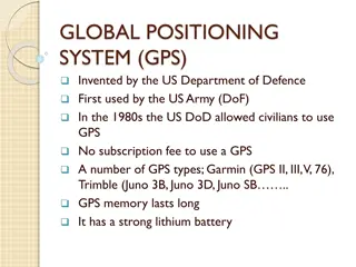
CHAPTER 4 GLOBAL POSITIONING SYSTEM GPS 4.1Introduction At the beginning of the 1970s, a new project was proposed GPS. This concept promised to fulfill all the requirements of the US government, namely that one should be able to determine ones position accurately, at any point on the earth s surface, at any time, in any weather conditions. GPS is the shortened form of NAVSTAR GPS. This is an acronym for NAVigation System with TimeAnd Ranging Global Positioning System. The first satellites were launched into space in 1978. The System was declared fully operational inApril 1995. The Global Positioning System consists of 24 satellites, that circle the globe once every 12 hours, to provide worldwide position, time and velocity information. GPS makes it possible to precisely identify locations on the earth by measuring distance from the satellites. GPS allows you to record or create locations from places on the earth and help you navigate to and from those places. The total GPS configuration is comprised of three distinct segments: . The Space Segment . Satellites orbiting the earth. . The Control Segment . Stations positioned on the earth s equator to control the satellites . The User Segment . Anybody that receives and uses the GPS signal as shown in fig (4.1). 3
Figure 4.1: GPS segments 4.2 The Space Segment The Space Segment is designed to consist of 24 satellites orbiting the earth at approximately 20200 km , Each satellite completes one earth orbit every twelve hours (two orbits every 24 hours). At time of writing there are 26 operational satellites orbiting the earth as shown in fig (4.2). Fig (4.2)GPS Satellite Constellation 4
The space segment is so designed that there will be a minimum of 4 satellites visible above a 15 cut-off angle at any point of the earth s surface at any one time. Four satellites are the minimum that must be visible for most applications. Each GPS satellite has several very accurate atomic clocks on board. The clocks operate at a fundamental frequency of 10.23MHz. This is used to generate the signals that are broadcast from the satellite. The satellites broadcast two carrier waves constantly. These carrier waves are in the L- Band (used for radio), and travel to earth at the speed of light. These carrier waves are derived from the fundamental frequency, generated by a very precise atomic clock: Each satellite has a design life of approximately 10 years, weighs about 2,000 pounds, and is about 17 feet across with its solar panels extended. 4.2The Control Segment The Control Segment consists of one master control station ( MCS) , 5 monitor stations and 4 ground antennas distributedAmongst 5 locations roughly on the earth s equator as shown in fig ( 4.3). fig ( 4.3 ). 5
The Control Segment tracks as shown in (fig 4.4 ) the GPS satellites, updates their orbiting position and calibrates and synchronizes their clocks.Afurther important function is to determine the orbit of each satellite and Predict it s path for the following 24 hours. This information is uploaded to each satellite and subsequently broadcast from it. This enables the GPS Receiver to know where each satellite can be expected to be found. Fig ( 4.4) The MCS uplinks data to GPS satellites which includes: Almanac, which is a log of all GPS satellite positions and health, and allows a GPS receiver to identify which satellites are in its hemisphere, and at what times. An almanac is like a schedule telling a GPS receiver when and where satellites will be overhead. Transmitted continuously by all satellites, the almanac allows GPS receivers to choose the best satellite signals to use to determine position. Ephemeris data is unique to each satellite, and provides highly accurate satellite position (orbit) information for that GPS satellite alone. It does not include information about the GPS constellation as a whole. Ephemeris information is also transmitted as a part of each satellite s time signal. 6
By using the information from the GPS satellite constellation almanac in conjunction with the ephemeris data from each satellite, the position of a GPS satellite can be very precisely determined for a given time. Clock-correction factors for each satellite; necessary to ensure that all satellites are operating at the same precise time (known as GPS Time ). Atmospheric data (to help correct most of the distortion caused by the GPS satellite signals passing through the ionosphere layer of the atmosphere). 4.4 The User Segment The User Segment comprises of anyone using a GPS receiver to receive the GPS signal and determine their position and/ or time. Typical applications within the user segment are land navigation for hikers, vehicle location, surveying, marine navigation, aerial navigation, machine control etc, fig (4.5) shows a kind of GPS receiver Fig (4.5) 7


 the GPS")