Geographic Coordinates: Importance and Significance

WIND AND OCEAN ECOSYSTEM
Project EDDIE Module
WHY DO WE CARE ABOUT WIND?
•
In graduate school all oceanographers take classes in
•
Biological Oceanography
•
Geological Oceanography
•
Chemical Oceanography
•
Physical Oceanography
•
Because all of these disciplines and processes depend on
each other
SECTION A
LATITUDE AND LONGITUDE
•
Have you heard of this?
•
What do you think it means?
•
How can we use latitude and longitude?
LATITUDE AND LONGITUDE
WHAT DO THOSE NUMBERS MEAN?
Geographic coordinates
WHAT DO THOSE NUMBERS MEAN?
•
When we use latitude and longitude, we express it as a series
of numbers (with a few letters).
•
BUT WHAT DOES THAT MEAN?!!!
GEOGRAPHIC COORDINATES
•
We call these numbers ‘geographic coordinates’ and we can
express these in a variety of ways
•
Two well known ways: Degrees, minutes, seconds, and
decimal degrees
Degrees, minutes, seconds
DEGREES, MINUTES, SECONDS
•
Latitude: 26 degrees, 21 minutes, 31 seconds N
•
Longitude: 080 degrees, 04 minutes, 59 seconds W
•
What does this mean in words (how did we move on the
surface of the Earth)?
•
We have moved 26 degrees, 21 minutes, and 31 seconds
north of the equator
•
We have moved 80 degrees, 04 minutes, and 59 seconds west
of the Prime Meridian
•
Does anyone know where this is?
DECIMAL DEGREES
•
Latitude: 26.3586885
•
Longitude: -80.0830984
•
This is the SAME location, just listed in decimal degrees.
•
Why are there positive and negative values?
•
Positive latitudes are north of the equator
•
Negative latitudes are south of the equator
•
Positive longitudes are east of Prime meridian
•
Negative longitudes are west of the Prime Meridian
DECIMAL DEGREES VS DEGREES
MINUTES SECONDS
Decimal degrees vs degrees minutes
seconds
Manual
conversion:
Decimal
Degrees =
Degrees +
((Minutes /
60) +
(Seconds /
3600))
SCIENTIFIC
BUOYS
•
A floating device
carrying scientific
equipment
•
Collects weather or
oceanographic data
•
Can be stationary
(moored) or passively
moving (drifting)
NOAA Scientific Buoy
NOAA BUOY OBSERVING SYSTEMS
•
Continuously collected weather and oceanographic data from a world
wide network
•
Utilized by scientists to access data needed for experiments
•
Database access
LET’S FIND SOME BUOY LOCATIONS!
•
Complete Activity A
SECTION B
OCEAN CURRENTS
•
A continuous movement of water in a predicable direction
•
Currents regulate ocean ecosystems by bringing warm water towards
the poles and bringing cold water towards the equator
•
What is the closest current to where you live?
Global Currents
WESTERN
BOUNDARY
CURRENTS
•
Strongest and fastest
currents on earth
•
Water in WBCs can move
25 to 75 miles a day!
•
Located on the western
side of ocean basins
•
Transport hot water
towards the poles
The Gulf Stream
BEARING/DIRECTION
•
How many of you have ever
used a compass for
navigation?
•
Which directions are the
cardinal
directions?
•
Which directions are the
ordinal
directions?
Cardinal and ordinal directions
BEARING/DIRECTION
•
When we talk about wind, we are talking about two different
things
•
Wind direction
is the direction the wind is coming
from
•
Wind Bearing
is the direction the wind is moving an object
towards
N:0° or 360°
NE
E: 90°
SE
S: 180°
SW
W: 270°
NW
Range: 22.6°
to 67.5°
Range:
337.6° to
22.5°
Range: 67.6°
to 112.5°
Range:
112.6° to
157.5°
Range:
157.6° to
202.5°
Range:
292.6° to
337.5°
Range:
247.6° to
292.5°
Range:
202.6° to
247.5°
WIND ROSE PLOT
•
A wind rose is a figure that shows the number of times wind has
blown in a certain direction at a specific speed
The wind blew from the
south at 3 m/s a total of
almost 15 times during the
period
The wind blew from the
northeast at 2 m/s a
total of 25 times during
the period
BACK TO BUOYS
•
Meta-data
•
What do you think this
means?
•
‘Data about data’
•
How did we get the data?
•
What did we do to the
data? (did we process it?)
•
When did we collect the
data?
•
What do the variables in our
data mean?
LET’S MAKE A WIND ROSE PLOT!
•
Activity B
EKMAN TRANSPORT WRAPPER
•
In the northern hemisphere
water is deflected to the
right of the wind above it
•
This process continues down
the water column
•
In the southern hemisphere
the water deflection is to
the left
•
This is called Ekman
transport!
Ekman Spiral
SECTION C
UPWELLING
•
A physical oceanographic process
•
Causes primary production (photosynthesis and growth) to
increase as microscopic phytoplankton eat the upwelled nutrients
Ocean surface
temperature cools
and primary
production
increases
Cold, deep,
nutrient rich
water rises
in the water
column
As a
result
LET’S INVESTIGATE THE CONNECTION
OF WIND TO UPWELLING
•
Activity C
UPWELLING WRAPPER
•
Upwelling is driven by wind
and Ekman transport
•
As the wind blows south
along the California coast
surface water is deflected
offshore
•
Cold, deep, nutrient water
rises to fill the gap, feeding
the ocean ecosystem!
•
Upwelling drives many big
ocean fisheries and it is all
drive by wind!
Wind and Upwelling
SECTION D
SATELLITE DATA
MODIS: MODERATE RESOLUTION IMAGING
SPECTRORADIOMETER
•
MODIS satellite covers every point on Earth every 1-2
days
•
Gives us a TON of data!
•
Monitors ice/clouds
•
Surface temperatures of the Earth’s land and water
•
Particularly helpful in monitoring changes in the
biosphere
•
photosynthetic activity of land and marine plants
MODIS images
Explore the significance of geographic coordinates in oceanography and ecosystems. Learn why wind plays a crucial role in various oceanographic disciplines. Discover how latitude and longitude are utilized to pinpoint locations on Earth's surface, whether using degrees, minutes, seconds or decimal degrees.

Download Presentation

Please find below an Image/Link to download the presentation.
The content on the website is provided AS IS for your information and personal use only. It may not be sold, licensed, or shared on other websites without obtaining consent from the author. Download presentation by click this link. If you encounter any issues during the download, it is possible that the publisher has removed the file from their server.
E N D
Presentation Transcript
WIND AND OCEAN ECOSYSTEM Project EDDIE Module
WHY DO WE CARE ABOUT WIND? In graduate school all oceanographers take classes in Biological Oceanography Geological Oceanography Chemical Oceanography Physical Oceanography Because all of these disciplines and processes depend on each other
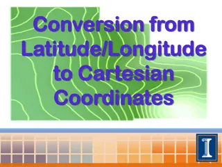
LATITUDE AND LONGITUDE Have you heard of this? What do you think it means? How can we use latitude and longitude?
Geographic coordinates WHAT DO THOSE NUMBERS MEAN?
WHAT DO THOSE NUMBERS MEAN? When we use latitude and longitude, we express it as a series of numbers (with a few letters). BUT WHAT DOES THAT MEAN?!!!
GEOGRAPHIC COORDINATES We call these numbers geographic coordinates and we can express these in a variety of ways Two well known ways: Degrees, minutes, seconds, and decimal degrees Degrees, minutes, seconds
DEGREES, MINUTES, SECONDS Latitude: 26 degrees, 21 minutes, 31 seconds N Longitude: 080 degrees, 04 minutes, 59 seconds W What does this mean in words (how did we move on the surface of the Earth)? We have moved 26 degrees, 21 minutes, and 31 seconds north of the equator We have moved 80 degrees, 04 minutes, and 59 seconds west of the Prime Meridian Does anyone know where this is?
DECIMAL DEGREES Latitude: 26.3586885 Longitude: -80.0830984 This is the SAME location, just listed in decimal degrees. Why are there positive and negative values? Positive latitudes are north of the equator Negative latitudes are south of the equator Positive longitudes are east of Prime meridian Negative longitudes are west of the Prime Meridian
DECIMAL DEGREES VS DEGREES MINUTES SECONDS Manual conversion: Decimal Degrees = Degrees + ((Minutes / 60) + (Seconds / 3600)) Decimal degrees vs degrees minutes seconds
SCIENTIFIC BUOYS A floating device carrying scientific equipment Collects weather or oceanographic data Can be stationary (moored) or passively moving (drifting) NOAA Scientific Buoy
NOAA BUOY OBSERVING SYSTEMS Continuously collected weather and oceanographic data from a world wide network Utilized by scientists to access data needed for experiments Database access
LETS FIND SOME BUOY LOCATIONS! Complete Activity A
OCEAN CURRENTS A continuous movement of water in a predicable direction Currents regulate ocean ecosystems by bringing warm water towards the poles and bringing cold water towards the equator What is the closest current to where you live? Global Currents
WESTERN BOUNDARY CURRENTS Strongest and fastest currents on earth Water in WBCs can move 25 to 75 miles a day! Located on the western side of ocean basins Transport hot water towards the poles The Gulf Stream
BEARING/DIRECTION How many of you have ever used a compass for navigation? Which directions are the cardinal directions? Which directions are the ordinal directions? Cardinal and ordinal directions
BEARING/DIRECTION When we talk about wind, we are talking about two different things Wind direction is the direction the wind is coming from Wind Bearing is the direction the wind is moving an object towards
N:0 or 360 NE NW Range: 337.6 to 22.5 Range: 22.6 to 67.5 Range: 292.6 to 337.5 Range: 247.6 to 292.5 Range: 67.6 to 112.5 W: 270 E: 90 Range: 112.6 to 157.5 Range: 202.6 to 247.5 Range: 157.6 to 202.5 SE SW S: 180
WIND ROSE PLOT A wind rose is a figure that shows the number of times wind has blown in a certain direction at a specific speed The wind blew from the northeast at 2 m/s a total of 25 times during the period The wind blew from the south at 3 m/s a total of almost 15 times during the period
BACK TO BUOYS Meta-data What do you think this means? Data about data How did we get the data? What did we do to the data? (did we process it?) When did we collect the data? What do the variables in our data mean?
LETS MAKE A WIND ROSE PLOT! Activity B
EKMAN TRANSPORT WRAPPER In the northern hemisphere water is deflected to the right of the wind above it This process continues down the water column In the southern hemisphere the water deflection is to the left This is called Ekman transport! Ekman Spiral
UPWELLING A physical oceanographic process Causes primary production (photosynthesis and growth) to increase as microscopic phytoplankton eat the upwelled nutrients Cold, deep, nutrient rich water rises in the water column Ocean surface temperature cools and primary production increases As a result
LETS INVESTIGATE THE CONNECTION OF WIND TO UPWELLING Activity C
UPWELLING WRAPPER Upwelling is driven by wind and Ekman transport As the wind blows south along the California coast surface water is deflected offshore Cold, deep, nutrient water rises to fill the gap, feeding the ocean ecosystem! Upwelling drives many big ocean fisheries and it is all drive by wind! Wind and Upwelling
MODIS: MODERATE RESOLUTION IMAGING SPECTRORADIOMETER MODIS images MODIS satellite covers every point on Earth every 1-2 days Gives us a TON of data! Monitors ice/clouds Surface temperatures of the Earth s land and water Particularly helpful in monitoring changes in the biosphere photosynthetic activity of land and marine plants