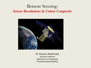
Remote Sensing and Cadastral Survey
 undefined


L4 – SATELLITE AND AERIAL
IMAGES
Cadastral Survey


Satellite Images
Geo-referenced images and digitize features in the
image directly on the screen.
Nowadays, satellite images with a resolution of less
than one meter are possible to obtain in Ethiopia.
If reference points with known coordinates are
obtained, they can be used to determine the
position, scale and rotation of the image compared
to the ground coordinate system.
To calculate this, the reference points must be
possible to identify with high accuracy and
without doubt in the image
Geo-referencing will be done by software such as
ArcGIS.
Using the tools of software, it is then possible to
draw the whole parcels from details that are marked
in the image.
Parcels drawn from images should therefore be
regarded as a helpful tool to collect data, but should
always be followed by a confirmation survey on the
ground such as handheld GPS.
Spatial resolution
Spatial resolution of an imaging system can be
measured in a number of different ways. It is the
size of the smallest object that can be discriminated
by the sensor.
The greater the sensor's resolution, the greater the
data volume and smaller the area covered.
Satellite Image resolutions
Advantage of Satellite Image
Generally the image gives a very good overview
of the survey, making it easy to verify that all
parcels and details in an area are measured.
Making a parcel is easier in satellite image than
with ground survey.
It is easy to detect in the image if e.g. a parcel
border line is slightly bent, and digitize this with
some extra points along the line. This is often missed
in ground surveys, where the bent border is often
only represented by a single line.
Disadvantage of Satellite Images
The image is describing at the time taken
Leads wrong digitizing of parcel borders between
two parcels
Clouds might obscure parts of the image.
High initial cost
Error due to height differences in the image
To
georeference
the image, it is needed to find
details in the image that can be clearly identified in
the field.
Sources of errors
Errors in the geo-referencing
optical errors in the camera used
Errors in surveyed reference points
High precision GPS or total stations are
recommended for the survey of the ground points for
Georef.
In General satellite images are excellent tool to
acquire a general planning map, but confirmation in
the field of each parcel is necessary. It is also
important to check the image accuracy regarding
both the resolution and the orthorectification.
Aerial Images
Aerial photogrammetry involves the use of
photographs taken in a systematic manner from the
air.
They are then controlled by land survey and
measured by photogrammetric techniques.
Accuracies achieved are comparable with those
obtained by land survey and in many cases the
work is carried out more economically.
Advantages of Aerial over Satellite Images
The considerably lower height of the exposures gives a
high resolution, often on decimeter level in the ground
coordinate system.
From a stereo pair of images, a 3D model can be
created from the stereo perspective of the details in the
images. This will automatically give an accurate terrain
model for the rectification. The amount of needed
ground control points is much lower than the terrain
model needed for satellite image rectification.
The use of ground control points for the
photogrammetric calculations will give an accurate
georeference of the images.
Next Time
Lecture 4 Cadastral Maps
Utilizing satellite and aerial images for cadastral surveying in Ethiopia, focusing on georeferencing, spatial resolution, advantages, and disadvantages of satellite images. Learn about overcoming errors and the importance of ground confirmation surveys.

Download Presentation

Please find below an Image/Link to download the presentation.
The content on the website is provided AS IS for your information and personal use only. It may not be sold, licensed, or shared on other websites without obtaining consent from the author.If you encounter any issues during the download, it is possible that the publisher has removed the file from their server.
You are allowed to download the files provided on this website for personal or commercial use, subject to the condition that they are used lawfully. All files are the property of their respective owners.
The content on the website is provided AS IS for your information and personal use only. It may not be sold, licensed, or shared on other websites without obtaining consent from the author.
E N D
Presentation Transcript
L4 SATELLITE AND AERIAL IMAGES Cadastral Survey
Satellite Images Geo-referenced images and digitize features in the image directly on the screen. Nowadays, satellite images with a resolution of less than one meter are possible to obtain in Ethiopia. If reference points with known coordinates are obtained, they can be used to determine the position, scale and rotation of the image compared to the ground coordinate system. To calculate this, the reference points must be possible to identify with high accuracy and without doubt in the image
Geo-referencing will be done by software such as ArcGIS. Using the tools of software, it is then possible to draw the whole parcels from details that are marked in the image. Parcels drawn from images should therefore be regarded as a helpful tool to collect data, but should always be followed by a confirmation survey on the ground such as handheld GPS.
Spatial resolution Spatial resolution of an imaging system can be measured in a number of different ways. It is the size of the smallest object that can be discriminated by the sensor. The greater the sensor's resolution, the greater the data volume and smaller the area covered.
Advantage of Satellite Image Generally the image gives a very good overview of the survey, making it easy to verify that all parcels and details in an area are measured. Making a parcel is easier in satellite image than with ground survey. It is easy to detect in the image if e.g. a parcel border line is slightly bent, and digitize this with some extra points along the line. This is often missed in ground surveys, where the bent border is often only represented by a single line.
Disadvantage of Satellite Images The image is describing at the time taken Leads wrong digitizing of parcel borders between two parcels Clouds might obscure parts of the image. High initial cost Error due to height differences in the image To georeference the image, it is needed to find details in the image that can be clearly identified in the field.
Sources of errors Errors in the geo-referencing optical errors in the camera used Errors in surveyed reference points High precision GPS or total stations are recommended for the survey of the ground points for Georef. In General satellite images are excellent tool to acquire a general planning map, but confirmation in the field of each parcel is necessary. It is also important to check the image accuracy regarding both the resolution and the orthorectification.
Aerial Images Aerial photogrammetry involves the use of photographs taken in a systematic manner from the air. They are then controlled by land survey and measured by photogrammetric techniques. Accuracies achieved are comparable with those obtained by land survey and in many cases the work is carried out more economically.
Advantages of Aerial over Satellite Images The considerably lower height of the exposures gives a high resolution, often on decimeter level in the ground coordinate system. From a stereo pair of images, a 3D model can be created from the stereo perspective of the details in the images. This will automatically give an accurate terrain model for the rectification. The amount of needed ground control points is much lower than the terrain model needed for satellite image rectification. The use of ground control points for the photogrammetric calculations will give an accurate georeference of the images.
Next Time Lecture 4 Cadastral Maps