Plate Tectonics and Boundaries Overview
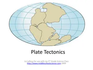
The content discusses various aspects of plate tectonics and boundaries, including the best procedures for assessments, features at convergent and divergent boundaries, the movements of ocean plates relative to islands, identifying plate boundaries on a map, and reasons for the delay in accepting plate tectonics theory. Images and questions related to tectonic activities, such as oceanic ridges, trenches, and plate interactions, are presented to enhance understanding.
Download Presentation

Please find below an Image/Link to download the presentation.
The content on the website is provided AS IS for your information and personal use only. It may not be sold, licensed, or shared on other websites without obtaining consent from the author.If you encounter any issues during the download, it is possible that the publisher has removed the file from their server.
You are allowed to download the files provided on this website for personal or commercial use, subject to the condition that they are used lawfully. All files are the property of their respective owners.
The content on the website is provided AS IS for your information and personal use only. It may not be sold, licensed, or shared on other websites without obtaining consent from the author.
E N D
Presentation Transcript
An Assessment: Think Pair Share Best procedures: read quietly to yourself (so you don t give any subconscious clues) As the instructor, we read it too, for timing, then ask if anyone needs more time If not, it s time to vote simultaneously use your fingers, right in front of your chest so others don t see
The North American continent is 1. a part of a larger tectonic plate that floats on the asthenosphere 2. a part of a larger tectonic plate that floats on top of the oceanic crust 3. a tectonic plate sinking beneath the Pacific plate 4. a tectonic plate that floats next to the Pacific plate 5. composed of at least two tectonic plates
Which features are likely to be found at a convergent boundary formed by two oceanic plates? A. An oceanic ridge B. An oceanic trench C. A series of transform faults D. An island arc Which of these features should be seen at a divergent boundary in the ocean? 1. Just A 2. B and D 3. A and C 4. Just D
This is a topographic map of the Philippines, a country known for volcanic eruptions. Describe the motions of the ocean plates relative to the islands. South China Sea Philippin e Sea 1. Only the Philippine Sea is moving relative to the islands; it s moving right. Only the South China and Celebes Seas are moving; they re moving right. The South China and Celebes Sea are moving left; the Philippine Sea is moving right. The South China and Celebes Sea are moving right; the Philippine Sea is moving left. All three seas are moving left. 2. Celebes Sea 3. 4. 5.
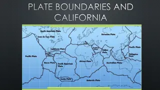
Which points in this diagram mark plate boundaries, and why? A C E D B 1. All of them, because they are changes in elevation due to interactions between the plates B and E, because they are drop-offs from the continental shelves B because it is a trench, and C because it is a ridge C because it is a trench, and E because it is a mountain range C because it is a mountain range, and A because it is a 2. 3. 4. 5.
Broad scientific interest and increasing testing of the theory of plate tectonics waiting until the 1950 s and 1960 s, because A. Discussions regarding continental drift or plate tectonics were very limited most scientists hadn t heard about it. B. Scientists were missing key data about the seafloor. C. There was limited interest in volcanic eruptions and earthquakes before then. D. Ideas about mantle convection currents and seafloor spreading began to get more attention. 1. A and B are true 2. B and D are true 3. A and C are true 4. A, B, and C are true 5. A, B, C, and D are true
What is a scientific theory? A. Theories are educated guesses. B. Theories that are proven become laws. C. Theories have been tested many times. D. Theories never change. E. Theories relate to a narrow set of phenomena. 1. A and B are true 2. C and D are true 3. Only C is true 4. A, B, and E are true 5. C, D, and E are true
