Guide to Ordering and Downloading VIIRS L2 Data Files from NOAA CLASS
Learn how to order and download VIIRS L2 data files from NOAA CLASS. Register with CLASS, search for datasets, select geographic areas and date/time periods, choose VIIRS products, and place your order using step-by-step instructions provided in the guide.
0 views • 14 slides
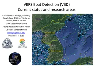
VIIRS Boat Detection (VBD) Research Overview
The Visible Infrared Imaging Radiometer Suite (VIIRS) program, a joint effort between NASA and NOAA, focuses on weather prediction and boat detection using low light imaging data collected at night. The VIIRS system provides global coverage with sensitive instruments and efficient data flow processe
1 views • 13 slides
NASA MODIS and VIIRS Land Surface Temperature and Emissivity Products Overview
Explore NASA's MODIS and VIIRS continuity products for monitoring land surface temperature and emissivity. Learn about MODIS/VIIRS LST&E updates, new VIIRS products, and the MODIS-VIIRS continuity effort. Dive into error dependencies, algorithms, band emissivity, and uncertainty estimates provid
0 views • 43 slides

Assessment of VIIRS Cloud Mask (VCM) Beta Evaluation
Evaluation of the Beta version of the VIIRS Cloud Mask (VCM) highlights that it is minimally validated, potentially containing significant errors. The product is an early release, not suitable for quantitative scientific studies, emphasizing the need for further tuning and evaluation in various aspe
0 views • 7 slides

NPP VIIRS Pre-Launch Performance and SDR Validation Overview
This presentation covers the pre-launch performance evaluation and SDR validation of the NPP VIIRS instrument, highlighting comparisons with MODIS Aqua, spectral and spatial characteristics, radiometric and polarization sensitivities, as well as calibration and validation strategies. It discusses th
0 views • 32 slides
Overview of VIIRS Cloud Properties Products and Requirements
The VIIRS Cloud Properties Products discussion covers beta maturity, product teams, user groups, EDR maturity definitions, and cloud property requirements including base height measurement, cloud cover uncertainties, effective particle size precision, optical thickness, and top height specifications
0 views • 25 slides

VIIRS Land Surface Temperature (LST) Calibration Approach and Data Analysis
The VIIRS Land Surface Temperature (LST) Provisional Status project, led by Dr. Yunyue Yu, focuses on improving the LST EDR through algorithm coefficient updates and calibrations. The calibration process involves regression steps and comparisons with reference datasets like MODIS Aqua LST. Various c
0 views • 29 slides
Diagnosing Low-Topped Precipitation Events Using Satellite Imagery
Utilizing MODIS/VIIRS Night-Time Microphysics RGB Imagery combined with Proximity Soundings can enhance situational awareness and aid in diagnosing low-topped precipitation events. Various satellite images and data sources are analyzed to understand why heavy rain occurred in Havre, MT, despite mini
0 views • 17 slides
Performance Review of STAR's CrIS SDR Calibration and Validation Task
This document provides an overview of the performance review conducted on the CrIS SDR Calibration and Validation Task at the STAR Review Meeting in October 2012. Tasks include managerial and technical leadership, trending and monitoring of instrument data quality, inter-sensor comparisons, measurem
0 views • 24 slides
Advanced Satellite Systems for Environmental Monitoring
The Joint Polar Satellite System (JPSS) utilizes advanced instruments like ATMS, CrIS, VIIRS, OMPS, and CERES to provide crucial data for weather forecasting, ozone monitoring, and Earth radiation studies. The Suomi NPP and JPSS-1 instruments offer high-resolution temperature, water vapor, and image
0 views • 30 slides
Assimilation of NPP VIIRS Aerosol Optical Depth Data in Global Model
Preparation and assimilation of aerosol optical depth data from NPP VIIRS into a global aerosol model, including product descriptions, data requirements, processed observations, and conclusions on VIIRS aerosol products. Details on AOT, APSP, SM classification, and environmental data records are cov
0 views • 19 slides
MODIS/VIIRS Atmosphere Discipline Team Session - May 2023, College Park, MD
The MODIS/VIIRS Atmosphere Discipline Team hosted a session in May 2023 at College Park, MD, focusing on various aspects of atmospheric science. The session included presentations on aerosols, clouds, data access, continuity products, and new science products. Speakers discussed topics such as ambie
0 views • 4 slides
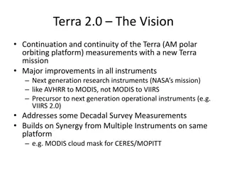
Terra 2.0: Advancements in Earth Observation Instruments and Platforms
Terra 2.0 envisions a new mission continuation focusing on major improvements in research instruments like MODIS 2.0 and VIIRS, with enhanced capabilities for measuring various Earth parameters. The platform enhancements include smaller, lighter designs and multiple platforms for better coverage. Di
0 views • 6 slides
Cryosphere Product Beta Maturity Summary and Comparison
Requests for beta maturity of snow and ice EDRs and IPs were addressed on 14 March 2013 by the Cryosphere Products Validation Team. Criteria for beta justification and validation were outlined for various users in the U.S., including NOAA and NASA. Specific focus was on the VIIRS Ice Surface Tempera
0 views • 23 slides
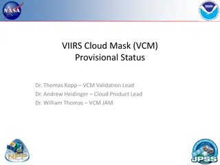
Understanding VIIRS Cloud Mask (VCM) Provisional Status and Requirements
VIIRS Cloud Mask (VCM) is a critical tool for cloud cover determination, used in processing EDRs by classifying pixels as Clear, Cloudy, Probably Clear, or Probably Cloudy. VCM requirements detail criteria like Probability of Correct Typing, Cloud Leakage Rate, and False Alarm Rate. Definitions of t
0 views • 42 slides
MODIS and VIIRS Product Status Overview - May 2023
The MODIS and VIIRS Product Status for May 2023 discusses the current processing status of MODIS and VIIRS data, reprocessing plans, algorithm changes, geolocation updates, and upcoming activities of the science team meetings. Key points include the forward processing status, C7 reprocessing plan, V
0 views • 6 slides