Weather Map Interpretation
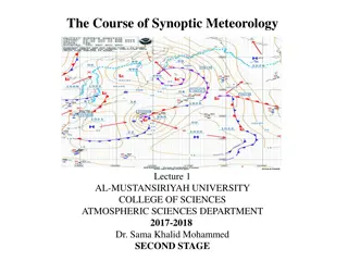
Weather maps provide data on various weather elements at a specific time. They show isobars, wind direction, cloud cover, rainfall, and more. Weather maps differ from synoptic charts which provide additional detailed information. Analyzing weather maps helps predict weather trends.
6 views • 7 slides
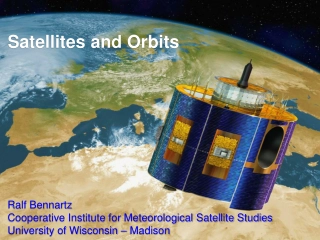
Satellites and Orbits
The realm of satellites and orbits, covering topics such as Kepler's Laws, meteorological satellite orbits, the history of satellite remote sensing, and different types of orbits including geostationary and sun-synchronous orbits. Explore the significance of inclination angles, orbital speeds, and d
3 views • 22 slides
Advancements in Solar-Terrestrial Research and Meteorology
The Solar-Terrestrial Centre of Excellence (STCE) focuses on ongoing activities and opportunities in the field of meteorology, with a special emphasis on Antarctica. Their annual meetings cover topics like water vapor feedback mechanisms, extreme weather events forecasting, cloud and precipitation s
0 views • 14 slides
Environmental Workshop Overview: Ministry of Environment in the Solomon Islands
The Environment and Conservation Division (ECD) of the Ministry of Environment, Climate Change, Disaster Management, and Meteorology in the Solomon Islands focuses on sustainable environmental management, conservation, and protection of natural resources. The ECD's vision is to safeguard the environ
1 views • 15 slides
Understanding Irrigation Scheduling for Optimal Crop Yield
Scientific irrigation scheduling plays a vital role in determining the correct timing and quantity of water application for crops to enhance yields efficiently while preserving soil quality. Various criteria are utilized in irrigation scheduling, such as potential evapotranspiration (PET) estimation
13 views • 58 slides
Understanding Precipitation in Meteorology
Precipitation in meteorology is the result of atmospheric water vapor condensing and falling to Earth, a vital element of hydrology. It can occur in liquid or solid forms through processes like evaporation, cooling, condensation, and droplet growth. Different geographic and climate conditions impact
0 views • 17 slides
Understanding Basic Meteorology Concepts for Air Quality Management
Pollutants circulate in the troposphere following air movement patterns around low-pressure fronts and high-pressure systems. Anticyclones and cyclones play a crucial role in atmospheric stability and pollutant dispersion. The relationship between lapse rates determines air stability and pollutant d
0 views • 24 slides
Restructuring of USACE HEC-HMS Meteorologic Model
Significant modifications have been made to the HEC-HMS meteorologic model to enhance modeling tasks' ease and intuitiveness. The Met Model Restructure updates in versions 4.9 to 4.11 streamline meteorologic processes, introduce new features like automatic linkages and zonal editors for snowmelt, an
0 views • 19 slides
Insights into Agrometeorology: Importance, Applications, and Impact
Agrometeorology serves agriculture by aiding in land use, food production, and resource management. It plays a crucial role in strategic agricultural decisions, such as irrigation schemes, crop selection, and machinery use. Weather forecasts and climate patterns are key for effective planning, espec
0 views • 8 slides
Understanding Physical Climatology and Agrometeorology
Exploring the relationship between physical climatology and agrometeorology, this branch of meteorology delves into the effects of weather and climate on agriculture. Through studying processes occurring from soil depths to atmospheric levels, agricultural meteorologists play a crucial role in ensur
0 views • 8 slides
Exploring the Fascinating World of Clouds
Discover the enchanting formations of clouds, from fluffy Cumulus to ominous Cumulonimbus. Learn about how clouds form, the unique attributes of Fog, Stratus, Nimbostratus, Cumulus, Cumulonimbus, and Cirrus clouds, and their impact on weather patterns. This informative presentation provides insight
0 views • 9 slides
Forces Affecting Air Movement: Pressure Gradient Force and Coriolis Force
The pressure gradient force (PGF) causes air to move from high pressure to low pressure, with characteristics including direction from high to low, perpendicular to isobars, and strength proportional to isobar spacing. The Coriolis force influences wind direction due to the Earth's rotation, making
0 views • 20 slides
Experimental Lightning Flash Prediction Based on Real-Time Forecast
This PowerPoint presentation provides real-time experimental lightning flash prediction based on initial conditions data from GFS and WRF models. The forecast covers Day 1 and Day 2 with detailed insights on 24-hour accumulated total lightning flash counts and 3-hourly accumulated total lightning fl
0 views • 8 slides
Understanding Atmospheric Thickness and Its Applications
Atmospheric thickness refers to the difference in geopotential height between two pressure surfaces, which is dependent on the mean virtual temperature of the layer in between. This concept plays a key role in determining temperature gradients, identifying fronts, and aiding in weather forecasting,
0 views • 11 slides
Real-Time Experimental Lightning Flash Prediction and Analysis
Cutting-edge real-time lightning flash prediction model output for Day1 with 24-hour accumulated total lightning flash counts and 3-hourly accumulated total lightning flash counts overlaid with max reflectivity data. Stay tuned for Day2 forecast updates. Prepared by experts at the Indian Institute o
0 views • 8 slides
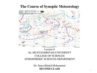
Understanding Synoptic Meteorology: A Comprehensive Overview
Synoptic meteorology delves into various aspects of atmospheric sciences, encompassing scales of atmospheric motion, weather maps, air masses, fronts, jet streams, and more. Through the study of synoptic meteorology, meteorologists gain insights into interpreting the state of the troposphere and for
1 views • 17 slides
Real-time Experimental Lightning Flash Prediction Report
This Real-time Experimental Lightning Flash Prediction Report presents a detailed analysis of lightning flash forecasts based on initial conditions. Prepared by a team at the Indian Institute of Tropical Meteorology, Ministry of Earth Sciences, India, the report includes data on accumulated total li
0 views • 6 slides
Real-time Lightning Flash Prediction Research Update
Experimental lightning flash prediction based on initial conditions for Day 1, including total lightning flash counts and hourly accumulated data with maximum reflectivity overlays. Day 2 forecast updates coming soon. Prepared by the Indian Institute of Tropical Meteorology.
0 views • 8 slides
Experimental Lightning Flash Prediction Report
Real-time lightning flash prediction report based on initial conditions. Prepared by a team at the Indian Institute of Tropical Meteorology, Ministry of Earth Sciences, India. Includes 24-hour accumulated total lightning flash counts data for Day1, along with 3-hourly accumulated total lightning fla
0 views • 6 slides
SERCOM-3 Gender Action Plan History and Evolution
The Gender Action Plan within the World Meteorological Organization (WMO) has evolved over the years to promote gender equality in meteorology, hydrology, and related sciences. Initially formulated in 2007, it was revised in 2015 and updated in subsequent years to include activities such as promotin
0 views • 6 slides
International Baccalaureate British Section Language and Literature Exam Details
This detailed guide outlines the structure and content of the International Baccalaureate British Section Language and Literature Exam. It covers the choice of works, written exam requirements, oral exam format, and synoptic topic discussion. Students will find information on the types of texts, ess
0 views • 11 slides
Alumni of the Month Ryan Lueck - Graduate Student Spotlight
Ryan Lueck, Alumni of the Month, shares his journey from undergraduate studies in meteorology to graduate school focusing on upward lightning phenomena. He provides insights into his experience in graduate school, his research on lightning, and offers valuable advice for those interested in pursuing
1 views • 5 slides
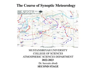
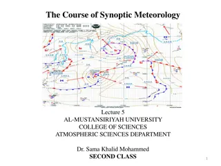
Exploring the Fundamentals of Synoptic Meteorology at Mustansiriya University
Dive into the course of Synoptic Meteorology offered at Mustansiriya University with topics covering atmospheric motion scales, weather maps, air masses, fronts, and jet streams. Learn how to analyze and interpret weather data through the study of high and low-pressure systems, jet streams, and more
0 views • 17 slides
Understanding Synoptic Meteorology: Fronts and Weather Phenomena
Fronts are boundary surfaces that separate air masses of different densities, leading to various meteorological phenomena. Cold fronts, warm fronts, occluded fronts, and stationary fronts impact weather patterns differently, affecting temperature, moisture levels, and wind direction. Understanding t
0 views • 22 slides
EUREC4A UK CMO Forecasting Initiative: Weather Forecast Details
Detailed weather forecast information for the Caribbean region provided by the EUREC4A UK CMO Forecasting Initiative. The forecast covers various parameters including surface analysis, synoptic charts, moisture content, wind speeds at different levels, sea conditions, and more. Updates on winds, hum
0 views • 10 slides
Understanding Model Evaluation in Meteorology
Model evaluation in meteorology involves verifying, hypothesizing, proving, and improving models through a systematic process. Factors such as error analysis, grid spacing, model resolution, domain size, computational errors, chaotic equations, and initial condition errors play critical roles in ass
0 views • 17 slides
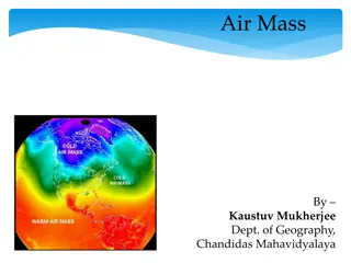
Understanding Air Masses in Meteorology
Air masses play a significant role in meteorology, covering vast areas with uniform physical properties. They are classified based on temperature, moisture content, and source regions, which can be continental or maritime. Air masses form in regions with little wind and can sit over an area for an e
0 views • 27 slides
Insights into Meteorology and Warning Systems at Iowa State University
Discover the journey of Daryl Herzmann, a meteorology expert from Iowa State University, as he shares his experiences working with NWS and creating tools like NWSChat. Explore the concept of "Dog and Pony Show," his achievements, and the purpose of his maps in understanding weather gradients.
0 views • 66 slides
Cadence for Supernovae in LSST and Dark Energy Hubble Diagrams
This content discusses the cadence for supernovae observations in the Large Synoptic Survey Telescope (LSST) and presents Hubble diagrams related to Supernovae and Dark Energy research. The images and descriptions focus on cosmological aspects, distance moduli, observational strategies, and constrai
0 views • 21 slides
Evolution and Challenges in Cloud Resolving NWP Models
Explore the evolution and challenges faced in cloud-resolving Numerical Weather Prediction (NWP) models over the past 50 years. Discover key milestones, such as the development of climate models and data assimilation systems, alongside persistent issues in predicting warm season phenomena and tropic
0 views • 45 slides
Overview of 2014 NCEP Production Suite Review on Global Modeling
The 2014 NCEP Production Suite Review highlighted the significant implementation of the 13 km Global Forecast System (GFS). This major update involved substantial enhancements in resolution, observations, analysis, and physics, impacting various NCEP models and centers. The improved 13 km GFS brough
0 views • 20 slides
Understanding Frontogenesis and Frontolysis in Meteorology
Meteorology enthusiasts can explore the concepts of frontogenesis and frontolysis, the evolution of cyclones, and the role of the Norwegian School Meteorologists in describing fronts. Dive into the mechanisms behind the formation and weakening of horizontal temperature gradients, the interaction bet
0 views • 60 slides
Understanding Atmospheric Stability and Lapse Rates in Meteorology
Explore the concepts of lapse rates, stability determination, adiabatic processes, and cloud formation in meteorology. Learn how to calculate lapse rates, assess atmospheric stability, and predict cloud formation conditions based on temperature changes with altitude. Dive into real-world examples an
0 views • 13 slides
Understanding Pressure Surfaces and Environmental Lapse Rates in Meteorology
This content discusses how pressure surfaces slope from low to high latitudes due to temperature changes, calculating the slope of pressure surfaces at different latitudes, determining wind speed based on slope, computing environmental lapse rates, and analyzing stability using dry and moist adiabat
0 views • 12 slides
Radiosonde Technology and Upper Atmosphere Measurements in Meteorology
Upper atmosphere measurements above the surface are crucial for forecasting and research in meteorology. Radiosondes, carried by balloons, provide data on pressure, temperature, humidity, wind speed, and direction. These measurements are vital for analyses and research, especially in emergency situa
0 views • 19 slides
Assessing WRF EMS for Texas Heavy Rainfall Event
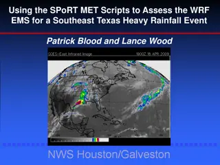
Using the SPoRT MET Scripts, researchers analyzed the WRF EMS for a heavy rainfall event in Southeast Texas. The study emphasized the importance of selecting appropriate PBL and Microphysics settings for accurate assessment. Various synoptic overviews and weather data from April 18th, 2009 were used
0 views • 26 slides
Understanding Air Masses in Synoptic Meteorology
Air masses are large bodies of air with uniform temperature and moisture conditions, influencing weather patterns across vast regions. Source regions play a key role in determining the characteristics of air masses, with factors such as stability of atmospheric circulation and surface properties sha
1 views • 17 slides
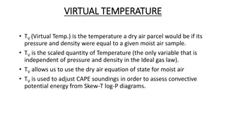
Understanding Virtual Temperature in Meteorology
Virtual temperature (TV) is a crucial concept in meteorology, representing the temperature a dry air parcel would have under specific conditions. It allows for adjustments in convective potential energy assessments and is essential for interpreting Skew-T log-P diagrams. When calculated accurately,
0 views • 4 slides
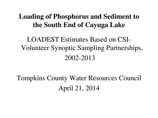
Estimation Methodology for Phosphorus and Sediment Loading in Cayuga Lake Watershed
Explore the process of estimating phosphorus and sediment loading at the south end of Cayuga Lake using LOADEST methodology. Learn how to combine synoptic monitoring data with USGS flow measurements and run calculations to obtain yearly load numbers. Get step-by-step instructions and access helpful
0 views • 13 slides
Weather Forecast Details for Madagascar
Satellite images, synoptic charts, analysis, wind patterns, and precipitation forecasts for Madagascar show a generally calm weather scenario with light winds and few showers expected over the northern part in the upcoming days. The western coast may experience warmer temperatures. No extreme weathe
0 views • 12 slides

