Exploring Surface Tension and Wettability in Nature
Discover the fascinating world of surface tension and wettability through engaging experiments and observations, from water cohesion on a penny to the microscopic structures on lotus leaves. Delve into the role of cohesion and adhesion, surface wettability factors, and everyday applications of these
2 views • 17 slides
Understanding Surfaces and Interfacial Energy in Chemistry
Surfaces play a crucial role in free energy and dissolution processes, impacting surface tension and interfacial energy. Learn about the adsorption of molecules, surface excess properties, and the contributions of surface area and curvature to surface energy. Dive into concepts such as Laplace's equ
6 views • 71 slides
Understanding Cadastral Systems in Land Management
Cadastral systems play a crucial role in land management by handling land registration, property taxation, and land tenure. These systems involve private conveyancing, registration of deeds, cadastral surveying, and mapping to maintain records efficiently. They provide information on parcel index ma
1 views • 16 slides
Evolution of Land Law Systems in Trinidad and Tobago
Trinidad and Tobago's land law systems consist of the Common Law System and the Registered Land System. The Common Law system governs unregistered land where title passes upon execution and delivery of the deed. In contrast, the Registered Land System confers ownership upon registration and offers c
0 views • 28 slides
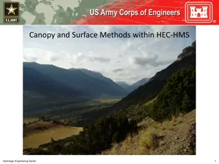
Understanding Canopy and Surface Methods in HEC-HMS
Explore the various canopy and surface methods utilized in HEC-HMS for managing water resources. Learn about canopy interception, evapotranspiration, common parameter values, and factors affecting losses. Delve into available methods, canopy storage values, and surface depression storage. Enhance yo
0 views • 12 slides
Understanding Runoff in Surface Water Systems
Runoff, the flow of precipitation and other contributions in surface streams, plays a crucial role in watershed systems. It encompasses various sources such as surface runoff, interflow, and base flow. Surface runoff, which travels over the ground surface to channels, is influenced by factors like s
1 views • 27 slides
Understanding Land, Soil, and Water Resources
Natural resources such as land, soil, and water are crucial for human activities. Land comprises the lithosphere and is utilized for various purposes based on land use patterns. The study of land use patterns is essential for economic planning, as the availability of land is limited, leading to conf
5 views • 25 slides
Understanding Ocean Currents and Effects
Ocean currents play a crucial role in the movement of water across the Earth's surface. Wind-driven surface currents, influenced by the Coriolis effect, move water horizontally and impact climate patterns worldwide. Major currents extend deep below the surface and can move rapidly, while rip current
0 views • 14 slides
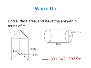
Exploring Surface Area in Mathematics
Delve into the concept of surface area as an essential mathematical topic, understanding its significance in everyday life and its application in various 3D shapes. Learn how to calculate surface area for different space figures like prisms and pyramids through step-by-step methods. Engage with esse
6 views • 21 slides
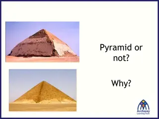
Exploring Pyramid Geometry for Surface Area Calculations
Delve into the concept of surface area calculations for pyramids, ranging from identifying fake pyramids to determining the surface area of iconic structures like the Great Pyramid. Learn about the essential information needed, such as base length and slant height, to derive accurate measurements. D
0 views • 32 slides
Challenges in Land Allocation and Administration by Traditional Authorities and Communal Land Boards
The Communal Land Reform Act of 2002 introduced Communal Land Boards to assist Traditional Authorities in land administration. However, challenges such as misconceptions of powers, limited technical capacity, inadequate resources, and unclear procedures have hindered smooth registration and resoluti
0 views • 15 slides
Update Reports: Baroka Ba Nkwana, Bakoni-Ba-Mmamaro CPA, and Enquiry from Mr. C. Mathebe Presentation to the Portfolio Committee on Agriculture, Land Reform, and Rural Development
This report provides updates to the Portfolio Committee on Agriculture, Land Reform, and Rural Development regarding Mr. Collen Mathebe's matter, Bakoni-Ba-Mmamaro CPA, and Baroka Ba Nkwana Land Claim. Mr. Mathebe's issue cannot be resolved through the Land Title Adjustment Act, and alternative opti
0 views • 38 slides
Land Governance in Malawi: Challenges and Progress
Malawi's land governance system has evolved significantly since the colonial era, with a framework that includes institutional and legal aspects. The country has faced challenges in managing land disputes, valuation, taxation, and public land use. The institutional setup involves the central governm
0 views • 23 slides
Understanding Surface Tension in Physical Pharmacy Lab
Surface tension is a crucial concept in physical pharmacy lab dealing with gas-solid or gas-liquid interfaces. It refers to the force per unit length required to balance the inward pull on the surface. Interfacial tension, cohesive forces, and adhesive forces play significant roles in determining su
0 views • 16 slides
Land Governance Framework in Botswana: A Country Scoping Study
Botswana, a landlocked middle-income country in Southern Africa, faces challenges such as high population growth, unemployment, poverty, and a less skilled workforce. This study examines the land governance framework in Botswana, focusing on key challenges in land administration, dispute resolution,
0 views • 15 slides
Implications of Land Reform in Namibia: Social and Economic Insight
Land reform in Namibia is crucial for inclusive growth and shared prosperity, with access to land being a key factor. Productive land usage can lead to wealth creation and social development. The importance of agriculture in the economy is highlighted, along with the need for skilled farmers and a s
0 views • 7 slides
Enhancing Land Degradation Neutrality Targets in Lebanon's National Action Programme
Integrating LDN targets into Lebanon's National Action Programme, led by Dr. Chadi Mohanna, aims to align the NAP with the UNCCD's 10-Year Strategy, set national targets for Land Degradation Neutrality, and implement measures to combat land degradation aggravated by climate change. The project focus
0 views • 23 slides
Understanding Near-Surface Sea Temperature Development in NCEP GFS/CFS
This informative piece delves into the evolution of Near-Surface Sea Temperature (NSST) within the NCEP GFS/CFS, discussing its significance in Numerical Weather Prediction (NWP) systems, the utilization of sea surface temperature (SST), and the T-profile near the sea surface. It covers the role of
0 views • 28 slides
Understanding Atmosphere-Ocean Coupling in Madden-Julian Oscillation
Atmosphere-ocean coupled processes in the Madden-Julian Oscillation (MJO) play a crucial role in intraseasonal oscillations. This paper review by Shao Yun-Chuan explores how the ocean's Sea Surface Temperature (SST) influences surface fluxes, MJO convection, and energy balance dynamics. It delves in
0 views • 17 slides
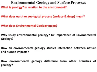
Understanding Environmental Geology and Surface Processes
Geology in relation to the environment involves studying Earth's geological processes, both surface and deep, and their impacts on nature and human activities. Environmental geology focuses on the interaction between humans and the Earth's near-surface environment, addressing hazards like erosion, f
0 views • 71 slides
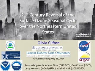
Surface Ozone Seasonal Cycle Reversal Study in Northeastern United States Lower Manhattan
Study on the reversal of the surface ozone seasonal cycle over Northeastern United States Lower Manhattan, analyzing the impact of NOx and VOC emissions on Surface O3 levels. Research shows a 26% decrease in regional NOx emissions leading to changes in the seasonal cycle of surface ozone concentrati
0 views • 24 slides
Understanding Surface Tension in Physical Pharmacy Lab
Surface tension is a critical aspect in physical pharmacy lab experiments, involving the study of forces at gas-solid or gas-liquid interfaces. It is the force per unit length required to counterbalance the net inward pull on a surface. The concept extends to interfacial tension, cohesive and adhesi
0 views • 21 slides
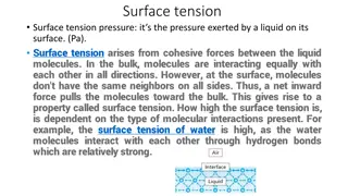
Understanding Surface Tension: Properties, Measurement Methods, and Calculations
Surface tension is the pressure exerted by a liquid on its surface due to cohesive forces among molecules. The measurement methods include the liquid rise in a capillary tube technique, drop weight method, and bubble pressure method. The surface tension coefficient can be calculated using the equati
0 views • 12 slides
Overview of the Mizoram Land Revenue Act, 2013
The Mizoram Land Revenue Act, 2013 replaced several previous regulations and came into effect on June 1, 2013. It establishes authorities for land management, outlines control and powers over land, and provides guidelines for land allotment for specific purposes. The Act designates the Government of
0 views • 18 slides
Update on Northeast Land Transfers: Presentation to Roundtable Members
Ministry of Indigenous Relations and Reconciliation provided an update on land transfers in Northeastern British Columbia, focusing on Treaty Land Entitlement, stakeholder engagement, and communication methods. The presentation highlighted the historical land debt, final settlement agreements, and t
0 views • 8 slides
VIIRS Land Surface Temperature (LST) Calibration Approach and Data Analysis
The VIIRS Land Surface Temperature (LST) Provisional Status project, led by Dr. Yunyue Yu, focuses on improving the LST EDR through algorithm coefficient updates and calibrations. The calibration process involves regression steps and comparisons with reference datasets like MODIS Aqua LST. Various c
0 views • 29 slides
Land Reform in the Context of Devolution in Kenya
Kenya, with a land area of 582,646 sq. Km, has undergone land reform in the context of devolution since gaining independence in 1963. The country's adoption of the Constitution in 2010 led to the establishment of a system with 1 national government and 47 devolved governments. Kajiado County, inhabi
0 views • 33 slides
Importance of Land Records in Preventing Land Disputes
Land records play a crucial role in documenting ownership, facilitating land-related transactions, and preventing costly litigation. They serve as a lifeline for effective governance and provide legal status to landowners, ensuring clarity and transparency in land ownership. Without proper land reco
0 views • 15 slides
Impact of Land Policies in Georgia: Headright System, Land Lotteries, and Yazoo Land Fraud
Georgia pursued various land policies post-Revolutionary War to allocate land obtained from Native Americans. The headright system granted land to soldiers and white men, aiming to boost population and state power. Land lotteries distributed land through random draws. The Yazoo land fraud scandal ta
0 views • 20 slides
5 Steps Questionnaire on Mapping Land Degradation and Sustainable Land Management
Preparation for mapping land degradation and sustainable land management involves steps such as preparing the base map, identifying contributing specialists, assessing land use systems, understanding land degradation types, and providing expert recommendations. The process includes analyzing area tr
0 views • 32 slides
Understanding Surface Chemistry and Adsorption Phenomena
Surface chemistry is a crucial branch of chemistry that focuses on the chemical processes occurring at interfaces between different surfaces like solid-liquid, solid-gas, and liquid-gas. This field plays a significant role in various industries, including electronics. Adsorption, absorption, and sor
0 views • 15 slides
Understanding Surface Chemistry and Adsorption Phenomenon
Surface chemistry explores the interactions that occur at surfaces and interfaces, with adsorption being a key phenomenon. Adsorption involves the concentration of molecules on a surface, with adsorbents and adsorbates playing crucial roles. Desorption, the opposite process, removes adsorbed substan
1 views • 21 slides
Establishment of GCOS Surface Reference Network (GSRN) Pilot Phase
The establishment of the GCOS Surface Reference Network (GSRN) Pilot Phase aims to improve the accuracy, stability, and comparability of surface observations for Essential Climate Variables (ECVs). The GSRN will serve as the reference network for surface observations, providing data traceability and
0 views • 7 slides
Changes in Viscose Fabric Surface Morphology Due to Sunlight Exposure
This study explores the impact of sunlight exposure on the surface morphology of viscose fabrics. Direct exposure to sunlight for 120 days during summer showed significant changes in fiber surface depressions. The observed damage in mechanical properties correlated with alterations in surface morpho
0 views • 11 slides
Ashumet Park Common Land Project Overview
The Ashumet Park Common Land Project aims to transform Lot 8 into a multi-use community area in Ashumet Valley. The project includes three phases: Land Survey, Land Clearing, and Grass Installation. Phase 1 involved conducting a land survey, while Phase 2 focused on land clearing by removing trees a
0 views • 7 slides
Mathematical Insights into Surface Plasmon Polaritons
This mathematical explanation delves into the intricacies of surface plasmon polaritons, covering Maxwell's equations, wavenumbers, bulk and surface plasmon-polariton formulations, medium considerations, excitation conditions, losses, and matching examples with air, gold, and sapphire prisms. Detail
0 views • 13 slides
Satellite Applications in Estimating Earth's Surface Energy Budget
Satellites play a crucial role in estimating the Surface Energy Budget (SEB) by providing data on various components such as Surface Radiation Budget and Surface Turbulent Fluxes. The SEB includes factors like net radiation flux, sensible and latent heat fluxes, and subsurface heat transfer. Satelli
0 views • 38 slides
Geometry Concepts for Surface Area Calculations
Explore various geometric shapes such as pyramids and cones to calculate surface area. Learn the differences between prisms and pyramids, understand the importance of altitude and slant height in pyramids, and differentiate between lateral and surface areas. Practice finding lateral and surface area
0 views • 16 slides
Surface-to-Surface Radiation Verification and Boundary Detection in COMSOL
Explore the verification of surface-to-surface radiation setups in COMSOL, detecting incorrect radiation configurations with nonradiating boundaries. Learn how to identify and resolve nonradiating boundaries, ensuring accurate and effective radiation simulations. Discover the importance of selecting
0 views • 10 slides
Native Land Stewardship: Path to Climate Equity
Stephanie Leon-Rodriguez presents a proposal focused on promoting land back initiatives, including federal support programs like the Land Buy-Back Program for Tribal Nations and conservation easements. State support through initiatives like the Mass Conservation Land Tax Credit Program is also highl
0 views • 13 slides


