ARGOS Inventory by Fund Queries Presentation Slides
The presentation slides showcase the ARGOS Inventory by Fund Queries project, featuring detailed information and visuals to help understand the queries and data analysis process. The slides provide insights into inventory management methods based on different funds, highlighting key aspects of the A
2 views • 14 slides
Geospatial Knowledge: Shaping the Future of Digital Society
Exploring the pivotal role of geospatial knowledge in tomorrow's global digital society, the Geospatial Knowledge Infrastructure (GKI) Project aims to advance the integration of digital economies, societies, and citizens through location-based services and technologies. With a focus on stakeholder e
1 views • 23 slides
Overview of AFRIGIST's Capacity Building Activities
AFRIGIST, the African Regional Institute for Geospatial Information Science and Technology, aims to provide quality training and education in geospatial science to enhance sustainable development in Africa. Established under the United Nations Economic Commission for Africa, AFRIGIST focuses on deve
1 views • 20 slides
Temporal Data Management in TSQL Queries
Explore the realm of temporal data in TSQL queries, delving into the concepts of valid time and transaction time, different types of relations like snapshot and bi-temporal, and the significance of time dimensions in database management. Learn how temporal databases support time-related queries for
6 views • 41 slides
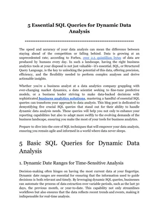
5 Essential SQL Queries for Dynamic Data Analysis
Explore the transformative power of SQL with our latest guide, which highlights five critical SQL queries essential for dynamic data analysis. This post covers how these queries can be utilized by business analytics tools to enable data analysts, scientists, and BI professionals to extract actionabl
6 views • 8 slides
Knowledge Graph and Corpus Driven Segmentation for Entity-Seeking Queries
This study discusses the challenges in processing entity-seeking queries, the importance of corpus in complementing knowledge graphs, and the methodology of segmentation for accurate answer inference. The research aims to bridge the gap between structured knowledge graphs and unstructured queries li
0 views • 24 slides
Performance of Nearest Neighbor Queries in R-trees
Spatial data management research focuses on designing robust spatial data structures, inventing new models, constructing query languages, and optimizing query processing. This study explores the estimation of query performance and selectivity, specifically in R-trees, for efficient access planning.
3 views • 32 slides
Evolution of ASPRS Positional Accuracy Standards for Geospatial Data
New technological advancements have prompted the need for updated ASPRS positional accuracy standards for digital geospatial data. Legacy standards from the 1990s are no longer sufficient given the shift towards modern mapping technologies. The new era of mapping involves factors like camera calibra
0 views • 21 slides
Geospatial Technology Services at University of Edinburgh
The University of Edinburgh, through its Information Services, specializes in developing and delivering projects involving geospatial technology. They offer the Digimap Service, providing online access to maps and geospatial data. The university subscribes to the Eduserv Chest Agreement for Esri pro
1 views • 29 slides
International Hydrographic Organization Report Summary
The report highlights the activities and achievements of the NATO Geospatial Maritime Working Group (GMWG) in 2018/19, focusing on providing maritime geospatial standards, governance, production support, and operational information. It discusses the progress and key outcomes of the NATO AML Co-Produ
0 views • 13 slides
The Differences Between Web Queries and WRDS-Cloud Queries
Explore the distinctions between web queries and WRDS-Cloud queries, such as the tools used, query limitations, and knowledge requirements. Learn how to access support for WRDS Cloud and enhance your data research skills.
1 views • 5 slides
Exploring the Power of Wise Queries in Statistical Learning
Dive into the world of statistical learning with a focus on the impact of wise queries. Discover how statistical problems are approached, the significance of statistical queries, and the comparisons between wise and unary queries. Explore the implications for PAC learning and uncover key insights in
2 views • 8 slides
National Geospatial Information Management Strategy Action Plan Update
The National Geospatial Information Management Strategy Action Plan Update outlines five strategic goals focusing on governance, data, access, interoperability, and development. Under each goal, multiple action points are detailed, including reviewing council roles, updating legislation, coordinatin
4 views • 13 slides
Empowering Women in Geospatial Information: A Look at Fiji and the Pacific
Explore the impactful role of women in geospatial information management in Fiji and the Pacific region through the leadership, achievements, and future prospects highlighted in the article. From Meizyanne Hicks leading the way to the significant contributions by women in the geospatial industry, th
0 views • 6 slides
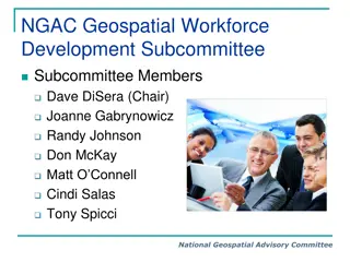
NGAC Geospatial Workforce Development Subcommittee Activities Overview
The NGAC Geospatial Workforce Development Subcommittee's purpose is to provide recommendations for developing a skilled geospatial workforce. The subcommittee members are actively involved in various activities such as examining STEM education synergies, reviewing federal job classification codes, a
0 views • 12 slides
Geospatial Database Development for KRISHI Portal: Nodal Officers Workshop
Geospatial databases play a crucial role in providing location-specific agricultural services through the KRISHI Portal. This workshop focuses on the core objective of the portal, simple GeoPortal architecture, main services offered, the significance of geospatial data, and the utilization of spatia
0 views • 45 slides
SQL Queries and Joins in Database Applications Lecture
Discover a comprehensive overview of SQL queries, including nested and deeply nested queries, in the context of database applications. Learn about joining tables, finding sailors who reserved specific boats, handling NULL values, and more in this informative lecture featuring examples and explanatio
0 views • 53 slides
SQL Part II Lecture Summary: Nested Queries, Joins, and Updates for Database Applications
In this SQL lecture, Mohammad Hammoud covers nested queries, insertion, deletion, updates, handling NULL values, join variants, and advanced query techniques. Examples include finding sailors who have reserved specific boats, using nested queries to filter data, and deep nested queries for complex d
0 views • 53 slides
Evolution of Geospatial Governance in the United States
Geospatial governance in the United States has evolved over the years, with key milestones such as the establishment of the Geographic Board, the National Spatial Data Infrastructure, and the role of Federal agencies in surveying and mapping activities. Significant reports have highlighted the need
1 views • 11 slides
Geospatial Portfolio Management and NGDA Themes Overview
Explore the roles and responsibilities of Theme Leads, Dataset Managers, and the Investment Collaboration Process in Geospatial Portfolio Management. Understand the significance of National Geospatial Data Assets (NGDA) Themes, Theme Lead Agency roles, and the proposed NGDA Themes for effective port
0 views • 17 slides
k-Ary Search on Modern Processors
The presentation discusses the importance of searching operations in computer science, focusing on different types of searches such as point queries, nearest-neighbor key queries, and range queries. It explores search algorithms including linear search, hash-based search, tree-based search, and sort
0 views • 18 slides
UN-GGIM Private Sector Network: Enhancing Global Geospatial Initiatives
The UN-GGIM Private Sector Network (PSN) serves as a platform for private sector collaboration with Member States on geospatial initiatives. The PSN aims to enhance the world's geospatial capabilities, support policy development, and address global challenges. It operates independently while alignin
0 views • 17 slides
Geospatial Private Sector in Africa: Opportunities and Challenges
The geospatial private sector in Africa faces challenges due to its small and disjointed nature, with a focus mainly on multinational corporations. Initiatives like UN-GGIM are encouraging private sector participation at national and continental levels. Efforts are being made to include the private
0 views • 6 slides
Geospatial and Statistical Data Integration in Rwanda: A Closer Look at RCMRD's Role
Explore the evolution of geospatial and statistical data integration in Rwanda, focusing on the initiatives led by Dr. Emmanuel Nkurunziza, General Director of RCMRD. Discover how advancements in geospatial technologies and statistical systems are shaping sustainable development in the region.
0 views • 14 slides
Cloud-based Geospatial Query Processing Using MapReduce and Voronoi Diagrams
This research paper presents a cloud-based approach for processing geospatial queries efficiently using MapReduce and Voronoi diagrams. The motivation behind the study, related works in the field, preliminary concepts of MapReduce, Voronoi diagram creation, query types, performance evaluation, and f
0 views • 30 slides
Recent Developments in Marine Geospatial Information Management
The Baltic Sea Hydrographic Commission and related activities highlight significant developments in marine geospatial information management, including upcoming council meetings, GEBCO initiatives, and UN-GGIM endorsements of integrated marine geospatial frameworks. These efforts aim to enhance data
4 views • 8 slides
Metadata Cleansing Using SPARQL Update Queries
Learn how to transform and cleanse RDF metadata using SPARQL Update queries to conform to the ADMS-AP for Joinup. This tutorial provides essential knowledge on converting metadata for interoperability solutions and the main queries involved. Discover how to ensure your metadata is compliant and read
0 views • 37 slides
Advanced Techniques for Orthogonal Skyline Counting Queries
Advanced techniques for orthogonal skyline counting queries discuss optimal planar solutions, dividing and conquering for topmost point identification, efficient vertical slab counting, succinct data structures for prefix sums and range maxima, upper bounds on degree and multi-slab queries, as well
0 views • 11 slides
Development of UN-IGIF Action Plan in Cameroon: Addressing Geospatial Data Governance Challenges
The journey of developing a UN-IGIF Action Plan at the country level in Cameroon begins with identifying stakeholders and common strategic priorities, mobilizing support, setting up project teams, drafting action plans, and organizing workshops. The lack of coordination among geospatial information
0 views • 4 slides
Efficient Network Traffic Queries Handling Strategies
Solve network traffic queries efficiently by ensuring constant memory updates and minimal memory access. Implement strategies such as managing multiple data structures for various query types and coordinating queries to optimize packet processing. Explore the coupon collector problem to enhance quer
0 views • 26 slides
Optimizing Queries and Constructing Percentage Cube in Business Intelligence
Presented at ENSMA, this paper introduces optimized strategies for constructing a percentage cube to enhance processing of complex queries in modern business intelligence. It discusses challenges, comparison between percentage queries and percentage cube, and showcases a data cube analysis of car sa
0 views • 21 slides
Unified Framework for Efficient Ranking-Related Queries Processing
The research paper discusses a unified framework focusing on efficiently processing ranking-related queries. It covers dual mapping and ranking, k-lower envelope usage in ranking, top-k queries solutions, and applications like identifying user preferences. The study showcases algorithms, experimenta
0 views • 22 slides
Northern Utah GIS Workforce Survey 2014 Results Overview
The Northern Utah GIS Workforce Needs Survey Results for 2014 provide insights into the demographics, industry experience, survey respondents by county in Utah, and educational requirements for GIS/geospatial technicians. The survey highlights the distribution of position titles, length of experienc
1 views • 26 slides
Jena SPARQL for Mac and RDF Queries
Jena SPARQL for Mac is a powerful tool for querying RDF graphs using SPARQL. Learn about RDF graphs, models, triples, and how SPARQL queries work. Explore ARQ, a query engine that supports the SPARQL RDF Query language and features multiple query languages. Discover how to install ARQ and execute SP
0 views • 25 slides
Enhanced Parcel Queries in Kansas by Kristen Jordan
Project aims to provide expanded tools and services for statewide parcel queries in Kansas. Background includes the Kansas Data Access and Support Center's existing project and the implementation of a REST web service. Specific goals involve accessing services through desktop and web applications, p
0 views • 20 slides
Recent Developments in Geospatial Information Management in the Asia-Pacific Region
Key events include the Executive Board Meeting in Singapore, the 11th Plenary Meeting in India, Fourth Ministerial Conference on Space Applications in Indonesia, workshops on geospatial information sharing, and UN-GGIM-AP's contribution to the global geodesy agenda. Activities such as elections, wor
0 views • 9 slides
Weak Visibility Queries of Line Segments in Simple Polygons - Overview
This information discusses weak visibility queries of line segments in simple polygons, focusing on topics such as visibility of line segments, visibility polygons, visibility graphs, and related previous work on preprocessing and data structures for visibility queries in simple polygons.
0 views • 26 slides
Investigating Anomalous DNS Queries: A Case Study from DNS-OARC 25, Dallas
The exploration uncovers a surge in AAAA queries, leading to a 20% spike in billing. Through meticulous analysis, patterns emerged showing excessive AAAA queries for specific nameservers lacking AAAA glue. Remedies included reaching out to providers and deploying temporary fixes. The resolution invo
0 views • 13 slides
Probabilistic Query Answering and Group Nearest Neighbor Queries
This chapter delves into probabilistic query types, focusing on probabilistic group nearest neighbor queries. Explore the definitions, processing techniques, and applications of such queries. Learn how probabilistic data management plays a crucial role in uncertain databases, spatial queries, and mo
0 views • 34 slides
Assessment of Geospatial Data Readiness for SDG Monitoring in African Countries
Quick assessment conducted during the workshop in Addis Ababa, Ethiopia, revealed the utilization of geospatial data for national and regional planning among African countries. Findings indicate the availability of fundamental geospatial datasets, highlighting the importance of incorporating geoinfo
0 views • 18 slides

