
Geology of Ogun State, Nigeria: Insights and Implications
The geology of Ogun State in southwestern Nigeria, particularly within the Dahomey or Benin Basin, holds significant value for understanding the region's origins and geological evolution. This includes insights on sedimentary basins, the Wilson Cycle, and the unique characteristics of the Dahomey or
3 views • 35 slides
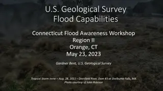
U.S. Geological Survey Flood Capabilities.
Explore the U.S. Geological Survey's flood capabilities in Connecticut, including real-time streamflow data, precipitation monitoring, groundwater levels, and more. Access tools for flood documentation, peakflow analysis, and national water monitoring through interactive dashboards. Stay informed an
3 views • 19 slides

Unraveling the Complexity of Physical Geography for Easier Learning
Explore the accessibility of physical geography in comparison to other geographical aspects, debunk myths surrounding its difficulty, identify challenging topics like geological timescale and earthquakes, and discover strategies to make physical geography inclusive and engaging for students and educ
3 views • 12 slides
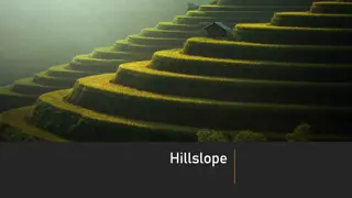
Understanding Hillslopes and Their Significance in Geomorphology
Hillslopes are angular inclinations of terrain between hilltops and valley bottoms, shaped by geological structures, climate, vegetation cover, and denudational processes. They are key geomorphic features in fluvial drainage basins, playing a crucial role in landscape formation and water/sediment tr
6 views • 22 slides
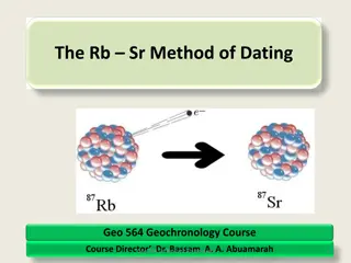
Understanding the Rb-Sr Method of Dating in Geochemistry
Explore the principles of the Rb-Sr dating method in geochemistry, focusing on radioactive decay of Rubidium and Strontium isotopes in geological materials. Learn about isotope data presentation, application in dating geological processes, and the significance of Rb and Sr in the periodic table.
3 views • 62 slides

Understanding Gravitational Anomalies and Interpretation Challenges
Gravitational anomalies pose an inverse problem in determining characteristics of underlying bodies. Surface gravity values provide insights into geometric shape, dimensions, density contrast, and depth. Interpreting anomalies requires integrating gravimetric analysis with other geological data. Cal
5 views • 62 slides
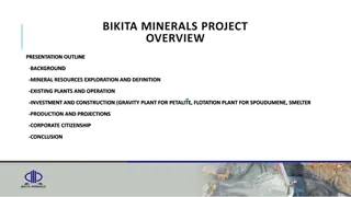
Bikita Minerals Project Overview
Bikita Minerals is a historic mine acquired by Sinomine in 2022, with significant investments in exploration and expansion. The project includes mineral resources exploration, existing plants and operations, investment in construction, production projections, corporate citizenship, and more. The min
2 views • 17 slides

Medical Geology and Environmental Health Studies at Western Oregon University
Explore the interdisciplinary field of Medical Geology at Western Oregon University, covering topics such as environmental exposure, geological impacts on nutrition, geologic hazards, and water quality. Discover how the Earth's subsystems interact and affect human health, with a focus on pathways of
1 views • 12 slides
Discovering Oman: A Comparison of Landscapes
Explore the unique physical features of Oman, from its rocky deserts to towering mountains and scenic coastlines. Contrasting with the UK, discover how Oman's natural landscapes offer a fascinating glimpse into its geological diversity.
7 views • 11 slides
Fulfilling FSP Responsibilities at US Geological Survey
Supervisors at the US Geological Survey play a crucial role in overseeing project proposal and plan development, ensuring compliance with Fundamental Science Practices (FSP). This involves managing USGS authors, deciding on research result categorization, releasing data, and adhering to open science
0 views • 19 slides
Understanding Fossil Diversity in Geology Labs
Explore the world of fossils and geological time scales in a Geology for Non-Science Majors lab under Dr. Kate Bulinski at Bellarmine University. Understand major paleontological events, diversifications, mass extinctions, and groups of organisms while learning to graph in Microsoft Excel.
0 views • 21 slides
Understanding the Pace of Landform Changes
Exploring how landforms transform over time, this lesson delves into the speed at which geological features evolve. By comparing examples like the Grand Canyon and the Mississippi River delta, students learn how scientists collect data to determine the rate of change through measurements and photogr
5 views • 18 slides
Understanding Geological Maps: Interpretation and Description
Training in geological map interpretation aims to accurately identify features depicted on maps through careful examination of geological information. The description of a geological map involves a chronological synthesis of geological data, analysis of the geology of an area focusing on relief, suc
0 views • 15 slides
Understanding the Geological Time Scale and Earth's Evolution
Studying the geological time scale is crucial for comprehending Earth's history, evolution of life, and significant events that shaped our planet. Evidences like field observations, fossil records, and radioactive dating contribute to constructing this vast timeline. Major occurrences such as mass e
1 views • 46 slides
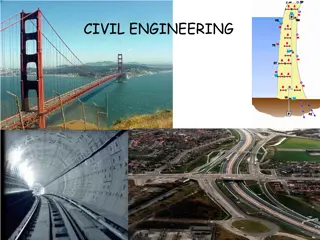
Understanding Civil Engineering: Dams, Reservoirs, and Geological Considerations
Civil engineering work encompasses various structures like dams, embankments, motorways, bridges, buildings, and more. Building dams and reservoirs involves considerations of geological factors, rock properties, and structural design. Different types of dams, such as gravity dams and arch dams, serv
0 views • 23 slides
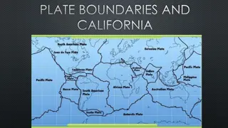
Plate Boundaries and Geological Events in California
California is located on a plate boundary experiencing major geologic events. The state's landforms are shaped by plate tectonic activity. Understanding stress types at plate boundaries can help prevent damage and save lives. The interaction at plate boundaries plays a crucial role in shaping Earth'
0 views • 14 slides
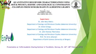
Integrated Reservoir Characterization in Semliki Basin, Albertine Graben
Quantitative reservoir characterization using rock physics, seismic, and geological constraints is crucial for hydrocarbon prospect evaluation. This study by Nakajigo Joan explores the integration of these disciplines in the Semliki Basin to improve reservoir property delineation and reduce uncertai
0 views • 24 slides

Geological Structures and Landscapes: A Detailed Overview
The illustrations and descriptions in the content depict various geological structures, including faults, folds, anticlines, and their effects on the landscape. The formation processes, such as folding, faulting, weathering, and erosion, are explained, highlighting how these natural phenomena shape
0 views • 9 slides
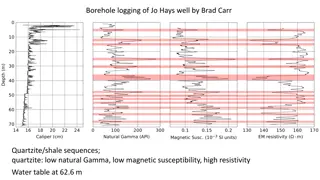
Borehole Logging of Jo Hays Well by Brad Carr - Geological Analysis
Explore the borehole logging results of Jo Hays Well conducted by Brad Carr, revealing quartzite/shale sequences with specific characteristics like low natural gamma, low magnetic susceptibility, and high resistivity. The water table is identified at 62.6 meters depth, offering insights into the geo
0 views • 4 slides
Unveiling the Fascinating World of Caves
Delve into the intriguing realm of caves, natural formations in the earth's surface that hold tales of geological wonders. Discover how caves are formed, their diverse types, and their significance in providing shelter for various species. Explore the art of speleology and the captivating formations
2 views • 5 slides
The Plate Tectonic Story of Joyner's Find Greenstone Belt in Western Australia
The Joyner's Find Greenstone Belt in Western Australia lies near the Yilgarn Craton and offers insights into early Archean history through its geological mapping and stratigraphy. This small greenstone belt features mafic volcanic rocks, banded iron formations, and siliciclastic sediments, forming a
0 views • 21 slides
Earth's Geological Processes and Environmental Impact of Mining
Earth's geological processes involve the formation and movement of tectonic plates, creating divergent and convergent boundaries, leading to events like earthquakes and volcanic eruptions. Gold mining, a process that extracts small amounts of gold from large quantities of rock using cyanide leaching
0 views • 51 slides
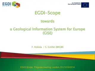
Geological Information System for Europe: EGDI-Scope Progress Meeting 2014
Toward a Geological Information System for Europe (GISE), the EGDI-Scope project aims to support European Commission policies on mining wastes, Water Framework Directive (WFD), INSPIRE, biodiversity, water, air, and geology. By organizing an information system instead of a data infrastructure, it pr
0 views • 11 slides
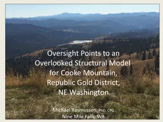
Structural Model for Cooke Mountain in Republic Gold District, NE Washington
This article presents an overlooked structural model for Cooke Mountain in the Republic Gold District of NE Washington. It covers various geological aspects such as the Quesnel Terrane, growth of metamorphic core complexes, and the geology of the Republic, WA area. Detailed descriptions and images o
0 views • 19 slides
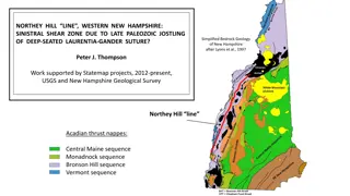
Bedrock Geology of Western New Hampshire: Northey Hill Line and Geological Features
The Northey Hill Line in Western New Hampshire is a sinistral shear zone resulting from Late Paleozoic tectonic activities. The area showcases a complex geological history with Acadian thrust nappes, Oliverian domes, and Mesozoic faults, providing insights into the region's structural evolution. Thi
0 views • 34 slides
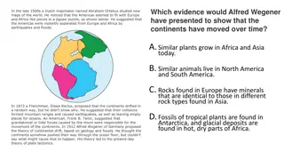
Understanding Earth's Structure and Continental Drift Theories
Dutch mapmaker Abraham Ortelius noted the jigsaw fit of continents, leading to the theory of continental drift. Alfred Wegener proposed the movement of continents based on geological evidence, influencing plate tectonics theory. Earth's layers vary from the thick mantle to the solid inner core due t
0 views • 27 slides
Unraveling Plate Tectonics: Impact of Earth's Geological Formations
Exploring the intricate relationship between plate tectonics and significant geological events such as Permian-Triassic extinctions, lava eruptions, and bolide impacts. Delve into the origins of Earth's tectonic movements and their profound impact on the planet's history.
0 views • 28 slides
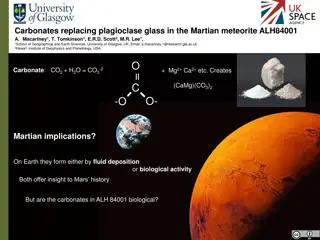
Carbonates Replacing Plagioclase Glass in Martian Meteorite ALH84001
The carbonates replacing plagioclase glass in the Martian meteorite ALH84001 have raised questions about their origin - whether they are biologically formed or through other geological processes. Discovered in Antarctica in 1984, this meteorite has been dated to over 4 billion years and initially mi
0 views • 14 slides
Unveiling Earth's Past: Fossils and Geological Clues
Explore the mysteries of Earth's past through fossils, rocks, and geological evidence. Learn how paleontologists decipher ancient life and environments, from unique preservation methods to the principles of catastrophism and uniformitarianism. Delve into the formation of fossils and the slow process
0 views • 25 slides
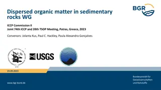
Dispersed Organic Matter in Sedimentary Rocks - Review Paper for Geological Application Studies in the 21st Century
The WG on Dispersed Organic Matter in Sedimentary Rocks is working on a review paper focusing on application studies of dispersed organic matter (DOM) within a geological context. The paper aims to provide an insightful overview titled "Applications of Dispersed Organic Matter Petrology in the 21st
0 views • 18 slides
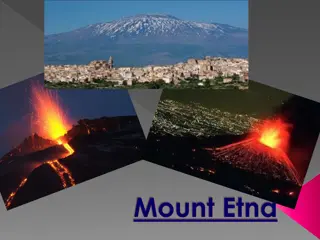
Discovering Mount Etna: A Geological Wonder in Sicily
Unveil the mysteries of Mount Etna, an active volcano in Sicily, through its history, location, and fascinating facts. Learn about the rocks it produces, its UNESCO World Heritage Site status, and unique geological features. Explore its significance in tourism and agriculture while understanding the
0 views • 17 slides
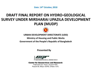
Hydro-Geological Survey Report in Mirsharai Upazila
This draft final report presents the findings of a hydro-geological survey conducted under the Mirsharai Upazila Development Plan by the Urban Development Directorate in Bangladesh. The report includes digital elevation models, aquifer architecture, isopach maps, cross-sections, aquifer frameworks,
0 views • 27 slides
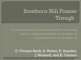
Exploring Mars 2020 Elevation Constraints and Geological Features
The content showcases images and information related to the exploration of Mars, focusing on the Nili Fossae Trough site and the unique geological features present. It highlights the diverse materials discovered, elevation challenges, slope characteristics, and the composition of ancient Martian ter
0 views • 32 slides
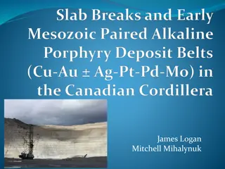
Geology and Magmatism in Canadian Cordilleran Terranes
The content discusses the geological features of Cordilleran terranes in Canada, including the Stikine and Quesnel arcs, Cache Creek, Slide Mountain, and more. It delves into the relationship between magmatism, porphyry mineralization, and subduction processes, highlighting the Kutcho-Sitlika-Venabl
0 views • 14 slides
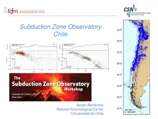
Monitoring Chile's Geological and Volcanic Activity: Subduction Zone Observatory and IPOC Network
Chile's Subduction Zone Observatory, led by Sergio Barrientos at the National Seismological Center, University of Chile, focuses on observing seismic and geological events with cutting-edge technology and networks. The IPOC Chile Volcanological Network monitors around 40 volcanoes, utilizing various
0 views • 4 slides
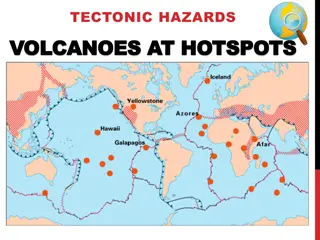
Exploring Volcanoes and Hotspots: A Geological Adventure
Delve into the world of volcanoes and hotspots in this educational content, uncovering the mysteries of how these geological features form and behave. From extinct volcanoes to the movement of tectonic plates, journey through fascinating concepts with informative visuals and engaging activities.
0 views • 9 slides
Various Landscapes and Geological Features in Washington and Montana
Explore a diverse collection of images showcasing the unique geological formations and landscapes found in Washington and Montana. From sand deposition along the Columbia River to talus slopes at the base of basalt colonnades, witness the beauty of nature's creations in these stunning photographs.
0 views • 19 slides
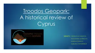
Exploring Cyprus's Geological Wonders: Troodos Geopark
Discover the geological marvels of Cyprus through a historical review of Troodos Geopark, revealing how the island emerged from the depths of the ocean due to tectonic movements. Unveil the ancient ophiolite rocks of the Troodos mountain range, showcasing the collision of African and Eurasian plates
0 views • 5 slides
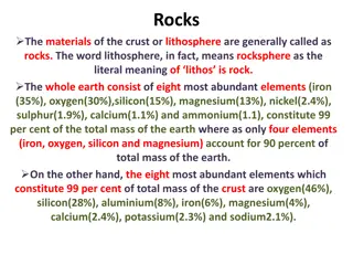
Understanding Rocks: Composition, Importance, and Role in Earth's Evolution
Rocks, composed of various minerals, form the materials of the earth's crust. They play a crucial role in shaping erosion patterns and landforms, with their composition influencing the landscape evolution over time. Rocks are key in dating earth's history and understanding geological processes. Expl
0 views • 4 slides
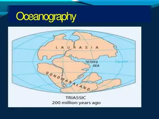
Comprehensive Overview of Oceanography
Oceanography is a fascinating and interdisciplinary scientific field that encompasses the study of seas and oceans. It covers topics such as geography, geology, chemistry, physics, biology, climatology, and engineering. Oceanography is subdivided into geological, physical, chemical, and biological b
0 views • 24 slides