
Coastal Monitoring and Lessons Learned in Southwest England
Southwest England's coastal monitoring efforts, including the South West Coastal Monitoring program and lessons learned from the destruction of Hallsands in 1917 due to lack of understanding of coastal processes. The monitoring involves data collection on beach profiles, bathymetry, wave patterns, a
4 views • 15 slides

Coastal Path Promotion Poster Design for Wales
Design promotional posters for the Coastal Path in Wales to encourage visitors to explore the 870-mile long coastal walking path accessible to walkers, cyclists, families, limited mobility individuals, and horse riders. Discuss the essence of marketing, its impact, target audience, and advantages an
4 views • 28 slides
Understanding Enamel Caries: Zones and Histopathology
Enamel caries is examined through histopathology, revealing four distinct zones - Translucent, Dark, Body, and Unaffected. Each zone presents unique characteristics, such as pore formation and light absorption. Understanding these zones is crucial for identifying and describing enamel caries accurat
1 views • 16 slides

Integrated Coastal Zone Management & Exclusive Economic Zone (EEZ) - Sustainable Coastal Management
The coastal zone is a vital area where land and sea interact, presenting dynamic challenges and opportunities. Integrated Coastal Zone Management (ICZM) is a science-based approach to managing coastal areas, aiming for sustainability by balancing environmental, economic, and human activities. ICZM,
0 views • 10 slides
Understanding Coastal Processes and Erosion
Coasts are dynamic environments shaped by a variety of processes such as erosion and transportation. Waves influence the size and energy of waves, while erosion is caused by processes like corrasion and solution. Coastal transportation involves suspension, solution, and saltation. The impact of mari
6 views • 18 slides
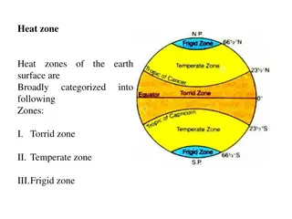
Earth's Heat Zones and Celestial Events Explained
Heat zones of the earth surface are categorized into Torrid, Temperate, and Frigid zones. The Torrid Zone lies between the Tropic of Cancer and the Tropic of Capricorn, experiencing the most direct sunlight. The Temperate Zones have milder climates and are situated between the Arctic and Antarctic C
0 views • 7 slides
Understanding Federal Consistency in Coastal Zone Management
This presentation serves as an introduction to Federal Consistency in the context of Coastal Zone Management, emphasizing the importance of compliance with enforceable policies outlined in the Coastal Zone Management Act. It highlights the role of the Division of Coastal Resources Management (DCRM)
1 views • 13 slides
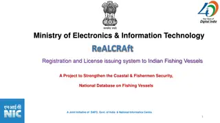
Modernizing Indian Fishing Vessel Registration & Licensing System for Coastal Security
A government initiative, the Registration and Licensing of Fishing Craft (ReALCRAFT) project aims to enhance coastal security by registering Indian fishing vessels under a national database. The system issues Registration Certificates and Fishing License Certificates online, ensuring unique identifi
0 views • 31 slides
Understanding Qualified Opportunity Zones Tax Benefits
Qualified Opportunity Zones (Opportunity Zones) offer tax incentives to investors who reinvest capital gains in designated low-income communities. By utilizing Qualified Opportunity Funds (QOF), investors can benefit from capital gains deferral, partial gain exclusion, and full gain exclusion on app
0 views • 12 slides
4th SPC Regional Technical Meeting on Coastal Fisheries and Aquaculture - Provisional Agenda
The 4th SPC Regional Technical Meeting on Coastal Fisheries and Aquaculture is set to take place on 12-15 October 2021 in a virtual format. The agenda includes sessions on integrating e-data systems into coastal fisheries, enhancing capacity for fisheries management, and community-based fisheries di
0 views • 9 slides
Subdivision Analysis for Load Zones Optimization
This project aims to subdivide existing load zones to enhance aggregations and SCED clearing processes. Criteria for subdivision, determining the number of new zones, and clustering based on pricing are addressed. A study will be conducted to subdivide existing zones into 3, 4, and 5 new zones, clus
0 views • 6 slides
National Cyclone Risk Mitigation Project Phase I Summary
The National Cyclone Risk Mitigation Project (NCRMP) aims to reduce cyclone risk and vulnerability in coastal areas by developing an Early Warning Dissemination System, constructing cyclone risk mitigation infrastructure, and building capacity in coastal communities. Phase I in Andhra Pradesh and Od
0 views • 31 slides
Guidelines for Quarantine and Movement Control Zones and Premises
This presentation outlines the designation of zones, areas, and premises as per the FAD PReP/NAHEMS guidelines for quarantine and movement control. It covers the establishment of control areas, minimum sizes of zones, and premises designations including infected, contact, suspect, and at-risk premis
0 views • 16 slides
Understanding Coastal Landforms: Formation and Characteristics
Coastal landforms are features shaped by erosion and sedimentation processes along coastlines. These landforms, including headlands, cliffs, bays, spits, salt marshes, and beaches, are predominantly influenced by factors such as wave action, longshore currents, tides, and climatic elements like wind
0 views • 35 slides
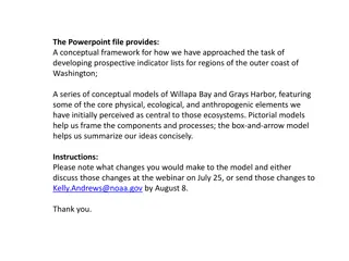
Ecological Indicators for Coastal Estuary Habitat Analysis
Explore conceptual frameworks and models for developing indicator lists in the coastal estuary habitats of Washington, focusing on key components like intertidal zones, shorebirds, fishes, and more. Dive into the connections within food webs, physical drivers, climate change impacts, and weather ele
0 views • 12 slides
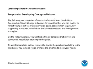
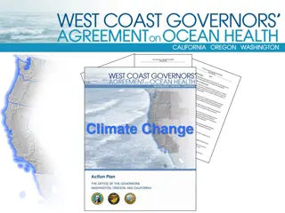
Coastal Conservation Strategies for Climate Resilience
Develop conceptual models for coastal conservation goals, targets, and management strategies in the context of climate change. Templates provided for reducing coastal flooding using natural areas, addressing non-climate and climate stressors, and implementing effective management strategies to enhan
3 views • 6 slides
Louisiana Coastal Flooding Litigation Overview
The content discusses various aspects related to the Katrina Canal breaches consolidated litigation in Louisiana, focusing on the legal implications, failures in flood control measures, geology of coastal Louisiana, coastal elevations, and the impact of canal breaches on flooding in the region. It a
1 views • 30 slides
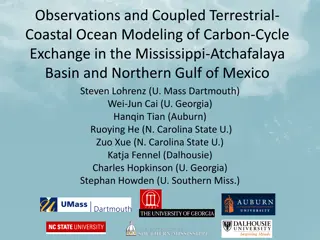
Coupled Terrestrial-Coastal Modeling of Carbon Exchange in the Gulf of Mexico
Explore the interactions between terrestrial and coastal systems in the Mississippi-Atchafalaya Basin and Northern Gulf of Mexico through coupled terrestrial-coastal ocean modeling. The study focuses on carbon dynamics, uncertainties in coastal carbon budgets, and the NASA IDS project's approach. Fu
3 views • 26 slides
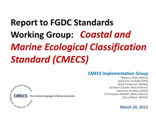
Coastal and Marine Ecological Classification Standard (CMECS) Implementation Progress
The report highlights the development, timeline, objectives, and importance of the Coastal and Marine Ecological Classification Standard (CMECS) along with its implementation progress. It discusses the need for a national standard for classifying coastal and marine habitats, the objectives of CMECS,
1 views • 38 slides
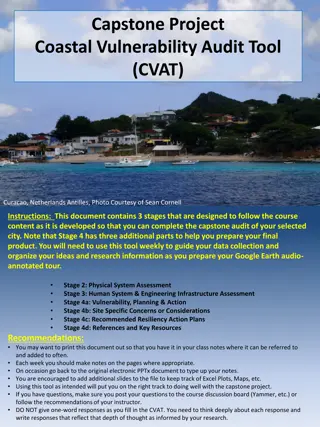
Coastal Vulnerability Audit Tool (CVAT) for Curacao, Netherlands Antilles
This document outlines the stages of the Coastal Vulnerability Audit Tool (CVAT) for assessing the physical system and human system & engineering infrastructure of Curacao, Netherlands Antilles. It covers key aspects such as coastal setting, climatic and tectonic settings, topographic profile, coast
0 views • 10 slides
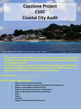
Coastal Vulnerability Assessment of Curacao, Netherlands Antilles
Conduct a comprehensive Coastal Vulnerability Audit of Curacao, Netherlands Antilles, using the Coastal Vulnerability Audit Tool (CVAT) to assess physical, human, and engineering infrastructure systems, as well as vulnerability, planning, and resiliency action plans. Consider factors such as climati
0 views • 10 slides
Enhancing Coastal Fisheries Data Collection in Kiribati: Challenges and Innovations
Presentation at the First Regional Technical Meeting on Coastal Fisheries in Kiribati covered current data collection methods, challenges faced including communication delays and lack of fisheries officers, and proposed innovations such as a smartphone app for e-reporting and using VHF radio for ema
0 views • 9 slides
NOAA SAR High-Resolution Coastal Winds Overview
NOAA's Operational SAR Sea Surface Wind Products provide detailed information on wind patterns derived from SAR images. The system aims to implement high-resolution wind production, capable of deriving winds from various SAR satellites. The operational goals include compatibility with international
0 views • 28 slides
Coastal Climate Change Impacts and Adaptation Strategies Overview
This overview delves into the impacts of climate change on coastal areas, including shoreline changes, coastal hazards, and coastal geomorphic systems. It highlights the physical forcing mechanisms, such as sea level rise and increased storm activity, affecting these regions. The assessment emphasiz
0 views • 14 slides

Flood Definitions and Impacts on Insurance Claims
Understanding various aspects of riverine and coastal flooding, along with related politics, can shed light on the importance of FEMA flood definitions in determining insurance claim payouts. Topics include floodplain areas like floodway and flood fringe, types of buildings with insurance rates, and
0 views • 27 slides

Export Marketing and Promotion Organizations in India
Government of India has established various export marketing and promotion organizations since 1951 to assist the export sector. These organizations play a crucial role in promoting and diversifying India's exports by providing services such as advisory functions, information collection, trade deleg
0 views • 9 slides

Integrated Terrestrial-Coastal Ocean Framework for Carbon Management
An advanced framework integrating terrestrial and coastal ocean observations and modeling is developed to support carbon management decisions. The study focuses on assessing the impacts of land use, human activities, and climate scenarios on the carbon cycle, particularly dissolved inorganic carbon
0 views • 5 slides
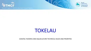
Coastal Fisheries and Aquaculture Priorities in Tokelau
This document discusses the technical issues and priorities for coastal fisheries and aquaculture in Tokelau, a group of low-lying coral atolls heavily dependent on coastal resources. It highlights the need for assessing fisheries resources, supporting sustainability, and exploring aquaculture poten
0 views • 6 slides
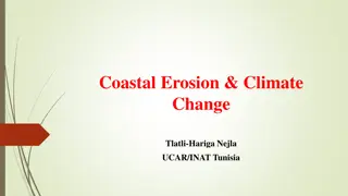
Understanding Coastal Erosion and Climate Change Impact in Tunisia
Coastal erosion and climate change pose significant threats to Tunisia's coastal areas, affecting ecosystems, economy, and human livelihoods. Climate change exacerbates erosion through rising sea levels, extreme weather events, and human activities. Understanding these phenomena is crucial for susta
0 views • 18 slides
Distribution Pattern of River Zones in China
China has a vast network of rivers with different characteristics and distribution patterns. The country is divided into five zones based on factors like precipitation and runoff levels, ranging from abundant to deficit zones. These zones play a crucial role in understanding the water resources and
0 views • 14 slides
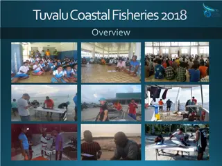
Tuvalu Coastal Fisheries 2018 Overview and Current Activities
Tuvalu Coastal Fisheries Department aims to maximize social and economic returns by sustainably managing marine resources. Their priorities include supporting livelihoods through inshore fisheries and generating revenue from oceanic fisheries. The Coastal Division focuses on outer island and Funafut
0 views • 8 slides
Understanding Coastal Processes: Erosion, Deposition, and Human Impact
Coastal processes involve a complex interplay of erosion, deposition, and human activities that impact the dynamic equilibrium of coastlines. Energy from tides, waves, wind, and currents shape the land-water interface, while human use of coasts introduces conflicts leading to unstable systems. Sedim
0 views • 44 slides

Understanding Target Heart Rate Zones for Optimal Exercise Benefits
Exploring the concept of target heart rate zones for effective exercise routines, this resource delves into different training zones based on age and intensity levels. It explains how to exercise within your target heart rate zone to achieve specific fitness goals like building endurance, improving
0 views • 9 slides
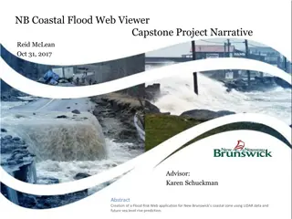
Creating a Coastal Flood Risk Web Application in New Brunswick
Addressing flood risk reduction in New Brunswick, this project utilizes LiDAR data and sea level rise predictions to identify flood hazards, plan for community resilience, and communicate mitigation strategies. With a focus on coastal zones, the initiative aims to provide accurate flood hazard maps
0 views • 18 slides
Coastal Management and Insurance Industry in New Zealand
Coastal areas in New Zealand face risks from flooding, storm surges, and sea-level rise, making insurance crucial for managing property losses. Insurers respond to coastal risks by adjusting premiums, excesses, and coverage. Long-term coastal planning involves managing risks through strategic buildi
0 views • 6 slides
Understanding Trip Rates and Balancing Productions and Attractions in Urban Planning
Trips generated at household ends are categorized as productions and are attracted to various zones for activities like work, shopping, social visits, and medical trips. Urban planners determine trip generation rates to estimate the number of trips attracted to specific zones. This process involves
0 views • 6 slides
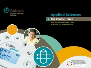
Understanding Candle Flame Temperature through Color Zones Model
Explore the correlation between temperature and color in a candle flame using the three zones model. Learn how the different zones of a candle flame represent varying temperatures, from the blue basal region to the orange/brown incomplete combustion area. Conduct experiments to measure these tempera
0 views • 21 slides
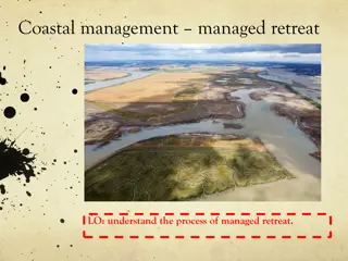
Understanding Managed Retreat in Coastal Management: Wallasea Island Case Study
Wallasea Island in Essex, England employed managed retreat as a coastal management strategy, removing the sea wall to allow natural coastal processes. This decision, despite impacting local agriculture, led to the creation of salt marshes, serving as a cost-effective and environmentally beneficial s
0 views • 7 slides
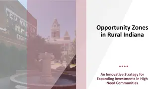
Opportunity Zones in Rural Indiana: Driving Investments in High-Need Communities
The presentation discusses the Opportunity Zones program in rural Indiana aimed at boosting investments in underserved communities. It covers the purpose of Opportunity Zones, how they originated, their selection process in Indiana, the program's mechanics, potential investment areas, the New Rural
0 views • 33 slides
Facing Higher Sea Levels and Coastal Flooding in New York City: Impacts and Resilience Strategies
The research highlights the increasing threat of higher sea levels and coastal flooding in New York City, exemplified by Hurricane Sandy. It discusses observed sea level rise trends, top coastal storm floods, and climate change projections. Initiatives like the New York City Panel on Climate Change
0 views • 22 slides