Geospatial Knowledge: Shaping the Future of Digital Society


G
e
o
s
p
a
t
i
a
l
K
n
o
w
l
e
d
g
e
a
t
t
h
e
H
e
a
r
t
o
f
T
o
m
o
r
r
o
w
’
s
G
l
o
b
a
l
D
i
g
i
t
a
l
S
o
c
i
e
t
y
John
Kedar
17
th
August 2023


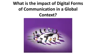
What does society want? Data
or Knowledge?
Digital and geospatial ecosystems merging
https://doi.org/10.5281/zenodo.3229400
Geospatial Knowledge Infrastructure (GKI) Project:
Advancing role of geospatial knowledge in world
economy, society and environment
3 phase project :
1.
Consider GKI
2.
Consider user sectors
3.
National deep dives and
GKI readiness 75 countries
•
Supports UN-IGIF
•
Moves thinking beyond current SDIs
•
Broadening government stakeholders
•
Growing value chain across user sectors
•
Helps geospatial agency innovation (SP5)
Growing understanding of users
Main outputs and outcomes
Final Report and 2024
Readiness Index
Stakeholder Engagement
Disruption
Tomorrow’s Geospatial Infrastructure
Vision
Geospatial knowledge at the heart of tomorrow’s global digital
society.
Geospatial Knowledge Infrastructure
………. a blueprint to integrate digital economies, societies and
citizens with geospatial approaches, data and technologies and,
in so doing, deliver the location-based knowledge, services and
automation expected in this 4IR digital age
GKI Principles
•
Knowledge is the focus.
•
Unified geo-digital ecosystem.
•
Predictive.
•
Led by users.
•
Decentralized.
•
Collaborative solutions.
•
Agility.
•
Achievable actions now and then scale.
GKI Elements
Governments
Industry
Digital ecosystem &
infrastructure
Relationship between GKI and UN IGIF
DRAFT AT 09/04/21 9
GKI Project Year 2 User Industry Focus
Energy Transition
Transport & Infrastructure
Autonomous Driving
Land Administration
Logistics and Supply Chain
Cities
Public Safety and Security
Agriculture
Agriculture
Sectoral Challenges
•
Productivity to meet increasing demand
•
Distribution
•
Climate change
•
Resilience to protracted crises, natural disasters and conflicts
•
Efficient farm management
•
Technology affordability
•
Slow uptake of innovation
•
Rural area network coverage
•
Lack of rural infrastructure including warehousing
•
National and international governance
•
Efficient administration (including land use permits, subsidies and insurance)
Role of geospatial knowledge - technology, applications and data
SDG 2: Zero Hunger
For example, Target 2.3:
By 2030, double the agricultural productivity and incomes of
small-scale food producers, in particular women, indigenous
peoples, family farmers, pastoralists and fishers, including
through secure and equal access to land, other productive
resources and inputs, knowledge, financial services, markets and
opportunities for value addition and non-farm employment
SDG 2: Zero Hunger – Hand-in-hand
Hand-in-Hand - is an evidence-based, country-led and country-owned
initiative of the Food and Agriculture Organization of the United Nations to
accelerate agricultural transformation and sustainable rural development to
eradicate poverty (SDG1) and end hunger and all forms of malnutrition (SDG2).
Geo-AI for agri-food system digital transformation.
Hand-in-Hand’s
Geospatial Platform
unlocks over 2 million data layers for more targeted,
evidence-based interventions
Cloud-based
Infrastructure
Multi-disciplinary data
federation and integration
Standards-
driven
Visualization, dissemination, multi-
criteria data analysis, image processing &
knowledge discovery enabled by GeoAI
Hand-in-hand participation
•
Knowledge enables a holistic approach to improving
the whole crop production system on a specific
holding;
•
Earth Observation (EO) supports crop monitoring
and yield prediction;
•
Governments open up high-resolution soil and
hydro-meteorology data (from EO) to enable
knowledge generation for small holders and
industry;
•
This knowledge is made accessible through
smartphones, with integration and analysis hidden
from the user.
SDG 2: Zero Hunger
Rezatec’s Geospatial Artificial Intelligence
(AI) solution for sugar beet processors
combines remote sensing and data science
to assist with procurement and inputs
optimisations for processors and their
contract farmers.
SDG 2: Zero Hunger
GKI Project Year 2 User Industry Focus
Energy Transition
Transport & Infrastructure
Autonomous Driving
Land Administration
Logistics and Supply Chain
Cities
Public Safety and Security
Agriculture
Phase 2 Report – October 2022
•
The value proposition of GKI for
eight geospatial user industries.
•
Assessment of GKI readiness for
50 countries.
Why a GKI Readiness Index?
What does the readiness index consider?
GKI Project Phase 3
Deep dive workshops
:
Netherlands, USA, Saudia Arabia,
India, South Africa
UN GGIM Future Geospatial Information Ecosystem
Please complete the questionnaires that
have been sent to countries
A Journey
To find out more and contribute:
GKI White Paper
https://www.geospatialworld.net/gw-assets/pdf/GKI-White-
Paper.pdf
GKI Phase 2 Report and Readiness Index
https://b24-snpob1.bitrix24.site/GKI-Phase-2-Report-
Download-2022
GKI Phase 3 Final Proposition –
draft for discussion
https://geospatialworld.net/consulting/gw-assets/pdf/Draft-
GKI-Proposition-Document.pdf
G
e
o
s
p
a
t
i
a
l
K
n
o
w
l
e
d
g
e
a
t
t
h
e
h
e
a
r
t
o
f
t
o
m
o
r
r
o
w
’
s
g
l
o
b
a
l
d
i
g
i
t
a
l
s
o
c
i
e
t
y
This is a 20 minute presentation
Exploring the pivotal role of geospatial knowledge in tomorrow's global digital society, the Geospatial Knowledge Infrastructure (GKI) Project aims to advance the integration of digital economies, societies, and citizens through location-based services and technologies. With a focus on stakeholder engagement and disruptive innovations, the GKI envisions a unified geo-digital ecosystem driven by predictive, user-led, and collaborative solutions. This blueprint outlines achievable actions to deliver the expected automation in the 4IR digital age.

Download Presentation

Please find below an Image/Link to download the presentation.
The content on the website is provided AS IS for your information and personal use only. It may not be sold, licensed, or shared on other websites without obtaining consent from the author. Download presentation by click this link. If you encounter any issues during the download, it is possible that the publisher has removed the file from their server.
E N D
Presentation Transcript
Geospatial Knowledge at the Heart of Tomorrow s Global Digital Society John Kedar 17th August 2023
What does society want? Data or Knowledge?
Digital and geospatial ecosystems merging https://doi.org/10.5281/zenodo.3229400
Geospatial Knowledge Infrastructure (GKI) Project: Advancing role of geospatial knowledge in world economy, society and environment 3 phase project : 1. Consider GKI 2. Consider user sectors 3. National deep dives and GKI readiness 75 countries Supports UN-IGIF Moves thinking beyond current SDIs Broadening government stakeholders Growing value chain across user sectors Helps geospatial agency innovation (SP5) Growing understanding of users
Main outputs and outcomes Stakeholder Engagement Final Report and 2024 Readiness Index Disruption
Tomorrows Geospatial Infrastructure Vision Geospatial knowledge at the heart of tomorrow s global digital society. Geospatial Knowledge Infrastructure . a blueprint to integrate digital economies, societies and citizens with geospatial approaches, data and technologies and, in so doing, deliver the location-based knowledge, services and automation expected in this 4IR digital age
GKI Principles Knowledge is the focus. Unified geo-digital ecosystem. Predictive. Led by users. Decentralized. Collaborative solutions. Agility. Achievable actions now and then scale.
GKI Elements Governments Digital ecosystem & infrastructure Industry
Relationship between GKI and UN IGIF DRAFT AT 09/04/21 9
GKI Project Year 2 User Industry Focus Land Administration Transport & Infrastructure Autonomous Driving Energy Transition Logistics and Supply Chain Agriculture Public Safety and Security Cities
Sectoral Challenges Productivity to meet increasing demand Distribution Climate change Resilience to protracted crises, natural disasters and conflicts Efficient farm management Technology affordability Slow uptake of innovation Rural area network coverage Lack of rural infrastructure including warehousing National and international governance Efficient administration (including land use permits, subsidies and insurance)
SDG 2: Zero Hunger For example, Target 2.3: By 2030, double the agricultural productivity and incomes of small-scale food producers, in particular women, indigenous peoples, family farmers, pastoralists and fishers, including through secure and equal access to land, other productive resources and inputs, knowledge, financial services, markets and opportunities for value addition and non-farm employment
SDG 2: Zero Hunger Hand-in-hand Hand-in-Hand - is an evidence-based, country-led and country-owned initiative of the Food and Agriculture Organization of the United Nations to accelerate agricultural transformation and sustainable rural development to eradicate poverty (SDG1) and end hunger and all forms of malnutrition (SDG2). Geo-AI for agri-food system digital transformation. Hand-in-Hand s Geospatial Platform unlocks over 2 million data layers for more targeted, evidence-based interventions Visualization, dissemination, multi- criteria data analysis, image processing & knowledge discovery enabled by GeoAI Cloud-based Infrastructure Multi-disciplinary data federation and integration Standards- driven
SDG 2: Zero Hunger Knowledge enables a holistic approach to improving the whole crop production system on a specific holding; Earth Observation (EO) supports crop monitoring and yield prediction; Governments open up high-resolution soil and hydro-meteorology data (from EO) to enable knowledge generation for small holders and industry; This knowledge is made accessible through smartphones, with integration and analysis hidden from the user.
SDG 2: Zero Hunger Rezatec s Geospatial Artificial Intelligence (AI) solution for sugar beet processors combines remote sensing and data science to assist with procurement and inputs optimisations for processors and their contract farmers.
GKI Project Year 2 User Industry Focus Land Administration Transport & Infrastructure Autonomous Driving Energy Transition Logistics and Supply Chain Agriculture Public Safety and Security Cities
Phase 2 Report October 2022 The value proposition of GKI for eight geospatial user industries. Assessment of GKI readiness for 50 countries.
What does the readiness index consider? Pillar Sub-pillars Geospatial Mandate in Sectoral Policies UNIGIF Adoption Open & Linked Data Earth Observation Infrastructure National Geospatial Collaborations Innovation Promotion Programs Core Geospatial Policies Pillar 1: Integrated Policy Framework Enabling Policies Fundamental Data Themes Positioning Infrastructure Pillar 2: Foundation Data Pillar 3: Partnerships & Collaborations International Collaborations Industry Capacity Industry Networks Pillar 4: Industry Leadership Pillar 5: Applications, Analytics and Modeling Pillar 6: Geospatial Dimension to Digital Infrastructure User Adoption 4IR Adoption and Integration Spatial Data Access Standards Institutional Capacity Capacity Building Digital Readiness
GKI Project Phase 3 South Africa Kenya Morocco + Egypt + Nigeria + Ethiopia + Rwanda + Tanzania + Ghana + Mozambique + Namibia + Cameroon + Burkina Faso Deep dive workshops: Netherlands, USA, Saudia Arabia, India, South Africa
Geospatial Knowledge at the heart of tomorrow s global digital society A Journey To find out more and contribute: GKI White Paper https://www.geospatialworld.net/gw-assets/pdf/GKI-White- Paper.pdf GKI Phase 2 Report and Readiness Index https://b24-snpob1.bitrix24.site/GKI-Phase-2-Report- Download-2022 GKI Phase 3 Final Proposition draft for discussion https://geospatialworld.net/consulting/gw-assets/pdf/Draft- GKI-Proposition-Document.pdf


 Project:")