Analysis of Union Township Land Use and Recommendations for Improvement
Union Township faces challenges with potential overdevelopment impacting its rural and agricultural character. This document outlines the purpose, goals, and importance of the Master Plan, zoning map, and preservation areas. Recommendations aim to balance smart development with landscape preservation.
Download Presentation
Please find below an Image/Link to download the presentation.
The content on the website is provided AS IS for your information and personal use only. It may not be sold, licensed, or shared on other websites without obtaining consent from the author. Download presentation by click this link. If you encounter any issues during the download, it is possible that the publisher has removed the file from their server.

Presentation Transcript
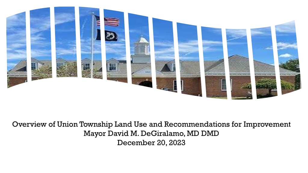
------------ Overview of Union Township Land Use and Recommendations for Improvement Mayor David M. DeGiralamo, MD DMD December 20, 2023
WHAT IS THE PURPOSE OF THIS DOCUMENT? Union Township is home. It has a well-known, cherished history and an aesthetically pleasing rural and agricultural character. However, as modernization over the years and decades largely has necessitated, the underlying appearance of our Township (and of other municipalities throughout the County and State) has changed. Union Township in particular faces both a unique opportunity for smart development along the sizable Route 78 corridor but also a very real risk of overdevelopment should the landscape be changed in an undesirable way. The influx of additional industry, traffic and regional commuter influences could have, among other things, a pronounced and deleterious impact on our roads, on our soil, water and environment, on the safety of our residents and on the overarching aesthetic of the Township we have come to appreciate and to covet. Further, recent commercial development applications have brought this issue into the clear collective consciousness of our resident base and have raised the potential scepter that such developments, were they to be approved, could have on our Township. It makes an analysis of our Township standing and protections more time-sensitive than perhaps ever before. 2 2
The goals of this document are: 1) to serve as an introductory primer to residents on what our Master Plan and Land Use Ordinances are (what they mean, what they represent, and what they allow), 2) our current and potential future standing on open space and undevelopable land (and how we compare with other municipalities within Hunterdon County), 3) to explain in some detail our zoning map (and the districts incorporated within it), 4) to distinguish between the Highlands Council Preservation and Planning areas within our Township (and the relative protections afforded us by each), and 5) any possible means by which we can further curb over-development and be more at cause in the future landscape we seek to create. 3
FIRST, WHAT EXACTLY IS A MASTER PLAN? A Master Plan is the basis of the goals and objectives for a town. It is a statement of objectives, principles and assumptions, policies and standards upon which the constituent proposals for physical, economic and social development of the municipality are based. It summarizes the desired local goals and objectives of the town's development/redevelopment and its preservation. A Master Plan is a forward-looking document designed to guide the Legislative Body (Township Committee) and the Planning Board/Board of Adjustments to determine what the community will look like years into the future, i.e. 10-15 years into the future. A Master Plan provides policy direction for land use, community facilities, circulation, and other needs important to each town. It is a view from a high level , focusing on ways to: Preserve a municipality s unique CHARACTER and all that is important to the community Enhance LIVABILITY, and Plan for DESIRED CHANGE with future development 4
A Master Plan tends to be broken up into elements or chapters. At its most basic, a Master Plan must have a LAND USE element (plan) and a HOUSING element. The land use element should show existing development and proposed development for potential future uses. The housing element should delineate residential standards, describe available housing and prospective needs. Those two mandatory elements should consider: topography, soil conditions and geology, drainage, water supply, groundwater recharge, streams, wetlands, woodlands, and floodplains. In addition, because we are in the Highlands , our Master Plan must include a policy statement indicating the relationship of proposed development in the town as compared to the Highlands Regional Master Plan . Many master plans also include an OPEN SPACE, RECREATION, and COMMUNITY FACILITIES plan, a CIRCULATION plan, UTILITY SERVICES, STORMWATER MANAGEMENT and OTHER elements that are deemed important by the community. Questions that tend to be answered by a Master Plan: What is the status of the municipality right now? What are its immediate needs? What are the short-term goals that should be planned for? What is the long term? How do we want the municipality to look/grow/operate 10+ years in the future? 5
HOW OFTEN SHOULD A MASTER PLAN BE REVIEWED AND/OR CHANGED? A Master Plan, to be effective, should be a dynamic, living and breathing document. It is not set in stone. It should be, and is required by law to be, re-examined every ten years. That re-examination process ensures that the document can continuously satisfy the community s needs and goals even as those needs and goals evolve over time. NJ State law requires public notice of a hearing on adoption of, revision or amendment to the Master Plan, ten days prior to any scheduled hearing. Our last re-examination and re-adoption was completed on November 13, 2023. This Master Plan confirmed Union Township s goal to retain its rural and agricultural character and continuation of open space preservation. 6
WHAT IS THE RELATIONSHIP BETWEEN A MASTER PLAN AND ZONING AND LAND USE ORDINANCES? One way to look at the relationship between a master plan and zoning/ordinances is this: If the MASTER PLAN were like the CEO of an organization (ie., setting the vision and goals for an entity), then the ZONING/ORDINANCES are like the COO of that organization (ie., providing the specific and detailed boundaries around the execution of this vision). For starters, the zoning and ordinances developed by the town need to be consistent with the Master Plan. As an example, a Master Plan can t state that the municipality envisions a town center and then the zoning map and ordinances have no plan for a town center. They have to be in general alignment. The zoning map and ordinances are how the municipality can carry out the specifics of the Master Plan goals. Any variances to the zoning ordinance must demonstrate conformance with the Master Plan. Contained within our Township s Master Plan is an OPEN SPACE AND RECREATION PLAN ELEMENT. It combines a recreation plan element with the conservation of land for open space and farmland. It also summarizes the Township s vision for open space and recreation and provides a framework for protection and preservation of open space and recreational opportunities. The most recent iteration of the document was approved in 2020, replacing the Township s 2002 document. Regarding open space, the following was written within the element s executive summary: Open space provides opportunities for recreation, land for the protection of environmentally sensitive land and water resources, preservation of wildlife habitats and other natural environments, a gathering place for community events and visual relief from urbanization. Setting aside land for these purposes also supports property values. Open space includes active recreation, passive recreation, and conservation lands. 7
For reference, active recreation consists of organized sports or leisure activities that usually require specialized fields or equipment and have a list of rules. Passive recreation includes less formal activities, such as hiking, horseback riding or bird watching. And conservation areas are intended to be left in their natural states for wildlife refuges, as buffers between developments or to protect environmentally sensitive land and water resources. The Township has a history of support of preservation of open space, natural resources (including ground water quantity and quality, groundwater recharge areas, wetlands, stream corridors, woodlands, and wildlife habitat, especially for threatened and endangered species), and its aesthetic/rural character. The 1999 Comprehensive Master Plan included recommendations for controls on land use that included deed restrictions to help protect natural resources and preservation of scenic corridors. Implementation of those goals has resulted in permanent conservation easements prohibiting future development. The 2002 Open Space and Recreation Plan further emphasized the importance of open space and agricultural heritage preservation. Based on these goals, Union Township initiated acquisition of parkland, farmland preservation and other conservation easements. In 2003, a Natural Resources Inventory (NRI) documented the important environmental features and resources present in the Township. This inventory formed the basis for recommendations in the 2004 Master Plan LAND USE element that focused on the expansion of the Township s Watershed Management zone and the reduction of the intensity of development along the I-78 corridor. 8
HIGH-LEVEL DATA POINTS ON UNION TOWNSHIPS OPEN SPACES AND PRESERVED LANDS Our Township has an area of more than 20 square miles, or more than 13,000 acres. Municipal/County Open Space: 797 acres Including Hoffman Park (owned jointly by the county and municipality), Finn Park (owned by the municipality) and the Union Furnace nature preserve (owned by the county) State-owned Open Space: 3,777 acres Including the Clinton Wildlife Management Area and Spruce Run Reservoir Privately held Open Space and Preserved Farmland: 1,066 acres Total: 5,640 acres (or approximately 40% of total Union Township land) In addition, in the 2020 Open Space and Recreation plan element, an additional 897 of potential open space acreage was highlighted (including the western portion of the current Edna Mahan correctional facility land). The Township historically has taken a multi-prong approach to open space with the goal of adding more. Most new development will include a requirement to include much of the remaining undeveloped land in a conservation easement, prohibiting most new development. Open space tax provides a reliable source of funding to acquire open space or limit development potential (e.g., farmland preservation). The Township partners with State, County and Federal agencies to leverage the open space funds. Once land is preserved, the Township puts some of the existing development in private ownership to recoup open space expenditures and property ratables. 9
WHERE DOES UNION TOWNSHIP STAND ON OPEN SPACE? There are a number of guidelines that have been put out to assess the adequacy of open space in a municipality. Notably, the Balanced Land Use Concept targets a minimum of 3% of a municipality s developed and developable land to be set aside as open space, and excluded land from this calculation is acreage with slopes greater than 12%, wetlands and preserved lands. Based on this, our Township has developed and developable land of an estimated 4,672 acres, resulting in a need for 140 acres of open space. Including the jointly owned Hoffman Park, Union has approximately 607 acres of open space, well in excess of the guideline. Even when Hoffman Park is stripped out of the calculation, Union has 253 acres of open space, nearly twice the guideline. The National Park and Recreation Association guidelines point to a range of 6.25-10.5 acres of municipality-owned active recreation parkland per 1,000 residents. If one assumes that Union Township has 5,500 residents (excluding Edna Mahan inmates), this would suggest that approximately 35 acres of active recreation parkland would be required. Finn Park and Millbrook Park total 146.5 acres, more than four times the guideline recommendation. As a point of reference, open space in Hunterdon County accounts for approximately 27% of total county acreage. Union Township s 39% ranks as the SECOND LARGEST percentage in the County (as shown on Table 1). It is more than 40% greater than the County average. 10
Farmland Preservation Acreage Total Open Space Acreage Open/Farmland Acreage 26 39 0 16 29 53 0 47 9 63 0 77 32 132 0 124 19 152 0 165 0 271 0 549 2,677 3,307 3,394 4,410 1,786 3,302 2,650 4,472 4,981 7,012 2,097 4,258 3,171 5,411 5,181 7,594 1,554 4,088 1,442 4,003 4,086 7,755 799 5,091 1,390 6,047 1,094 7,707 36,417 76,143 Municipality Lebanon Borough Flemington Borough Hampton Borough Milford Borough Califon Borough Lambertville City Glen Gardner Borough Bloomsbury Borough Stockton Borough Clinton Town Frenchtown Borough High Bridge Borough Franklin Township Alexandria Township Tewksbury Township Holland Township East Amwell Township West Amwell Township Kingwood Township Delaware Township Raritan Township Bethlehem Township Readington Township Union Township Lebanon Township Clinton Township TOTAL Total Acreage % of Municipality 577 690 971 817 627 783 991 632 392 918 786 1,555 14,831 17,758 20,334 15,321 18,272 13,984 22,805 23,702 24,094 13,287 30,605 13,169 20,272 21,706 279,878 12 16 23 47 54 77 6.7% 2.3% 5.4% 5.7% 10.1% 9.8% 13.3% 19.6% 38.9% 18.0% 34.4% 35.3% 22.3% 24.8% 16.2% 29.2% 38.4% 30.4% 23.7% 32.0% 17.0% 30.1% 25.3% 38.7% 29.8% 35.5% 27.2% Table 1: Open Space By Municipality 100 124 133 165 271 549 630 1,016 1,516 1,822 2,031 2,161 2,240 2,412 2,535 2,560 3,669 4,292 4,658 6,613 39,726 Sources: NJGIN Open Space and State Municipal Layers and Hunterdon SADC website 11
Figure 1: Zoning Map 12
UNION TOWNSHIPS DISTRICTS Union Township land (whether residential or commercial) is generally categorized into 15 districts (shown on Figure 1), each of which has delineated permitted uses. Other uses not specified are prohibited. Residential properties are categorized into 7 of these districts: Country Residential Conservation Management Agricultural Preservation 1 Agricultural Preservation 2 Village Residential Multifamily Residential Watershed Management The selection of a category in a particular region takes a number of factors into consideration, including (among other things): steep slopes, soil quality and erosion potential, groundwater availability, presence of threatened and endangered species, C-1 category streams and associated buffers and whether certain neighborhoods were built prior to the advent of current municipal planning and zoning. 13
As examples, Watershed Management district residences are on properties with steep slopes, poor suitability for on-lot sewer systems, high soil erosion potential, proximity to Spruce Run Reservoir and limited groundwater availability. Agricultural Preservation district residences consist of the most agriculturally rich soils. Given the relative scarcity of such soil, the agricultural preservation of such lands is more important. And in older villages, such as the long-standing regions of Pattenburg Main Street and the Perryville end of Finn Road, residences are located within the Village Residential district. Residential districts differ on a number of criteria, including (among other things): uses by right and by conditional approval, minimum (and in certain cases, maximum) lot areas, impervious surface requirements, building heights and setback distances. Interested residents should look at Figure 1 to locate their specific district (if not known already), and permitted uses and dimensional regulations can be found by consulting our Land Use Ordinances (available on our website: www.uniontwp-hcnj.org) to obtain more details. 14
Commercial/industrial properties are categorized into 6 of these districts: Village Commercial Planned Commercial Professional Office Office Research Quarry Utility Most of the non-residential uses are located in a relatively narrow strip along the Route 78 corridor. As is the case with residential districts, commercial districts differ on a number of criteria, as well, including the aforementioned items. Once again, interested residents should consult with the zoning maps and the Land Use Ordinances for additional details. Finally, there exist 2 other special districts: Institutional (and other state-owned properties) Parkland 15
Evergreen Properties (or Hunterdon Hills Playhouse) Figure 2: Select Lots Grand Colonial Perryville Center Perryville Liquors Formerly Foster Wheeler Exxon Shell Cree Wine 16
Sawyers NJDEP F&W Figure 3: Select Lots Pilot QuickChek Liberty Quarry ARC of Hunterdon Plushanski Construction LLC Clinton Block Kal Freight Republic Services 17
Figure 4: Select Lots Lehigh Gas Clinton Station Diner Wells Fargo Powerco Prime Storage Edna Mahan Kramer Electronics Green Rock Recycling 18
WHAT IS THE HIGHLANDS COUNCIL? The Highlands Water Protection and Planning Council (or Highlands Council ) is an agency of State government that partners with Counties and Local Municipalities to implement The Highlands Water protection and Planning Act of 2004. It adopts a Regional Master Plan (the Highlands Regional Master Plan) focused on protecting natural resources within the Highlands Region. The Highlands Region has 859,358 acres in northwestern part of New Jersey involving 88 municipalities and 7 counties (Hunterdon, Bergen, Morris, Passaic, Somerset, Sussex and Warren). WHAT (AND WHERE) ARE UNION S PRESERVATION AND PLANNING AREAS? Union s Preservation and Planning Areas are shown on the attached map (see Figure 5). Approximately 80% of the Township is located within the Preservation Area. The Planning Area is mainly along the I-78/173 corridor from Clinton west and then in the southernmost tip, south of Cooks Cross Road. North of I-78 is almost exclusively Preservation Area due to the proximity of Spruce Run Reservoir. 19
Figure 5: Highlands Preservation Map 20
WHAT IS THE DISTINCTION BETWEEN THE PRESERVATION AND PLANNING AREAS UNDER THE HIGHLANDS REGIONAL MASTER PLAN? The primary distinction between the Preservation Area and the Planning Area is that the lands within the Preservation Area are required to submit for plan conformance, which means that the land use regulations and zoning would be compatible with the Highlands Regional Master Plan. Plan conformance, i.e. zoning, for the Planning Area is voluntary, meaning the municipality can choose to opt into plan conformance or it can continue along using its existing zoning. The difference is that the State made assessments that lands within the Preservation Area were within imminent peril from development pressures and subjected them to standards within the Highlands Act and NJDEP regulations. Planning Area goals include: promoting continued agricultural, recreational and cultural uses encouraging residential and commercial development that is consistent and compatible with the State Development and Redevelopment Plan, Smart Growth Strategies and allowing development/redevelopment within the Planning Area in conformance with a Regional plan. Preservation Area goals include: preserving contiguous lands in the Highlands Region, preserving and protecting unique natural resources, limiting development incompatible with preservation and protection of natural resources, water quality, habitats and other features. 21
SHOULD UNION TOWNSHIP SUBMIT TO THE PLANNING AREA FOR HIGHLANDS CONFORMANCE? Union could voluntarily submit its Planning Area to Highlands and then have to act to amend its zoning to parallel Highlands regulations. Opting in, or plan conformance , would involve revising local planning regulations to implement the Highlands Act so as to align the goals, objectives, policies and regulations with the Highlands Act. Conformance would provide Union with the benefit of State support, in both planning and legal defense against zoning challenges, but in so doing, would also diminish local control over our own Master Plan and zoning regulations. Union also can elect not to seek plan conformance for the Planning Area and continue with its own zoning and regulations, as it has been doing, but then it would not benefit from financial protections from the State. Finally, Union can elect to adopt certain land use regulations that it deems desirable that parallel Highlands Regulation, tailoring them to Union s needs and objectives. Local control in this instance would be retained and we likely could benefit from Highlands Council best practices, but Union would be required to finance to defend lawsuit challenges on its own. As one likely can see, plan conformance either all or in part is not a simple or easy decision and requires much assessment, thought and judgment. 22
A DEEP DIVE ON OUR 78 CORRIDOR PLANNING AREA Within the Route 78 Corridor PLANNING area of the Township, there are approximately 40 commercial lots, as shown in Figures 3 and 4. Along the SOUTH border of this Route 78 corridor, the following can be seen, by district: 1 OFFICE RESEARCHset of lots (formerly the Foster Wheeler property) 11-12 VILLAGE COMMERCIALlots (including, among others, KAL Freight, the former Clinton Block , QuickChek, Shell, Republic Services) 2-3 QUARRY lots (Liberty and Green Rock), and 2-3 INSTITUTIONAL lots (the current Edna Mahan correctional facility and other state-owned properties) Along the NORTH border of this Route 78 corridor, the following can be seen, by district: 12-15 PROFESSIONAL OFFICElots (including, among others, Pilot, Sawyer s Security, and Kramer Electronics) 5 PLANNED COMMERCIAL lots (including, among others, Clinton Station Diner, Prime Storage and Powerco) Several WATERSHED MANAGEMENT lots (including, among others, NJ DEP Fish and Wildlife, as well as residences located on Frontage Road) Importantly, it should be noted only uses that are expressly included in the ordinance are permitted. ANY use not included in the ordinance is prohibited. Accordingly, there are no districts in Union Township where uses such as warehousing are permitted. 23
WHERE DOES THE TOWNSHIPS PLANNING BOARD AND BOARD OF ADJUSTMENT FIT IN? In Union Township, we have a combined Planning Board and Board of Adjustment, The Board is composed of nine members, plus three alternates. When the group acts as the Planning Board, all members participate. The Board is governed by the New Jersey Municipal Land Use laws and regulations, and by the Union Township Land Use Ordinances. The Board is responsible for developing and maintaining the Master Plan for adoption by the Township Committee. It is responsible for reviewing and recommending ordinances that support the Plan. And along with the Zoning Officer, it also reviews and approve building projects and site plans. When a particular project doesn t comply with the Ordinance, the Board hears applications for and grants appropriate variances from the ordinance. The applicant is required to demonstrate that the variance is consistent with the goals of the Master Plan and does not create a detriment to the community. Variance applications are heard in public meetings and notice is provided via newspapers and written notices mailed to nearby property owners. Site plans for major projects, commercial and residential, are also approved by the Board. These matters are considered in a public hearing where residents and other interested parties are invited to ask questions and comment. 24
As stated previously, our Land Use Ordinances define different zoning districts and the uses that are permitted (uses by right) and conditional uses (requiring Planning Board approval) in each district. When a non-permitted use is requested via an application, it is referred to as the Board of Adjustment . Examples of non-permitted uses are a retail store in a residential zone, an apartment in a barn, or an accessory structure that exceeds size limits. These are called use variances. The Municipal Land Use Law places a strict burden of proof on the applicant to justify the granting of the variance. The Ordinance also defines standards for things such as building height, setbacks from lot boundaries, impervious coverage limits and the like. When the project seeks approval for deviations from these requirements, a bulk variance is required. The Planning Board generally meets on the second and fourth Thursday of most months at the Municipal Building. Check the Township website for the schedule and agenda. 25
SUMMARY THOUGHTS: 1. Our Master Plan has drawn for decades special attention to our Township s rural and agricultural character and the importance of preserving it. 2. We have a recently re-examined and up-to-date Master Plan (as of October 2023); in addition, our Land Use ordinances make clear the specific uses allowed in residential and commercial districts; warehousing is not a permitted use in any of our 15 districts. 3. Union has the second largest percentage of open space to total acreage in the County (at 39%), well above the County average of 27%. The Township continues to pursue additional open space through a variety of mechanisms. 4. However, Union has one of the largest footprints along the 78 Corridor in the state, representing a source of opportunity for smart development but also a source of risk for undesired development (in both the amount of development and in the quality or type of development). 5. Steps can (and should) be taken in the coming months to bolster further our zoning and strategic positioning to protect against undesired over-development. 26
MY RECOMMENDATIONS TO OUR TOWNSHIP COMMITTEE, TO OUR PLANNING BOARD AND TO OUR RESIDENTS: I would like to put forward the following five overarching recommendations: 1. Conduct a deeper dive on our Master Plan. While the Master Plan recently was re-examined in late 2023 (with only minor changes made to the prior iteration), we will seek additional public input in 2024 to determine if additional changes are desired. Importantly, it is my sense that the Highlands Council can provide us with financial assistance associated with a Master Plan re-examination, easing the burden to our taxpayer base of such an undertaking. I will encourage my Township Committee colleagues to authorize such an endeavor in the new year. 2. Consider Highlands Council protection of our Planning area. This could afford us with stronger positioning and additional resources (zoning, legal and other) to protect us from inappropriate development. Both the pros and cons of such an association should be weighed. 3. Consider an overlay on our Quarry properties and Institutional lots, including Edna Mahan. As the three quarries in our Township reach a place of completion, it might serve our interests to have additional zoning overlay distinctions placed upon them, perhaps mitigating against the risk of a new developer claiming that a Quarry districting of a lot that is no longer quarry-able is too restrictive. In addition, an overlay on the Edna Mahan/Hunterdon Developmental Center lots (currently designated as Institutional ) could afford us future protections, as well. 27
4. Create a forward-looking group to be more proactive with the State-owned Edna Mahan property. As there has been considerable discussion around the potentially imminent closure of the Edna Mahan correctional facility, I believe it might be of good use for us to bring together a team of public officials and planning board members (from Union Township, from Town of Clinton and from Franklin Township) and relevant other parties to consider proactive ideas and plans that could be brought to the State for consideration. In this way, we might be able to be more at cause in what the property becomes, rather than merely reactive to what is bestowed upon us. I will be asking my Township Committee colleagues for permission to create such a group. We might also want to consider the acquisition of the western portion of the Edna Mahan property, a forested area previously described in prior Master Plan documents as possible future acquisition targets. 5. Continue to raise our collective awareness around matters of Township development. Education and information matter, as do the coalescence of untapped intellectual and professional capital. As it has been from the beginning, I believe that transparency in governance, access to information and the inclusion of much-needed feedback are central to effective Township management. It is my hope that this document and this commentary can serve as a launching point for additional campaigns toward bolstering our positioning regarding commercial over-development, so that the Township s history and enviable aesthetic character can be preserved, now and in the decades to come. 28
------------ THANK YOU! UNION STRONG
------------ WITH GRATITUDE TO THE FOLLOWING CONTENT CONTRIBUTORS: Resident and Former Planning Board Chair JOHN SCOTT Planning Board Chairman ALAN FORD Planning Board Vice Chairman BRIAN KIRKPATRICK Planning Board member BRANDI BARTOLOMEO MACHALA Zoning Officer/Planning Board Secretary LEIGH GRONAU